world.wikisort.org - Colombia
Amazonas (Spanish pronunciation: [amaˈsonas]) is a department of Southern Colombia in the south of the country. It is the largest department in area while also having the 3rd smallest population. Its capital is Leticia and its name comes from the Amazon River, which drains the department.
Department of Amazonas
Departamento del Amazonas | |
|---|---|
Department | |
 Flag  Coat of arms | |
| Motto(s): Entre todos podemos (Spanish: All together we can) | |
| Anthem: Himno de Amazonas | |
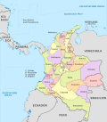
 Amazonas shown in red | |
 Topography of the department | |
| Country | |
| Region | Amazonía Region |
| Established | October 5, 1991 |
| Capital | Leticia |
| Government | |
| • Governor | Jesús Galdino Cedeño (2020-present)[1][2] |
| Area | |
| • Total | 109,665 km2 (42,342 sq mi) |
| • Rank | 1st |
| Population (2018)[4] | |
| • Total | 76,589 |
| • Rank | 30th |
| • Density | 0.70/km2 (1.8/sq mi) |
| Time zone | UTC-05 |
| ISO 3166 code | CO-AMA |
| HDI (2019) | 0.717[5] high · 26th of 33 |
| Website | www.amazonas.gov.co |
Toponymy
The department name comes from the name of the Amazon River. The river was named by the Spanish explorer Francisco de Orellana (1511 - 1546), who, on his voyage of exploration, said he was attacked by "fierce females" looked like Amazons of the Greek mythology, however, the existence of a female warrior tribe in that time hasn't been demonstrated and it is possible that they were long-haired Native American warriors who impressed the conqueror who called the jungle and the river with the name of Amazon.
Culture
The following ethnic groups are found in the department: Bora, Cocama, Macuna, Mirana, Okaina, Ticunas, Tucano, Uitoto, Yagua, and Yucuna, among others. These groups are more than 5,000 years old.
| Year | Pop. | ±% |
|---|---|---|
| 1938 | 6,414 | — |
| 1951 | 7,619 | +18.8% |
| 1964 | 12,962 | +70.1% |
| 1973 | 15,677 | +20.9% |
| 1985 | 39,937 | +154.7% |
| 1993 | 56,399 | +41.2% |
| 2005 | 67,726 | +20.1% |
| 2018 | 76,589 | +13.1% |
| Source:[6] | ||
National parks

The Amazonas Department covers 109,665 km2 (42,342 sq mi) of protected area, most of it under the name of "forest reserve" since 1959. There are currently four "National Parks" (Amacayacú, Cahuinarí, Rio Puree, and Yagoje Apaporis).
Municipalities and communities
- El Encanto
- La Chorrera
- La Pedrera
- La Victoria
- Leticia
- Mirití-Paraná
- Puerto Alegría
- Puerto Arica
- Puerto Nariño
- Puerto Santander
- Tarapacá

See also
- Amazonas State, Venezuela
- Amazonas State, Brazil
References
- "Statement of Financial Position March 2021" (PDF). Retrieved 13 June 2021.
- Espectador, El (2021-05-22). "ELESPECTADOR.COM". ELESPECTADOR.COM (in Spanish).
- "Nuestro Departamento: Información general: Geografía". Gobernación del Amazonas. Archived from the original on 2012-06-29.
- "DANE". Archived from the original on November 13, 2009. Retrieved February 13, 2013.
- "Sub-national HDI - Area Database - Global Data Lab". hdi.globaldatalab.org. Retrieved 2018-09-13.
- "Reloj de Población". DANE. Departamento Administrativo Nacional de Estadísitica. Archived from the original on 16 January 2018. Retrieved 14 January 2020.
External links
 Amazonas Department travel guide from Wikivoyage
- Territorial-Environmental Information System of Colombian Amazon SIAT-AC website
- Essential Travel Information to Leticia and its Surroundings
На других языках
[de] Departamento de Amazonas
Das Departamento del Amazonas ist ein großes, aber sehr dünn besiedeltes Departamento im äußersten Süden Kolumbiens. Lediglich am Grenzfluss zu Peru gibt es eine größere Anzahl von Siedlungen.- [en] Amazonas Department
[ru] Амасонас (Колумбия)
Амасо́нас (исп. Amazonas) — один из департаментов Колумбии. Назван по реке Амазонке. Располагается на юге страны, граничит на востоке с Бразилией, на юго-западе — с Перу. Административный центр — город Летисия.Другой контент может иметь иную лицензию. Перед использованием материалов сайта WikiSort.org внимательно изучите правила лицензирования конкретных элементов наполнения сайта.
WikiSort.org - проект по пересортировке и дополнению контента Википедии
