world.wikisort.org - Colombia
Guaviare (Spanish pronunciation: [ɡwaˈβjaɾe]) is a department of Colombia. It is in the southern central region of the country. Its capital is San José del Guaviare. Guaviare was created on July 4, 1991, by the new Political Constitution of Colombia. Up until that point, it was a national territory that operated as a commissariat, segregated from territory of the then Commissariat of Vaupés on December 23, 1977.
Department of Guaviare
Departamento del Guaviare | |
|---|---|
Department | |
 Flag  Coat of arms | |
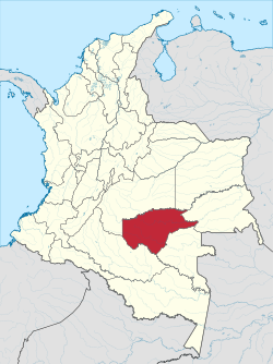 Guaviare shown in red | |
 Topography of the department | |
| Coordinates: 2°34′N 72°38′W | |
| Country | |
| Region | Amazon Region |
| Established | July 4, 1991 |
| Capital | San José del Guaviare |
| Government | |
| • Governor | Nebio De Jesus Echeverry Cadavid (2016–2019) |
| Area | |
| • Total | 53,460 km2 (20,640 sq mi) |
| • Rank | 8th |
| Population (2018)[3] | |
| • Total | 82,767 |
| • Rank | 28th |
| • Density | 1.5/km2 (4.0/sq mi) |
| Time zone | UTC-05 |
| ISO 3166 code | CO-GUV |
| HDI (2019) | 0.755[4] high · 14th of 33 |
Municipalities
History
Originally inhabited by the indigenous Nukak people, Guaviare was one of the regions colonized during the Amazon rubber boom of the 1910s and 1940s. Many families migrated from the centre of the country, seeking fast revenue and escaping from the bi-partisan violence taking place in other regions of Colombia. Nevertheless, the 'rubber fever' ended quickly, leaving the new inhabitants of Guaviare alone in an immense rainforest difficult to conquer.[5] The boom of cocaine in the second half of the 20th century attracted new colonizers who migrated from other impoverished regions attracted by the coca revenues. Following this new wave of colonization, the territory started growing almost 30,000 hectares (74,000 acres) of coca per year.[6] Several segments of Guaviare's territory were controlled by drug traffickers and the Revolutionary Armed Forces of Columbia (FARC) guerrilla group during this period in which violence was widespread and clashes between the factions of the Colombian armed conflict were constant. According to Colombia's Victims Unit, the conflict in Guaviare has had more than 93,000 victims since 1985, with more than 83,000 displaced and 6,612 dead.[7]
The Colombian government's efforts to fight against coca cultivation have faced several difficulties. Aerial aspersion of glyphosate over the coca crops was suspended by a judicial order as it was potentially risky for the health of the inhabitants. Additionally, plans to replace coca with other crops have encountered legal, environmental, and economic restrains that limit their viability.[8] None of these crops could match the level of profit that coca provided.[9] The introduction of cattle to the region has reduced the farmers' dependence on coca by generating alternative sources of income. However, deforestation caused by cattle-ranching has led to droughts, fires, and loss of biodiversity.
The demobilization of the FARC in 2016 has led to the improvement of the living conditions in rural areas of Guaviare, although FARC dissident groups that did not demobilize still exert territorial control of some zones of the department.
Demographics
| Year | Pop. | ±% |
|---|---|---|
| 1985 | 47,073 | — |
| 1993 | 97,602 | +107.3% |
| 2005 | 95,551 | −2.1% |
| 2018 | 82,767 | −13.4% |
| Source:[10] | ||
Racial makeup
- Indigenous Latinos (90.09%)
- Afro-Colombians (5.86%)
- Amerindians or Indigenous (4.05%)
The Nukak, a nomadic tribe that was uncontacted until 1988, live in Guaviare.
Notes
- "Datos y Cifras del Guaviare" (PDF). Gobernacion del Guaviare. 2009. Archived from the original (PDF) on 2013-02-16. Retrieved 2013-02-16.
- Kline, Harvey F. (2012). "Guariare, Department of". Historical Dictionary of Colombia. Lanham, Maryland: Scarecrow Press. p. 248. ISBN 978-0-8108-7813-6.
- "DANE". Archived from the original on November 13, 2009. Retrieved February 13, 2013.
- "Sub-national HDI - Area Database - Global Data Lab". hdi.globaldatalab.org. Retrieved 2018-09-13.
- "Can a Tropical Bird Take the Jungles of Colombia out of the 'Conflict Trap'?". Strife. 2020-12-16. Retrieved 2021-01-27.
- MinJusticia. "Caracterización Regional de la problemática asociada a las drogas ilícitas en el departamento de Guaviare" (PDF).
{{cite web}}: CS1 maint: url-status (link) - Victim's Unit. "General Report".
{{cite web}}: CS1 maint: url-status (link) - Investigación científica para el desarrollo sostenible de la región Amazónica Colombiana. "ZONIFICACIÓN AMBIENTAL Y ORDENAMIENTO DE LA RESERVA FORESTAL DE LA AMAZONÍA, CREADA MEDIANTE LA LEY 2ª DE 1959, EN EL DEPARTAMENTO DE GUAVIARE" (PDF).
{{cite web}}: CS1 maint: url-status (link) - "Los retos para sustituir los cultivos de coca en el Guaviare". Cerosetenta (in Spanish). 2017-12-13. Retrieved 2021-01-27.
- "Reloj de Población". DANE. Departamento Administrativo Nacional de Estadísitica. Archived from the original on 28 October 2016. Retrieved 6 July 2017.
References
- "Government of Guaviare official website" (in Spanish). Archived from the original on 2018-06-14. Retrieved 2007-02-25.
External links
Departments of Colombia | ||
|---|---|---|
 | ||
This Department of Guaviare location article is a stub. You can help Wikipedia by expanding it. |
На других языках
[de] Departamento del Guaviare
Das Departamento del Guaviare ist ein dünn besiedeltes Departamento im Südosten Kolumbiens, etwa 300 bis 500 km südöstlich der Hauptstadt Bogotá. Den politischen Status Departamento erhielt die Region erst 1991, wie auch andere abgelegene Gebiete und Intendencias in Amazonien.- [en] Guaviare Department
[ru] Гуавьяре (департамент)
Гуавья́ре (исп. Guaviare) — один из департаментов Колумбии. Располагается в южной части страны. Административный центр — город Сан-Хосе-дель-Гуавьяре. На территории депертамента частично расположен национальный парк Чирибикете — крупнейший национальный парк Колумбии.Другой контент может иметь иную лицензию. Перед использованием материалов сайта WikiSort.org внимательно изучите правила лицензирования конкретных элементов наполнения сайта.
WikiSort.org - проект по пересортировке и дополнению контента Википедии