world.wikisort.org - Colombia
Putumayo (Spanish pronunciation: [putuˈmaʝo]) is a department of Southern Colombia. It is in the south-west of the country, bordering Ecuador and Peru. Its capital is Mocoa.
Department of Putumayo
Departamento del Putumayo | |
|---|---|
Department | |
 Flag  Coat of arms | |
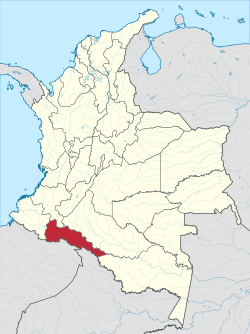 Putumayo shown in red | |
 Topography of the department | |
| Coordinates: 1°09′N 76°37′W | |
| Country | |
| Region | Amazonía Region |
| Established | 1991 |
| Capital | Mocoa |
| Government | |
| • Governor | Sorrel Parisa Aroca Rodriguez(2016-2019) |
| Area | |
| • Total | 24,885 km2 (9,608 sq mi) |
| • Rank | 16th |
| Population (2018)[3] | |
| • Total | 348,182 |
| • Rank | 26th |
| • Density | 14/km2 (36/sq mi) |
| Time zone | UTC-05 |
| ISO 3166 code | CO-PUT |
| Municipalities | 13 |
| HDI (2019) | 0.717[4] high · 26th of 33 |
| Website | www.putumayo.gov.co |
The word putumayo comes from the Quechua languages. The verb p'utuy means "to spring forth" or "to burst out", and mayu means river. Thus it means "gushing river".
History
| Year | Pop. | ±% |
|---|---|---|
| 1973 | 67,336 | — |
| 1985 | 174,129 | +158.6% |
| 1993 | 264,291 | +51.8% |
| 2005 | 310,132 | +17.3% |
| 2018 | 348,182 | +12.3% |
| Source:[5] | ||
Originally, the southwestern area of the department belonged to the Cofán Indians, the northwestern to the Kamentxá Indians, the central and southern areas to tribes that spoke Tukano languages (such as the Siona), and the eastern to tribes that spoke Witoto languages. Part of the Kamentxá territory was conquered by the Inca Huayna Cápac in 1492, who, after crossing the Cofán territory, established a Quechua population on the valley of Sibundoy, known today as Ingas. After the Inca defeat in 1533, the region was invaded by the Spanish in 1542, and from 1547 was administered by Catholic missions.
The current territory of Putumayo was linked to Popayan during the Spanish Colonial Period and in the first Republican decades belonged to the "Azuay Department", which included territories in Ecuador and Perú. Later a long process of territorial redistributions began:
- 1831: Popayán Province.
- 1857: Estado Federal del Cauca.
- 1886: Cauca Department.
- 1905: Intendencia del Putumayo.
- 1909: Intendencia del Caquetá.
- 1912: Comisaría Especial del Putumayo.
- 1953: Department of Nariño.
- 1957: Comisaría Especial del Putumayo.
- 1968: Intendencia Especial del Putumayo.
- 1991: Putumayo Department.
Municipalities
| Municipalities | Map |
|---|---|
|
 |
See also
- Santuario Orito Indí-Andé Fauna and Flora Sanctuary
References
- "Nuestro departamento: Información general". Gobernación del Putumayo.
- Kline, Harvey F. (2012). "Putumayo, Department of". Historical Dictionary of Colombia. Lanham, Maryland: Scarecrow Press. p. 415. ISBN 978-0-8108-7813-6.
- "DANE". Archived from the original on 13 November 2009. Retrieved 13 February 2013.
- "Sub-national HDI - Area Database - Global Data Lab". hdi.globaldatalab.org. Retrieved 13 September 2018.
- "Reloj de Población". DANE. Departamento Administrativo Nacional de Estadísitica. Archived from the original on 28 October 2016. Retrieved 6 July 2017.
External links
- (in Spanish) Government of Putumayo official website
- Territorial-Environmental Information System of Colombian Amazon SIAT-AC website
Departments of Colombia | ||
|---|---|---|
 | ||
На других языках
- [en] Putumayo Department
[ru] Путумайо
Путума́йо (исп. Putumayo) — один из департаментов Колумбии. Располагается на юго-западе страны. Граничит с Эквадором и Перу. Административный центр — город Мокоа.Другой контент может иметь иную лицензию. Перед использованием материалов сайта WikiSort.org внимательно изучите правила лицензирования конкретных элементов наполнения сайта.
WikiSort.org - проект по пересортировке и дополнению контента Википедии