world.wikisort.org - China
The city of Xinmin (Chinese: 新民; pinyin: Xīnmín; Wade–Giles: Hsin-min) is a county-level city of Liaoning Province, Northeast China, it is under the administration of the prefecture-level city of Shenyang. It contains the westernmost point of and is by far the most spacious of the county-level divisions of Shenyang City.[3] Xinmin borders Faku County to the northeast, Shenbei New Area and Yuhong District to the east, Tiexi District to the southeast, and Liaozhong County to the south; it also borders the prefecture-level cities of Jinzhou to the west and Fuxin to the northwest.
Xinmin
新民市 | ||||||||||||||||||||||||||||||||||||||||||
|---|---|---|---|---|---|---|---|---|---|---|---|---|---|---|---|---|---|---|---|---|---|---|---|---|---|---|---|---|---|---|---|---|---|---|---|---|---|---|---|---|---|---|
County-level city | ||||||||||||||||||||||||||||||||||||||||||
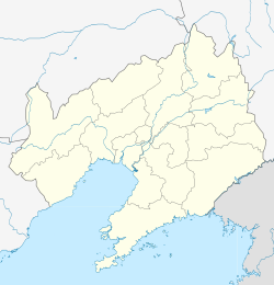 Xinmin Location in Liaoning | ||||||||||||||||||||||||||||||||||||||||||
| Coordinates: 41°59′49″N 122°49′23″E[1] | ||||||||||||||||||||||||||||||||||||||||||
| Country | People's Republic of China | |||||||||||||||||||||||||||||||||||||||||
| Province | Liaoning | |||||||||||||||||||||||||||||||||||||||||
| Sub-provincial city | Shenyang | |||||||||||||||||||||||||||||||||||||||||
| Area | ||||||||||||||||||||||||||||||||||||||||||
| • County-level city | 3,318.0 km2 (1,281.1 sq mi) | |||||||||||||||||||||||||||||||||||||||||
| • Urban | 22.50 km2 (8.69 sq mi) | |||||||||||||||||||||||||||||||||||||||||
| Population (2010) | ||||||||||||||||||||||||||||||||||||||||||
| • County-level city | 657,763 | |||||||||||||||||||||||||||||||||||||||||
| • Estimate (2017) | 701,000 | |||||||||||||||||||||||||||||||||||||||||
| • Density | 200/km2 (510/sq mi) | |||||||||||||||||||||||||||||||||||||||||
| • Urban (2017)[2] | 178,900 | |||||||||||||||||||||||||||||||||||||||||
| Time zone | UTC+8 (China Standard) | |||||||||||||||||||||||||||||||||||||||||
| Postal code | 1103XX | |||||||||||||||||||||||||||||||||||||||||
| Shenyang district map |
| |||||||||||||||||||||||||||||||||||||||||

Administrative divisions
The city administration of Xinmin covers five subdistricts, 11 towns, and 13 townships.[4]
Subdistricts:
- Dongcheng Subdistrict (东城街道), Xicheng Subdistrict (西城街道), Liaobin Subdistrict (辽滨街道), Xinliu Subdistrict (新柳街道), Xincheng Subdistrict (新城街道)
Towns:
- Dahongqi (大红旗镇), Liangshan (梁山镇), Daliutun (大柳屯镇), Gongzhutun (公主屯镇), Xinglong (兴隆镇), Xinglongbao (兴隆堡镇), Hutai (胡台镇), Fahaniu (法哈牛镇), Qiandangbao (前当堡镇), Damintun (大民屯镇), Liuhegou (柳河沟镇)
Townships:
- Gaotaizi Township (高台子乡), Jinwutaizi Township (金五台子乡), Hongqi Township (红旗乡), Lutun Township (卢屯乡), Yaobao Township (姚堡乡), Zhoutuozi Township (周坨子乡), Yujiawobao Township (于家窝堡乡), Xinnongcun Township (新农村乡), Dongsheshanzi Township (东蛇山子乡), Taotun Township (陶屯乡), Luojiafangzi Township (罗家房子乡), Sandaogangzi Township (三道岗子乡), Zhangjiatun Township (张家屯乡)
Climate
| Climate data for Xinmin (1981−2010) | |||||||||||||
|---|---|---|---|---|---|---|---|---|---|---|---|---|---|
| Month | Jan | Feb | Mar | Apr | May | Jun | Jul | Aug | Sep | Oct | Nov | Dec | Year |
| Record high °C (°F) | 7.0 (44.6) |
16.6 (61.9) |
21.1 (70.0) |
29.8 (85.6) |
33.6 (92.5) |
37.5 (99.5) |
35.3 (95.5) |
35.8 (96.4) |
33.0 (91.4) |
28.5 (83.3) |
20.4 (68.7) |
12.2 (54.0) |
37.5 (99.5) |
| Average high °C (°F) | −4.9 (23.2) |
−0.2 (31.6) |
7.0 (44.6) |
16.6 (61.9) |
23.4 (74.1) |
27.4 (81.3) |
28.8 (83.8) |
28.4 (83.1) |
24.2 (75.6) |
16.3 (61.3) |
5.4 (41.7) |
−2.3 (27.9) |
14.2 (57.5) |
| Daily mean °C (°F) | −10.8 (12.6) |
−6.2 (20.8) |
1.2 (34.2) |
10.4 (50.7) |
17.3 (63.1) |
22.0 (71.6) |
24.4 (75.9) |
23.6 (74.5) |
17.8 (64.0) |
10.0 (50.0) |
0.0 (32.0) |
−7.8 (18.0) |
8.5 (47.3) |
| Average low °C (°F) | −15.5 (4.1) |
−11.2 (11.8) |
−3.8 (25.2) |
4.7 (40.5) |
11.6 (52.9) |
17.1 (62.8) |
20.7 (69.3) |
19.5 (67.1) |
12.6 (54.7) |
4.6 (40.3) |
−4.5 (23.9) |
−12.2 (10.0) |
3.6 (38.6) |
| Record low °C (°F) | −30.0 (−22.0) |
−26.5 (−15.7) |
−16.9 (1.6) |
−7.5 (18.5) |
1.5 (34.7) |
5.7 (42.3) |
13.7 (56.7) |
7.6 (45.7) |
0.1 (32.2) |
−8.5 (16.7) |
−19.52 (−3.14) |
−28.2 (−18.8) |
−30.0 (−22.0) |
| Average precipitation mm (inches) | 3.9 (0.15) |
4.7 (0.19) |
15.1 (0.59) |
33.3 (1.31) |
44.2 (1.74) |
77.1 (3.04) |
151.6 (5.97) |
137.0 (5.39) |
64.5 (2.54) |
29.3 (1.15) |
13.7 (0.54) |
5.0 (0.20) |
579.4 (22.81) |
| Average relative humidity (%) | 56 | 51 | 49 | 50 | 54 | 67 | 80 | 79 | 70 | 62 | 59 | 58 | 61 |
| Source: China Meteorological Data Service Center[5] | |||||||||||||
References
- Google (2014-07-02). "Xinmin" (Map). Google Maps. Google. Retrieved 2014-07-02.
- Ministry of Housing and Urban-Rural Development, ed. (2019). China Urban Construction Statistical Yearbook 2017. Beijing: China Statistics Press. p. 50. Retrieved 11 January 2020.
- 分地区土地面积和人口密度 (2012年末) (in Chinese). Shenyang Statistics Bureau. Retrieved 6 July 2014.
- 沈阳市-行政区划网
- 中国地面气候标准值月值(1981-2010) (in Simplified Chinese). China Meteorological Data Service Center. Retrieved 24 September 2022.
External links
This Liaoning location article is a stub. You can help Wikipedia by expanding it. |
На других языках
- [en] Xinmin, Liaoning
[ru] Синьминь
Синьми́нь (кит. упр. 新民, пиньинь Xīnmín, буквально: «новые люди») — городской уезд города субпровинциального значения Шэньян (КНР).Другой контент может иметь иную лицензию. Перед использованием материалов сайта WikiSort.org внимательно изучите правила лицензирования конкретных элементов наполнения сайта.
WikiSort.org - проект по пересортировке и дополнению контента Википедии