world.wikisort.org - China
Zhangwu County (Chinese: 彰武; pinyin: Zhāngwǔ) is a county in the north of Liaoning province, China. It is under the administration of Fuxin City, the centre of which lies 82 kilometres (51 mi) to the southwest, with a population of 410,000[when?] residing in an area of 3,635 km2 (1,403 sq mi). It is served by G25 Changchun–Shenzhen Expressway, G2511 Xinmin–Lubei Expressway, and China National Highways 101 and 304.
Zhangwu
彰武县 | |
|---|---|
County | |
 Location in Fuxin City | |
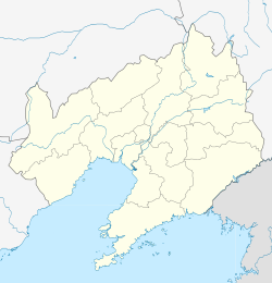 Zhangwu Location of the seat in Liaoning | |
| Coordinates: 42°23′N 122°32′E | |
| Country | People's Republic of China |
| Province | Liaoning |
| Prefecture-level city | Fuxin |
| Township-level divisions |
|
| County seat | Zhangwu Town (彰武镇) |
| Area | |
| • Total | 3,635 km2 (1,403 sq mi) |
| Elevation | 84 m (275 ft) |
| Population | |
| • Total | 410,000 |
| • Density | 110/km2 (290/sq mi) |
| Time zone | UTC+8 (China Standard) |
| Postal code | 123200 |
| Area code(s) | 0418 |
| Website | zhangwu |
Geography
Zhangwu County has a monsoon-influenced humid continental climate (Köppen Dwa), with great seasonal contrast in temperature, precipitation, and humidity. Winters are long and cold, with a January average of −11.7 °C (10.9 °F), while summers are hot and humid, with a July average of 24.1 °C (75.4 °F). Precipitation is very low in winter and is heavily concentrated in the summer months. With monthly percent possible sunshine ranging from 46% in July to 67% in January and February, there are 2,673 hours of bright sunshine annually. The annual mean temperature is 7.88 °C (46.2 °F).
| Climate data for Zhangwu County (1981−2010 normals) | |||||||||||||
|---|---|---|---|---|---|---|---|---|---|---|---|---|---|
| Month | Jan | Feb | Mar | Apr | May | Jun | Jul | Aug | Sep | Oct | Nov | Dec | Year |
| Average high °C (°F) | −5.2 (22.6) |
−0.4 (31.3) |
6.9 (44.4) |
16.6 (61.9) |
23.6 (74.5) |
27.7 (81.9) |
28.9 (84.0) |
28.4 (83.1) |
24.2 (75.6) |
16.1 (61.0) |
4.9 (40.8) |
−2.9 (26.8) |
14.1 (57.3) |
| Daily mean °C (°F) | −11.7 (10.9) |
−7.0 (19.4) |
0.5 (32.9) |
9.9 (49.8) |
17.1 (62.8) |
21.8 (71.2) |
24.1 (75.4) |
23.1 (73.6) |
17.3 (63.1) |
9.3 (48.7) |
−1.0 (30.2) |
−8.8 (16.2) |
7.9 (46.2) |
| Average low °C (°F) | −17.2 (1.0) |
−12.9 (8.8) |
−5.3 (22.5) |
3.5 (38.3) |
10.8 (51.4) |
16.3 (61.3) |
19.9 (67.8) |
18.6 (65.5) |
11.2 (52.2) |
3.4 (38.1) |
−6.2 (20.8) |
−14.0 (6.8) |
2.3 (36.2) |
| Average precipitation mm (inches) | 2.4 (0.09) |
2.3 (0.09) |
11.2 (0.44) |
24.8 (0.98) |
39.7 (1.56) |
83.5 (3.29) |
145.1 (5.71) |
109.2 (4.30) |
46.4 (1.83) |
20.6 (0.81) |
10.1 (0.40) |
2.5 (0.10) |
497.8 (19.6) |
| Average precipitation days (≥ 0.1 mm) | 1.8 | 2.1 | 3.5 | 6.2 | 8.4 | 12.3 | 12.7 | 10.5 | 7.7 | 5.3 | 3.1 | 1.8 | 75.4 |
| Average relative humidity (%) | 54 | 49 | 46 | 49 | 52 | 66 | 79 | 79 | 69 | 60 | 57 | 57 | 60 |
| Mean monthly sunshine hours | 194.5 | 199.6 | 240.3 | 245.2 | 267.2 | 251.8 | 214.1 | 230.3 | 241.2 | 224.7 | 186.0 | 178.4 | 2,673.3 |
| Percent possible sunshine | 67 | 67 | 65 | 62 | 60 | 55 | 46 | 54 | 65 | 66 | 63 | 63 | 62 |
| Source: China Meteorological Administration (precipitation days and sunshine 1971–2000)[1][2] | |||||||||||||
Administrative divisions
There are eight towns, 12 townships, and four ethnic townships in the county.[3]
Towns:
- Zhangwu (彰武镇)
- Harto (哈尔套镇)
- Zhanggutai (章古台镇)
- Dongliujiazi (东六家子镇)
- Wufeng (五峰镇)
- Fengjia (冯家镇)
- Houxinqiu (后新邱镇)
- A'erxiang (阿尔乡镇)
Townships:
|
|
References
- 中国气象数据网 - WeatherBk Data (in Chinese (China)). China Meteorological Administration. Retrieved 2020-04-15.
- 中国地面国际交换站气候标准值月值数据集(1971-2000年). China Meteorological Administration. Archived from the original on 2013-09-21. Retrieved 2010-05-25.
- 2011年统计用区划代码和城乡划分代码:彰武县 (in Chinese). National Bureau of Statistics of the People's Republic of China. Retrieved 2012-07-17.
External links
This Liaoning location article is a stub. You can help Wikipedia by expanding it. |
На других языках
- [en] Zhangwu County
[ru] Чжанъу
Чжанъу́ (кит. упр. 彰武, пиньинь Zhāngwǔ) — уезд городского округа Фусинь провинции Ляонин (КНР).Другой контент может иметь иную лицензию. Перед использованием материалов сайта WikiSort.org внимательно изучите правила лицензирования конкретных элементов наполнения сайта.
WikiSort.org - проект по пересортировке и дополнению контента Википедии