world.wikisort.org - China
Huanren Manchu Autonomous County (simplified Chinese: 桓仁满族自治县; traditional Chinese: 桓仁滿族自治縣; pinyin: Huánrén Mǎnzú Zìzhì Xìan, Manchu: ᡥᡠᠸᠠᠨᡵᡝᠨ
ᠮᠠᠨᠵᡠ
ᠪᡝᠶᡝ
ᡩᠠᠰᠠᠩᡤᠠ
ᠰᡳᠶᠠᠨ; Mölendroff: huwanren manju beye dasangga siyan), formerly Huairen County (Chinese: 懐仁縣), is a county under the administration of Benxi City, in eastern Liaoning province, People's Republic of China, bordering Jilin to the east. It is also one of 11 Manchu autonomous counties and one of 117 autonomous counties nationally. As a county, Huanren was established in 1877. It was reorganised as an autonomous county in 1989 with approval of the State Council. The county covers 3,362 square kilometres (1,298 sq mi) and has 293,505 population (2000 census), and Huanren Town is its seat.
Huanren
桓仁县 ᡥᡠᠸᠠᠨᡵᡝᠨ ᠰᡳᠶᠠᠨ | |
|---|---|
Autonomous county | |
桓仁满族自治县 Huanren ManchuAutonomous County | |
 | |
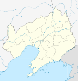
 Huanren County in Benxi City | |
 Huanren Location of the county seat in Liaoning | |
| Coordinates: 41°16′N 125°22′E | |
| Country | People's Republic of China |
| Province | Liaoning |
| Prefecture-level city | Benxi |
| County seat | Huanren |
| Area | |
| • Total | 3,362 km2 (1,298 sq mi) |
| Elevation | 251 m (823 ft) |
| Population (2000) | |
| • Total | 293,505 |
| • Density | 87/km2 (230/sq mi) |
| • Major nationalities | Manchu Han |
| Time zone | UTC+8 (China Standard) |
| Postal code | 117200 |
| Area code | 0414 |
| Website | hr |
Administrative divisions
Huanren County is divided into 13 Subdivisions: one subdistrict, eight towns and four townships including one ethnic township. The main nationalities are Manchu, Han, Hui and Korean people.
Subdistrict:
- Baguacheng (八卦城街道)
Towns:
- Huanren (桓仁镇)
- Gucheng (古城镇)
- Erpengdianzi (二棚甸子镇)
- Shajianzi (沙尖子镇)
- Wulidianzi (五里甸子镇)
- Hualai (华来镇)
- Muyuzi (木盂子镇)
- Balidianzi (八里甸子镇)
- Pulebao (普乐堡朝鲜族镇)
Townships:
- Xiangyang (向阳乡)
- Yahe (雅河朝鲜族乡)
- Heigou (黑沟乡)
- Beidianzi (北甸子乡)
Climate
Huanren has a monsoon-influenced humid continental climate (Köppen Dwa) with hot and humid summers and rather long, cold, and very dry winters. More than two-thirds of the annual rainfall occurs from June thru August. Monthly 24-hour average temperatures range from −12.4 °C (9.7 °F) in January to 23.0 °C (73.4 °F) in July, for an annual average of 6.93 °C (44.5 °F).
| Climate data for Huanren County (1971−2000) | |||||||||||||
|---|---|---|---|---|---|---|---|---|---|---|---|---|---|
| Month | Jan | Feb | Mar | Apr | May | Jun | Jul | Aug | Sep | Oct | Nov | Dec | Year |
| Record high °C (°F) | 4.9 (40.8) |
13.3 (55.9) |
19.3 (66.7) |
29.3 (84.7) |
33.6 (92.5) |
35.6 (96.1) |
35.9 (96.6) |
35.7 (96.3) |
31.5 (88.7) |
26.7 (80.1) |
18.6 (65.5) |
9.7 (49.5) |
35.9 (96.6) |
| Average high °C (°F) | −5.7 (21.7) |
−1.5 (29.3) |
6.0 (42.8) |
15.6 (60.1) |
21.7 (71.1) |
26.6 (79.9) |
27.7 (81.9) |
27.5 (81.5) |
22.2 (72.0) |
15.2 (59.4) |
5.1 (41.2) |
−2.9 (26.8) |
13.1 (55.6) |
| Daily mean °C (°F) | −12.4 (9.7) |
−8.2 (17.2) |
0.2 (32.4) |
8.8 (47.8) |
15.2 (59.4) |
19.9 (67.8) |
23.0 (73.4) |
22.1 (71.8) |
15.5 (59.9) |
8.3 (46.9) |
−0.5 (31.1) |
−8.7 (16.3) |
6.9 (44.4) |
| Average low °C (°F) | −18.3 (−0.9) |
−14.2 (6.4) |
−5.4 (22.3) |
2.5 (36.5) |
8.9 (48.0) |
14.7 (58.5) |
19.0 (66.2) |
17.9 (64.2) |
10.2 (50.4) |
2.5 (36.5) |
−5.2 (22.6) |
−13.8 (7.2) |
1.6 (34.8) |
| Record low °C (°F) | −30.6 (−23.1) |
−30.1 (−22.2) |
−29.4 (−20.9) |
−10.2 (13.6) |
−2.9 (26.8) |
5.6 (42.1) |
10.6 (51.1) |
5.4 (41.7) |
−2.0 (28.4) |
−9.2 (15.4) |
−23.3 (−9.9) |
−30.2 (−22.4) |
−30.6 (−23.1) |
| Average precipitation mm (inches) | 6.3 (0.25) |
7.3 (0.29) |
12.8 (0.50) |
40.6 (1.60) |
62.5 (2.46) |
111.5 (4.39) |
210.0 (8.27) |
210.0 (8.27) |
76.2 (3.00) |
44.4 (1.75) |
24.0 (0.94) |
8.9 (0.35) |
814.5 (32.07) |
| Average precipitation days (≥ 0.1 mm) | 4.7 | 4.6 | 5.7 | 9.2 | 11.7 | 13.1 | 16.0 | 13.5 | 10.1 | 7.7 | 7.2 | 5.5 | 109.0 |
| Source: Weather China | |||||||||||||
Tourism
Wunu Mountain City, a Goguryeo site found in this county, is part of the combined UNESCO World Heritage Site that also includes sites in Ji'an, Jilin.
External links
Manchu-designated autonomous areas in China | ||||||||
|---|---|---|---|---|---|---|---|---|
| Counties |
|   | ||||||
||
This Liaoning location article is a stub. You can help Wikipedia by expanding it. |
На других языках
- [en] Huanren Manchu Autonomous County
[ru] Хуаньжэнь-Маньчжурский автономный уезд
Хуаньжэ́нь-Маньчжу́рский автономный уезд (кит. упр. 桓仁满族自治县, пиньинь Huánrén Mǎnzú zìzhìxiàn, маньчж. ᡥᡠᠸᠠᠨᡵᡝᠨ ᠮᠠᠨᠵᡠ ᠪᡝᠶᡝ ᡩᠠᠰᠠᠩᡤᠠ ᠰᡳᠶᠠᠨ) — автономный уезд в городском округе Бэньси, провинция Ляонин, КНР.Другой контент может иметь иную лицензию. Перед использованием материалов сайта WikiSort.org внимательно изучите правила лицензирования конкретных элементов наполнения сайта.
WikiSort.org - проект по пересортировке и дополнению контента Википедии