world.wikisort.org - China
Faku County (simplified Chinese: 法库县; traditional Chinese: 法庫縣; pinyin: Fǎkù Xiàn) is a county of Liaoning Province, Northeast China, it is under the administration of the prefecture-level city of Shenyang, the capital of Liaoning, 77 km (48 mi) north of downtown Shenyang. As of 2010[update], it has a population of 399,587 in an area of 2,285 km2 (882 sq mi). It lies on China National Highway 203. It borders Kangping County to the north, Shenbei New Area to the southeast, and Xinmin City to the southwest as well as the prefecture-level cities of Tieling to the east and Fuxin to the west.
Faku
法库县 | ||||||||||||||||||||||||||||||||||||||||||
|---|---|---|---|---|---|---|---|---|---|---|---|---|---|---|---|---|---|---|---|---|---|---|---|---|---|---|---|---|---|---|---|---|---|---|---|---|---|---|---|---|---|---|
County | ||||||||||||||||||||||||||||||||||||||||||
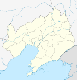 Faku Location in Liaoning | ||||||||||||||||||||||||||||||||||||||||||
| Coordinates: 42°29′42″N 123°24′40″E[1] | ||||||||||||||||||||||||||||||||||||||||||
| Country | People's Republic of China | |||||||||||||||||||||||||||||||||||||||||
| Province | Liaoning | |||||||||||||||||||||||||||||||||||||||||
| Sub-provincial city | Shenyang | |||||||||||||||||||||||||||||||||||||||||
| Area | ||||||||||||||||||||||||||||||||||||||||||
| • Total | 2,285 km2 (882 sq mi) | |||||||||||||||||||||||||||||||||||||||||
| Population (2010) | ||||||||||||||||||||||||||||||||||||||||||
| • Total | 399,587 | |||||||||||||||||||||||||||||||||||||||||
| • Density | 170/km2 (450/sq mi) | |||||||||||||||||||||||||||||||||||||||||
| Time zone | UTC+8 (China Standard) | |||||||||||||||||||||||||||||||||||||||||
| Postal code | 1104XX | |||||||||||||||||||||||||||||||||||||||||
| Shenyang district map |
| |||||||||||||||||||||||||||||||||||||||||

Administrative divisions
There are eight towns, 11 townships, and one ethnic township within the county.[3]
|
Towns:
|
Townships:
|
Climate
| Climate data for Faku (1981−2010) | |||||||||||||
|---|---|---|---|---|---|---|---|---|---|---|---|---|---|
| Month | Jan | Feb | Mar | Apr | May | Jun | Jul | Aug | Sep | Oct | Nov | Dec | Year |
| Record high °C (°F) | 6.8 (44.2) |
17.1 (62.8) |
20.7 (69.3) |
30.1 (86.2) |
34.6 (94.3) |
37.2 (99.0) |
37.5 (99.5) |
35.0 (95.0) |
32.0 (89.6) |
28.4 (83.1) |
20.1 (68.2) |
12.3 (54.1) |
37.5 (99.5) |
| Average high °C (°F) | −6.2 (20.8) |
−1.4 (29.5) |
6.2 (43.2) |
16.2 (61.2) |
23.1 (73.6) |
27.1 (80.8) |
28.2 (82.8) |
27.7 (81.9) |
23.4 (74.1) |
15.4 (59.7) |
4.2 (39.6) |
−3.6 (25.5) |
13.4 (56.1) |
| Daily mean °C (°F) | −12.5 (9.5) |
−7.7 (18.1) |
0.1 (32.2) |
9.7 (49.5) |
16.9 (62.4) |
21.6 (70.9) |
23.8 (74.8) |
22.8 (73.0) |
16.9 (62.4) |
9.0 (48.2) |
−1.3 (29.7) |
−9.4 (15.1) |
7.5 (45.5) |
| Average low °C (°F) | −17.9 (−0.2) |
−13.3 (8.1) |
−5.4 (22.3) |
3.5 (38.3) |
10.8 (51.4) |
16.4 (61.5) |
19.8 (67.6) |
18.5 (65.3) |
11.1 (52.0) |
3.3 (37.9) |
−6.2 (20.8) |
−14.5 (5.9) |
2.2 (35.9) |
| Record low °C (°F) | −34.4 (−29.9) |
−31.0 (−23.8) |
−21.3 (−6.3) |
−9.3 (15.3) |
−1.1 (30.0) |
2.1 (35.8) |
10.7 (51.3) |
6.9 (44.4) |
−0.7 (30.7) |
−12.4 (9.7) |
−23.4 (−10.1) |
−30.3 (−22.5) |
−34.4 (−29.9) |
| Average precipitation mm (inches) | 3.6 (0.14) |
4.0 (0.16) |
14.5 (0.57) |
31.5 (1.24) |
45.6 (1.80) |
90.1 (3.55) |
154.3 (6.07) |
149.0 (5.87) |
49.1 (1.93) |
27.8 (1.09) |
13.3 (0.52) |
4.1 (0.16) |
586.9 (23.1) |
| Average relative humidity (%) | 60 | 53 | 49 | 50 | 52 | 66 | 81 | 81 | 70 | 61 | 60 | 60 | 62 |
| Source: China Meteorological Data Service Center[4] | |||||||||||||
References
- Google (2014-07-02). "Faku" (Map). Google Maps. Google. Retrieved 2014-07-02.
- 分地区土地面积和人口密度 (2012年末) (in Chinese). Shenyang Statistics Bureau. Archived from the original on 26 September 2018. Retrieved 6 July 2014.
- 2011年统计用区划代码和城乡划分代码:法库县 (in Chinese). National Bureau of Statistics of the People's Republic of China. Archived from the original on 2012-12-08. Retrieved 2012-07-17.
- 中国地面气候标准值月值(1981-2010) (in Simplified Chinese). China Meteorological Data Service Center. Retrieved 24 September 2022.
External links
Authority control | |
|---|---|
| General | |
| National libraries | |
This Liaoning location article is a stub. You can help Wikipedia by expanding it. |
На других языках
- [en] Faku County
[ru] Факу
Факу́ (кит. упр. 法库, пиньинь Fǎkù) — уезд города субпровинциального значения Шэньян (КНР). Название в переводе с маньчжурского языка означает «запруда для ловли рыбы».Другой контент может иметь иную лицензию. Перед использованием материалов сайта WikiSort.org внимательно изучите правила лицензирования конкретных элементов наполнения сайта.
WikiSort.org - проект по пересортировке и дополнению контента Википедии