world.wikisort.org - China
Kaiyuan (simplified Chinese: 开原; traditional Chinese: 開原; pinyin: Kāiyuán; lit. 'Open Plains') is a county-level city in the northeast of Liaoning, People's Republic of China, bordering Jilin for a small section to the north. It is under the administration of Tieling City, the centre of which lies 33 kilometres (21 mi) to the southwest.
Kaiyuan
开原市 K'ai-yüan | |
|---|---|
County-level city | |
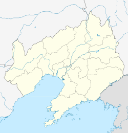
 Location in Tieling City | |
 Kaiyuan Location of the city centre in Liaoning | |
| Coordinates: 42°32′46″N 124°02′17″E | |
| Country | People's Republic of China |
| Province | Liaoning |
| Prefecture-level city | Tieling |
| Area | |
| • County-level city | 2,813.3 km2 (1,086.2 sq mi) |
| • Urban | 150.39 km2 (58.07 sq mi) |
| Population (2017)[1] | |
| • County-level city | 600,000 |
| • Density | 210/km2 (550/sq mi) |
| • Urban | 212,900 |
| Time zone | UTC+8 (China Standard) |
| Postal code | 112300 |
| Area code | 0024 |
Administrative divisions

There are 3 subdistricts, 9 towns, and 9 townships under the city's administration.[2]
Subdistricts:
- Xincheng Subdistrict (新城街道), Laocheng Subdistrict (老城街道), Xingkai Subdistrict (兴开街道)
Towns:
- Babao (八宝镇), Qingyunbao (庆云堡镇), Kaoshan (靠山镇), Yemin (业民镇), Jingouzi (金沟子镇), Zhonggu (中固镇), Bakeshu (八棵树镇), Lianhua (莲花镇), Weiyuanbao (威远堡镇)
Townships:
- Chengdong Township (城东乡), Sanjiazi Township (三家子乡), Songshanbao Township (松山堡乡), Majiazhai Township (马家寨乡), Lijiatai Township (李家台乡), Shangbadi Manchu Ethnic Township (上肥地满族乡), Xiabadi Manchu Ethnic Township (下肥地满族乡), Huangqizhai Manchu Ethnic Township (黄旗寨满族乡), Linfeng Manchu Ethnic Township (林丰满族乡)
Geography and climate
Kaiyuan is situated in northeastern Liaoning in the southeastern part of Tieling City on the eastern bank of the middle reaches of the Liao River. It borders Dongfeng County and Qingyuan Manchu Autonomous County to the east, Tieling County to the south, Faku and Changtu counties to the west, and Lishu County (Jilin) to the north. Its administrative area reaches a maximal north–south extent of 86 km (53 mi) and east–west width of 89.4 km (55.6 mi). In the east, the land begins to transition to the foothills of the Changbai Mountains, while the west is marked by the Songliao Plain.
Kaiyuan has a monsoon-influenced humid continental climate (Köppen Dwa), characterised by hot, humid summers and long, cold and windy, but dry winters. The four seasons here are distinctive. A majority of the annual rainfall of 673 mm (26.5 in) occurs in July and August alone. The monthly 24-hour average temperature ranges from −13.4 °C (7.9 °F) in January to 23.9 °C (75.0 °F) in July, and the annual mean is 7.3 °C (45.1 °F).
| Climate data for Kaiyuan (1981−2010) | |||||||||||||
|---|---|---|---|---|---|---|---|---|---|---|---|---|---|
| Month | Jan | Feb | Mar | Apr | May | Jun | Jul | Aug | Sep | Oct | Nov | Dec | Year |
| Record high °C (°F) | 6.9 (44.4) |
17.6 (63.7) |
21.3 (70.3) |
30.6 (87.1) |
34.2 (93.6) |
37.1 (98.8) |
36.6 (97.9) |
35.8 (96.4) |
33.2 (91.8) |
28.5 (83.3) |
21.5 (70.7) |
13.3 (55.9) |
37.1 (98.8) |
| Average high °C (°F) | −6.4 (20.5) |
−1.5 (29.3) |
6.2 (43.2) |
16.4 (61.5) |
23.2 (73.8) |
27.5 (81.5) |
28.6 (83.5) |
28.0 (82.4) |
23.6 (74.5) |
15.6 (60.1) |
4.5 (40.1) |
−3.6 (25.5) |
13.5 (56.3) |
| Daily mean °C (°F) | −13.4 (7.9) |
−8.3 (17.1) |
0.1 (32.2) |
9.8 (49.6) |
16.9 (62.4) |
21.8 (71.2) |
23.9 (75.0) |
22.8 (73.0) |
16.6 (61.9) |
8.9 (48.0) |
−1.3 (29.7) |
−9.8 (14.4) |
7.3 (45.2) |
| Average low °C (°F) | −19.4 (−2.9) |
−14.5 (5.9) |
−5.5 (22.1) |
3.5 (38.3) |
10.6 (51.1) |
16.3 (61.3) |
19.7 (67.5) |
18.2 (64.8) |
10.6 (51.1) |
3.1 (37.6) |
−6.3 (20.7) |
−15.1 (4.8) |
1.8 (35.2) |
| Record low °C (°F) | −37.9 (−36.2) |
−33.9 (−29.0) |
−22.8 (−9.0) |
−11.7 (10.9) |
−2.2 (28.0) |
5.0 (41.0) |
11.3 (52.3) |
5.5 (41.9) |
−2.3 (27.9) |
−11.0 (12.2) |
−23.6 (−10.5) |
−33.1 (−27.6) |
−37.9 (−36.2) |
| Average precipitation mm (inches) | 5.7 (0.22) |
6.5 (0.26) |
17.2 (0.68) |
33.5 (1.32) |
50.6 (1.99) |
86.2 (3.39) |
186.8 (7.35) |
177.3 (6.98) |
50.4 (1.98) |
32.8 (1.29) |
18.1 (0.71) |
7.8 (0.31) |
672.9 (26.48) |
| Average precipitation days (≥ 0.1 mm) | 3.4 | 3.9 | 5.1 | 7.9 | 9.2 | 12.5 | 13.8 | 11.3 | 8.2 | 6.9 | 5.2 | 4.2 | 91.6 |
| Average relative humidity (%) | 68 | 63 | 56 | 51 | 54 | 66 | 80 | 81 | 73 | 65 | 66 | 68 | 66 |
| Source 1: China Meteorological Data Service Center[3] | |||||||||||||
| Source 2: Weather China (precipitation days 1971–2000)[4] | |||||||||||||
Notable people
- Sheng Shicai (1897–1970), a warlord who ruled Xinjiang from 1933 to 1944.
- Xiao Jie (1957), Chinese politician
- Xiaoshenyang (1981), Chinese actor
References
- Ministry of Housing and Urban-Rural Development, ed. (2019). China Urban Construction Statistical Yearbook 2017. Beijing: China Statistics Press. p. 50. Retrieved 11 January 2020.
- 铁岭市-行政区划网. XZQH.
- 中国地面气候标准值月值(1981-2010) (in Simplified Chinese). China Meteorological Data Service Center. Retrieved 24 September 2022.
- Weather China 枣阳 - 气象数据 -中国天气网 (in Chinese). Weather China. Retrieved 24 September 2022.
{{cite web}}: Check|url=value (help)
External links
Authority control | |
|---|---|
| General | |
| National libraries | |
На других языках
- [en] Kaiyuan, Liaoning
[ru] Кайюань (Телин)
Кайюа́нь (кит. упр. 开原, пиньинь Kāiyuán) — городской уезд городского округа Телин провинции Ляонин (КНР).Другой контент может иметь иную лицензию. Перед использованием материалов сайта WikiSort.org внимательно изучите правила лицензирования конкретных элементов наполнения сайта.
WikiSort.org - проект по пересортировке и дополнению контента Википедии