world.wikisort.org - China
Xiapu (Chinese: 霞浦; pinyin: Xiápǔ; Foochow Romanized: Hà-puō) is a county in the municipal region of Ningde, Fujian, People's Republic of China, located along a stretch of East China Sea coast, with many harbours and islands. It is bordered by Fuding City and Zherong County to the north, Fu'an City and Ningde's urban area to the west, and Luoyuan County, Fuzhou and the Matsu Islands of Lienchiang County, Republic of China (Taiwan) to the south.
Xiapu County
霞浦县 Siapu | |
|---|---|
County | |
 Sunset on the beach of Xiapu | |
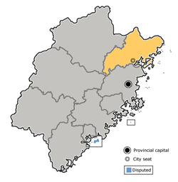
 Xiapu in Ningde | |
 Ningde in Fujian | |
| Coordinates: 26°57′37″N 119°58′28″E | |
| Country | People's Republic of China |
| Province | Fujian |
| Prefecture-level city | Ningde |
| Area | |
| • Total | 1,716 km2 (663 sq mi) |
| Population | |
| • Total | 355,100 |
| • Density | 210/km2 (540/sq mi) |
| Time zone | UTC+8 (China Standard) |
| Website | xiapu |
Xiapu is famous among landscapes lover photographers.
- Area: 1,716 square kilometres (663 sq mi)
- Population: 510,000[when?]
- Postal code: 355100
Administration
The county executive, legislature and judiciary are in Songcheng Town (松城镇), together with the CPC and PSB branches.
Xiapu has jurisdiction over 6 other towns (镇; zhèn) and over 7 townships (乡; xiāng), of which three are ethnic townships designated for the native She people.[1]

Towns
- Sansha (三沙镇)
- Yacheng (牙城镇)
- XiNan(溪南镇 and 下埔)[2]
- Shajiang (沙江镇)
- Xiahu (下浒镇)
- Changchun (长春镇)
Townships
- Baiyang (柏洋乡)
- Beibi (北壁乡)
- Haidao (海岛乡)
- Zhouyang (州洋乡)
- Yantian She-nation Ethnic Township (盐田畲族乡)
- Shuimen She-nation Ethnic Township (水门畲族乡)
- Chongru She-nation Ethnic Township (崇儒畲族乡)
Scenic Areas

- Yushan Island (嵛山岛)
- Xiahu Beach (下浒海滩)
Transportation
- Xiapu Railway Station on the Wenzhou-Fuzhou Railway
Xiapu Manichaean manuscripts
In 2008 the Xiapu Manichaean manuscripts became known to the scientific world in Shangwan Village, in Baiyang Township, Xiapu County. They are manuscripts from the ancient little-practiced religion known as Manichaeism, which now only exists as Chinese Manichaeism. They continue to be used by a local priest in his Manichaean sermons.
In comparison with the older Manichaeism and other sinicised Manichaeism, the Xiapu Manichaean texts strongly emphasize the worship of Jesus.[3]
Xiapu in the News
In 2009 August 9, Xiapu was where Typhoon Morakot made continental landfall. A million people had just been evacuated from vulnerable areas of this and surrounding counties.[citation needed]
Climate
| Climate data for Xiapu (1981−2010) | |||||||||||||
|---|---|---|---|---|---|---|---|---|---|---|---|---|---|
| Month | Jan | Feb | Mar | Apr | May | Jun | Jul | Aug | Sep | Oct | Nov | Dec | Year |
| Record high °C (°F) | 26.2 (79.2) |
26.7 (80.1) |
31.6 (88.9) |
33.1 (91.6) |
35.6 (96.1) |
38.4 (101.1) |
40.1 (104.2) |
38.6 (101.5) |
37.5 (99.5) |
34.4 (93.9) |
30.8 (87.4) |
28.0 (82.4) |
40.1 (104.2) |
| Average high °C (°F) | 13.5 (56.3) |
13.4 (56.1) |
15.9 (60.6) |
20.7 (69.3) |
25.2 (77.4) |
29.0 (84.2) |
32.6 (90.7) |
32.1 (89.8) |
29.2 (84.6) |
25.5 (77.9) |
21.3 (70.3) |
16.1 (61.0) |
22.9 (73.2) |
| Daily mean °C (°F) | 9.9 (49.8) |
10.1 (50.2) |
12.4 (54.3) |
16.9 (62.4) |
21.6 (70.9) |
25.5 (77.9) |
28.7 (83.7) |
28.4 (83.1) |
25.6 (78.1) |
21.5 (70.7) |
17.2 (63.0) |
12.0 (53.6) |
19.2 (66.5) |
| Average low °C (°F) | 7.4 (45.3) |
7.8 (46.0) |
10.0 (50.0) |
14.3 (57.7) |
18.9 (66.0) |
22.6 (72.7) |
25.4 (77.7) |
25.4 (77.7) |
22.8 (73.0) |
18.4 (65.1) |
14.2 (57.6) |
9.0 (48.2) |
16.4 (61.4) |
| Record low °C (°F) | −1.0 (30.2) |
−1.4 (29.5) |
0.2 (32.4) |
5.5 (41.9) |
9.9 (49.8) |
15.1 (59.2) |
20.2 (68.4) |
21.7 (71.1) |
15.5 (59.9) |
7.8 (46.0) |
3.5 (38.3) |
−2.7 (27.1) |
−2.7 (27.1) |
| Average precipitation mm (inches) | 52.8 (2.08) |
82.0 (3.23) |
144.9 (5.70) |
135.4 (5.33) |
172.7 (6.80) |
228.3 (8.99) |
131.7 (5.19) |
191.1 (7.52) |
137.5 (5.41) |
53.8 (2.12) |
47.2 (1.86) |
38.2 (1.50) |
1,415.6 (55.73) |
| Average relative humidity (%) | 77 | 81 | 83 | 83 | 83 | 84 | 80 | 80 | 78 | 74 | 74 | 74 | 79 |
| Source: China Meteorological Data Service Center[4] | |||||||||||||
See also
Notes and references
- "金农网福建省宁德市霞浦县乡镇、村信息". Archived from the original on July 7, 2011. Retrieved August 9, 2009.
- "Xiapu, China". Geographical Names. Retrieved 2021-02-21.
- "7 Yishu (Jesu) Worship in Xiapu Manichaean Manuscripts", Yearbook of Chinese Theology 2018, BRILL, pp. 97–112, 2018-01-01, doi:10.1163/9789004384972_008, ISBN 978-90-04-38497-2, retrieved 2021-06-07
- 中国地面气候标准值月值(1981-2010) (in Simplified Chinese). China Meteorological Data Service Center. Retrieved 7 November 2022.
External links
На других языках
[de] Xiapu
Der Kreis Xiapu (chinesisch .mw-parser-output .Hani{font-size:110%}霞浦县, Pinyin Xiápǔ Xiàn) ist ein chinesischer Kreis in der Provinz Fujian. Er gehört zum Verwaltungsgebiet der bezirksfreien Stadt Ningde (宁德市). Xiabu hat eine Fläche von 1.696 km² und zählt 475.936 Einwohner (Stand: 2020)[1]. Sein Hauptort ist das Straßenviertel Songcheng (松城街道);- [en] Xiapu County
[fr] Xian de Xiapu
Le xian de Xiapu (霞浦县 ; pinyin : Xiápǔ Xiàn) est un district administratif de la province du Fujian en Chine. Il est placé sous la juridiction de la ville-préfecture de Ningde.[ru] Сяпу
Сяпу́ (кит. упр. 霞蒲, пиньинь Xiápǔ) — уезд городского округа Ниндэ провинции Фуцзянь (КНР).Другой контент может иметь иную лицензию. Перед использованием материалов сайта WikiSort.org внимательно изучите правила лицензирования конкретных элементов наполнения сайта.
WikiSort.org - проект по пересортировке и дополнению контента Википедии