world.wikisort.org - China
Shanghang (simplified Chinese: 上杭县; traditional Chinese: 上杭縣; pinyin: Shàngháng Xiàn; Pe̍h-ōe-jī: Siôngháng Gnuâi; Hakka: Sông-hông-yen) is a county in southwest Fujian Province, China, bordering Guangdong Province to the southwest. It is under the administration of the prefecture-level city of Longyan.

Shanghang County
上杭县 | |
|---|---|
County | |
 Shanghang long-distance bus station | |
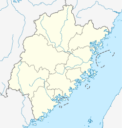 Shanghang Location of the seat in Fujian | |
| Coordinates: 25°02′58″N 116°25′12″E | |
| Country | People's Republic of China |
| Province | Fujian |
| Prefecture-level city | Longyan |
| Time zone | UTC+8 (China Standard) |
Transportation
Part of Shanghang County is accessed by China National Highway 319, coming west from Xinluo (新罗区), the municipal seat. The county seat, conventionally called Shanghang itself but officially Linjiang Town (临江镇), is reached by Route 205. The Ganzhou–Longyan Railway passes through western Shanghang.
Tourism
The county's most famous cultural-historical attraction is in the town of Gutian (古田镇), namely the site of the Gutian Congress in December 1929.
Administration
The county administers 17 towns (镇; zhèn), 3 townships (Chinese: 乡; pinyin: xiāng), and 2 ethnic townships (Chinese: 民族乡; pinyin: mínzú xiāng).[1]
Towns
Shanghang County's 17 towns are as follows:[1]
- Linjiang
- Lincheng
- Zhongdu
- Lanxi
- Rentian
- Baisha
- Gutian
- Caixi
- Nanyang
- Jiaoyang
- Jiuxian
- Huyang
- Xikou
- Taiba
- Tongxian
- Xiadu
- Chadi
Townships
Shanghang County's 3 townships are as follows:[1]
- Panjing Township
- Buyun Township
- Shanhu Township
Ethnic Townships
Shanghang County's 2 ethnic townships are as follows:[1]
- Lufeng She Ethnic Township
- Guanzhuang She Ethnic Township
Climate
| Climate data for Shanghang (1981−2010) | |||||||||||||
|---|---|---|---|---|---|---|---|---|---|---|---|---|---|
| Month | Jan | Feb | Mar | Apr | May | Jun | Jul | Aug | Sep | Oct | Nov | Dec | Year |
| Record high °C (°F) | 28.8 (83.8) |
32.5 (90.5) |
31.7 (89.1) |
34.5 (94.1) |
36.1 (97.0) |
37.4 (99.3) |
38.9 (102.0) |
39.0 (102.2) |
37.9 (100.2) |
36.4 (97.5) |
35.0 (95.0) |
29.5 (85.1) |
39.0 (102.2) |
| Average high °C (°F) | 16.7 (62.1) |
18.4 (65.1) |
21.1 (70.0) |
25.6 (78.1) |
29.0 (84.2) |
31.0 (87.8) |
33.8 (92.8) |
33.2 (91.8) |
31.6 (88.9) |
28.3 (82.9) |
23.7 (74.7) |
18.7 (65.7) |
25.9 (78.7) |
| Daily mean °C (°F) | 10.7 (51.3) |
13.0 (55.4) |
15.9 (60.6) |
20.7 (69.3) |
24.0 (75.2) |
26.2 (79.2) |
28.1 (82.6) |
27.6 (81.7) |
25.9 (78.6) |
22.3 (72.1) |
17.2 (63.0) |
12.4 (54.3) |
20.3 (68.6) |
| Average low °C (°F) | 6.9 (44.4) |
9.4 (48.9) |
12.5 (54.5) |
17.4 (63.3) |
20.6 (69.1) |
23.2 (73.8) |
24.3 (75.7) |
24.2 (75.6) |
22.3 (72.1) |
18.1 (64.6) |
12.8 (55.0) |
8.3 (46.9) |
16.7 (62.0) |
| Record low °C (°F) | −2.3 (27.9) |
−0.1 (31.8) |
−0.6 (30.9) |
7.1 (44.8) |
13.2 (55.8) |
15.3 (59.5) |
19.7 (67.5) |
20.8 (69.4) |
14.6 (58.3) |
8.4 (47.1) |
0.4 (32.7) |
−5.0 (23.0) |
−5.0 (23.0) |
| Average precipitation mm (inches) | 51.7 (2.04) |
105.6 (4.16) |
174.8 (6.88) |
209.5 (8.25) |
230.1 (9.06) |
273.6 (10.77) |
137.6 (5.42) |
213.5 (8.41) |
135.9 (5.35) |
39.4 (1.55) |
37.5 (1.48) |
36.2 (1.43) |
1,645.4 (64.8) |
| Average relative humidity (%) | 72 | 76 | 79 | 80 | 79 | 82 | 76 | 79 | 76 | 71 | 70 | 71 | 76 |
| Source: China Meteorological Data Service Center[2] | |||||||||||||
International cooperation
List of Shanghang County's sister and twin cities:[3]
 Bor, Serbia
Notes and references
- 2019年统计用区划代码 (in Chinese). National Bureau of Statistics of China. 2019. Archived from the original on 8 September 2020. Retrieved 8 September 2020.
- 中国地面气候标准值月值(1981-2010) (in Simplified Chinese). China Meteorological Data Service Center. Retrieved 7 November 2022.
- "Grad Bor 3. oktobra slavi svoj dan. Dolaze gosti iz Ukrajine, Makedonije i Rumunije, ali ne i Francuzi, Crnogorci i Kinezi" (website). Istmedia. Retrieved 2 October 2019.
External links
На других языках
[de] Shanghang
Shanghang (chinesisch .mw-parser-output .Hans{font-size:110%}上杭县, Pinyin Shàngháng Xiàn) ist ein chinesischer Kreis der bezirksfreien Stadt Longyan in der Provinz Fujian. Er hat eine Fläche von 2.855 Quadratkilometern und zählt 376.392 Einwohner (Stand: 2020).- [en] Shanghang County
[fr] Xian de Shanghang
Le xian de Shanghang (上杭县 ; pinyin : Shàngháng Xiàn) est un district administratif de la province du Fujian en Chine. Il est placé sous la juridiction de la ville-préfecture de Longyan.[ru] Шанхан
Шанха́н (кит. упр. 上杭, пиньинь Shàngháng) — уезд городского округа Лунъянь провинции Фуцзянь (КНР).Другой контент может иметь иную лицензию. Перед использованием материалов сайта WikiSort.org внимательно изучите правила лицензирования конкретных элементов наполнения сайта.
WikiSort.org - проект по пересортировке и дополнению контента Википедии