world.wikisort.org - China
Pinghe County (simplified Chinese: 平和县; traditional Chinese: 平和縣; pinyin: Pínghé Xiàn; Pe̍h-ōe-jī: Pêng-hô-koān) is a county of the prefecture-level city of Zhangzhou, in southern Fujian province, PRC, bordering Guangdong province to the west.[1]
This article needs additional citations for verification. (December 2009) |
Pinghe County
平和县 Pinghwo; Pingho | |
|---|---|
County | |
 Jinxi Creek Valley west of Xiaoxi Town | |
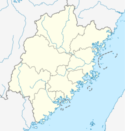 Pinghe Location in Fujian | |
| Coordinates: 24°21′48″N 117°18′54″E | |
| Country | People's Republic of China |
| Province | Fujian |
| Prefecture-level city | Zhangzhou |
| Time zone | UTC+8 (China Standard) |
Administrative Division
The administrative centre or seat of Pinghe County is Xiaoxi (小溪镇).
Towns (镇, zhen)
Most of Pinghe's old People's communes, after spending the 80s and even 90s as Townships, have been upgraded to Towns. Aside of Xiaoxi, there are now nine:[2]
- Wenfeng (文峰)
- Shange (山格
- Nansheng (南胜)
- Banzai (坂仔)
- Anhou (安厚)
- Daxi (大溪)
- Jiufeng (九峰)
- Xiazhai (霞寨)
- Luxi (芦溪)
- Guoqiang (国强)
Townships (乡, xiang)
There are five townships.
Economy

Pinghe County is famous for its pomelos.
Tulou

Numerous Fujian Tulou, earth buildings of round, rectangular and other shapes, can be found within Pinghe County, primarily in its western part (viz., various villages of Luxi, Xiazhai, Jiufeng and Daxi Towns). One of them, the Xishuang Lou (西爽楼), located in Xi'an Village a few kilometers north of Xiazhai town center, has been described by some researchers as the "largest of the rectangular [tulou] in existence".[3] Unfortunately, only parts of the compound have survived to this day.[4]
Climate
| Climate data for Pinghe (1981−2010) | |||||||||||||
|---|---|---|---|---|---|---|---|---|---|---|---|---|---|
| Month | Jan | Feb | Mar | Apr | May | Jun | Jul | Aug | Sep | Oct | Nov | Dec | Year |
| Record high °C (°F) | 30.8 (87.4) |
31.8 (89.2) |
33.7 (92.7) |
36.2 (97.2) |
36.1 (97.0) |
38.7 (101.7) |
39.7 (103.5) |
39.3 (102.7) |
37.6 (99.7) |
35.4 (95.7) |
34.3 (93.7) |
31.1 (88.0) |
39.7 (103.5) |
| Average high °C (°F) | 20.1 (68.2) |
20.9 (69.6) |
23.2 (73.8) |
26.8 (80.2) |
29.9 (85.8) |
32.0 (89.6) |
34.4 (93.9) |
33.7 (92.7) |
32.1 (89.8) |
29.4 (84.9) |
25.7 (78.3) |
21.6 (70.9) |
27.5 (81.5) |
| Daily mean °C (°F) | 13.9 (57.0) |
15.1 (59.2) |
17.4 (63.3) |
21.5 (70.7) |
24.7 (76.5) |
27.0 (80.6) |
28.7 (83.7) |
28.1 (82.6) |
26.6 (79.9) |
23.6 (74.5) |
19.4 (66.9) |
15.0 (59.0) |
21.8 (71.2) |
| Average low °C (°F) | 9.9 (49.8) |
11.2 (52.2) |
13.4 (56.1) |
17.6 (63.7) |
20.9 (69.6) |
23.5 (74.3) |
24.6 (76.3) |
24.5 (76.1) |
22.8 (73.0) |
19.4 (66.9) |
14.8 (58.6) |
10.6 (51.1) |
17.8 (64.0) |
| Record low °C (°F) | −1.2 (29.8) |
1.4 (34.5) |
0.8 (33.4) |
9.3 (48.7) |
13.6 (56.5) |
17.3 (63.1) |
21.8 (71.2) |
21.6 (70.9) |
17.0 (62.6) |
10.2 (50.4) |
2.7 (36.9) |
−2.9 (26.8) |
−2.9 (26.8) |
| Average precipitation mm (inches) | 42.9 (1.69) |
95.1 (3.74) |
134.9 (5.31) |
179.1 (7.05) |
215.7 (8.49) |
277.4 (10.92) |
198.6 (7.82) |
302.4 (11.91) |
220.7 (8.69) |
48.7 (1.92) |
34.6 (1.36) |
32.4 (1.28) |
1,782.5 (70.18) |
| Average relative humidity (%) | 77 | 77 | 78 | 79 | 79 | 81 | 77 | 80 | 78 | 75 | 76 | 76 | 78 |
| Source: China Meteorological Data Service Center[5] | |||||||||||||
References
- http://www1.fjta.com/zhangzhou/pinghexian/ Archived 2011-07-11 at the Wayback Machine (in Chinese)
- http://www.hdzxw.com/news/93/n-208293.html (in Chinese)
- Fred Thompson (February 1996), "Earthly fortresses - communal housing in China", The Architectural Review
- "霞寨镇西爽楼已倒塌 土楼成大土堆", 海峡都市报, 2011-09-26, archived from the original on 2013-01-16, retrieved 2012-04-07
- 中国地面气候标准值月值(1981-2010) (in Simplified Chinese). China Meteorological Data Service Center. Retrieved 7 November 2022.
External links
- Pinghe County official website (in Chinese)
На других языках
[de] Pinghe
Pinghe (chinesisch .mw-parser-output .Hant{font-size:110%}平和縣 / .mw-parser-output .Hans{font-size:110%}平和县, Pinyin Pínghé Xiàn) ist ein Kreis der bezirksfreien Stadt Zhangzhou, der südlichsten der neun bezirksfreien Städte der chinesischen Provinz Fujian. Sein Hauptort ist die Großgemeinde Xiaoxi. Er hat eine Fläche von 2.310 km² und zählt 455.042 Einwohner (Stand: Zensus 2020)[1], die Bevölkerungsdichte beträgt 197 Einw./km².- [en] Pinghe County
[fr] Xian de Pinghe
Le xian de Pinghe (平和县 ; pinyin : Pínghé Xiàn) est un district administratif de la province du Fujian en Chine. Il est placé sous la juridiction de la ville-préfecture de Zhangzhou.[it] Contea di Pinghe
La contea di Pinghe (平和县S, Pínghé XiànP) è una contea della Cina, situata nella provincia del Fujian.[ru] Пинхэ
Пинхэ́ (кит. упр. 平和, пиньинь Pínghé) — уезд городского округа Чжанчжоу провинции Фуцзянь (КНР).Другой контент может иметь иную лицензию. Перед использованием материалов сайта WikiSort.org внимательно изучите правила лицензирования конкретных элементов наполнения сайта.
WikiSort.org - проект по пересортировке и дополнению контента Википедии