world.wikisort.org - China
Qumarlêb County (Tibetan: ཆུ་དམར་ལེབ་རྫོང་།, Wylie: chu dmar leb rdzong, ZYPY: Qumarlêb Zong; simplified Chinese: 曲麻莱县; traditional Chinese: 曲麻萊縣; pinyin: Qūmálái Xiàn) is a county in the northeast of the Yushu Tibetan Autonomous Prefecture, south-central Qinghai province, China.
Qumarlêb County
曲麻莱县 · ཆུ་དམར་ལེབ་རྫོང་། | |
|---|---|
County | |
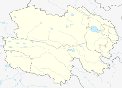
 Location of Qumarlêb County (red) in Yushu Prefecture (yellow) and Qinghai | |
 Qumarlêb Location of the seat in Qinghai | |
| Coordinates: 34°08′N 95°48′E | |
| Country | People's Republic of China |
| Province | Qinghai |
| Autonomous prefecture | Yushu |
| Area | |
| • Total | 47,000 km2 (18,000 sq mi) |
| Elevation | 4,191 m (13,750 ft) |
| Population (2020) | |
| • Total | 52,400 |
| • Density | 1.1/km2 (2.9/sq mi) |
| Time zone | UTC+8 (China Standard) |
| Postal code | 815500 |
Geography and climate


With an elevation of around 4,200 metres (14,000 ft), Qumarlêb County has an alpine climate (Köppen ETH), with long, very cold winters, and short, cool and rainy summers. Average low temperatures are below freezing from mid September to late May; however, due to the wide diurnal temperature variation, average highs are only below freezing from mid/late November until early March. Despite frequent rain during summer, when a majority of days sees rain, no month has less than 50 percent of possible sunshine; with monthly percent possible sunshine ranging from 51 percent in June to 78 percent in November, the county seat receives 2,782 hours of bright sunshine annually. The monthly 24-hour average temperature ranges from −14.5 °C (5.9 °F) in January to 8.9 °C (48.0 °F) in July, while the annual mean is −2.13 °C (28.2 °F). Over three-fourths of the annual precipitation of 406 mm (16.0 in) is delivered from June to September.
| Climate data for Qumarlêb County (1971−2000) | |||||||||||||
|---|---|---|---|---|---|---|---|---|---|---|---|---|---|
| Month | Jan | Feb | Mar | Apr | May | Jun | Jul | Aug | Sep | Oct | Nov | Dec | Year |
| Average high °C (°F) | −5.1 (22.8) |
−2.4 (27.7) |
2.1 (35.8) |
6.3 (43.3) |
10.7 (51.3) |
13.3 (55.9) |
15.6 (60.1) |
15.4 (59.7) |
11.8 (53.2) |
6.3 (43.3) |
0.4 (32.7) |
−3.7 (25.3) |
5.9 (42.6) |
| Average low °C (°F) | −22.8 (−9.0) |
−19.1 (−2.4) |
−13.5 (7.7) |
−8.9 (16.0) |
−3.6 (25.5) |
1.2 (34.2) |
3.2 (37.8) |
1.8 (35.2) |
−0.6 (30.9) |
−7.7 (18.1) |
−16.7 (1.9) |
−21.8 (−7.2) |
−9 (15.7) |
| Average precipitation mm (inches) | 3.0 (0.12) |
3.9 (0.15) |
7.2 (0.28) |
11.8 (0.46) |
37.7 (1.48) |
90.8 (3.57) |
92.2 (3.63) |
71.6 (2.82) |
65.5 (2.58) |
17.9 (0.70) |
2.3 (0.09) |
2.5 (0.10) |
406.4 (15.98) |
| Average precipitation days (≥ 0.1 mm) | 5.2 | 6.3 | 7.9 | 9.7 | 16.8 | 21.1 | 21.0 | 16.5 | 19.3 | 10.3 | 3.4 | 3.4 | 140.9 |
| Average relative humidity (%) | 48 | 43 | 42 | 47 | 58 | 67 | 68 | 67 | 71 | 61 | 49 | 46 | 56 |
| Mean monthly sunshine hours | 220.1 | 204.5 | 227.9 | 243.7 | 254.5 | 218.9 | 240.3 | 243.8 | 211.9 | 243.7 | 242.9 | 229.6 | 2,781.8 |
| Percent possible sunshine | 70 | 66 | 62 | 63 | 59 | 51 | 55 | 59 | 57 | 70 | 78 | 75 | 63 |
| Source: China Meteorological Administration | |||||||||||||
Administrative divisions
Qumarlêb County (Qumalai County) is divided to 1 towns and 5 townships.[1]
- Towns
- Yuegai (约改镇)
- Townships
|
|
References
- "统计用区划代码 www.stats.gov.cn" (in Chinese). XZQH. Retrieved 2020-12-27.
External links
This Qinghai location article is a stub. You can help Wikipedia by expanding it. |
На других языках
- [en] Qumarlêb County
[ru] Чумарлеб
Чумарлеб (кит. упр. 曲麻莱, пиньинь Qūmálái, палл. Цюймалай, тиб. ཆུ་དམར་ལེབ་, Вайли: chu dmar leb, тиб. пиньинь: Qumarlêb) — уезд в Юйшу-Тибетском автономном округе провинции Цинхай (КНР). Уезд назван в честь реки Чумар.Другой контент может иметь иную лицензию. Перед использованием материалов сайта WikiSort.org внимательно изучите правила лицензирования конкретных элементов наполнения сайта.
WikiSort.org - проект по пересортировке и дополнению контента Википедии