world.wikisort.org - China
![]() Hua'an (help·info) (simplified Chinese: 华安县; traditional Chinese: 華安縣; pinyin: Huá'ān Xiàn; Pe̍h-ōe-jī: Hôa-an-koān) is a county of Zhangzhou City, in the far south of Fujian province, People's Republic of China
Hua'an (help·info) (simplified Chinese: 华安县; traditional Chinese: 華安縣; pinyin: Huá'ān Xiàn; Pe̍h-ōe-jī: Hôa-an-koān) is a county of Zhangzhou City, in the far south of Fujian province, People's Republic of China
Hua'an County
华安县 | |
|---|---|
County | |
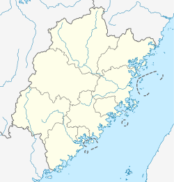 Hua'an Location in Fujian | |
| Coordinates: 24°50′N 117°31′E | |
| Country | People's Republic of China |
| Province | Fujian |
| Prefecture-level city | Zhangzhou |
| Time zone | UTC+8 (China Standard) |
The county comprises most of the lower watershed of the Jiulong River's north branch (九龙江北溪) and has long been a transport corridor. The first rail connection to the port of Xiamen, laid during the Great Leap Forward era, came down this valley.
The county seat is Huafeng (华丰镇). East of there, up a tributary valley, is Xiandu town (仙都镇), which features some prime examples of Tulou and Fujian Tulou.
Climate
| Climate data for Hua'an (1981−2010) | |||||||||||||
|---|---|---|---|---|---|---|---|---|---|---|---|---|---|
| Month | Jan | Feb | Mar | Apr | May | Jun | Jul | Aug | Sep | Oct | Nov | Dec | Year |
| Record high °C (°F) | 29.8 (85.6) |
32.4 (90.3) |
33.3 (91.9) |
35.6 (96.1) |
38.0 (100.4) |
38.7 (101.7) |
41.2 (106.2) |
39.5 (103.1) |
38.6 (101.5) |
36.6 (97.9) |
35.9 (96.6) |
30.1 (86.2) |
41.2 (106.2) |
| Average high °C (°F) | 18.9 (66.0) |
19.6 (67.3) |
21.8 (71.2) |
25.7 (78.3) |
29.1 (84.4) |
31.3 (88.3) |
34.4 (93.9) |
33.9 (93.0) |
31.8 (89.2) |
29.0 (84.2) |
24.9 (76.8) |
20.6 (69.1) |
26.8 (80.1) |
| Daily mean °C (°F) | 12.8 (55.0) |
14.1 (57.4) |
16.4 (61.5) |
20.4 (68.7) |
23.7 (74.7) |
26.2 (79.2) |
28.0 (82.4) |
27.6 (81.7) |
25.9 (78.6) |
22.6 (72.7) |
18.3 (64.9) |
13.9 (57.0) |
20.8 (69.5) |
| Average low °C (°F) | 8.9 (48.0) |
10.5 (50.9) |
12.8 (55.0) |
16.8 (62.2) |
20.2 (68.4) |
22.9 (73.2) |
24.0 (75.2) |
23.9 (75.0) |
22.3 (72.1) |
18.4 (65.1) |
13.9 (57.0) |
9.5 (49.1) |
17.0 (62.6) |
| Record low °C (°F) | −2.4 (27.7) |
−0.8 (30.6) |
−0.4 (31.3) |
5.5 (41.9) |
11.0 (51.8) |
15.5 (59.9) |
19.5 (67.1) |
19.8 (67.6) |
14.6 (58.3) |
8.1 (46.6) |
1.0 (33.8) |
−2.2 (28.0) |
−2.4 (27.7) |
| Average precipitation mm (inches) | 42.14 (1.66) |
95.6 (3.76) |
150.9 (5.94) |
181.0 (7.13) |
200.4 (7.89) |
269.9 (10.63) |
179.4 (7.06) |
240.2 (9.46) |
170.2 (6.70) |
51.8 (2.04) |
35.0 (1.38) |
33.4 (1.31) |
1,649.94 (64.96) |
| Average relative humidity (%) | 75 | 78 | 80 | 81 | 81 | 83 | 79 | 80 | 79 | 74 | 73 | 73 | 78 |
| Source: China Meteorological Data Service Center[1] | |||||||||||||
Administrative divisions
Towns:[2]
- Huafeng (华丰镇), Fengshan (丰山镇), Shajian (沙建镇), Xinxu (新圩镇), Gao'an (高安镇), Xiandu (仙都镇)
Townships:
- Makeng Township (马坑乡), Hulin Township (湖林乡), Gaoche Township (高车乡)
References
- 中国地面气候标准值月值(1981-2010) (in Simplified Chinese). China Meteorological Data Service Center. Retrieved 7 November 2022.
- "漳州市-行政区划网 www.xzqh.org" (in Chinese). XZQH. Retrieved 2012-05-24.
This Fujian location article is a stub. You can help Wikipedia by expanding it. |
На других языках
[de] Hua’an
Hua’an (chinesisch .mw-parser-output .Hans{font-size:110%}华安县, Pinyin Huá’ān Xiàn) ist ein Kreis der bezirksfreien Stadt Zhangzhou in der chinesischen Provinz Fujian. Sein Hauptort ist die Großgemeinde Huafeng (华丰镇). Der Kreis hat eine Fläche von 1.278 km² und zählt 134.276 Einwohner (Stand: Zensus 2020)[1]. Die Bevölkerungsdichte beträgt 105 Einwohner/km².- [en] Hua'an County
[fr] Xian de Hua'an
Le xian de Hua'an (华安县 ; pinyin : Huá'ān Xiàn) est un district administratif de la province du Fujian en Chine. Il est placé sous la juridiction de la ville-préfecture de Zhangzhou.[it] Contea di Hua'an
La contea di Hua'an (华安县S, Huá'ān XiànP) è una contea della Cina, situata nella provincia del Fujian.[ru] Хуаань
Хуаа́нь (кит. упр. 华安, пиньинь Huá'ān) — уезд городского округа Чжанчжоу провинции Фуцзянь (КНР).Текст в блоке "Читать" взят с сайта "Википедия" и доступен по лицензии Creative Commons Attribution-ShareAlike; в отдельных случаях могут действовать дополнительные условия.
Другой контент может иметь иную лицензию. Перед использованием материалов сайта WikiSort.org внимательно изучите правила лицензирования конкретных элементов наполнения сайта.
Другой контент может иметь иную лицензию. Перед использованием материалов сайта WikiSort.org внимательно изучите правила лицензирования конкретных элементов наполнения сайта.
2019-2026
WikiSort.org - проект по пересортировке и дополнению контента Википедии
WikiSort.org - проект по пересортировке и дополнению контента Википедии