world.wikisort.org - China
Dorbod Mongol Autonomous County (simplified Chinese: 杜尔伯特蒙古族自治县; traditional Chinese: 杜爾伯特蒙古族自治縣; pinyin: Dù'ěrbótè měnggǔzú Zìzhìxiàn; Mongolian: ᠳᠥᠷᠪᠡᠳ ᠮᠣᠩᠭᠣᠯ ᠥᠪᠡᠷᠲᠡᠭᠡᠨ ᠵᠠᠰᠠᠬᠤ ᠰᠢᠶᠠᠨ ) is a county in the west of Heilongjiang
Dorbod County | |
|---|---|
Autonomous county | |
| 杜尔伯特蒙古族自治县 · ᠳᠥᠷᠪᠡᠳ ᠮᠣᠩᠭᠣᠯ ᠥᠪᠡᠷᠲᠡᠭᠡᠨ ᠵᠠᠰᠠᠬᠤ ᠰᠢᠶᠠᠨ Dorbod Mongol Autonomous County | |
 | |
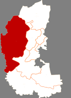 Dorbod in Daqing | |
 Daqing in Heilongjiang | |
| Coordinates: 46°51′46″N 124°26′33″E | |
| Country | People's Republic of China |
| Province | Heilongjiang |
| Prefecture-level city | Daqing |
| Area | |
| • Total | 6,427 km2 (2,481 sq mi) |
| Population (2010) | |
| • Total | 233,838 |
| • Density | 36/km2 (94/sq mi) |
| Time zone | UTC+8 (China Standard) |
province, China, bordering Jilin province to the southwest. It is under the jurisdiction of the prefecture-level city of Daqing. Formerly[when?] known as Dorbod Banner.[citation needed]
Administrative divisions
Dorbod Mongol Autonomous County is divided into 5 towns and 6 townships.[1]
- 5 towns
- Taikang (泰康镇), Hujitumo (胡吉吐莫镇), Yantongtun (烟筒屯镇), Talaha (他拉哈镇), Lianhuanhu (连环湖镇)
- 6 townships
- Yixin (一心乡), Ke'ertai (克尔台乡), Aolinxibo (敖林西伯乡), Bayanchagan (巴彦查干乡), Yaoxin (腰新乡), Jiangwan (江湾乡)
Demographics
The population of the county was 243,829 in 1999.[2]
It is named after the Dörbed Mongols.
Climate
| Climate data for Dorbod (1981−2010) | |||||||||||||
|---|---|---|---|---|---|---|---|---|---|---|---|---|---|
| Month | Jan | Feb | Mar | Apr | May | Jun | Jul | Aug | Sep | Oct | Nov | Dec | Year |
| Record high °C (°F) | −0.5 (31.1) |
9.4 (48.9) |
20.7 (69.3) |
31.8 (89.2) |
35.9 (96.6) |
40.5 (104.9) |
39.5 (103.1) |
36.1 (97.0) |
33.8 (92.8) |
27.1 (80.8) |
15.3 (59.5) |
5.8 (42.4) |
40.5 (104.9) |
| Average high °C (°F) | −12.6 (9.3) |
−6.7 (19.9) |
2.2 (36.0) |
13.1 (55.6) |
21.2 (70.2) |
26.7 (80.1) |
28.2 (82.8) |
26.7 (80.1) |
20.7 (69.3) |
11.3 (52.3) |
−1.3 (29.7) |
−10.4 (13.3) |
9.9 (49.9) |
| Daily mean °C (°F) | −18.0 (−0.4) |
−12.9 (8.8) |
−3.5 (25.7) |
7.1 (44.8) |
15.4 (59.7) |
21.4 (70.5) |
23.6 (74.5) |
22.0 (71.6) |
15.4 (59.7) |
6.1 (43.0) |
−5.9 (21.4) |
−15.1 (4.8) |
4.6 (40.3) |
| Average low °C (°F) | −22.4 (−8.3) |
−18.1 (−0.6) |
−8.9 (16.0) |
1.2 (34.2) |
9.5 (49.1) |
16.1 (61.0) |
19.3 (66.7) |
17.7 (63.9) |
10.5 (50.9) |
1.5 (34.7) |
−9.8 (14.4) |
−18.9 (−2.0) |
−0.2 (31.7) |
| Record low °C (°F) | −36.8 (−34.2) |
−32.6 (−26.7) |
−23.2 (−9.8) |
−10.6 (12.9) |
−0.8 (30.6) |
3.9 (39.0) |
12.0 (53.6) |
9.7 (49.5) |
−0.7 (30.7) |
−12.3 (9.9) |
−25.4 (−13.7) |
−32.2 (−26.0) |
−36.8 (−34.2) |
| Average precipitation mm (inches) | 1.3 (0.05) |
1.2 (0.05) |
5.8 (0.23) |
20.5 (0.81) |
28.5 (1.12) |
72.0 (2.83) |
135.8 (5.35) |
95.1 (3.74) |
37.4 (1.47) |
15.8 (0.62) |
3.4 (0.13) |
2.8 (0.11) |
419.6 (16.51) |
| Average relative humidity (%) | 69 | 61 | 50 | 47 | 48 | 59 | 72 | 72 | 63 | 58 | 61 | 68 | 61 |
| Source: China Meteorological Data Service Center[3] | |||||||||||||
References
- "国家统计局" (in Chinese). National Bureau of Statistics of the People's Republic of China. Retrieved 2021-12-07.
- (in English) National Population Statistics Materials by County and City - 1999 Period, in China County & City Population 1999, Harvard China Historical GIS
- 中国地面气候标准值月值(1981-2010) (in Simplified Chinese). China Meteorological Data Service Center. Retrieved 23 August 2022.
External links
- (in Chinese) Government site - Google translation
See also
- Eastern Dorbet
Mongol-designated autonomous areas in China | |||||||||
|---|---|---|---|---|---|---|---|---|---|
| Regions |
|  | |||||||
| Prefectures and counties |
| ||||||||
| |||||||||
Authority control | |
|---|---|
| General | |
| National libraries | |
This Heilongjiang location article is a stub. You can help Wikipedia by expanding it. |
На других языках
- [en] Dorbod Mongol Autonomous County
[ru] Дурбэд-Монгольский автономный уезд
Дурбэд-Монгольский автономный уезд (кит. упр. 杜尔伯特蒙古族自治县, пиньинь Dù'ěrbótè Měnggǔzú Zìzhìxiàn, монг. Дөрвөдийн Монгол өөртөө засах шянь) — автономный уезд в городском округе Дацин провинции Хэйлунцзян КНР. Слово «Дурбэд» происходит от монгольского слова, означающего «четыре», и связано с происхождением дурбэдских монголов (потомков Джочи-Хасара).Текст в блоке "Читать" взят с сайта "Википедия" и доступен по лицензии Creative Commons Attribution-ShareAlike; в отдельных случаях могут действовать дополнительные условия.
Другой контент может иметь иную лицензию. Перед использованием материалов сайта WikiSort.org внимательно изучите правила лицензирования конкретных элементов наполнения сайта.
Другой контент может иметь иную лицензию. Перед использованием материалов сайта WikiSort.org внимательно изучите правила лицензирования конкретных элементов наполнения сайта.
2019-2026
WikiSort.org - проект по пересортировке и дополнению контента Википедии
WikiSort.org - проект по пересортировке и дополнению контента Википедии