world.wikisort.org - China
Hulin (Chinese: 虎林; pinyin: Hǔlín; lit. 'tiger forest') is a county-level city on the Muling River in southeastern Heilongjiang province, People's Republic of China. With a population of around 200,000, it is under the administration of Jixi. Nearby are Lake Xingkai, 51 kilometres (32 mi) to the southwest, the Usuri River, which forms the Russian border 38 kilometres (24 mi) to the east. The main agricultural products include soybeans, cattle, milk, various organic produces, and lumber.[1]
Hulin
虎林市 | |
|---|---|
County-level city | |
 Location of the city | |
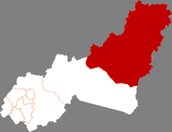
 Hulin Location in Heilongjiang | |
| Coordinates: 45°46′N 132°56′E | |
| Country | People's Republic of China |
| Province | Heilongjiang |
| Prefecture-level city | Jixi |
| Municipal seat | Hulin Town (虎林镇) |
| Area | |
| • Total | 9,328.71 km2 (3,601.84 sq mi) |
| Elevation | 85 m (280 ft) |
| Population (2010) | |
| • Total | 317,884 |
| • Density | 34/km2 (88/sq mi) |
| Time zone | UTC+8 (China Standard) |
| Postal code | 230381 |
| Climate | Dwb |
| Website | hljhulin |
Geography and climate

Hulin has a monsoon-influenced humid continental climate (Köppen Dwb), with long, bitterly cold, but dry winters, and warm, humid summers. The monthly 24-hour average temperature ranges from −18.3 °C (−1 °F) in January to 21.6 °C (71 °F) in July, and the annual mean is 3.49 °C (38.3 °F). More than 2/3 of the year's precipitation occurs from June to September.
| Climate data for Hulin (1971−2000) | |||||||||||||
|---|---|---|---|---|---|---|---|---|---|---|---|---|---|
| Month | Jan | Feb | Mar | Apr | May | Jun | Jul | Aug | Sep | Oct | Nov | Dec | Year |
| Record high °C (°F) | 2.1 (35.8) |
7.1 (44.8) |
17.0 (62.6) |
26.2 (79.2) |
30.4 (86.7) |
33.7 (92.7) |
35.2 (95.4) |
34.7 (94.5) |
31.5 (88.7) |
24.8 (76.6) |
13.4 (56.1) |
4.7 (40.5) |
35.2 (95.4) |
| Average high °C (°F) | −13.2 (8.2) |
−8.1 (17.4) |
0.6 (33.1) |
11.3 (52.3) |
18.6 (65.5) |
23.3 (73.9) |
26.4 (79.5) |
25.5 (77.9) |
20.2 (68.4) |
11.4 (52.5) |
−0.4 (31.3) |
−10.2 (13.6) |
8.8 (47.8) |
| Daily mean °C (°F) | −18.3 (−0.9) |
−13.6 (7.5) |
−4.4 (24.1) |
5.5 (41.9) |
12.7 (54.9) |
18.0 (64.4) |
21.6 (70.9) |
20.7 (69.3) |
14.5 (58.1) |
5.7 (42.3) |
−5.4 (22.3) |
−15.1 (4.8) |
3.5 (38.3) |
| Average low °C (°F) | −23.1 (−9.6) |
−19 (−2) |
−9.8 (14.4) |
0.2 (32.4) |
7.0 (44.6) |
13.2 (55.8) |
17.3 (63.1) |
16.4 (61.5) |
9.4 (48.9) |
0.7 (33.3) |
−9.9 (14.2) |
−19.6 (−3.3) |
−1.4 (29.4) |
| Record low °C (°F) | −34.7 (−30.5) |
−31.9 (−25.4) |
−30.3 (−22.5) |
−11 (12) |
−3.4 (25.9) |
5.0 (41.0) |
10.6 (51.1) |
6.1 (43.0) |
−2.6 (27.3) |
−14.4 (6.1) |
−27.6 (−17.7) |
−31.5 (−24.7) |
−34.7 (−30.5) |
| Average precipitation mm (inches) | 5.4 (0.21) |
5.8 (0.23) |
12.4 (0.49) |
33.4 (1.31) |
55.2 (2.17) |
82.1 (3.23) |
108.2 (4.26) |
112.5 (4.43) |
78.0 (3.07) |
48.6 (1.91) |
15.9 (0.63) |
8.1 (0.32) |
565.6 (22.26) |
| Average precipitation days (≥ 0.1 mm) | 5.9 | 5.2 | 6.5 | 9.5 | 13.5 | 14.1 | 12.7 | 13.2 | 11.2 | 9.2 | 7.8 | 7.7 | 116.5 |
| Source: Weather China | |||||||||||||
Administrative divisions
Hulin City is divided into 7 towns and 4 townships.[2]
- 7 towns
- Hulin (虎林镇), Dongfanghong (东方红镇), Yingchun (迎春镇), Hutou (虎头镇), Yanggang (杨岗镇), Dongcheng (东诚镇), Baodong (宝东镇)
- 4 townships
- Xinyue (新乐乡), Weiguang (伟光乡), Zhenbaodao (珍宝岛乡), Abei (阿北乡)
References
- Hulin Government web site.
- "国家统计局" (in Chinese). National Bureau of Statistics of the People's Republic of China. Retrieved 2021-12-07.
Heilongjiang topics | |
|---|---|
Harbin (capital) | |
| General |
|
| Geography | |
| Education |
|
| Visitor attractions |
|
| |
На других языках
- [en] Hulin
[ru] Хулинь
Хули́нь (кит. упр. 虎林, пиньинь Hǔlín) — городской уезд городского округа Цзиси провинции Хэйлунцзян (КНР). Название городского уезда происходит от протекающей здесь реки Цихулиньхэ.Другой контент может иметь иную лицензию. Перед использованием материалов сайта WikiSort.org внимательно изучите правила лицензирования конкретных элементов наполнения сайта.
WikiSort.org - проект по пересортировке и дополнению контента Википедии