world.wikisort.org - China
Fangzheng County (simplified Chinese: 方正县; traditional Chinese: 方正縣; pinyin: Fāngzhèng Xiàn) is a county of Heilongjiang Province, Northeast China, it is under the administration of the prefecture-level city of Harbin, the capital of Heilongjiang. It borders Tonghe County to the north, Yilan County to the northeast, Yanshou County to the south, Bin County to the west, and Mulan County to the northwest, as well as the prefecture-level city of Mudanjiang to the northwest.
Fangzheng County
方正县 | |
|---|---|
County | |
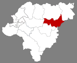 Location of Fangzheng in Harbin | |
 Harbin in Heilongjiang | |
| Coordinates: 45°50′31″N 128°50′10″E[1] | |
| Country | People's Republic of China |
| Province | Heilongjiang |
| Sub-provincial city | Harbin |
| Area | |
| • Total | 2,968.6 km2 (1,146.2 sq mi) |
| Population (2010)[3] | |
| • Total | 203,853 |
| • Density | 69/km2 (180/sq mi) |
| Time zone | UTC+8 (China Standard) |
| Postal code | 1508XX |
| Area code | 0451 |
| Website | hrbfz |
Administrative divisions
Fangzheng County is divided into 4 towns and 4 townships.[4]
- 4 towns
- Fangzheng (方正镇), Huifa (会发镇), Daluomi (大罗密镇), Demoli (得莫利镇)
- 4 townships
- Tianmen (天门乡), Songnan (松南乡), Deshan (德善乡), Baoxing (宝兴乡)
Demographics
The population of the district was 230,000.[5]
There are many descendants of Japanese settlers in Manchukuo.[6]
Climate
| Climate data for Fangzheng (1981−2010) | |||||||||||||
|---|---|---|---|---|---|---|---|---|---|---|---|---|---|
| Month | Jan | Feb | Mar | Apr | May | Jun | Jul | Aug | Sep | Oct | Nov | Dec | Year |
| Record high °C (°F) | 2.6 (36.7) |
8.6 (47.5) |
19.3 (66.7) |
29.8 (85.6) |
34.2 (93.6) |
36.4 (97.5) |
36.5 (97.7) |
36.8 (98.2) |
30.7 (87.3) |
27.0 (80.6) |
17.7 (63.9) |
5.9 (42.6) |
36.8 (98.2) |
| Average high °C (°F) | −12.8 (9.0) |
−7.1 (19.2) |
1.8 (35.2) |
12.9 (55.2) |
20.4 (68.7) |
25.4 (77.7) |
27.4 (81.3) |
26.1 (79.0) |
20.7 (69.3) |
11.8 (53.2) |
−0.7 (30.7) |
−10.2 (13.6) |
9.6 (49.3) |
| Daily mean °C (°F) | −18.6 (−1.5) |
−13.7 (7.3) |
−4.2 (24.4) |
6.4 (43.5) |
13.8 (56.8) |
19.7 (67.5) |
22.3 (72.1) |
20.9 (69.6) |
14.2 (57.6) |
5.6 (42.1) |
−5.8 (21.6) |
−15.4 (4.3) |
3.8 (38.8) |
| Average low °C (°F) | −23.7 (−10.7) |
−19.8 (−3.6) |
−9.9 (14.2) |
0.8 (33.4) |
7.7 (45.9) |
14.6 (58.3) |
18.2 (64.8) |
16.7 (62.1) |
8.8 (47.8) |
0.7 (33.3) |
−10.2 (13.6) |
−19.9 (−3.8) |
−1.3 (29.6) |
| Record low °C (°F) | −38.6 (−37.5) |
−35.0 (−31.0) |
−29.3 (−20.7) |
−11.0 (12.2) |
−4.2 (24.4) |
4.9 (40.8) |
11.7 (53.1) |
7.5 (45.5) |
−3.2 (26.2) |
−16.3 (2.7) |
−27.7 (−17.9) |
−35.0 (−31.0) |
−38.6 (−37.5) |
| Average precipitation mm (inches) | 5.6 (0.22) |
5.2 (0.20) |
13.7 (0.54) |
25.8 (1.02) |
51.8 (2.04) |
92.7 (3.65) |
143.8 (5.66) |
141.2 (5.56) |
60.5 (2.38) |
37.3 (1.47) |
14.4 (0.57) |
8.7 (0.34) |
600.7 (23.65) |
| Average relative humidity (%) | 73 | 69 | 63 | 61 | 64 | 73 | 82 | 84 | 78 | 68 | 68 | 73 | 71 |
| Source: China Meteorological Data Service Center[7] | |||||||||||||
Notes and references
- Google (2014-07-02). "Fangzheng" (Map). Google Maps. Google. Retrieved 2014-07-02.
- Harbin Statistical Yearbook 2011 (《哈尔滨统计年鉴2011》). Accessed 8 July 2014.
- 2010 Census Harbin primary statistics report (《哈尔滨市2010年第六次全国人口普查主要数据公报》). Accessed 8 July 2014.
- "国家统计局 2019" (in Chinese). National Bureau of Statistics of the People's Republic of China. Retrieved 2021-12-07.
- "Profile of Fangzheng County" (in Chinese). Official website of Fangzheng County Government. 2010-07-04. Retrieved 2011-08-04.
- Kan, Karoline (15 May 2018). "A Chinese Town's Deep Bonds with Japan Bring Wealth and Hatred". The New York Times.
- 中国地面气候标准值月值(1981-2010) (in Simplified Chinese). China Meteorological Data Service Center. Retrieved 23 August 2022.
External links
- (in Chinese) Government site
Authority control | |
|---|---|
| General | |
| National libraries | |
This Heilongjiang location article is a stub. You can help Wikipedia by expanding it. |
На других языках
- [en] Fangzheng County
[ru] Фанчжэн
Фанчжэ́н (кит. упр. 方正, пиньинь Fāngzhèng) — уезд города субпровинциального значения Харбин провинции Хэйлунцзян (КНР).Текст в блоке "Читать" взят с сайта "Википедия" и доступен по лицензии Creative Commons Attribution-ShareAlike; в отдельных случаях могут действовать дополнительные условия.
Другой контент может иметь иную лицензию. Перед использованием материалов сайта WikiSort.org внимательно изучите правила лицензирования конкретных элементов наполнения сайта.
Другой контент может иметь иную лицензию. Перед использованием материалов сайта WikiSort.org внимательно изучите правила лицензирования конкретных элементов наполнения сайта.
2019-2026
WikiSort.org - проект по пересортировке и дополнению контента Википедии
WikiSort.org - проект по пересортировке и дополнению контента Википедии