world.wikisort.org - Brazil
Santa Maria de Jetibá is the name of a municipality and of its capital in central Espírito Santo, Southeastern Brazil. It was founded in 1857 by Pomeranian immigrants who arrived through the state capital Vitória by going up the river Santa Maria.
Santa Maria de Jetibá | |
|---|---|
 Vale do Canaã (portuguese), a valley near of this town | |
 Flag  Seal | |
 Location in Espírito Santo | |
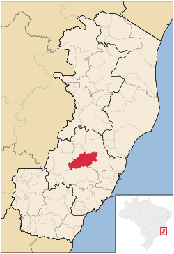
 Santa Maria de Jetibá Location in Brazil | |
| Coordinates: 20°2′27″S 40°44′45″W | |
| Country | Brazil |
| Region | Southeast |
| State | State of Espírito Santo |
| Founded | May 6, 1988 |
| Government | |
| • Mayor | Eduardo Stuhr (PDT) |
| Area | |
| • Total | 735.552 km2 (283.998 sq mi) |
| Elevation | 720 m (2,360 ft) |
| Population (2020 [1]) | |
| • Total | 41,015 |
| • Density | 51.319/km2 (132.92/sq mi) |
| Demonym | Santamariense |
| Time zone | UTC−3 (BRT) |
| Postal Code | 29645000 |
| Website | Santa Maria de Jetibá City Hall |
Geography
Located in the south-central mountain region of Espírito Santo, this municipality has an area of 735.55 square kilometers. The town of Santa Maria de Jetibá is 720 meters above sea level, and the highest point in the state is Garrafão Peak, at 1200 meters (3937 ft) above sea level.
People
With a total population of 41,015 (2020), Santa Maria de Jetibá is considered one of the last significant East Pomeranian-speaking communities in the world. Those immigrants (Pomeranians), who came from the historical region Pomerania, now part of Germany and Poland where it is known as Pommern and Pomorze respectively.
In Brazil, many Pomeranians also established communities in Santa Catarina (see Pomerode) and Rio Grande do Sul (see Arroio do Padre). Santa Maria de Jetibá is a place where the people still speak solely East Pomeranian in their day-to-day life. Due to the isolation of this community, most of the members of the community live in very poor conditions. Due also to financial constraints by the state, very little investment in education is forthcoming, and the language barrier persists to be a real problem for the community. This also hinders their future prospects, of course, by them not having proper education, thus a reasonable expectation in the work market. Those communities are mainly rural.
Demography
Most of the population of that city is descended from Pomeranian and German peoples. [2][3] East Pomeranian, a dialect of Low German, has co-official status in Santa Maria de Jetibá.
| Race | Percentage |
|---|---|
| Whites | 81.8% |
| Blacks | 1.9% |
| Mixed | 15.6% |
| Asian | 0.7% |
Source: 2010 Census
Climate
Santa Maria de Jetibá is on a high valley and the altitude of this Town is about 700m above the sea level. The elevation of this municipality changes the climate and it features a cool and dry climate on winters and an wet and hot days and cool nights on summers. Santa Maria de Jetibá features a humid subtropical climate type Cwa.
| Santa Maria de Jetibá | ||||||||||||||||||||||||||||||||||||||||||||||||||||||||||||
|---|---|---|---|---|---|---|---|---|---|---|---|---|---|---|---|---|---|---|---|---|---|---|---|---|---|---|---|---|---|---|---|---|---|---|---|---|---|---|---|---|---|---|---|---|---|---|---|---|---|---|---|---|---|---|---|---|---|---|---|---|
| Climate chart (explanation) | ||||||||||||||||||||||||||||||||||||||||||||||||||||||||||||
| ||||||||||||||||||||||||||||||||||||||||||||||||||||||||||||
| ||||||||||||||||||||||||||||||||||||||||||||||||||||||||||||
| Month | Jan | Feb | Mar | Apr | May | Jun | Jul | Aug | Sep | Oct | Nov | Dec | Year |
|---|---|---|---|---|---|---|---|---|---|---|---|---|---|
| Average high °C (°F) | 28.6 (83.5) |
28.3 (82.9) |
27.1 (80.8) |
25.5 (77.9) |
24.5 (76.1) |
23.7 (74.7) |
24.2 (75.6) |
24.6 (76.3) |
25.2 (77.4) |
26.0 (78.8) |
26.8 (80.2) |
26.1 (79.0) |
25.9 (78.6) |
| Average low °C (°F) | 18.0 (64.4) |
18.0 (64.4) |
16.8 (62.2) |
14.8 (58.6) |
13.0 (55.4) |
12.4 (54.3) |
12.9 (55.2) |
14.2 (57.6) |
15.5 (59.9) |
16.6 (61.9) |
17.4 (63.3) |
16.0 (60.8) |
15.5 (59.8) |
| Average precipitation mm (inches) | 188 (7.4) |
103 (4.1) |
125 (4.9) |
88 (3.5) |
60 (2.4) |
36 (1.4) |
49 (1.9) |
48 (1.9) |
66 (2.6) |
125 (4.9) |
193 (7.6) |
209 (8.2) |
1,290 (50.8) |
| Source: Clic RBS (in Portuguese) [4] | |||||||||||||
See also
- Low German language
References
- IBGE 2020
- Santa Maria de Jetibá realiza a II PomerBR Archived 2017-03-16 at the Wayback Machine
- Santa Maria de Jetibá realiza 23ª Festa Pomerana Archived 2014-03-04 at the Wayback Machine
- Climate-data.org "Climatologia de Santa Maria de Jetibá - ES" (in Portuguese). Clic RBS. Retrieved 4 August 2011.
{{cite web}}: Check|url=value (help)
External links
 Santa Maria de Jetibá travel guide from Wikivoyage
Capital: Vitória | ||||||||||
| Mesoregion Central |
|  | ||||||||
| Mesoregion Litoral Norte |
| |||||||||
| Mesoregion Noroeste |
| |||||||||
| Mesoregion Sul |
| |||||||||
Authority control | |
|---|---|
| General | |
| National libraries | |
This geographical article relating to Espírito Santo is a stub. You can help Wikipedia by expanding it. |
На других языках
- [en] Santa Maria de Jetibá
[ru] Санта-Мария-ди-Жетиба
Санта-Мария-ди-Жетиба (порт. Santa Maria de Jetibá) — муниципалитет в Бразилии, входит в штат Эспириту-Санту. Составная часть мезорегиона Центр штата Эспириту-Санту. Входит в экономико-статистический микрорегион Санта-Тереза. Население составляет 32 844 человека на 2006 год. Занимает площадь 735,552 км². Плотность населения — 44,7 чел./км².Другой контент может иметь иную лицензию. Перед использованием материалов сайта WikiSort.org внимательно изучите правила лицензирования конкретных элементов наполнения сайта.
WikiSort.org - проект по пересортировке и дополнению контента Википедии