world.wikisort.org - Brazil
Águia Branca ("white eagle" in English) is a municipality located in the west-central portion of the state of Espírito Santo, in southeastern Brazil. The municipality has a population of 9,631 (2020) and its area is 454 km².[2]
Águia Branca | |
|---|---|
Municipality | |
 Flag  Coat of arms | |
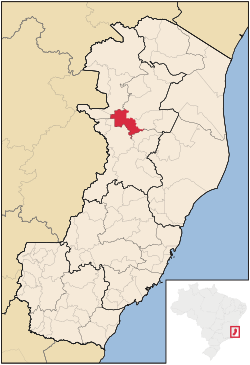 Location in Espírito Santo state | |
 Águia Branca Location in Brazil | |
| Coordinates: 18°58′58″S 40°44′24″W | |
| Country | Brazil |
| Region | Southeast |
| State | Espírito Santo |
| Area | |
| • Total | 454 km2 (175 sq mi) |
| Population (2020 [1]) | |
| • Total | 9,631 |
| • Density | 21/km2 (55/sq mi) |
| Time zone | UTC−3 (BRT) |
History
It was first colonized by Polish immigrants, in 1928. Polish was widely spoken in the region till the Second World War, when the Brazilian government prohibited education in Polish and German.
Geography
Located 226 km from the state capital Vitória. Municipalities it shares borders with include: (west) Mantenópolis and Pancas. (north) Barra de São Francisco and Nova Venécia. (south) São Domingos do Norte. (east) São Gabriel da Palha.
The municipality is in a markedly mountainous region of the state, and Águia Branca town looks up at great finger shaped stone peaks which surround the area. Municipal maximum height is at 878m above sea level.
References
- IBGE 2020
- IBGE -
External links
Capital: Vitória | ||||||||||
| Mesoregion Central |
|  | ||||||||
| Mesoregion Litoral Norte |
| |||||||||
| Mesoregion Noroeste |
| |||||||||
| Mesoregion Sul |
| |||||||||
This geographical article relating to Espírito Santo is a stub. You can help Wikipedia by expanding it. |
На других языках
- [en] Águia Branca
[ru] Агиа-Бранка
Агиа-Бранка (порт. Águia Branca) — муниципалитет в Бразилии, входит в штат Эспириту-Санту. Составная часть мезорегиона Северо-запад штата Эспириту-Санту. Входит в экономико-статистический микрорегион Нова-Венесия. Население составляет 9436 человек на 2006 год. Занимает площадь 449,630 км². Плотность населения — 21,0 чел./км².Другой контент может иметь иную лицензию. Перед использованием материалов сайта WikiSort.org внимательно изучите правила лицензирования конкретных элементов наполнения сайта.
WikiSort.org - проект по пересортировке и дополнению контента Википедии