world.wikisort.org - Brazil
Fundão (Portuguese pronunciation: [fũˈdɐ̃w]) is a municipality in Espírito Santo, south eastern Brazil. Its population was 21,948 (2020) and its area is 280 km².[2]
Fundão | |
|---|---|
Municipality | |
| Municipality of Fundão | |
 View of Fundão from peak of Goiapaba-Açu | |
 Flag  Seal | |
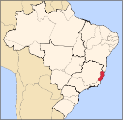
 Location in the Espírito Santo | |
 | |
| Coordinates: 19°55′58″S 40°24′25″W | |
| Country | |
| Region | Southeast |
| State | |
| Founded | 5 July 1923 |
| Government | |
| • Mayor | Pretinho Nunes (PDT) |
| Area | |
| • Total | 279.648 km2 (107.973 sq mi) |
| Elevation | 41 m (135 ft) |
| Population (2020 [1]) | |
| • Total | 21,948 |
| • Density | 63.05/km2 (163.3/sq mi) |
| Time zone | UTC−3 (BRT) |
| Postal Code | 29185-000 |
| Area code | +55 27 |
| Website | Fundão, Espírito Santo |
History
This municipality was created on the 5 July 1923. It was created from part of Nova Almeida municipality, which today is no longer a municipality but a town (distrito in Portuguese) of Serra municipality.
Location
Situated about 57 km from the state capital Vitória. Bordering municipalities include: Aracruz and Ibiraçu (N), Santa Teresa and Santa Leopoldina (W), Serra, Espírito Santo (S) and the Atlantic Ocean (E).
The coastline of the municipality is protected by the 112,545 hectares (278,100 acres) Costa das Algas Environmental Protection Area, created in 2010.[3]
See also
- IBGE
References
- IBGE 2020
- "Cidades". IBGE. Archived from the original on 11 June 2008. Retrieved 2014-08-03.
- APA Costa das Algas (in Portuguese), ISA: Instituto Socioambiental, retrieved 28 October 2016
Capital: Vitória | ||||||||||
| Mesoregion Central |
|  | ||||||||
| Mesoregion Litoral Norte |
| |||||||||
| Mesoregion Noroeste |
| |||||||||
| Mesoregion Sul |
| |||||||||
| Authority control |
|
|---|
This geographical article relating to Espírito Santo is a stub. You can help Wikipedia by expanding it. |
На других языках
- [en] Fundão, Espírito Santo
[ru] Фундан (Эспириту-Санту)
Фундан (порт. Fundão) — муниципалитет в Бразилии, входит в штат Эспириту-Санту. Составная часть мезорегиона Северное побережье штата Эспириту-Санту. Находится в составе крупной городской агломерации. Входит в экономико-статистический микрорегион Линьярис. Население составляет 16 431 человек на 2009 год. Занимает площадь 279,648 км². Плотность населения — 58,8 чел./км².Другой контент может иметь иную лицензию. Перед использованием материалов сайта WikiSort.org внимательно изучите правила лицензирования конкретных элементов наполнения сайта.
WikiSort.org - проект по пересортировке и дополнению контента Википедии