world.wikisort.org - Australia
Bathurst Regional Council is a local government area in the Central West region of New South Wales, Australia. The area is located adjacent to the Great Western Highway, Mid-Western Highway, Mitchell Highway and the Main Western railway line. At the 2016 census, the Bathurst Region had a population of 41,300.[1]
| Bathurst Regional Council New South Wales | |||||||||||||||
|---|---|---|---|---|---|---|---|---|---|---|---|---|---|---|---|
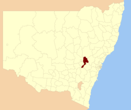 Location in New South Wales | |||||||||||||||
 Bathurst Civic Centre | |||||||||||||||
| Coordinates | 33°25′S 149°34′E | ||||||||||||||
| Population | |||||||||||||||
| • Density | 10.812/km2 (28.00/sq mi) | ||||||||||||||
| Established | 26 May 2004 | ||||||||||||||
| Area | 3,820 km2 (1,474.9 sq mi) | ||||||||||||||
| Mayor | Robert Taylor (Unaligned) | ||||||||||||||
| Council seat | Bathurst | ||||||||||||||
| Region | Central West | ||||||||||||||
| State electorate(s) | Bathurst | ||||||||||||||
| Federal division(s) | Calare | ||||||||||||||
| Website | Bathurst Regional Council | ||||||||||||||
| |||||||||||||||
The administrative centre of the area is located in the city of Bathurst, approximately 200 kilometres (120 mi) west of Sydney central business district.
The mayor of Bathurst is Cr. Robert Taylor, Deputy Mayor being Cr. Benjamin Fry, both unaligned politicians.[3]

City, towns and localities
In addition to the city of Bathurst, the LGA contains the villages of Eglinton, Freemantle, Perthville, Rockley, Raglan, Georges Plains, Trunkey Creek, Brewongle, Vittoria, Peel, Wattle Flat, Sofala, Hill End, Meadow Flat, Sallys Flat and Caloola.
Demographics
| Selected historical census data for Bathurst Regional local government area | ||||||
|---|---|---|---|---|---|---|
| Census year | 2011[4] | 2016[1] | ||||
| Population | Estimated residents on census night | 38,519 | ||||
| LGA rank in terms of size within New South Wales | 52nd | |||||
| % of New South Wales population | 0.56% | |||||
| % of Australian population | 0.18% | |||||
| Estimated ATSI population on census night | 1,634 | |||||
| % of ATSI population to residents | 4.20% | |||||
| Cultural and language diversity | ||||||
| Ancestry, top responses | Australian | 32.9% | ||||
| English | 30.1% | |||||
| Irish | 10.9% | |||||
| Scottish | 7.3% | |||||
| German | 2.6% | |||||
| Language, top responses (other than English) | Mandarin | 0.2% | ||||
| Arabic | 0.3% | |||||
| Cantonese | 0.2% | |||||
| Punjabi | n/a | |||||
| German | 0.2% | |||||
| Religious affiliation | ||||||
| Religious affiliation, top responses | Catholic | 34.1% | ||||
| No religion, so described | 16.0% | |||||
| Anglican | 23.2% | |||||
| Not stated | n/a | |||||
| Presbyterian and Reformed | 4.6% | |||||
| Median weekly incomes | ||||||
| Personal income | Median weekly personal income | A$544 | A$646 | |||
| % of Australian median income | 94% | |||||
| Family income | Median weekly family income | A$1,437 | A$1,632 | |||
| % of Australian median income | 97% | |||||
| Household income | Median weekly household income | A$1,142 | A$1,310 | |||
| % of Australian median income | 93% | |||||
Council
Current composition and election method
Bathurst Regional Council is composed of nine councillors elected proportionally as a single ward. All councillors are elected for a fixed three-year term of office. The mayor is elected by the councillors at the first meeting of the council. The most recent election of councillors was held on 4 December 2021, and the makeup of the council is as follows:[5]
| Party | Councillors | |
|---|---|---|
| Independents and Unaligned | 9 | |
| Total | 9 | |
The current Council, elected in 2021, in order of election, is:[5]
| Councillor | Party | Notes | |
|---|---|---|---|
| Ben Fry | Independent | Deputy Mayor | |
| Robert (Stumpy) Taylor | Unaligned | Mayor 2022-date.[6] | |
| Ian North | Independent | Mayor 2021-2021. | |
| Marg Hogan | Independent | ||
| Kirralee Burke | Independent | Elected on Ben Fry's ticket. | |
| Graeme Hanger OAM | Independent | Mayor 2017-2019.[7] | |
| Jess Jennings | Independent | ||
| Andrew (Struthy) Smith | Unaligned | Elected on Robert (Stumpy) Taylor's ticket. | |
| Warren Aubin | Independent | ||
History
Bathurst was proclaimed a city in 1885.[8] The Bathurst Region was created on 26 May 2004 as a result of a merger of Bathurst City and Evans Shire.
A 2015 review of local government boundaries recommended that the Bathurst Region merge with the Oberon Shire to form a new council with an area of 7,443 square kilometres (2,874 sq mi) and support a population of approximately 47,000.[9] The outcome of an independent review was expected to be completed by mid–2016. Bathurst Regional Council was officially notified on 6 March 2017 by the NSW State Government that the proposed merger between Bathurst Regional Council and Oberon Council will not proceed. The letter from the Minister for Local Government Gabrielle Upton advising Council of the decision can be viewed on the Bathurst Regional Council official website.
Sister cities
Bathurst has had a sister city relationship with Ohkuma (Japan) since March 1991.The relationship provides an opportunity for both Bathurst and Ohkuma residents to learn about each other's culture and language.As part of the relationship Council coordinates the Sister City Working Party. This group is made up of different community members who have an interest in Japan and further developing the strong relationship that already exists between Bathurst and Ohkuma. Bathurst has sister city relations with the following city:[10]
 Ōkuma, Japan, since 1991
References
- Australian Bureau of Statistics (27 June 2017). "Bathurst Regional (A)". 2016 Census QuickStats. Retrieved 7 July 2017.
- "3218.0 – Regional Population Growth, Australia, 2017–18". Australian Bureau of Statistics. 27 March 2019. Retrieved 27 March 2019. Estimated resident population (ERP) at 30 June 2018.
- Therese, Ryan (15 January 2021). "Contact Bathurst Regional Councillors". Bathurst Regional Council. Archived from the original on 17 December 2015. Retrieved 15 January 2021.
- Australian Bureau of Statistics (31 October 2012). "Bathurst Regional (A)". 2011 Census QuickStats. Retrieved 23 December 2012.
- "Bathurst Regional - Councillor Election results". NSW Electoral Commission. 21 December 2021. Retrieved 18 March 2022.
- "What's in a nickname? How Stumpy became the Mayor of Bathurst". ABC News. 25 January 2022. Retrieved 18 March 2022.
- "Graeme Hanger elected the new mayor of Bathurst". Western Advocate. 2 March 2017. Retrieved 17 May 2018.
- "Bathurst". Geographical Names Register (GNR) of NSW. Geographical Names Board of New South Wales. Retrieved 23 May 2006.
- "Merger proposal: Bathurst Regional Council, Oberon Council" (PDF). Government of New South Wales. January 2016. p. 7. Retrieved 4 March 2016.
- "Sister Cities". Community. Bathurst Regional Council. Archived from the original on 26 February 2012. Retrieved 15 October 2012.
External links
Authority control | |
|---|---|
| General | |
| National libraries | |
На других языках
[de] Bathurst Region
-33.416666666667149.56666666667 Die Bathurst Region ist ein lokales Verwaltungsgebiet (LGA) im australischen Bundesstaat New South Wales. Das Gebiet ist 3.820 km² groß und hat etwa 43.500 Einwohner.[1]- [en] Bathurst Regional Council
Другой контент может иметь иную лицензию. Перед использованием материалов сайта WikiSort.org внимательно изучите правила лицензирования конкретных элементов наполнения сайта.
WikiSort.org - проект по пересортировке и дополнению контента Википедии