world.wikisort.org - USA
Tustin is a city located in Orange County, California, in the Los Angeles metropolitan area. In 2020, Tustin had a population of 80,276. The city is located next to the county seat, Santa Ana, and does not include the unincorporated community of North Tustin.
Tustin, California | |
|---|---|
 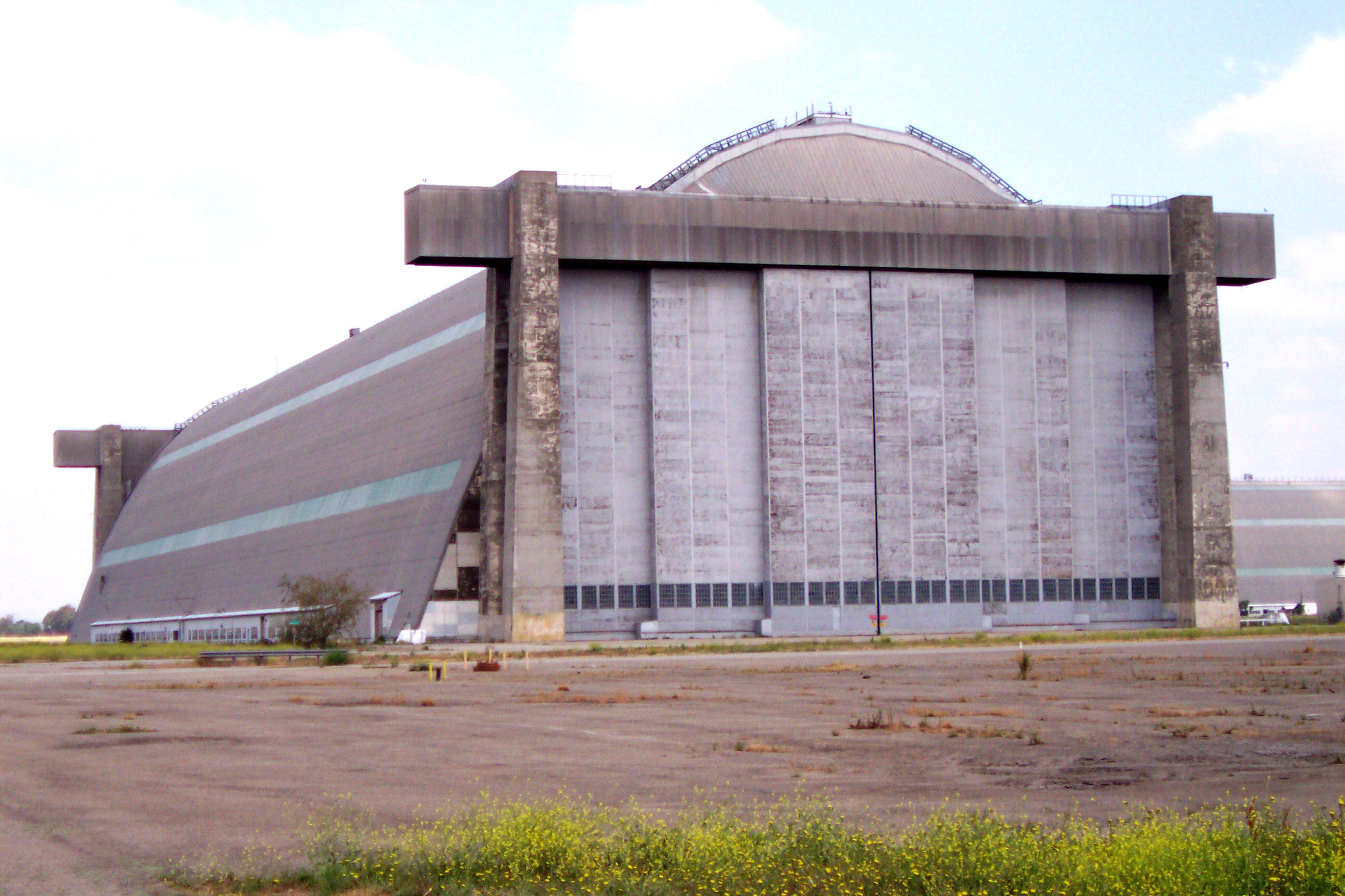  Clockwise from top: Tustin High School Student Quad, Old MCAS Base Tustin Blimp Hangar, Sherman Stevens House | |
 Seal | |
| Nickname: City of Trees | |
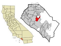 Location of Tustin within Orange County, California | |
 Tustin, California Location in the United States | |
| Coordinates: 33°44′23″N 117°48′49″W | |
| Country | |
| State | |
| County | |
| Incorporated | September 21, 1927[2] |
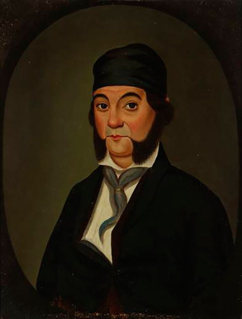
| Named for | Columbus Tustin |
| Government | |
| • Type | Council-Manager |
| • Mayor | Austin Lumbard[3] |
| • Mayor Pro Tem | Barry W. Cooper |
| • City Council | Letitia Clark Ryan Gallagher Rebecca "Beckie" Gomez |
| • City Manager | Matthew S. West |
| Area | |
| • Total | 11.12 sq mi (28.81 km2) |
| • Land | 11.12 sq mi (28.81 km2) |
| • Water | 0.00 sq mi (0.00 km2) 0% |
| Elevation | 138 ft (42 m) |
| Population (2020) | |
| • Total | 80,276 |
| • Density | 7,219.06/sq mi (18,697.28/km2) |
| Time zone | UTC−8 (Pacific) |
| • Summer (DST) | UTC−7 (PDT) |
| ZIP codes | 92780–92782 |
| Area code(s) | 657/714, 949 |
| FIPS code | 06-80854 |
| GNIS feature IDs | 1661590, 2412117 |
| Website | www |
History
Members of the Tongva and Juaneño/Luiseño nations long inhabited this area.[citation needed] After the 1769 expedition of Gaspar de Portolà, a Spanish expedition led by Father Junipero Serra named the area Vallejo de Santa Ana (Valley of Saint Anne). On November 1, 1776, Mission San Juan Capistrano became the area's first permanent European settlement in Alta California, New Spain.

In 1801, the Spanish Empire granted 62,500 acres (253 km2) to José Antonio Yorba, which he named Rancho San Antonio. Yorba's great rancho included the lands where the cities and communities of Olive, Orange, Villa Park, Santa Ana, Tustin, Costa Mesa and Newport Beach stand today. Smaller ranchos evolved from this large rancho including the Rancho Santiago de Santa Ana.
After the Mexican–American War, Alta California became part of the United States and American settlers arrived in this area. Columbus Tustin, a carriage maker from Northern California, founded the city in 1868 on 1,300 acres (5.3 km2) of land from the former Rancho Santiago de Santa Ana. The city was incorporated in 1927 with a population of about 900. The townsite was bordered by Camino Real on the south, Newport Avenue on the east, 1st Street on the north, and Route 43, now known as the Costa Mesa Freeway, on the west.

During World War II, a Navy anti-submarine airship base (later to become a Marine Corps helicopter station) was established on unincorporated land south of the city; the two dirigible hangars are among the largest wooden structures ever built and are listed on the National Register of Historic Places and ASCE List of Historic Civil Engineering Landmarks. Suburban growth after the war resulted in increased population, annexation of nearby unincorporated land including the base, and development of orchards and farmland into housing tracts and shopping centers.
Geography
According to the United States Census Bureau, the city has a total area of 11.1 square miles (28.7 km2). It is bordered by Irvine on the south and east, Orange and the census-designated Tustin Foothills on the north, and Santa Ana on the west.
The city is sometimes referred to as "The City of [the] Trees".[5] Native sycamores and oaks, native to the area, grew in abundance at the time of the founding of the city, and city founder Columbus Tustin was responsible for planting many more along the streets of the city.[6]
Climate
Tustin has a Mediterranean climate (Köppen climate classification Csa).
| Climate data for Tustin | |||||||||||||
|---|---|---|---|---|---|---|---|---|---|---|---|---|---|
| Month | Jan | Feb | Mar | Apr | May | Jun | Jul | Aug | Sep | Oct | Nov | Dec | Year |
| Average high °F (°C) | 70 (21) |
71 (22) |
72 (22) |
75 (24) |
77 (25) |
80 (27) |
85 (29) |
87 (31) |
85 (29) |
80 (27) |
76 (24) |
70 (21) |
78 (26) |
| Average low °F (°C) | 47 (8) |
48 (9) |
50 (10) |
53 (12) |
58 (14) |
61 (16) |
65 (18) |
67 (19) |
63 (17) |
57 (14) |
50 (10) |
46 (8) |
56 (13) |
| Average precipitation inches (mm) | 2.96 (75) |
3.07 (78) |
2.79 (71) |
.77 (20) |
.28 (7.1) |
.10 (2.5) |
.01 (0.25) |
.14 (3.6) |
.34 (8.6) |
.40 (10) |
1.22 (31) |
1.79 (45) |
13.87 (352) |
| Source: NOAA[7] | |||||||||||||
Neighborhoods
- Aliso
- Columbus Grove
- Columbus Square
- Greenwood
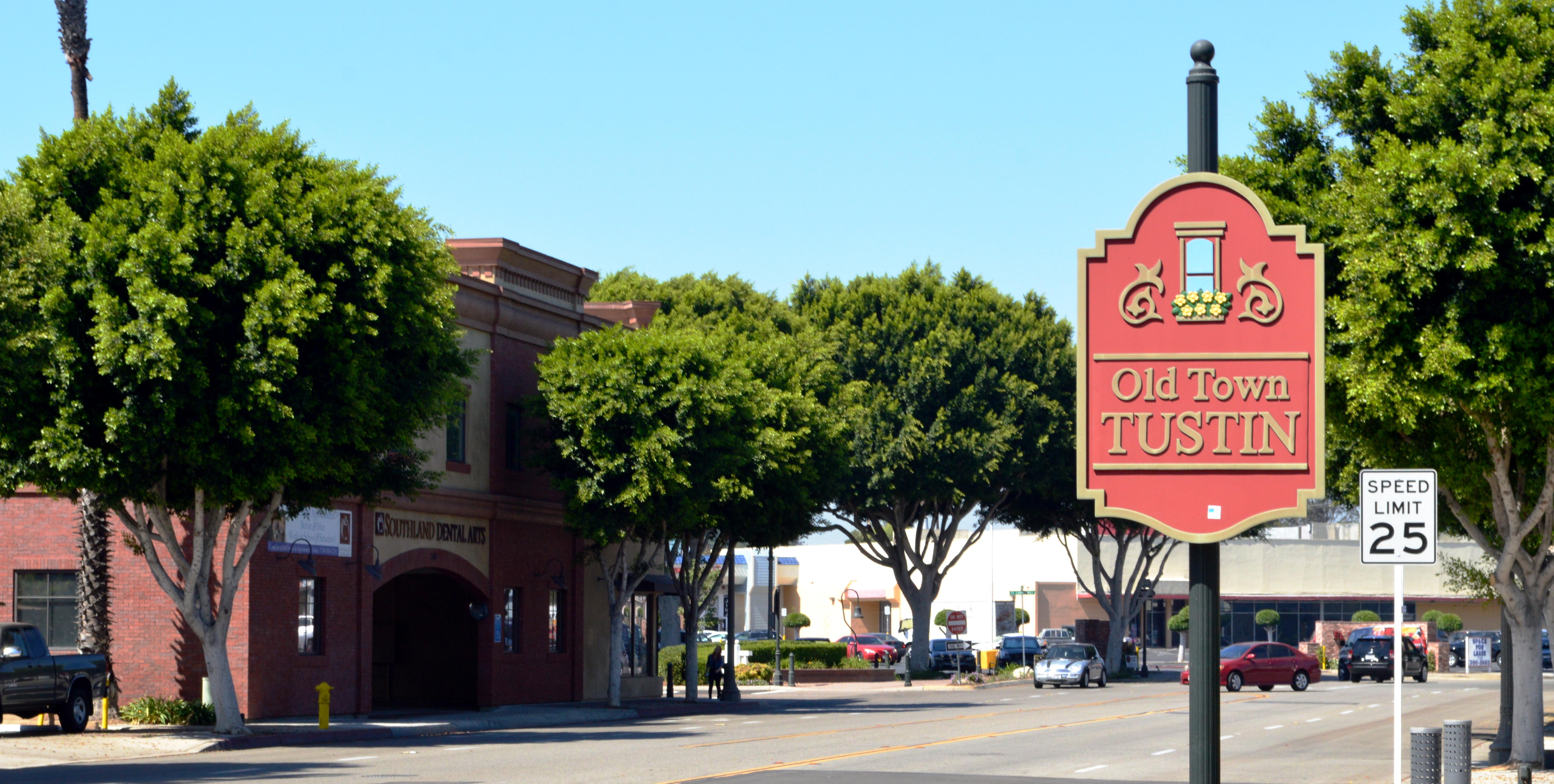
- Old Town Tustin
- Tustin Legacy
- Tustin Meadows/Peppertree/Laurelwood (one of the city's oldest planned neighborhoods)
- Tustin Ranch
- Walnut
Demographics
| Historical population | |||
|---|---|---|---|
| Census | Pop. | %± | |
| 1880 | 227 | — | |
| 1930 | 926 | — | |
| 1940 | 953 | 2.9% | |
| 1950 | 1,143 | 19.9% | |
| 1960 | 2,006 | 75.5% | |
| 1970 | 22,190 | 1,006.2% | |
| 1980 | 32,248 | 45.3% | |
| 1990 | 50,689 | 57.2% | |
| 2000 | 67,504 | 33.2% | |
| 2010 | 75,540 | 11.9% | |
| 2020 | 80,276 | 6.3% | |
| U.S. Decennial Census[9] | |||
2010
The 2010 United States Census reported that Tustin had a population of 75,540.[10] The population density was 6,816.7 per square mile (2,631.9/km2). The racial makeup was 39,729 (52.6%) White (34.8% Non-Hispanic White),[11] 1,722 (2.3%) African American, 442 (0.6%) Native American, 15,299 (20.3%) Asian, 268 (0.4%) Pacific Islander, 14,499 (19.2%) from other races, and 3,581 (4.7%) from two or more races. There were 30,024 people of Hispanic or Latino origin, of any race (39.7%).
The census reported that 75,020 people (99.3% of the population) lived in households, 340 (0.5%) lived in non-institutionalized group quarters and 180 (0.2%) were institutionalized.
There were 25,203 households, of which 10,465 (41.5%) had children under the age of 18 living in them, 12,969 (51.5%) were opposite-sex married couples living together, 3,494 (13.9%) had a female householder with no husband present, 1,472 (5.8%) had a male householder with no wife present. There were 1,568 (6.2%) unmarried opposite-sex partnerships and 193 (0.8%) same-sex married couples or partnerships. 5,178 households (20.5%) were one person and 1,403 (5.6%) had someone living alone who was 65 or older. The average household size was 2.98. There were 17,935 families (71.2% of households) and the average family size was 3.46.
The age distribution was 20,212 people (26.8%) under the age of 18, 6,856 (9.1%) aged 18 to 24, 25,033 (33.1%) aged 25 to 44, 17,006 (22.5%) aged 45 to 64, and 6,433 (8.5%) who were 65 or older. The median age was 33.4 years. For every 100 females, there were 94.7 males. For every 100 females age 18 and over, there were 91.6 males.
There were 26,476 housing units at an average density of 2,389.2 per square mile (922.5/km2). Of the occupied units, 12,813 (50.8%) were owner-occupied and 12,390 (49.2%) were rented. The homeowner vacancy rate was 1.3%; the rental vacancy rate was 5.8%. 36,783 people (48.7% of the population) lived in owner-occupied housing units and 38,237 people (50.6%) lived in rental housing units.
According to the 2010 census, Tustin had a median household income of $74,011, with 12.2% of the population living below the federal poverty line.[11]
2000
At the 2000 census, there were 67,504 people in 23,831 households, including 16,062 families, in the city.[12] The population density was 5,921.4 per square mile (2,286.3/km2). There were 25,501 housing units at an average density of 2,236.9 per square mile (863.7/km2). The racial make-up of the city was 58.72% White, 2.92% African American, 0.66% Native American, 14.90% Asian, 0.30% Pacific Islander, 17.94% from other races and 4.55% from two or more races. Hispanic or Latino of any race were 34.24% of the population.
Of the 23,831 households, 36.8% had children under the age of 18 living with them, 50.2% were married couples living together, 12.3% had a female householder with no husband present, and 32.6% were non-families. 24.1% of households were one person, and 5.2% were one person aged 65 or older. The average household size was 2.82 and the average family size was 3.37.

The age distribution was 26.8% under the age of 18, 9.3% from 18 to 24, 38.1% from 25 to 44, 18.6% from 45 to 64, and 7.1% 65 or older. The median age was 32 years. For every 100 females, there were 95.9 males. For every 100 females age 18 and over, there were 92.9 males.
The median household income was $55,985 and the median family income was $60,092. Males had a median income of $42,456 and females $33,688. The per capita income was $25,932. About 5.8% of families and 8.5% of the population were below the poverty line, including 10.8% of those under age 18 and 6.2% of those age 65 or over.
Economy
Top employers
According to the city's 2020 Comprehensive Annual Financial Report,[13] the top employers in the city are:
| # | Employer | # of employees |
|---|---|---|
| 1 | Tustin Unified School District | 2,850 |
| 2 | SchoolsFirst Federal Credit Union | 983 |
| 3 | Youngs Market Company LLC | 681 |
| 4 | Costco | 658 |
| 5 | New American Funding | 645 |
| 6 | City of Tustin | 409 |
| 7 | Avid Bioservices, Inc. | 230 |
| 8 | Vita Best Nutrition | 215 |
| 9 | Kaiser Permanente/Kaiser Foundation Hospitals | 200 |
| 10 | Logomark Inc. | 196 |
Arts and culture
Points of interest
- The Market Place, formerly known as Tustin Market Place
- The District
- Tustin Area Museum
- Enderle Center
- Marconi Automotive Museum
- Old Town Tustin
- Tustin Ranch Golf Course
Government
| Year | Democratic | Republican | Third Parties |
|---|---|---|---|
| 1980[14] | 20.20% 2,273 | 70.16% 7,894 | 9.63% 1,084 |
| 1984[15] | 23.16% 3,166 | 75.88% 10,375 | 0.97% 132 |
| 1988[16] | 29.28% 4,533 | 69.44% 10,750 | 1.27% 197 |
| 1992[17] | 30.70% 5,697 | 45.03% 8,357 | 24.27% 4,504 |
| 1996[18] | 37.65% 6,484 | 52.37% 9,020 | 9.99% 1,720 |
| 2000[19] | 39.97% 7,842 | 56.36% 11,058 | 3.67% 720 |
| 2004[20] | 40.62% 8,882 | 58.03% 12,691 | 1.35% 295 |
| 2008[21] | 51.53% 12,553 | 46.20% 11,254 | 2.27% 553 |
| 2012[22] | 49.54% 11,844 | 47.54% 11,366 | 2.93% 700 |
| 2016[23] | 56.52% 15,143 | 36.17% 9,690 | 7.31% 1,957 |
| 2020[24] | 60.81% 21,096 | 36.91% 12,804 | 2.29% 793 |
Local
The Tustin City Council is composed of five members elected at large; the mayorship rotates among the council members and is primarily a ceremonial role.
Mayor Allan Bernstein was elected to the Tustin City Council in 2012. In 2019, Letitia Clark was chosen to serve as mayor pro tem, Charles E. "Chuck" Puckett, Barry Cooper and Austin Lumbard are also on the City Council as council members.[3]
Local politics in the late 1990s and early 2000s were dominated by the 1997 closure of the local Marine Corps Air Station and plans for the subsequent commercial development of the land, including an unsuccessful bid by neighboring Santa Ana to build a school on the land, part of which is within Santa Ana Unified School District's territory.
State and federal
In the California State Legislature, Tustin is in the 37th Senate District, represented by Democrat Dave Min and in the 68th Assembly District, represented by Republican Steven Choi.[25]
In the United States House of Representatives, Tustin is in California's 45th congressional district, represented by Democrat Katie Porter.[26]
Education

Primary and secondary education in Tustin and surrounding unincorporated areas is overseen by the Tustin Unified School District. Tustin High School is a California Distinguished School, as is Foothill High School. Arnold O. Beckman High School is in the Best High Schools according to U.S. News & World Report.[27] Tustin High School is also well-known regionally for its strong Model United Nations program.[citation needed] Springfield College, a non-profit, private, higher education institute, is located in the city of Tustin.
Police and Fire services

The Tustin Police Department is the local law enforcement agency of the city. The department's jurisdiction includes the entire 11.12 square miles (29 km2) of the city of Tustin, as well as the Tustin Legacy development.
Founded in 1928, the Tustin Police Department started with one officer, John Stanton, as "street superintendent", which changed to "chief of police" two months later. Chief Stanton was the only Tustin officer until 1942. At the time of his appointment, there were no police headquarters or stations, and he took calls from his home. The Tustin Police Department had roughly three officers in 1948, twenty years after its founding.[28]
Fire protection in Tustin is provided by the Orange County Fire Authority.
Notable people
Actors
- Cuba Gooding Jr., actor[29]
- Rachel Kimsey, actress
- Matthew Lillard, actor
- Caroline Sunshine, actress
Athletes
- Sam Baker, former NFL player
- James Beaumont "Beau" Bell, NFL player
- Heath Bell, MLB player
- Milorad Čavić, swimmer
- Chris Chester, NFL player
- Gerrit Cole, MLB player[30]
- DeShaun Foster, NFL player
- Evelyn Furtsch, swimmer
- Alfonso Gómez, boxer
- Doug Gottlieb, TV sports analyst and host, former college basketball player
- Mark Grace, former MLB player, coach
- Shawn Green, former MLB player
- Rex Hudler, former MLB player
- Phil Hughes, MLB player
- Matt Konan, professional ice hockey player
- Jillian Kraus (born 1986), water polo player
- Caitlin Lowe, former softball player
- Matt McCoy, former NFL player
- Frostee Rucker, NFL player
- Dave Staton, former MLB player[30]
- Richard Umphrey III, former NFL player
- Zack Weiss, American-Israeli MLB pitcher
- Coryn Rivera, Professional Cyclist
Other
- Mary Kay Letourneau, former schoolteacher convicted for statutory second degree rape[31]
- John Locke, fictional character on the television show Lost[32]
- Claude Nowell, businessperson
References
- "Tustin". Geographic Names Information System. United States Geological Survey, United States Department of the Interior. Retrieved January 21, 2015.
- "California Cities by Incorporation Date". California Association of Local Agency Formation Commissions. Archived from the original (Word) on November 3, 2014. Retrieved August 25, 2014.
- "Mayor Letitia Clark". City of Tustin, California. Retrieved January 26, 2021.
- "2019 U.S. Gazetteer Files". United States Census Bureau. Retrieved July 1, 2020.
- "Learn About The City". Tustin, CA. Retrieved March 1, 2021.
- Lovret, Juanita (June 7, 2012). "Tustin: The City of Trees". Orange County Register. Retrieved March 1, 2021.
- (NCEI), National Centers for Environmental Information. "1981-2010 Normals - Data Tools - Climate Data Online (CDO) - National Climatic Data Center (NCDC)". www.ncdc.noaa.gov. Retrieved March 21, 2018.
- "Resource Directory • Tustin, CA • CivicEngage".
- "Census of Population and Housing". United States Census Bureau. Retrieved January 29, 2019.
- "U.S. Census website". United States Census Bureau. 2010. Retrieved January 29, 2019.
- "State & County QuickFacts: Tustin (city), California". United States Census Bureau. March 31, 2015. Archived from the original on April 2, 2015. Retrieved January 29, 2019.
- "California 2000" (PDF). United States Census Bureau. 2003. Retrieved January 29, 2019.
- "Comprehensive Annual Financial Report, City of Tustin, California, Fiscal Year Ended June 30, 2020". Tustinca City. Retrieved February 3, 2021.
- Statement of the Vote. Sacramento, Calif. : The Secretary. 1968.
- Statement of the Vote. Sacramento, Calif. : The Secretary. 1968.
- Statement of the Vote. Sacramento, Calif. : The Secretary. 1968.
- California. Secretary of State (March 30, 1968). "Statement of vote". Sacramento, Calif. : The Secretary – via Internet Archive.
- California. Secretary of State (March 30, 1968). "Statement of vote". Sacramento, Calif. : The Secretary – via Internet Archive.
- "SOV.xls" (PDF). Retrieved June 1, 2020.
- "SOV.xls" (PDF). www.ocvote.com. November 29, 2004. Retrieved June 1, 2020.
- https://www.ocvote.com/fileadmin/user_upload/sov/gen2008/sov.pdf [bare URL PDF]
- https://www.ocvote.com/fileadmin/live/gen2012/sov-for-web.pdf [bare URL PDF]
- https://www.ocvote.com/fileadmin/live/gen2016/sov.pdf [bare URL PDF]
- "Votes cast" (PDF). www.ocvote.com. Retrieved January 18, 2021.
- "Statewide Database". UC Regents. Archived from the original on February 1, 2015. Retrieved December 18, 2014.
- "California's 45th Congressional District - Representatives & District Map". Civic Impulse, LLC.
- "U.S. News Best High Schools Rankings". U.S. News & World Report.
- no info given [bare URL]
- "Cuba Gooding Jr". Alumni Hall of Fame.
- "TWLL players in the majors". twll.com. Retrieved March 21, 2018.
- Warrick, Pamela (April 29, 1998). "The Fall from Spyglass Hill". Los Angeles Times. p. 4. Retrieved October 22, 2009.
- "Lost producer shares how he didn't forget his Tustin roots". Orange County Register.
Further reading
- Juanita Lovret, Tustin As It Once Was, 2011, History Press, ISBN 978-1-60949-461-2
- Guy Ball, Tustin, Arcadia Publishing, 2011. ISBN 0-7385-7037-0
- Carol Jordan, Tustin: An Illustrated History, ISBN 978-0-9800224-0-7 reprinted 2010 by the Tustin Area Historical Society
- Juanita Lovret, Remember When, 2003, Tustin Area Historical Society
- Carol Jordan, Mary Etzold, Tustin Heritage Walk, 1975. Tustin Area Bicentennial Foundation and Tustin Area Historical Society
External links
- Official website

- Tustin Area Historical Society website with history, articles, vintage photos
- Tustin photos at Orange County Archives
Places adjacent to Tustin, California | |
|---|---|
Orange County, California, United States | ||
| Areas |
| |
| Schools |
| |
| Transportation |
| |
| Landmarks |
| |
Municipalities and communities of Orange County, California, United States | ||
|---|---|---|
County seat: Santa Ana | ||
| Cities |
|  |
| CDPs |
| |
| Unincorporated communities |
| |
| Ghost town |
| |
| ||

Authority control | |
|---|---|
| General | |
| National libraries | |
| Other | |
На других языках
[de] Tustin (Kalifornien)
Tustin ist eine Stadt im Orange County im US-Bundesstaat Kalifornien, Vereinigte Staaten, mit 70.871 Einwohnern (Stand: 2006). Das Stadtgebiet hat eine Größe von 29,5 km². Die geographischen Koordinaten sind: 33° 43' 48,0" N 117° 48' 36,0" W- [en] Tustin, California
[es] Tustin (California)
Tustin, fundada en la década de 1870, es una ciudad ubicada en el condado de Orange en el estado estadounidense de California. En el año 2004 tenía una población de 74.825 habitantes y una densidad poblacional de 2536,44 personas por km².Другой контент может иметь иную лицензию. Перед использованием материалов сайта WikiSort.org внимательно изучите правила лицензирования конкретных элементов наполнения сайта.
WikiSort.org - проект по пересортировке и дополнению контента Википедии