world.wikisort.org - USA
Sierra County is a county located in the U.S. state of New Mexico. As of the 2020 Census, the population was 11,576.[1] Its county seat is Truth or Consequences.[2]
Sierra County | |
|---|---|
U.S. county | |
 Sierra County Courthouse in Truth or Consequences | |
 Seal | |
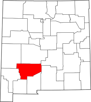 Location within the U.S. state of New Mexico | |
 New Mexico's location within the U.S. | |
| Coordinates: 33°08′N 107°11′W | |
| Country | |
| State | |
| Founded | 1884 |
| Named for | the Black Range (Spanish: Sierra Diablo) |
| Seat | Truth or Consequences |
| Largest city | Truth or Consequences |
| Area | |
| • Total | 4,236 sq mi (10,970 km2) |
| • Land | 4,179 sq mi (10,820 km2) |
| • Water | 57 sq mi (150 km2) 1.4%% |
| Population (2020) | |
| • Total | 11,576 |
| • Density | 2.9/sq mi (1.1/km2) |
| Time zone | UTC−7 (Mountain) |
| • Summer (DST) | UTC−6 (MDT) |
| Congressional district | 2nd |
| Website | www |
Geography
According to the U.S. Census Bureau, the county has a total area of 4,236 square miles (10,970 km2), of which 4,179 square miles (10,820 km2) is land and 57 square miles (150 km2) (1.4%) is water.[3]
Adjacent counties
- Catron County - northwest
- Socorro County - north
- Lincoln County - northeast
- Otero County - east
- Doña Ana County - south
- Luna County - south
- Grant County - west
National protected areas
- Cibola National Forest (part)
- El Camino Real de Tierra Adentro National Historic Trail (part)
- Gila National Forest (part)
Major highways
 I-25
I-25 US 85
US 85 NM 152
 NM 181
 NM 179
 NM 187
 NM 195
Demographics
| Historical population | |||
|---|---|---|---|
| Census | Pop. | %± | |
| 1910 | 3,536 | — | |
| 1920 | 4,619 | 30.6% | |
| 1930 | 5,184 | 12.2% | |
| 1940 | 6,962 | 34.3% | |
| 1950 | 7,186 | 3.2% | |
| 1960 | 6,409 | −10.8% | |
| 1970 | 7,189 | 12.2% | |
| 1980 | 8,454 | 17.6% | |
| 1990 | 9,912 | 17.2% | |
| 2000 | 13,270 | 33.9% | |
| 2010 | 11,988 | −9.7% | |
| 2020 | 11,576 | −3.4% | |
| U.S. Decennial Census[4] 1790-1960[5] 1900-1990[6] 1990-2000[7] 2010-2016[1] | |||
2000 census
As of the 2000 census,[8] there were 13,270 people, 6,113 households, and 3,618 families living in the county. The population density was 3 people per square mile (1/km2). There were 8,727 housing units at an average density of 2 per square mile (1/km2). The racial makeup of the county was 86.97% White, 0.48% Black or African American, 1.48% Native American, 0.17% Asian, 0.08% Pacific Islander, 8.27% from other races, and 2.54% from two or more races. 26.28% of the population were Hispanic or Latino of any race.
There were 6,113 households, out of which 20.40% had children under the age of 18 living with them, 47.50% were married couples living together, 8.60% had a female householder with no husband present, and 40.80% were non-families. 35.90% of all households were made up of individuals, and 19.30% had someone living alone who was 65 years of age or older. The average household size was 2.13 and the average family size was 2.75.
In the county, the population was spread out, with 20.10% under the age of 18, 5.40% from 18 to 24, 19.50% from 25 to 44, 27.40% from 45 to 64, and 27.70% who were 65 years of age or older. The median age was 49 years. For every 100 females there were 100.00 males. For every 100 females age 18 and over, there were 97.70 males.
The median income for a household in the county was $24,152, and the median income for a family was $29,787. Males had a median income of $24,570 versus $19,839 for females. The per capita income for the county was $15,023. About 13.80% of families and 20.90% of the population were below the poverty line, including 31.50% of those under age 18 and 14.70% of those age 65 or over.
2010 census
As of the 2010 census, there were 11,988 people, 5,917 households, and 3,126 families living in the county.[9] The population density was 2.9 inhabitants per square mile (1.1/km2). There were 8,356 housing units at an average density of 2.0 per square mile (0.77/km2).[10] The racial makeup of the county was 85.6% white, 1.7% American Indian, 0.4% black or African American, 0.4% Asian, 8.6% from other races, and 3.3% from two or more races. Those of Hispanic or Latino origin made up 28.0% of the population.[9] In terms of ancestry, 14.0% were German, 9.4% were American, 8.4% were English, and 8.0% were Irish.[11]
Of the 5,917 households, 17.8% had children under the age of 18 living with them, 40.0% were married couples living together, 8.9% had a female householder with no husband present, 47.2% were non-families, and 40.8% of all households were made up of individuals. The average household size was 1.98 and the average family size was 2.64. The median age was 54.5 years.[9]
The median income for a household in the county was $25,583, the lowest of any county in New Mexico. The median income for a family was $38,641. Males had a median income of $32,059 versus $26,213 for females. The per capita income for the county was $16,667. About 15.6% of families and 22.5% of the population were below the poverty line, including 29.8% of those under age 18 and 12.9% of those age 65 or over.[12]
Spaceport America
Spaceport America is located in Sierra County, 45 miles (72 kilometers) north of Las Cruces and 30 miles (48 kilometers) east of Truth or Consequences. Sierra County voters approved the creation of a spaceport tax district in April 2008, freeing up funding for its construction.[13] The first launch from Spaceport America occurred on September 25, 2006, since which over 300 launches have occurred. On May 22, 2021, Virgin Galactic's VSS Unity launched from the spaceport with three people aboard becoming the first crewed launch from both Spaceport America and New Mexico and making New Mexico the third U.S. state, after California and Florida, to send humans into space.[14]
Communities
Cities
- Elephant Butte
- Truth or Consequences (county seat)
Village
Census-designated places
Unincorporated communities
- Chloride
- Cuchillo
- Derry
- Engle
- Monticello
- Placitas
- Upham
Ghost towns
- Alamocita
- Aleman
- Chise
- Elephant Butte
- Hermosa
- Lake Valley
- San Albino
- San José
- San Ygnacio de la Alamosa
- Zapata
- San Navarro (Est: 1836 Abandoned: 1952)
Politics
| Year | Republican | Democratic | Third party | |||
|---|---|---|---|---|---|---|
| No. | % | No. | % | No. | % | |
| 2020 | 3,542 | 59.58% | 2,265 | 38.10% | 138 | 2.32% |
| 2016 | 3,010 | 58.10% | 1,612 | 31.11% | 559 | 10.79% |
| 2012 | 2,928 | 57.39% | 1,964 | 38.49% | 210 | 4.12% |
| 2008 | 3,017 | 55.00% | 2,352 | 42.88% | 116 | 2.11% |
| 2004 | 3,162 | 61.31% | 1,926 | 37.35% | 69 | 1.34% |
| 2000 | 2,721 | 59.33% | 1,689 | 36.83% | 176 | 3.84% |
| 1996 | 2,140 | 44.54% | 2,154 | 44.83% | 511 | 10.63% |
| 1992 | 1,562 | 35.36% | 1,771 | 40.09% | 1,085 | 24.56% |
| 1988 | 2,507 | 60.19% | 1,595 | 38.30% | 63 | 1.51% |
| 1984 | 2,663 | 66.00% | 1,335 | 33.09% | 37 | 0.92% |
| 1980 | 2,222 | 62.50% | 1,169 | 32.88% | 164 | 4.61% |
| 1976 | 1,665 | 51.04% | 1,564 | 47.95% | 33 | 1.01% |
| 1972 | 2,074 | 67.47% | 934 | 30.38% | 66 | 2.15% |
| 1968 | 1,624 | 57.06% | 930 | 32.68% | 292 | 10.26% |
| 1964 | 1,501 | 47.67% | 1,633 | 51.86% | 15 | 0.48% |
| 1960 | 1,890 | 60.64% | 1,220 | 39.14% | 7 | 0.22% |
| 1956 | 1,954 | 65.00% | 1,035 | 34.43% | 17 | 0.57% |
| 1952 | 2,033 | 63.61% | 1,158 | 36.23% | 5 | 0.16% |
| 1948 | 1,274 | 47.54% | 1,389 | 51.83% | 17 | 0.63% |
| 1944 | 1,112 | 52.26% | 1,008 | 47.37% | 8 | 0.38% |
| 1940 | 1,372 | 47.15% | 1,534 | 52.71% | 4 | 0.14% |
| 1936 | 951 | 37.12% | 1,587 | 61.94% | 24 | 0.94% |
| 1932 | 667 | 30.18% | 1,515 | 68.55% | 28 | 1.27% |
| 1928 | 766 | 53.79% | 657 | 46.14% | 1 | 0.07% |
| 1924 | 632 | 48.17% | 546 | 41.62% | 134 | 10.21% |
| 1920 | 862 | 56.79% | 642 | 42.29% | 14 | 0.92% |
| 1916 | 460 | 47.13% | 493 | 50.51% | 23 | 2.36% |
| 1912 | 176 | 28.16% | 352 | 56.32% | 97 | 15.52% |
Education
Truth or Consequences Schools is the school district for all of the county.[16]
See also
- National Register of Historic Places listings in Sierra County, New Mexico
References
- "State & County QuickFacts". United States Census Bureau. Archived from the original on June 6, 2011. Retrieved September 30, 2013.
- "Find a County". National Association of Counties. Retrieved June 7, 2011.
- "2010 Census Gazetteer Files". United States Census Bureau. August 22, 2012. Archived from the original on January 1, 2015. Retrieved January 2, 2015.
- "U.S. Decennial Census". United States Census Bureau. Retrieved January 2, 2015.
- "Historical Census Browser". University of Virginia Library. Retrieved January 2, 2015.
- "Population of Counties by Decennial Census: 1900 to 1990". United States Census Bureau. Retrieved January 2, 2015.
- "Census 2000 PHC-T-4. Ranking Tables for Counties: 1990 and 2000" (PDF). United States Census Bureau. Retrieved January 2, 2015.
- "U.S. Census website". United States Census Bureau. Retrieved January 31, 2008.
- "DP-1 Profile of General Population and Housing Characteristics: 2010 Demographic Profile Data". United States Census Bureau. Archived from the original on February 13, 2020. Retrieved January 24, 2016.
- "Population, Housing Units, Area, and Density: 2010 - County". United States Census Bureau. Archived from the original on February 13, 2020. Retrieved January 24, 2016.
- "DP02 SELECTED SOCIAL CHARACTERISTICS IN THE UNITED STATES – 2006-2010 American Community Survey 5-Year Estimates". United States Census Bureau. Archived from the original on February 13, 2020. Retrieved January 24, 2016.
- "DP03 SELECTED ECONOMIC CHARACTERISTICS – 2006-2010 American Community Survey 5-Year Estimates". United States Census Bureau. Archived from the original on February 13, 2020. Retrieved January 24, 2016.
- Kaufman, Marc (May 10, 2008). "New Mexico Moves Ahead on Spaceport". Washington Post. Retrieved July 24, 2008.
- "NM 'has finally reached the stars' - Albuquerque Journal". www.abqjournal.com. Retrieved January 16, 2022.
- Leip, David. "Dave Leip's Atlas of U.S. Presidential Elections". uselectionatlas.org. Retrieved April 2, 2018.
- "2020 CENSUS - SCHOOL DISTRICT REFERENCE MAP: Sierra County, NM" (PDF). U.S. Census Bureau. Retrieved July 12, 2022. - Text list
External links
- Sierra County Government
- Sierra County Tourism / Visitor Information
- Elephant Butte Chamber of Commerce Archived August 1, 2015, at the Wayback Machine
- Events for Truth or Consequences, Elephant Butte, and all of Sierra County
- Wilson, John P., Between the River and the Mountains: A History of Early Settlement in Sierra County, New Mexico, Report #40, John P. Wilson, Las Cruces, New Mexico, August 1985[permanent dead link]
Places adjacent to Sierra County, New Mexico | ||||||||||||||||
|---|---|---|---|---|---|---|---|---|---|---|---|---|---|---|---|---|
| ||||||||||||||||
Municipalities and communities of Sierra County, New Mexico, United States | ||
|---|---|---|
County seat: Truth or Consequences | ||
| Cities | 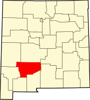 | |
| Villages | ||
| CDPs | ||
| Other communities |
| |
| Ghost towns |
| |
| ||
State of New Mexico | |
|---|---|
Santa Fe (capital) | |
| Topics |
|
| Society |
|
| Regions |
|
| Cities | |
| Counties | |
На других языках
[de] Sierra County (New Mexico)
Sierra County[1] ist ein County im Bundesstaat New Mexico der Vereinigten Staaten. Es liegt im Südwesten des Bundesstaates und hat 11.988 Einwohner. Der Verwaltungssitz (County Seat) ist Truth or Consequences.- [en] Sierra County, New Mexico
[ru] Сьерра (округ, Нью-Мексико)
Сье́рра (англ. Sierra County) — округ в юго-западной части штата Нью-Мексико в США. Административный центр округа — город Трут-ор-Консекуэнсес. По данным переписи за 2010 год число жителей округа составляло 11 988 человек.Другой контент может иметь иную лицензию. Перед использованием материалов сайта WikiSort.org внимательно изучите правила лицензирования конкретных элементов наполнения сайта.
WikiSort.org - проект по пересортировке и дополнению контента Википедии