world.wikisort.org - USA
Farmington is a city in San Juan County in the U.S. state of New Mexico. As of the 2020 census the city had a total population of 46,624 people. Farmington (and surrounding San Juan County) makes up one of the four Metropolitan Statistical Areas (MSAs) in New Mexico.
Farmington, New Mexico | |
|---|---|
City | |
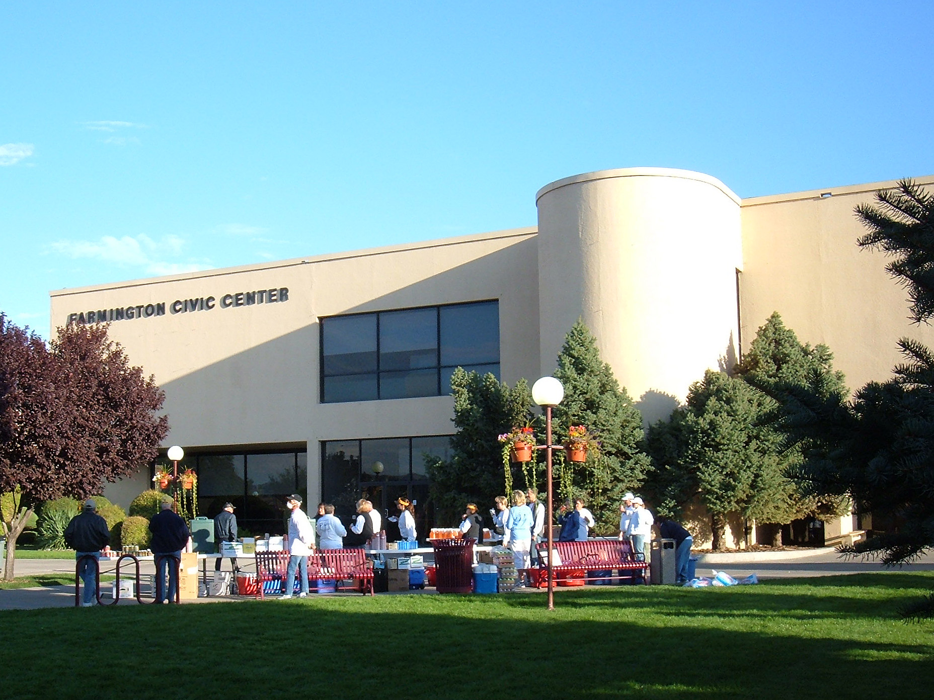 Farmington Civic Center | |
 Seal | |
| Nickname(s): Baseball Town, U.S.A | |
 Location of Farmington in New Mexico | |
 Farmington Location within New Mexico  Farmington Location within the United States | |
| Coordinates: 36°45′6″N 108°11′23″W | |
| Country | United States |
| State | New Mexico |
| County | San Juan |
| Founded | 1901 |
| Government | |
| • Mayor | Nathan Duckett |
| Area | |
| • Total | 34.95 sq mi (90.51 km2) |
| • Land | 34.46 sq mi (89.25 km2) |
| • Water | 0.49 sq mi (1.26 km2) |
| Elevation | 5,395 ft (1,644 m) |
| Population (2020)[2] | |
| • Total | 46,624 |
| • Density | 1,352.95/sq mi (522.38/km2) |
| Time zone | UTC−7 (Mountain Time Zone) |
| • Summer (DST) | UTC−6 (Mountain Daylight Time) |
| ZIP codes | 87401, 87402, 87499 |
| Area code | 505 |
| FIPS code | 35-25800 |
| GNIS feature ID | 0902246 |
| Website | www.fmtn.org |
Farmington is located at the junction of the San Juan River, the Animas River, and the La Plata River, and is located on the Colorado Plateau. Farmington is the largest city of San Juan County, one of the geographically largest counties in the United States covering 5,538 square miles (14,340 km2). Farmington serves as the commercial hub for most of northwestern New Mexico and the Four Corners region of four states. Farmington lies at or near the junction of several important highways: U.S. Highway 64, New Mexico Highway 170, New Mexico Highway 371, and New Mexico Highway 516.
It is on the Trails of the Ancients Byway, one of the designated New Mexico Scenic Byways.[3]
The primary non-government industries of Farmington are the production of petroleum, natural gas, and coal and its function as a major retail hub. Outside of Farmington, the Navajo Mine (coal), operated by the Navajo Transitional Energy Company (NTEC), is used entirely for fuel for the nearby Four Corners Generating Station to produce electric power.
History
The area that is now Farmington was settled by Ancestral Pueblo people in the 7th Century. Ruins can be visited at nearby Salmon Ruins and at the Aztec Ruins.[4] When the Ancestral Puebloans left the area, the Navajos, Jicarilla Apaches, and Utes moved into the area. A key part of the region was known in Navajo as Tóta' which means "where three rivers meet".[5]
Although Spanish and American mineral prospecting happened in the area, there were few permanent settlements. In 1868, the Navajo Nation was created, taking up the western half of San Juan County. Six years later, the U.S. government offered territory in the rest of San Juan County to the Jicarilla Apache but they refused. As a result, the area was opened for settlement and a number of settlers moved into the region from Southern Colorado.[4] The area was originally known as "Junction City" because of the access to the three rivers.[5]
In 1901 the town was incorporated and named Farmington with a population of 548.[4] By September 19, 1905, the railroad was finished connecting Farmington to Durango, Colorado, expanding economic and settlement opportunities. It was unusual in that it was a standard gauge railroad that connected to the Denver & Rio Grande Western narrow gauge lines of southwestern Colorado. The railroad converted the line to narrow gauge in 1923. The line was abandoned in 1968 and the line was dismantled to Durango in 1969.[6] In addition, in the 1920s there was significant investment in natural gas and oil in the area, although actual production remained low until the 1950s. With construction of a developed road connecting Farmington to U.S. Route 66 and Albuquerque in the 1940s and the construction of the San Juan Basin Natural Gas Pipeline in 1953 – a venture led by Tom Bolack – the population expanded significantly.[4] It grew from 3,637 in 1950 to 35,000 in 1953 and the expansion continued after that.[4] However, the significant connection to the energy industry made the economics of the town largely vulnerable to international market fluctuations during the 1970s energy crisis and resulted in some economic diversification.[4]
In 1967, as part of a joint U.S. Government-El Paso Electric operation, an underground nuclear detonation occurred 50 miles (80 km) east of Farmington and about 25 miles (40 km) south of Dulce, New Mexico in present-day Carson National Forest. This pilot project of Operation Plowshare, code-named Project Gasbuggy, was an attempt to fracture a large volume of underground bedrock to make more natural gas available for extraction by gas wells.[7]
The people of Farmington have been the subject of several civil rights investigations, including the 2005 report, The Farmington Report: Civil Rights for Native Americans 30 Years Later.[8]
On March 18, 1950, Farmington was the site of a mass UFO sighting in which over half the town's population was reported to have seen large saucers in the sky flying at rapid speeds.[5]
Geography
According to the U.S. Census Bureau, Farmington has a total area of 32.0 square miles (83 km2), of which 31.5 square miles (82 km2) is land and 0.5 square miles (1.3 km2) is water.
Climate
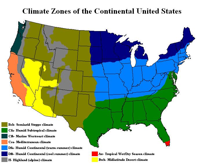
Farmington has a semi-arid climate.[9] The city can experience hot summers and cold winters with low precipitation throughout the year. The average annual snowfall is 12.3 inches (0.31 m).[10]
| Climate data for Farmington, New Mexico | |||||||||||||
|---|---|---|---|---|---|---|---|---|---|---|---|---|---|
| Month | Jan | Feb | Mar | Apr | May | Jun | Jul | Aug | Sep | Oct | Nov | Dec | Year |
| Average high °F (°C) | 41 (5) |
47 (8) |
56 (13) |
65 (18) |
75 (24) |
85 (29) |
90 (32) |
87 (31) |
79 (26) |
66 (19) |
52 (11) |
41 (5) |
65 (18) |
| Average low °F (°C) | 20 (−7) |
25 (−4) |
30 (−1) |
36 (2) |
46 (8) |
55 (13) |
61 (16) |
60 (16) |
52 (11) |
40 (4) |
29 (−2) |
21 (−6) |
40 (4) |
| Average precipitation inches (mm) | 0.53 (13) |
0.61 (15) |
0.78 (20) |
0.65 (17) |
0.54 (14) |
0.21 (5.3) |
0.90 (23) |
1.26 (32) |
1.04 (26) |
0.91 (23) |
0.68 (17) |
0.50 (13) |
8.61 (218.3) |
| Source: The Weather Channel[11] | |||||||||||||
Demographics
| Historical population | |||
|---|---|---|---|
| Census | Pop. | %± | |
| 1910 | 785 | — | |
| 1920 | 728 | −7.3% | |
| 1930 | 1,350 | 85.4% | |
| 1940 | 2,161 | 60.1% | |
| 1950 | 3,637 | 68.3% | |
| 1960 | 23,786 | 554.0% | |
| 1970 | 21,979 | −7.6% | |
| 1980 | 31,222 | 42.1% | |
| 1990 | 33,997 | 8.9% | |
| 2000 | 37,844 | 11.3% | |
| 2010 | 45,877 | 21.2% | |
| 2020 | 46,624 | 1.6% | |
| U.S. Decennial Census[12][2] | |||
As of the census[13] of 2010, there were 45,895 people and 17,548 housing units in Farmington. The racial makeup of the city was 62.8% White (including 52.4% White non-Hispanic), 1.0% African American, 22.2% Native American, 0.6% Asian, 0.1% Pacific Islander, and 4.2% from two or more races. Hispanic or Latino of any race were 22.4% of the population.
There were 16,466 households, out of which 33.4% had children under the age of 18 living with them, 49% were married couples living together, 13.6% had a female householder with no husband present, and 30.1% were non-families. 21.7% of all households were made up of individuals, and 8% had someone living alone who was 65 years of age or older. The average household size was 2.7 and the average family size was 3.19.

Arts and culture
Farmington has been the home of the Connie Mack World Series baseball tournament, played in August every year at Ricketts Park (capacity 5,072), since 1965 (except in 2020, when it was cancelled due to the COVID-19 pandemic). Connie Mack league regular season play includes players age 16 to 18. The Connie Mack World Series consists of 10 or more teams from various regions around the United States, including from Puerto Rico.[14][15]
Farmington holds a riverfest once a year. Area rivers are celebrated with a festival of music, fine arts, food, entertainment, a 10K and 5K run and walk, riverside trail walks, and river raft rides.
Piñon Hills Golf Course, designed by Ken Dye, in Farmington is one of the United States' Top Municipal Golf Courses. Owned and operated by the City of Farmington, Pinon Hills has been ranked in the Top Municipal Golf Courses by Golfweek Magazine for several years.[16]
Fishing, fly and reel, is a very popular activity in Farmington. Fishing is permitted on the San Juan River, Navajo Lake, Lake Farmington, Morgan Lake, the Animas River, Jackson Lake and Cutter Dam.
Education

The Farmington Municipal School District serves over 10,000 students in grades K-12 in 20 schools.[17] The high schools are Farmington High School, Piedra Vista High School, Rocinante High School, and San Juan College High School. There are four middle schools, Heights, Hermosa, Mesa View and Tibbetts.[18] New Mexico School for the Deaf operates a preschool facility in Farmington.[19] Navajo Preparatory School is a Bureau of Indian Education-affiliated tribal school.[20]
There are six private schools, if Navajo Preparatory is counted as one.[17] The National Center for Education Statistics counts Navajo Prep as public.[21] Sacred Heart School, Farmington (K-8), of the Roman Catholic Diocese of Gallup, was established in 1910.[22]
San Juan College is a public two-year college with average enrollment of about 10,000.[23]: 2–2
Farmington Public Library moved into a new building in 2003 and holds about 200,000 items in its collection. There was a branch library in Shiprock that is currently closed.
Infrastructure
Transportation
Air
- Farmington is served by Four Corners Regional Airport.
Highways
- U.S. Highway 64 is the major east–west highway through San Juan County and across Farmington.
- New Mexico Highway 170 extends northward from U.S. Highway 64 to the Colorado state line.
- New Mexico Highway 371 connects southward from U.S. Highway 64 to Interstate 40. It passes almost exclusively through the Navajo Indian reservation, and passes through only a few small towns or villages (such as Crownpoint and Thoreau). It is also the primary means of accessing the Bisti/De-Na-Zin Wilderness area.
- New Mexico Highway 516 is a southwest-northeast connector between Farmington and U.S. Highway 550 in Aztec.
- U.S. Highway 550 does not run through Farmington (nearby in Bloomfield and Aztec), but is a commonly referenced arterial by Farmington as a means to connect with central New Mexico, Interstate 25, Albuquerque, and (via I-25) the capital city of Santa Fe.
Intercity bus
- There is intercity bus service in Farmington, The Red Apple Transit.
- North Central Regional Transit District provides bus service from Chama, NM and Dulce, NM.
- The Navajo Transit System provides regional bus service in the Navajo Nation. Farmington is served by Route 07a from Newcomb, NM to Fort Defiance, AZ and Route 07b from Newcomb, NM to Shiprock, NM.[24]
Utilities
Electricity
- The Farmington Electric Utility System (FEUS) is owned and operated by the City of Farmington, serving approximately 46,000 metered customers. Its service territory covers 1,718 square miles and encompasses the city, much of San Juan County, and a small portion of Rio Arriba County.
- As of June 2021, the City generates approximately 36% of its consumed power from its own gas-fired generation facilities, 17% from the Navajo Dam hydroelectric facility, and the remainder purchased from third party generation resources.
- Aside from Navajo Lake (where generation facilities were established in 1988), a nominal amount of expansion of its owned generation facilities has been using renewable resources. Renewable energy is predominantly sourced from external third parties or via purchasing agreements with net metered facilities in its service area.[25]
Water and Wastewater
- The City's water comes from Farmington Lake, which is sourced from and fed using pumps located on the Animas River. Water and wasterwater treatment facilities, operations, and management are all contracted by the City to Jacobs Engineering Solutions.[26]
Solid Waste
- The City contracts all solid waste operations to Waste Management (of New Mexico) Inc., including general solid waste, recycling facilities and operations, and hazardous waste disposal. Disposal of City waste is done at the San Juan County Landfill, owned by the county and also operated by Waster Management of New Mexico.[27][28]
Telecommunications
- Cable service (television and Internet) is provided by Xfinity.
- Landline service (telephone and Internet) is provided by CenturyLink (Lumens Technologies).
- Mobile service (telephone and Internet) is provided by all major carriers. As of October 2022, 5G service remains unavailable.
Politics
As of August 2022, Farmington had approximately 28,548 active registered voters. There were 24.4% unaffiliated with a party, 51.0% Republican, 22.2% Democrat, 1.2% Libertarian, and 1.2% various other parties. Like the rest of San Juan County, it is a politically conservative community surrounded by generally more liberal counties, and situated within an overall more liberal/left-leaning state.[29][30]
Voting has historically strongly favored conservative ideals and candidates, although state and local government bonds and other tax-imposing initiatives are almost always approved by the electorate.[31]
Notable people
- Tom Bolack (1918–1998), Governor and Lieutenant Governor of New Mexico; Mayor of Farmington; oilman; rancher
- Mike Dunn (born 1985), athlete, Major League Baseball pitcher for the Colorado Rockies and the Miami Marlins
- Larry Echo Hawk (born 1948), former Attorney General of Idaho, 10th Assistant Secretary of the Interior for Indian Affairs, and general authority emeritus of the Church of Jesus Christ of Latter-day Saints
- Harris Hartz (born 1947), U.S. federal judge on the U.S. Court of Appeals for the Tenth Circuit
- Charly Martin (born 1984), NFL player
- Ralph Neely (born 1943), NFL offensive lineman for Dallas Cowboys
- Alana Nichols (born 1983), Paralympic gold medalist in alpine skiing and wheelchair basketball
- Onry Ozzborn (born 1979), rapper and founding member of Grayskul
- Chevel Shepherd (born 2002), singer and winner of the 15th season of The Voice
- Sleep (born 1976), rapper and member of The Chicharones
- Melanie Stansbury (born 1979), U.S. Representative, former state representative and scientist
- Duane Ward (born 1964), athlete, MLB pitcher for Toronto Blue Jays and Atlanta Braves
- Kenneth L. Worley (1948–1968), U.S. Marine who received the Medal of Honor
References
- "ArcGIS REST Services Directory". United States Census Bureau. Retrieved October 12, 2022.
- "Census Population API". United States Census Bureau. Retrieved October 12, 2022.
- Trail of the Ancients. Archived August 21, 2014, at the Wayback Machine New Mexico Tourism Department. Retrieved August 14, 2014.
- Smith, Claudia. "Farmington". New Mexico Office of the State Historian. Archived from the original on August 12, 2013. Retrieved August 25, 2012.
- Hudnall, Ken; Hudnall, Sharon (2005). Spritis of the Border IV: The History and Mystery of New Mexico. El Paso: Omega Press.
- "Farmington Branch". www.actionroad.net. Archived from the original on July 3, 2017. Retrieved April 5, 2018.
- Szasz, Ferenc M. (2006). Larger than Life: New Mexico in the Twentieth Century. Albuquerque, NM: University of New Mexico Press. p. 156.
- "Report" (PDF). www.usccr.gov. Retrieved July 20, 2019.
- "Photo" (PNG). 1.bp.blogspot.com. Retrieved July 20, 2019.
- "Welcome to Farmington, New Mexico". Farmington Chamber of Commerce. Retrieved September 24, 2012.
- "Average Weather for Farmington, NM – Temperature and Precipitation". Retrieved August 16, 2012.
- "Census of Population and Housing". Census.gov. Archived from the original on July 20, 2018. Retrieved June 4, 2015.
- "Farmington (city) QuickFacts". census.gov. Archived from the original on February 19, 2016. Retrieved April 5, 2018.
- "Connie Mack World Series canceled due to COVID-19". KRQE NEWS 13 - Breaking News, Albuquerque News, New Mexico News, Weather, and Videos. April 29, 2020. Retrieved October 30, 2022.
- "History". official site. Connie Mack World Series. Archived from the original on September 15, 2010. Retrieved December 9, 2010.
- "Best Municipal Courses 2011". Golfweek. May 25, 2012. Retrieved September 1, 2012.
- "Schools in Farmington New Mexico". Farmington Chamber of Commerce. Archived from the original on March 13, 2008. Retrieved May 18, 2008.
- "Farmington Municipal Schools". district.fms.k12.nm.us. Retrieved April 16, 2020.
- "About NMSD". New Mexico School for the Deaf. Retrieved July 20, 2021.
- "Navajo Preparatory School". Bureau of Indian Education. Retrieved January 13, 2022.
- "Navajo Preparatory School". National Center for Education Statistics. Retrieved January 13, 2022.
- "Home". Sacred Heart School, Farmington. Retrieved January 13, 2022.
Since 1910, Sacred Heart Catholic School has[...]
- San Juan College Fact Book 2007 (PDF). Farmington, NM: San Juan College Office of Institutional Research. Archived from the original (PDF) on July 19, 2011. Retrieved May 18, 2008.
- "Navajo Transit System - Home". www.navajotransit.com. Retrieved November 8, 2020.
- "Farmington Electric Utility System | Farmington, NM - Official Website". www.fmtn.org. Retrieved November 10, 2022.
- "Water & Wastewater Utilities | Farmington, NM - Official Website". www.fmtn.org. Retrieved November 10, 2022.
- "Sanitation Utilities | Farmington, NM - Official Website". www.fmtn.org. Retrieved November 10, 2022.
- "San Juan County Landfill | Management Facility (Disposal) | WMSolutions.com". www.wmsolutions.com. Retrieved November 10, 2022.
- "Current and Historical Registration Data | San Juan County, NM". www.sjcounty.net. Retrieved November 9, 2022.
- "San Juan County, NM Political Map – Democrat & Republican Areas in San Juan County | BestNeighborhood.org". bestneighborhood.org. Retrieved November 9, 2022.
- "Past Election Results | San Juan County, NM". www.sjcounty.net. Retrieved November 9, 2022.
External links
- Official Website of the City of Farmington
- Farmington Chamber of Commerce
- Farmington Convention & Visitors Bureau
Municipalities and communities of San Juan County, New Mexico, United States | ||
|---|---|---|
County seat: Aztec | ||
| Cities |  | |
| CDPs |
| |
| Other communities |
| |
| Indian reservations |
| |
| Footnotes | ‡This populated place also has portions in an adjacent county or counties | |
| ||
State of New Mexico | |
|---|---|
Santa Fe (capital) | |
| Topics |
|
| Society |
|
| Regions |
|
| Cities | |
| Counties | |
Authority control | |
|---|---|
| General | |
| National libraries | |
| Other |
|
На других языках
[de] Farmington (New Mexico)
Farmington ist eine Stadt mit 47.000 Einwohnern (Stand 2020) im San Juan County des Bundesstaats New Mexico der USA.- [en] Farmington, New Mexico
[ru] Фармингтон (Нью-Мексико)
Фа́рмингтон (англ. Farmington) — город на юго-западе США в округе Сан-Хуан штата Нью-Мексико. Население 45 877 человек (перепись 2010). Экономическая столица региона Четыре угла.Другой контент может иметь иную лицензию. Перед использованием материалов сайта WikiSort.org внимательно изучите правила лицензирования конкретных элементов наполнения сайта.
WikiSort.org - проект по пересортировке и дополнению контента Википедии