world.wikisort.org - USA
Derry is an unincorporated community located in Sierra County, New Mexico, United States. Derry is located on New Mexico State Road 187, 11.3 miles (18.2 km) northwest of Hatch. Derry has a post office with ZIP code 87933, which opened on August 11, 1911.[2][3] The town was named after Derry, Ireland, which was suggested by a former soldier.[4]
Derry | |
|---|---|
Unincorporated community | |
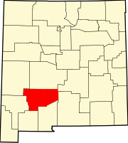
 Derry Location within the state of New Mexico  Derry Derry (the United States) | |
| Coordinates: 32°47′17″N 107°16′56″W | |
| Country | United States |
| State | New Mexico |
| County | Sierra |
| Elevation | 4,117 ft (1,255 m) |
| Time zone | UTC-7 (Mountain (MST)) |
| • Summer (DST) | UTC-6 (MDT) |
| Area code(s) | 575 |
| GNIS feature ID | 888335[1] |
Education
Truth or Consequences Municipal Schools is the school district for the entire county.[5] Truth or Consequences Middle School and Hot Springs High School, both in Truth or Consequences, are the district's secondary schools.
References
- "Derry". Geographic Names Information System. United States Geological Survey, United States Department of the Interior.
- "Postmaster Finder - Post Offices by ZIP Code". United States Postal Service. Retrieved November 9, 2014.
- United States Postal Service. "USPS - Look Up a ZIP Code". Retrieved November 9, 2014.
- Julyan, Robert (1996). The Place Names of New Mexico. University of New Mexico Press. p. 108. ISBN 0826316891.
- "2020 CENSUS - SCHOOL DISTRICT REFERENCE MAP: Sierra County, NM" (PDF). U.S. Census Bureau. Retrieved 2022-07-12. - Text list
Municipalities and communities of Sierra County, New Mexico, United States | ||
|---|---|---|
County seat: Truth or Consequences | ||
| Cities |
|  |
| Villages | ||
| CDPs |
| |
| Other communities |
| |
| Ghost towns |
| |
| ||
This New Mexico state location article is a stub. You can help Wikipedia by expanding it. |
Текст в блоке "Читать" взят с сайта "Википедия" и доступен по лицензии Creative Commons Attribution-ShareAlike; в отдельных случаях могут действовать дополнительные условия.
Другой контент может иметь иную лицензию. Перед использованием материалов сайта WikiSort.org внимательно изучите правила лицензирования конкретных элементов наполнения сайта.
Другой контент может иметь иную лицензию. Перед использованием материалов сайта WikiSort.org внимательно изучите правила лицензирования конкретных элементов наполнения сайта.
2019-2026
WikiSort.org - проект по пересортировке и дополнению контента Википедии
WikiSort.org - проект по пересортировке и дополнению контента Википедии