world.wikisort.org - USA
Oxford is a village in Oakland County in the U.S. state of Michigan. The population was 3,436 at the 2010 census. The village is located within Oxford Township.[4] Located about 30 miles (48 km) north of Detroit, it is a northern suburb of the Metro Detroit region.
Oxford, Michigan | |
|---|---|
Village | |
| Village of Oxford | |
 Intersection of Washington and Burdick | |
| Motto: "Our past guides our vision for the future." | |
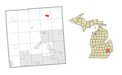 Location within Oakland County | |
 Oxford Location within the state of Michigan  Oxford Location within the United States | |
| Coordinates: 42°49′29″N 83°15′53″W | |
| Country | United States |
| State | Michigan |
| County | Oakland |
| Township | Oxford |
| Settled | 1823 |
| Incorporated | 1876 |
| Government | |
| • Type | Village council |
| • President | Kelsey Cooke |
| • Manager | Joe Madore |
| • Clerk | Tere Onica |
| Area | |
| • Village | 1.46 sq mi (3.78 km2) |
| • Land | 1.26 sq mi (3.26 km2) |
| • Water | 0.20 sq mi (0.52 km2) |
| Elevation | 1,056 ft (322 m) |
| Population (2020) | |
| • Village | 3,492 |
| • Density | 2,773.63/sq mi (1,071.31/km2) |
| • Metro | 4,296,250 (Metro Detroit) |
| Time zone | UTC-5 (EST) |
| • Summer (DST) | UTC-4 (EDT) |
| ZIP code(s) | 48371 |
| Area code(s) | 248 and 810 |
| FIPS code | 26-62020[2] |
| GNIS feature ID | 0634267[3] |
| Website | Official website |
History

During the early 19th century the northeast Oakland County area was largely avoided by the early settlers because it was believed to be nothing but impenetrable swamp land. The area was, at that time, nicknamed "The Barren Plains of Oxford."[5] It was called this primarily because of a report made in 1812 by the U.S. Surveyor General that described the area as a poor, barren, sandy land, on which scarcely any vegetation could grow with the exception of some very small scrubby oaks. It was concluded in the surveyors' report that there was one acre out of one hundred that appeared to be eligible for cultivation. Any hope for crop production was thought to be preposterous. At this point, the area was deemed worthless, and discouragement of any hope for development by forthcoming settlers was inevitable.
Purchase of public land in what is now called Oxford was in 1823 by a man named Elbridge G. Deming. Soon after, the first person to settle in Oxford was a wolf trapper named Avery Brown. He made use of the land and gave some credibility to its value. It wasn't long after that the first area post office was officially established in what was then known as Demingsburgh on May 2, 1834. Five years later, the name was officially changed to Oxford on January 15, 1839.[6] Elbridge D. Deming was the first postmaster for Oxford, as the post office was located in his log home near the intersection of M-24 and Metamora Road.
On November 30, 2021, a mass shooting occurred at Oxford High School. Four students were killed, and eight others were injured. School attendance was very low that day, as rumors had spread earlier that week of a shooting being about to occur. Most of the students escaped into a nearby Meijer. The suspect, a 15-year-old sophomore student,[7] reportedly fired between 15 and 20 bullets in a chemistry room and did not resist arrest.[8][9]
Geography
According to the United States Census Bureau, the village has a total area of 1.46 square miles (3.78 km2), of which 1.26 square miles (3.26 km2) is land and 0.20 square miles (0.52 km2) (1.37%) is water.[10]
Demographics
| Historical population | |||
|---|---|---|---|
| Census | Pop. | %± | |
| 1880 | 851 | — | |
| 1890 | 1,128 | 32.5% | |
| 1900 | 1,172 | 3.9% | |
| 1910 | 1,191 | 1.6% | |
| 1920 | 1,668 | 40.1% | |
| 1930 | 2,052 | 23.0% | |
| 1940 | 2,144 | 4.5% | |
| 1950 | 2,305 | 7.5% | |
| 1960 | 2,357 | 2.3% | |
| 1970 | 2,536 | 7.6% | |
| 1980 | 2,746 | 8.3% | |
| 1990 | 2,929 | 6.7% | |
| 2000 | 3,540 | 20.9% | |
| 2010 | 3,436 | −2.9% | |
| 2020 | 3,492 | 1.6% | |
| U.S. Decennial Census[11] | |||
2010 census
As of the census[12] of 2010, there were 3,436 people, 1,335 households, and 889 families residing in the village. The population density was 2,748.8 inhabitants per square mile (1,061.3/km2). There were 1,468 housing units at an average density of 1,174.4 per square mile (453.4/km2). The racial makeup of the village was 95.1% White, 1.9% African American, 0.2% Native American, 0.7% Asian, 0.7% from other races, and 1.3% from two or more races. Hispanic or Latino of any race were 4.4% of the population.
There were 1,335 households, of which 33.0% had children under the age of 18 living with them, 51.5% were married couples living together, 10.6% had a female householder with no husband present, 4.6% had a male householder with no wife present, and 33.4% were non-families. 29.1% of all households were made up of individuals, and 6.6% had someone living alone who was 65 years of age or older. The average household size was 2.49 and the average family size was 3.09.
The median age in the village was 38.5 years. 25% of residents were under the age of 18; 8.4% were between the ages of 18 and 24; 27.5% were from 25 to 44; 28.9% were from 45 to 64; and 10.2% were 65 years of age or older. The gender makeup of the village was 49.3% male and 50.7% female.
2000 census
As of the census[2] of 2000, there were 3,540 people, 1,402 households, and 918 families residing in the village. The population density was 2,873.5 per square mile (1,111.2/km2). There were 1,476 housing units at an average density of 1,198.1 per square mile (463.3/km2). The racial makeup of the village was 97.23% White, 0.59% African American, 0.28% Native American, 0.51% Asian, 0.31% from other races, and 1.05% from two or more races. Hispanic or Latino of any race were 2.66% of the population.
There were 1,402 households, out of which 35.6% had children under the age of 18 living with them, 53.4% were married couples living together, 9.4% had a female householder with no husband present, and 34.5% were non-families. 29.6% of all households were made up of individuals, and 7.2% had someone living alone who was 65 years of age or older. The average household size was 2.51 and the average family size was 3.15.
In the village, the population was spread out, with 28.2% under the age of 18, 8.1% from 18 to 24, 34.4% from 25 to 44, 21.2% from 45 to 64, and 8.2% who were 65 years of age or older. The median age was 34 years. For every 100 females, there were 96.6 males. For every 100 females age 18 and over, there were 93.7 males.
The median income for a household in the village was $53,885, and the median income for a family was $72,875. Males had a median income of $50,179 versus $29,938 for females. The per capita income for the village was $24,811. About 3.0% of families and 5.3% of the population were below the poverty line, including 6.1% of those under age 18 and 10.5% of those age 65 or over.
Arts and culture

The village center consists of shops, restaurants, and taverns stretching for two blocks. Local happenings such as athletic events, downtown fairs, scarecrow competitions, school plays, the annual Steamback golf outing at Oxford Hills and concerts garner a large turnout throughout the year and are reported in the weekly newspaper of record since 1898, The Oxford Leader.
The area's public high school, Oxford High School, was newly expanded in 2003–2004.
Education

The village of Oxford is home to the school district of Oxford Community Schools. The district has nine schools which include:
- Two high schools (Oxford High School and Oxford Bridges High School, the latter an alternative school )
- One middle school (Oxford Middle School)
- Five elementary schools (Clear Lake, Daniel Axford, Lakeville, Leonard, and Oxford Elementary). All five elementary schools earned an A on their EducationYes! Report cards for the 2010–2011 school year.
- One adjudicated youth school (Crossroads for Youth)
The primary mascot for Oxford Schools is the Wildcat. Both the high school and the middle school have sports teams which are referred to as Oxford Wildcats. The Oxford Wildcat logo is visible around the town, prominently on one of the three water towers.
In 2009 and in 2010, Oxford Community Schools was featured as one of the "Best Schools In Michigan". Two of the elementary schools Leonard Elementary and Lakeville Elementary both won Michigan Blue Ribbon Awards, making all Oxford elementary schools Michigan Blue Ribbon Schools. In the 2010-2011 year, Oxford High School moved from the Flint Metro League to the Oakland Activities Association.
Notable people
- Brace Beemer, actor who played the Lone Ranger on radio from 1941 to 1953, retired and raised thoroughbred horses on his 300-acre ranch Paint Creek Acres, until his death in 1965
- George H. Durand, U.S. Representative, lived in Oxford
- Nathan Gerbe, NHL player was born in Oxford and currently plays for the Columbus Blue Jackets of the National Hockey League
- Eric Ghiaciuc, NFL player for the New England Patriots, was born in Oxford on May 28, 1981
- Mike Lantry, NFL player, (University of Michigan / Dallas Cowboys)
- Chris Gambol, NFL player, (University of Iowa / Indianapolis Colts)
- Dave Rayner NFL player, (Michigan State University / Indianapolis Colts)
- Jim Bates (1964), NFL coach, from University of Tennessee, longtime NFL defensive coach (Packers, Broncos, Dolphins and Bucs) as well as Miami's head coach for eight games in 2004
- Zach Line, NFL player, played for Southern Methodist University, retired from New Orleans Saints roster as a fullback, currently head coach of Oxford football varsity team[citation needed]
- William R. Reed, commissioner of the Big Ten Conference from 1961 to 1971, was born in Oxford
- Albert J. Campbell, United States Representative from Montana, lived in Oxford[13]
- Ralph Gilles, an automotive designer currently serving as Head of Design for Fiat Chrysler Automobiles
- Josh Norris, NHL player was born in Oxford and currently plays for the Ottawa Senators of the National Hockey League
References
- "2020 U.S. Gazetteer Files". United States Census Bureau. Retrieved May 21, 2022.
- "U.S. Census website". United States Census Bureau. Retrieved 2008-01-31.
- U.S. Geological Survey Geographic Names Information System: Oxford, Michigan
- "Michigan: 2010 Population and Housing Unit Counts 2010 Census of Population and Housing" (PDF). 2010 United States Census. United States Census Bureau. September 2012. p. 37 Michigan. Retrieved August 17, 2021.
- Pendle, George (2016-02-08). "How a Small Town in Michigan Became the World's Gravel Capital". Atlas Obscura. Retrieved 2020-12-26.
- "michiganrailroads.com - Oxford, MI". www.michiganrailroads.com. Retrieved 2020-12-26.
- "Suspect's parents originated from Jacksonville, Florida, arrested by Oakland County officials in connection of Oxford". News4Jax. Retrieved 2021-12-01.
- Moran, Darcie. "Oxford High School shooting leaves 3 dead, 6 injured: Everything we know". Detroit Free Press. Retrieved 2021-11-30.
- "Oxford High School shooting: 3 students dead, 6 hurt including 1 teacher". WJBK. November 30, 2021. Retrieved November 30, 2021.
- "2019 U.S. Gazetteer Files". United States Census Bureau. Retrieved July 25, 2020.
- "Census of Population and Housing". Census.gov. Retrieved June 4, 2015.
- "U.S. Census website". United States Census Bureau. Retrieved 2012-11-25.
- "CAMPBELL, Albert James, (1857 - 1907)". Biographical Directory of the United States Congress. Retrieved October 14, 2012.
External links
Places adjacent to Oxford, Michigan | |
|---|---|
Municipalities and communities of Oakland County, Michigan, United States | ||
|---|---|---|
County seat: Pontiac | ||
| Cities |
|  |
| Villages | ||
| Charter townships | ||
| Civil townships | ||
| Unincorporated communities |
| |
| Footnotes | ‡This populated place also has portions in an adjacent county or counties | |
| ||
Metro Detroit | ||
|---|---|---|
| Topics |
|  |
| Detroit |
| |
| Municipalities over 80,000 | ||
| Municipalities 40,000 to 80,000 | ||
| Cultural enclaves |
| |
| Satellite cities | ||
| Counties in MSA | ||
| Counties in CSA | ||
| ||
Authority control | |
|---|---|
| General | |
| National libraries | |
| Other |
|
На других языках
[de] Oxford (Michigan)
Oxford ist ein Village im Oakland County im US-Bundesstaat Michigan, Vereinigte Staaten. Die Ortschaft gehört der Oxford Charter Township an und liegt ebenfalls in der Metropolregion Detroit. Im Jahr 2010 hatte Oxford 3436 Einwohner.- [en] Oxford, Michigan
Другой контент может иметь иную лицензию. Перед использованием материалов сайта WikiSort.org внимательно изучите правила лицензирования конкретных элементов наполнения сайта.
WikiSort.org - проект по пересортировке и дополнению контента Википедии