world.wikisort.org - USA
Brighton is a city in Metro Detroit[4] in the southeast portion of Livingston County in the U.S. state of Michigan. As of the 2010 census, the city population was 7,444. Brighton forms part of the South Lyon-Howell-Brighton Urban Area. It is one of two incorporated cities in Livingston County, and incorporates land that was part of Brighton, Green Oak and Genoa townships.
This article needs additional citations for verification. (October 2009) |
Brighton, Michigan | |
|---|---|
City | |
| City of Brighton | |
Left to right, from top: Downtown Brighton, Brighton City Hall, Old Town Hall, and South Ore Creek | |
|
Logo | |
| Motto: "Where quality is a way of life" | |
 Location within Livingston County | |
 Brighton Location in Michigan  Brighton Location in the United States | |
| Coordinates: 42°31′36″N 83°47′02″W | |
| Country | United States |
| State | Michigan |
| County | Livingston |
| Settled | 1832 |
| Incorporated | 1867 (village) 1928 (city) |
| Government | |
| • Type | Council–manager |
| • Mayor | Shawn Pipoly |
| • Mayor pro-tem | Susan Gardner |
| • Manager | Nate Geinzer |
| • Clerk | Tara Brown |
| Area | |
| • City | 3.69 sq mi (9.56 km2) |
| • Land | 3.51 sq mi (9.10 km2) |
| • Water | 0.18 sq mi (0.46 km2) |
| Elevation | 925 ft (282 m) |
| Population (2020) | |
| • City | 7,446 |
| • Density | 2,118.95/sq mi (818.06/km2) |
| • Metro | 4,296,250 (Metro Detroit) |
| Time zone | UTC-5 (Eastern (EST)) |
| • Summer (DST) | UTC-4 (EDT) |
| ZIP code(s) | 48114, 48116 |
| Area code(s) | 248 and 810 |
| FIPS code | 26-10620[2] |
| GNIS feature ID | 0621987[3] |
| Website | www |


History
Brighton was established in 1832. It was incorporated as a village in 1867 and as a city in 1928.[5]
Geography
According to the United States Census Bureau, the city has an area of 3.69 square miles (9.56 km2), of which 3.56 square miles (9.22 km2) is land and 0.13 square miles (0.34 km2) is water.[6]
Transportation
Major Thoroughfares
 I-96
I-96 US 23
US 23- Grand River Avenue
Climate
Brighton exhibits what is known as a continental climate biome. Within the heart of the Great Lakes region, Brighton weather ranges from warm summers with occasional thunderstorms to cold, dry winters with moderate to heavy snowfall.
| Climate data for Brighton, Michigan | |||||||||||||
|---|---|---|---|---|---|---|---|---|---|---|---|---|---|
| Month | Jan | Feb | Mar | Apr | May | Jun | Jul | Aug | Sep | Oct | Nov | Dec | Year |
| Record high °F (°C) | 66 (19) |
67 (19) |
79 (26) |
86 (30) |
92 (33) |
101 (38) |
100 (38) |
98 (37) |
96 (36) |
88 (31) |
78 (26) |
64 (18) |
101 (38) |
| Average high °F (°C) | 30 (−1) |
33 (1) |
43 (6) |
56 (13) |
68 (20) |
77 (25) |
82 (28) |
79 (26) |
72 (22) |
59 (15) |
46 (8) |
34 (1) |
57 (14) |
| Average low °F (°C) | 14 (−10) |
16 (−9) |
24 (−4) |
35 (2) |
47 (8) |
56 (13) |
60 (16) |
59 (15) |
51 (11) |
40 (4) |
31 (−1) |
20 (−7) |
38 (3) |
| Record low °F (°C) | −23 (−31) |
−16 (−27) |
−9 (−23) |
11 (−12) |
24 (−4) |
33 (1) |
41 (5) |
38 (3) |
26 (−3) |
16 (−9) |
−1 (−18) |
−18 (−28) |
−23 (−31) |
| Average precipitation inches (mm) | 1.52 (39) |
1.55 (39) |
2.13 (54) |
2.78 (71) |
2.83 (72) |
3.12 (79) |
2.52 (64) |
3.07 (78) |
3.00 (76) |
2.10 (53) |
2.47 (63) |
2.19 (56) |
29.28 (744) |
| Source: WeatherChannel[7] | |||||||||||||
Demographics
| Historical population | |||
|---|---|---|---|
| Census | Pop. | %± | |
| 1860 | 252 | — | |
| 1870 | 454 | 80.2% | |
| 1880 | 803 | 76.9% | |
| 1890 | 741 | −7.7% | |
| 1900 | 781 | 5.4% | |
| 1910 | 767 | −1.8% | |
| 1920 | 800 | 4.3% | |
| 1930 | 1,287 | 60.9% | |
| 1940 | 1,353 | 5.1% | |
| 1950 | 1,861 | 37.5% | |
| 1960 | 2,282 | 22.6% | |
| 1970 | 2,457 | 7.7% | |
| 1980 | 4,268 | 73.7% | |
| 1990 | 5,686 | 33.2% | |
| 2000 | 6,701 | 17.9% | |
| 2010 | 7,444 | 11.1% | |
| 2020 | 7,446 | 0.0% | |
| U.S. Decennial Census[8] | |||
The city's median household income in 2009 was $47,668, and the median family income was $77,105.[9] Males had a median income of $48,554 versus $30,877 for females. The city's per capita income was $29,781. Brighton's surrounding townships and communities, such as Brighton and Genoa Township, have median household incomes in excess of $90,000, making it one of the more prosperous places in Michigan. About 3.0% of families and 5.1% of the population were below the poverty line, including 5.9% of those under age 18 and 5.2% of those age 65 or over in the 2000 census.
2010 census
At the 2010 census the city had 7,444 people, 3,603 households, and 1,811 families. The population density was 2,091.0 inhabitants per square mile (807.3/km2). There were 3,905 housing units at an average density of 1,096.9 per square mile (423.5/km2). The city's racial makeup was 96.0% White, 0.7% African American, 0.4% Native American, 1.1% Asian, 0.6% from other races, and 1.2% from two or more races. Hispanic or Latino of any race were 2.3%.[10]
There were 3,603 households, of which 22.3% had children under the age of 18 living with them, 38.2% were married couples living together, 8.9% had a female householder with no husband present, 3.1% had a male householder with no wife present, and 49.7% were non-families. 42.7% of households were one person and 19.8% were one person aged 65 or older. The average household size was 2.02 and the average family size was 2.81.
The median age was 43.4 years. 19% of the city's population was under age 18; 7.1% was between age 18 and 24; 26% was from age 25 to 44; 26.1% was from 45 to 64, and 21.7% were age 65 or older. The city's gender makeup was 46.2% male and 53.8% female.
2000 census
At the 2000 census the city had 6,701 people, 3,103 households, and 1,746 families. The population density was 1,857.0 inhabitants per square mile (717.0/km2). There were 3,241 housing units at an average density of 898.2 per square mile (346.8/km2). The city's racial makeup was 99.76% White, 0.034% African American, 0.042% Native American, 0.21% Asian, 0.39% from other races, and 0.0093% from two or more races. Hispanic or Latino of any race were 1.48%.[2]
There were 3,103 households, of which 25.7% had children under the age of 18 living with them, 44.3% were married couples living together, 9.1% had a female householder with no husband present, and 43.7% were non-families. 37.8% of households were one person and 15.5% were one person aged 65 or older. The average household size was 2.15 and the average family size was 2.87.
21.7% of the city's population was under age 18, 8.5% was from age 18 to 24, 31.9% was from age 25 to 44, 21.4% was from age 45 to 64, and 16.6% was age 65 or older. The median age was 37 years. For every 100 females, there were 87.6 males. For every 100 females age 18 and over, there were 81.8 males.
Government
The city of Brighton's wastewater treatment plant facility is in Hamburg Township and services the city of Brighton and parts of Genoa, Brighton, and Hamburg townships. The city's two water plants also serve the city and parts of Genoa, Brighton and Hamburg townships.[11]
Fire service for the city is provided through a separate governmental entity called the Brighton Area Fire Authority, which also serves the Townships of Brighton and Genoa.
Library services for the city is provided through a separate governmental entity called the Brighton District Library, which also serves the townships of Brighton, Genoa and Green Oak.
Recreation services for the city is provided through a separate governmental entity called the Southeastern Livingston County Recreation Authority, which also serves the townships of Brighton, Genoa and Green Oak, as well as the Brighton Area Schools.
Business district
The town's major business districts are downtown and on either side of town. Brighton has two major shopping malls: Brighton Mall on the north side of town off of I-96 Exit 145 is a former enclosed mall which was rebuilt in 1996 as a power center, and Green Oak Village Place is a lifestyle center complex on the east side of town.
Several initiatives to revitalize downtown, such as streetscape improvements and displayed art, have been well received. A bronze nude entitled Decision Pending, purchased as part of the 2006 Brighton Biennial, generated some controversy and an unsuccessful campaign to relocate the statue.[12][13][14]
Notable people
- Drew Henson, quarterback for the Houston Texans, Dallas Cowboys, Minnesota Vikings, and Detroit Lions; attended Brighton High School
- Jonathon Merrill, defenseman for NHL's Detroit Red Wings; was raised in Brighton
- Mickey Stanley, center fielder for the Detroit Tigers; World Series champion (1968); lives in Brighton
- Morgan Trent, cornerback for the Cincinnati Bengals, Indianapolis Colts, Jacksonville Jaguars, and Washington Redskins; lived in Brighton
In popular culture
Brighton is the primary setting of the analog horror web series, The Walten Files
Gallery
 Downtown Brighton, Main St.
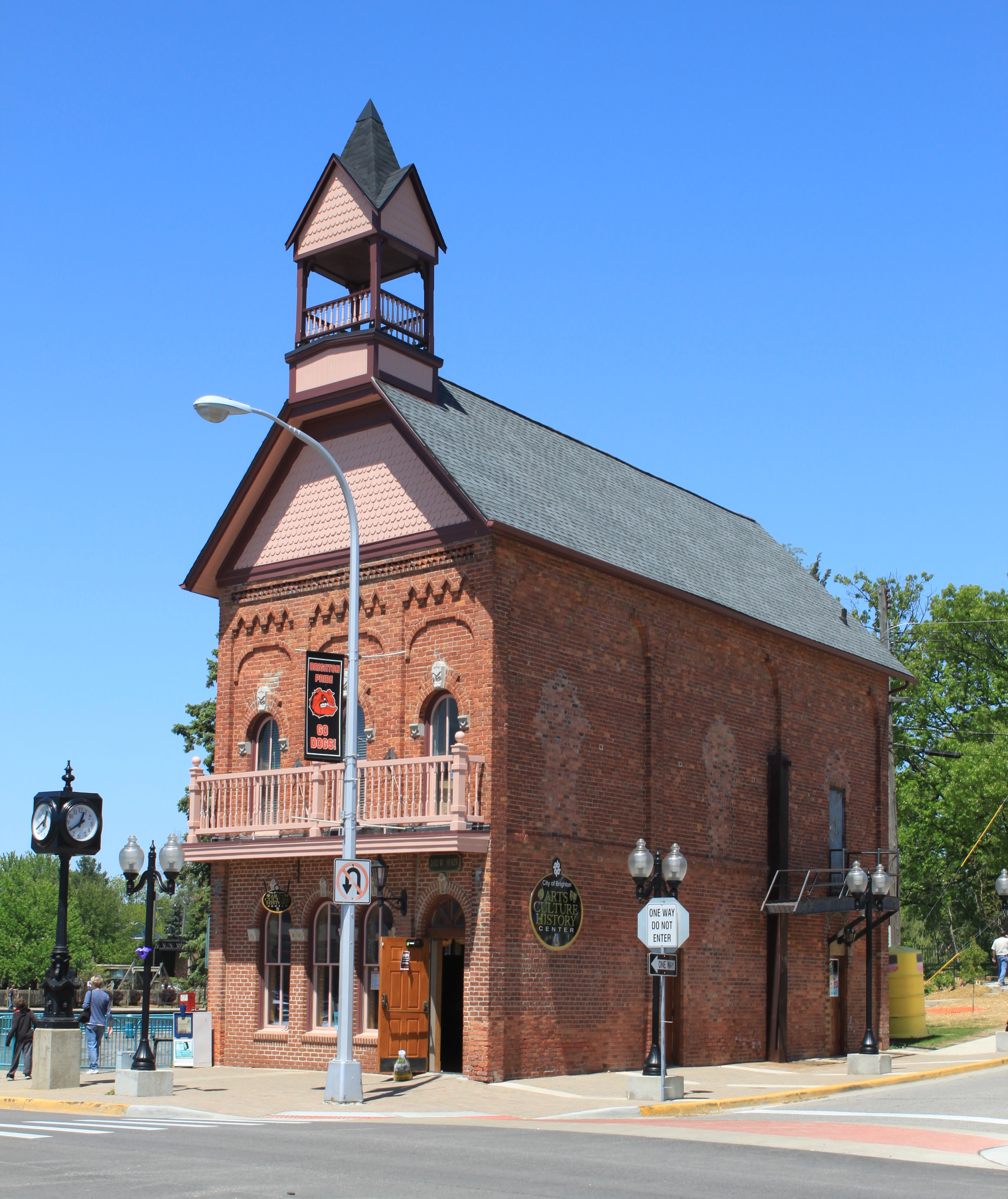
 Old Town Hall
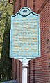 Old Town Hall historical marker
 St. Paul's Episcopal Church
 St. Paul's Episcopal Church historical marker
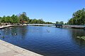 Millpond Park
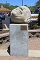 "Bob" sculpture, Main St. & Grand River Ave.
 Brighton High School


Education
Brighton Area Schools has 2 middle schools-Scranton and Maltby, a high school, and a few elementary schools. There is 1 private high school, Livingston Christian High School, and a middle school (same name). There is three private elementary and middle schools: Cornerstone Church And School, Holy Sprit Academy, and Shepheard of the Lakes Lutheran School.
References
- "2020 U.S. Gazetteer Files". United States Census Bureau. Retrieved May 21, 2022.
- "U.S. Census website". United States Census Bureau. Retrieved 2008-01-31.
- "US Board on Geographic Names". United States Geological Survey. 2007-10-25. Retrieved 2008-01-31.
- "MICHIGAN - Core Based Statistical Areas (CBSAs) and Counties" (PDF). United States Census Bureau.
- Romig, Walter (1973). Michigan Place Names. Wayne State University Press. p. 78. ISBN 978-0814318386. Retrieved 2013-09-26.
- "US Gazetteer files 2010". United States Census Bureau. Archived from the original on 2012-01-25. Retrieved 2012-11-25.
- "Monthly Weather for Brighton, MI 48114". The Weather Channel. Retrieved 2013-09-26.
- "Census of Population and Housing". Census.gov. Retrieved June 4, 2015.
- American FactFinder Archived April 17, 2014, at the Wayback Machine
- "U.S. Census website". United States Census Bureau. Retrieved 2012-11-25.
- "Welcome to City of Brighton, MI". www.brightoncity.org. Retrieved 2022-06-26.
- Moorehouse, Buddy (2010). "Woo-hoo! The Ugly Naked Guy is on the move". LivingstonTalk.com. Archived from the original on 2012-01-06.
- "Brighton Relocating 'Decision Pending' Statue". myFOXDetroit.com. 2010-08-23. Archived from the original on 2010-08-25.
- "City Of Brighton City Council Meeting, City Hall, October 7, 2010" (PDF). Archived from the original (PDF) on September 29, 2013.
External links
Municipalities and communities of Livingston County, Michigan, United States | ||
|---|---|---|
County seat: Howell | ||
| Cities |  | |
| Villages | ||
| Charter townships | ||
| Civil townships | ||
| CDPs | ||
| Other unincorporated communities |
| |
| Footnotes | ‡This populated place also has portions in an adjacent county or counties | |
| ||
Authority control | |
|---|---|
| General | |
| National libraries | |
| Other |
|
Другой контент может иметь иную лицензию. Перед использованием материалов сайта WikiSort.org внимательно изучите правила лицензирования конкретных элементов наполнения сайта.
WikiSort.org - проект по пересортировке и дополнению контента Википедии