world.wikisort.org - USA
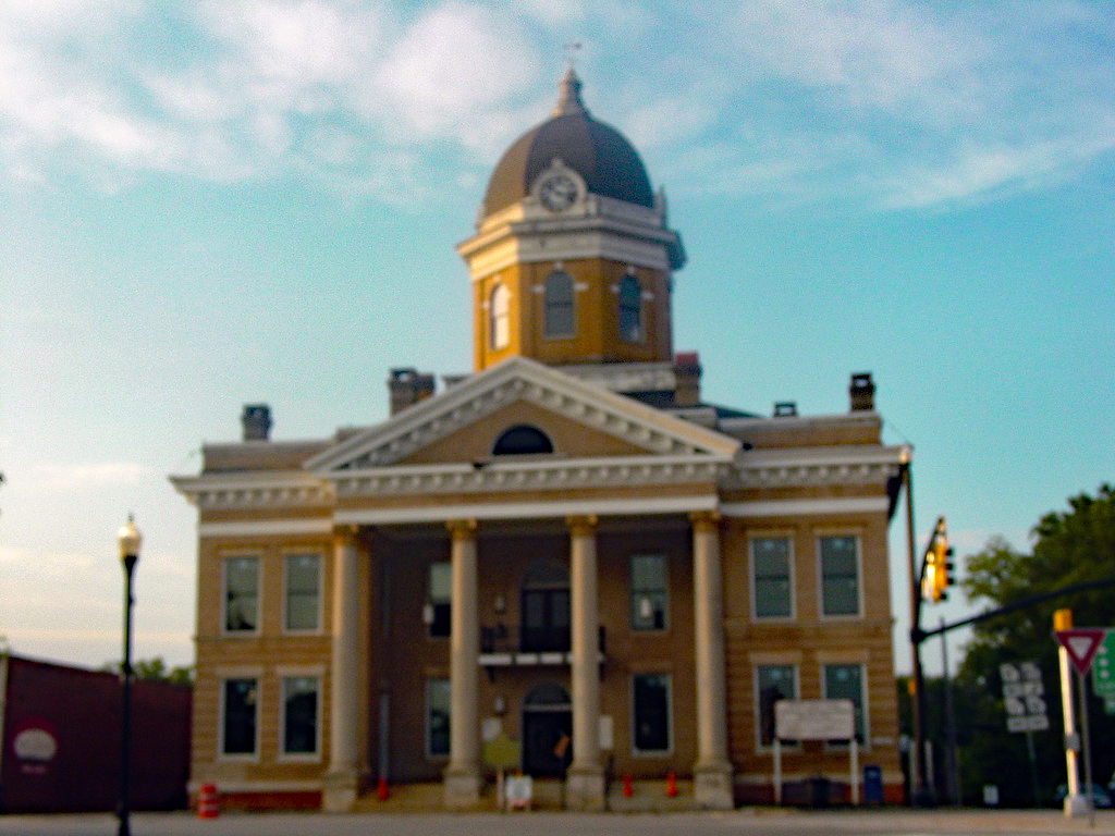
Monticello is the largest city and the county seat of Jasper County, Georgia,[4] United States. The city includes historic buildings such as the Jasper County Courthouse, Monticello High School and the Monticello Historic District. The population was 2,657 at the 2010 census.[5] It is 56 miles (90 km) southeast of Atlanta.
Monticello, Georgia | |
|---|---|
City | |
 Town square | |
| Motto: "Small town feel. Urban access. Endless opportunities." | |
 Location in Jasper County and the state of Georgia | |
| Coordinates: 33°18′12″N 83°41′9″W | |
| Country | United States |
| State | Georgia |
| County | Jasper |
| Area | |
| • Total | 4.28 sq mi (11.08 km2) |
| • Land | 4.16 sq mi (10.78 km2) |
| • Water | 0.12 sq mi (0.30 km2) |
| Elevation | 679 ft (207 m) |
| Population (2020) | |
| • Total | 2,541 |
| • Density | 610.67/sq mi (235.78/km2) |
| Time zone | UTC-5 (Eastern (EST)) |
| • Summer (DST) | UTC-4 (EDT) |
| ZIP code | 31064 |
| Area code | 706 |
| FIPS code | 13-52416[2] |
| GNIS feature ID | 0328830[3] |
| Website | www |
History
Monticello was founded in 1808 as seat of the newly formed Jasper County. The city was named after Monticello, the estate of Thomas Jefferson.[6] It was incorporated as a town in 1810 and as a city in 1901.[7]
Geography
Monticello is located in the center of Jasper County at 33°18′12″N 83°41′9″W (33.303247, -83.685766).[8] Georgia State Routes 11, 16, 83, and 212 all meet at the center of town. SR 11 leads north 18 miles (29 km) to Mansfield and south 25 miles (40 km) to Gray, SR 16 leads east 17 miles (27 km) to Eatonton and west the same distance to Jackson, SR 83 leads northeast 9 miles (14 km) to Shady Dale and southwest 26 miles (42 km) to Forsyth, and SR 212 leads northwest 42 miles (68 km) to the outskirts of Atlanta and southeast 32 miles (51 km) to Milledgeville.
According to the United States Census Bureau, the city has a total area of 3.2 square miles (8.4 km2), of which 0.03 square miles (0.07 km2), or 0.89%, are water.[5] The city is part of the Oconee River watershed.
Demographics
| Historical population | |||
|---|---|---|---|
| Census | Pop. | %± | |
| 1880 | 511 | — | |
| 1890 | 849 | 66.1% | |
| 1900 | 1,106 | 30.3% | |
| 1910 | 1,508 | 36.3% | |
| 1920 | 1,823 | 20.9% | |
| 1930 | 1,593 | −12.6% | |
| 1940 | 1,746 | 9.6% | |
| 1950 | 1,918 | 9.9% | |
| 1960 | 1,931 | 0.7% | |
| 1970 | 2,132 | 10.4% | |
| 1980 | 2,382 | 11.7% | |
| 1990 | 2,289 | −3.9% | |
| 2000 | 2,428 | 6.1% | |
| 2010 | 2,657 | 9.4% | |
| 2020 | 2,541 | −4.4% | |
| U.S. Decennial Census[9] | |||
2020 census
| Race | Num. | Perc. |
|---|---|---|
| White (non-Hispanic) | 1,036 | 40.77% |
| Black or African American (non-Hispanic) | 1,266 | 49.82% |
| Native American | 7 | 0.28% |
| Asian | 1 | 0.04% |
| Other/mixed | 85 | 3.35% |
| Hispanic or Latino | 146 | 5.75% |
As of the 2020 United States census, there were 2,541 people, 1,110 households, and 698 families residing in the city.
2000 census
As of the census[2] of 2000, there were 2,428 people, 927 households, and 609 families residing in the city. The population density was 805.8 inhabitants per square mile (311.1/km2). There were 1,006 housing units at an average density of 333.9 per square mile (128.9/km2). The racial makeup of the city was 44.77% White, 53.50% African American, 0.12% Native American, 0.37% Asian, 0.70% from other races, and 0.54% from two or more races. Hispanic or Latino people of any race were 3.17% of the population.
There were 927 households, out of which 33.9% had children under the age of 18 living with them, 40.0% were married couples living together, 22.0% had a female householder with no husband present, and 34.3% were non-families. 31.1% of all households were made up of individuals, and 14.7% had someone living alone who was 65 years of age or older. The average household size was 2.56 and the average family size was 3.21.
In the city, the population was spread out, with 28.3% under the age of 18, 8.2% from 18 to 24, 26.0% from 25 to 44, 21.6% from 45 to 64, and 15.9% who were 65 years of age or older. The median age was 36 years. For every 100 females, there were 79.7 males. For every 100 females age 18 and over, there were 73.1 males.
The median income for a household in the city was $35,058, and the median income for a family was $46,705. Males had a median income of $30,565 versus $21,793 for females. The per capita income for the city was $15,743. About 16.9% of families and 21.4% of the population were below the poverty line, including 24.6% of those under age 18 and 20.2% of those age 65 or over.
Education
Jasper County School District
The Jasper County School District holds pre-school to grade twelve, and consists of two elementary schools (K-2 & 3-5 respectively), a middle school, and a high school.[11] The district has 132 full-time teachers and over 2,181 students.[12]
- Jasper County Primary School
- Washington Park Elementary School
- Jasper County Middle School
- Jasper County High School
- Piedmont Academy - K3-12, co-ed, member of Georgia Independent School Association, established 1970[13]
Historic school
- Monticello High School - presently Thomas Persons Hall[14]
Representation in media
- The Bingo Long Traveling All-Stars & Motor Kings (1976) filmed many scenes in Monticello. The exteriors of buildings on the town square were remodeled to appear of the era of the movie.
- Murder in Coweta County (1982), starring Andy Griffith, Johnny Cash, and June Carter Cash
- Many scenes of My Cousin Vinny (1992) were set at the courthouse and town square, and other scenes were also shot in town.
Climate
The climate is characterized by relatively high temperatures and evenly distributed precipitation throughout the year. The Köppen Climate Classification subtype for this climate is "Csa" (Mediterranean Climate).[15]
| Climate data for Monticello, Georgia, 1991–2020 normals, extremes 1891–present | |||||||||||||
|---|---|---|---|---|---|---|---|---|---|---|---|---|---|
| Month | Jan | Feb | Mar | Apr | May | Jun | Jul | Aug | Sep | Oct | Nov | Dec | Year |
| Record high °F (°C) | 81 (27) |
85 (29) |
91 (33) |
99 (37) |
102 (39) |
108 (42) |
109 (43) |
108 (42) |
107 (42) |
98 (37) |
92 (33) |
84 (29) |
109 (43) |
| Mean maximum °F (°C) | 71.5 (21.9) |
75.1 (23.9) |
82.1 (27.8) |
86.2 (30.1) |
90.7 (32.6) |
95.1 (35.1) |
96.8 (36.0) |
96.3 (35.7) |
93.0 (33.9) |
86.9 (30.5) |
79.8 (26.6) |
73.5 (23.1) |
98.1 (36.7) |
| Average high °F (°C) | 57.3 (14.1) |
61.4 (16.3) |
69.4 (20.8) |
76.7 (24.8) |
83.7 (28.7) |
89.2 (31.8) |
92.3 (33.5) |
91.0 (32.8) |
86.3 (30.2) |
77.7 (25.4) |
68.0 (20.0) |
60.1 (15.6) |
76.1 (24.5) |
| Daily mean °F (°C) | 43.3 (6.3) |
46.7 (8.2) |
53.6 (12.0) |
61.1 (16.2) |
69.1 (20.6) |
76.6 (24.8) |
80.1 (26.7) |
78.9 (26.1) |
73.1 (22.8) |
63.0 (17.2) |
52.6 (11.4) |
45.9 (7.7) |
62.0 (16.7) |
| Average low °F (°C) | 29.4 (−1.4) |
31.9 (−0.1) |
37.8 (3.2) |
45.4 (7.4) |
54.6 (12.6) |
63.9 (17.7) |
68.0 (20.0) |
66.9 (19.4) |
60.0 (15.6) |
48.3 (9.1) |
37.2 (2.9) |
31.8 (−0.1) |
47.9 (8.9) |
| Mean minimum °F (°C) | 15.5 (−9.2) |
20.2 (−6.6) |
24.0 (−4.4) |
32.6 (0.3) |
42.0 (5.6) |
55.4 (13.0) |
62.1 (16.7) |
59.0 (15.0) |
48.7 (9.3) |
33.6 (0.9) |
24.4 (−4.2) |
20.1 (−6.6) |
13.9 (−10.1) |
| Record low °F (°C) | −7 (−22) |
6 (−14) |
10 (−12) |
25 (−4) |
36 (2) |
46 (8) |
54 (12) |
47 (8) |
40 (4) |
24 (−4) |
6 (−14) |
2 (−17) |
−7 (−22) |
| Average precipitation inches (mm) | 4.44 (113) |
4.33 (110) |
4.82 (122) |
3.56 (90) |
2.60 (66) |
3.79 (96) |
4.56 (116) |
3.92 (100) |
3.87 (98) |
2.94 (75) |
3.50 (89) |
4.37 (111) |
46.70 (1,186) |
| Average snowfall inches (cm) | 0.4 (1.0) |
0.2 (0.51) |
0.0 (0.0) |
0.0 (0.0) |
0.0 (0.0) |
0.0 (0.0) |
0.0 (0.0) |
0.0 (0.0) |
0.0 (0.0) |
0.0 (0.0) |
0.0 (0.0) |
0.0 (0.0) |
0.6 (1.51) |
| Average precipitation days (≥ 0.01 in) | 7.8 | 7.2 | 7.0 | 6.1 | 5.9 | 8.2 | 8.2 | 7.6 | 6.0 | 5.0 | 5.8 | 6.8 | 81.6 |
| Average snowy days (≥ 0.1 in) | 0.2 | 0.1 | 0.0 | 0.0 | 0.0 | 0.0 | 0.0 | 0.0 | 0.0 | 0.0 | 0.0 | 0.0 | 0.3 |
| Source 1: NOAA[16] | |||||||||||||
| Source 2: National Weather Service[17] | |||||||||||||
Geology and soils
The bedrock under Monticello is an intermediate-to-mafic type on which dark red clay with dark reddish brown loam topsoil is mapped as Lloyd series.[18][19]
Notable people
- William A. Connelly, sixth Sergeant Major of the Army
- Elizabeth Otis Dannelly (1838–1896), poet
- Rob Evan, singer, actor in many Broadway musicals, including The Dream Engine
- Willis Flournoy, Negro league baseball player
- Luke Gallows, professional wrestler
- Susan Holmes, politician; first female mayor of Monticello
- Buckshot Jones, NASCAR driver
- Ulysses Norris, University of Georgia football player; seven-year NFL career with the Detroit Lions (five years) and Buffalo Bills (two years)[20]
- John Gill Shorter, 17th governor of Alabama
- Sherry Smith, Major League Baseball player, pitched in two World Series
- Odell Thurman, University of Georgia and NFL football player
- Trisha Yearwood, country singer
References
- "2020 U.S. Gazetteer Files". United States Census Bureau. Retrieved December 18, 2021.
- "U.S. Census website". United States Census Bureau. Retrieved January 31, 2008.
- "US Board on Geographic Names". United States Geological Survey. October 25, 2007. Retrieved January 31, 2008.
- "Find a County". National Association of Counties. Retrieved June 7, 2011.
- "Geographic Identifiers: 2010 Census Summary File 1 (G001): Monticello city, Georgia". American Factfinder. U.S. Census Bureau. Archived from the original on February 13, 2020. Retrieved May 3, 2018.
- Krakow, Kenneth K. (1975). Georgia Place-Names: Their History and Origins (PDF). Macon, GA: Winship Press. p. 150. ISBN 0-915430-00-2.
- Hellmann, Paul T. (May 13, 2013). Historical Gazetteer of the United States. Routledge. p. 240. ISBN 978-1135948597. Retrieved November 30, 2013.
- "US Gazetteer files: 2010, 2000, and 1990". United States Census Bureau. February 12, 2011. Retrieved April 23, 2011.
- "Census of Population and Housing". Census.gov. Retrieved June 4, 2015.
- "Explore Census Data". data.census.gov. Retrieved December 18, 2021.
- Georgia Board of Education[permanent dead link], Retrieved June 20, 2010.
- School Stats, Retrieved June 20, 2010.
- "Piedmont Academy". www.piedmontacademy.com. Archived from the original on March 3, 2018. Retrieved March 2, 2018.
- "Thomas Persons Hall". Retrieved March 3, 2021.
- Climate Summary for Monticello, Georgia
- "U.S. Climate Normals Quick Access - Station: Monticello, GA". National Oceanic and Atmospheric Administration. Retrieved October 27, 2022.
- "NOAA Online Weather Data - NWS Atlanta". National Weather Service. Retrieved October 27, 2022.
- "SoilWeb: An Online Soil Survey Browser | California Soil Resource Lab".
- "Official Series Description - LLOYD Series".
- "RotoWire Fantasy Football, Baseball, Basketball and More".
External links
- City of Monticello official website
- Hebron Baptist Church historical marker
- Jackson Springs historical marker
- Site of Inn historical marker
- Citizens of the Year at jaspercountycoc.com via archive.org
Metro Atlanta | ||||||
|---|---|---|---|---|---|---|
|  | |||||
|
| ||||||
Municipalities and communities of Jasper County, Georgia, United States | ||
|---|---|---|
County seat: Monticello | ||
| City |  | |
| Town | ||
| Unincorporated communities | ||
| ||
| Authority control |
|
|---|
Другой контент может иметь иную лицензию. Перед использованием материалов сайта WikiSort.org внимательно изучите правила лицензирования конкретных элементов наполнения сайта.
WikiSort.org - проект по пересортировке и дополнению контента Википедии