world.wikisort.org - USA
The city of Lexington is the county seat[4] of Oglethorpe County, Georgia, United States. The population was 239 at the 2000 census.
Lexington, Georgia | |
|---|---|
City | |
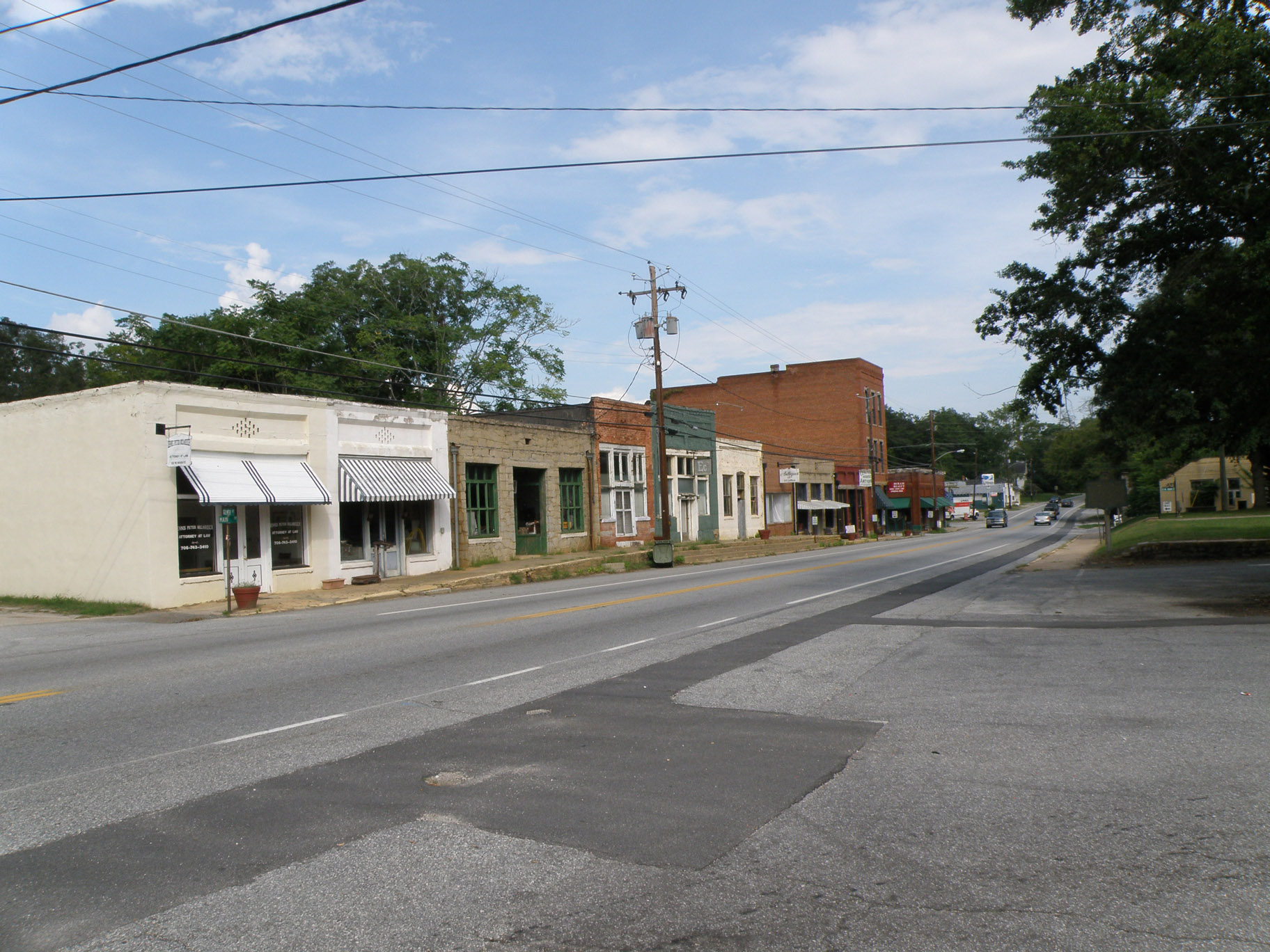 A part of Main Street looking East while standing in front of the courthouse. | |
 Location in Oglethorpe County and the state of Georgia | |
| Coordinates: 33°52′13″N 83°6′39″W | |
| Country | United States |
| State | Georgia |
| County | Oglethorpe |
| Area | |
| • Total | 0.55 sq mi (1.42 km2) |
| • Land | 0.55 sq mi (1.42 km2) |
| • Water | 0.00 sq mi (0.00 km2) |
| Elevation | 702 ft (214 m) |
| Population (2020) | |
| • Total | 203 |
| • Density | 370.44/sq mi (143.04/km2) |
| Time zone | UTC-5 (Eastern (EST)) |
| • Summer (DST) | UTC-4 (EDT) |
| ZIP code | 30648 |
| Area code | 706 |
| FIPS code | 13-46188[2] |
| GNIS feature ID | 0316791[3] |
| Website | lexingtonga |
Lexington is home to Shaking Rock Park.
History
Lexington was founded in 1800. That same year, the seat of Oglethorpe County was transferred to Lexington from Philomath.[5] Lexington was incorporated as a town in 1806, and is named for Lexington, Massachusetts.[6]
Geography
Lexington is located at 33°52′13″N 83°6′39″W (33.870351, -83.110916).[7] U.S. Route 78, as well as Georgia State Routes 22 and 77, all pass through the city. U.S. 78 leads southeast 25 mi (40 km) to Washington and northwest 17 mi (27 km) to Athens. GA-22 runs through the city concurrent with GA-22, leading north 15 mi (24 km) to Comer and southeast 28 mi (45 km) to Crawfordville. GA-77 leads northeast 25 mi (40 km) to Elberton and south 23 mi (37 km) to Union Point.
According to the United States Census Bureau, the city has a total area of 0.5 square miles (1.3 km2), all land.
Demographics
| Historical population | |||
|---|---|---|---|
| Census | Pop. | %± | |
| 1810 | 222 | — | |
| 1880 | 441 | — | |
| 1900 | 635 | — | |
| 1910 | 545 | −14.2% | |
| 1920 | 469 | −13.9% | |
| 1930 | 455 | −3.0% | |
| 1940 | 517 | 13.6% | |
| 1950 | 514 | −0.6% | |
| 1960 | 376 | −26.8% | |
| 1970 | 322 | −14.4% | |
| 1980 | 278 | −13.7% | |
| 1990 | 230 | −17.3% | |
| 2000 | 239 | 3.9% | |
| 2010 | 228 | −4.6% | |
| 2020 | 203 | −11.0% | |
| U.S. Decennial Census[8] | |||
As of the census[2] of 2000, there were 239 people, 101 households, and 65 families residing in the city. The population density was 439.6 inhabitants per square mile (169.7/km2). There were 115 housing units at an average density of 211.5 per square mile (81.7/km2). The racial makeup of the city was 70.71% White, 25.94% African American, 0.84% Native American, and 2.51% from two or more races. Hispanic or Latino of any race were 1.26% of the population.
There were 101 households, out of which 23.8% had children under the age of 18 living with them, 44.6% were married couples living together, 17.8% had a female householder with no husband present, and 35.6% were non-families. 28.7% of all households were made up of individuals, and 11.9% had someone living alone who was 65 years of age or older. The average household size was 2.27 and the average family size was 2.82.
In the city, the population was spread out, with 19.2% under the age of 18, 10.0% from 18 to 24, 28.5% from 25 to 44, 26.8% from 45 to 64, and 15.5% who were 65 years of age or older. The median age was 40 years. For every 100 females, there were 100.8 males. For every 100 females age 18 and over, there were 103.2 males.
The median income for a household in the city was $41,932, and the median income for a family was $56,875. Males had a median income of $22,417 versus $38,056 for females. The per capita income for the city was $22,513. About 4.1% of families and 7.9% of the population were below the poverty line, including 20.9% of those under the age of eighteen and 9.4% of those 65 or over.
Education
Oglethorpe County School District
The Oglethorpe County School District holds pre-school to grade twelve, and consists of a primary school (preK-2), an elementary school (3-5), a middle school (6-8), and a high school (9-12).[9] The district has 145 full-time teachers and over 2,281 students.[10]
- Oglethorpe County Elementary School
- Oglethorpe County Primary School
- Oglethorpe County Middle School
- Oglethorpe County High School
Notable people
- Nathan Crawford Barnett, member of the Georgia House of Representatives and Georgia Secretary of State for more than 30 years. Raised in Lexington, and educated at the Lexington Academy
- Clifford Cleveland Brooks, planter and politician; member of the Louisiana State Senate from 1924 to 1932, born in Lexington in 1886[11]
- William Harris Crawford, lawyer and politician
- George Rockingham Gilmer, statesman and politician
- Joseph Henry Lumpkin, lawyer
- Wilson Lumpkin, lawyer and politician
- Stephen Upson, lawyer and politician
References
- "2020 U.S. Gazetteer Files". United States Census Bureau. Retrieved December 18, 2021.
- "U.S. Census website". United States Census Bureau. Retrieved 2008-01-31.
- "US Board on Geographic Names". United States Geological Survey. 2007-10-25. Retrieved 2008-01-31.
- "Find a County". National Association of Counties. Archived from the original on May 31, 2011. Retrieved 2011-06-07.
- Hellmann, Paul T. (May 13, 2013). Historical Gazetteer of the United States. Routledge. p. 236. ISBN 978-1135948597. Retrieved 30 November 2013.
- Krakow, Kenneth K. (1975). Georgia Place-Names: Their History and Origins (PDF). Macon, GA: Winship Press. p. 132. ISBN 0-915430-00-2.
- "US Gazetteer files: 2010, 2000, and 1990". United States Census Bureau. 2011-02-12. Retrieved 2011-04-23.
- "Census of Population and Housing". Census.gov. Retrieved June 4, 2015.
- Georgia Board of Education[permanent dead link], Retrieved June 24, 2010.
- School Stats, Retrieved June 24, 2010.
- Henry E. Chambers, History of Louisiana, Vol. 2 (Chicago and New York City: The American Historical Society, Inc., 1925, p. 71)
Municipalities and communities of Oglethorpe County, Georgia, United States | ||
|---|---|---|
County seat: Lexington | ||
| Cities |  | |
| Town | ||
| Unincorporated communities |
| |
| Footnotes | ‡This populated place also has portions in an adjacent county or counties | |
| ||
| Authority control |
|---|
На других языках
[de] Lexington (Georgia)
Lexington ist eine Stadt im Oglethorpe County im US-Bundesstaat Georgia mit 228 Einwohnern (Stand: 2010).- [en] Lexington, Georgia
Другой контент может иметь иную лицензию. Перед использованием материалов сайта WikiSort.org внимательно изучите правила лицензирования конкретных элементов наполнения сайта.
WikiSort.org - проект по пересортировке и дополнению контента Википедии