world.wikisort.org - USA
Avalon is a borough in Cape May County, New Jersey. It is located on Seven Mile Island. As of the 2010 U.S. census, the full-time borough population was 1,334,[18][19][20] although it swells during the summer months. The population declined by 809 (−37.8%) from the 2,143 counted in the 2000 census, which had in turn increased by 334 (+18.5%) from the 1,809 counted in the 1990 census.[21] Geographically, Avalon is part of the South Jersey region.
Avalon, New Jersey | |
|---|---|
Borough | |
| Borough of Avalon | |
 Former Avalon Lighthouse | |
|
| |
| Motto: "Cooler by a Mile"[1] | |
 Avalon Borough highlighted in Cape May County. Inset map: Cape May County highlighted in the State of New Jersey. | |
 Census Bureau map of Avalon, New Jersey | |
 Avalon Location in Cape May County  Avalon Location in New Jersey  Avalon Location in the United States | |
| Coordinates: 39.086453°N 74.739003°W[2][3] | |
| Country | |
| State | |
| County | |
| Formed | 1723 as part of Middle Township |
| Incorporated | April 18, 1892 |
| Named for | Avalon of Arthurian legend |
| Government | |
| • Type | Faulkner Act (mayor–council) |
| • Body | Borough Council |
| • Mayor | Martin L. Pagliughi (R, term ends June 30, 2023)[5][6] |
| • Administrator | Scott J. Wahl[7] |
| • Municipal clerk | C. Danielle Nollett[8] |
| Area | |
| • Total | 5.06 sq mi (13.09 km2) |
| • Land | 4.27 sq mi (11.06 km2) |
| • Water | 0.79 sq mi (2.04 km2) 15.53% |
| • Rank | 275th of 565 in state 7th of 16 in county[2] |
| Elevation | 10 ft (3 m) |
| Population (2020) | |
| • Total | 1,243 |
| • Rank | 523rd of 566 in state 12th of 16 in county[11] |
| • Density | 291.10/sq mi (112.40/km2) |
| • Rank | 473rd of 566 in state 12th of 16 in county[11] |
| Time zone | UTC−05:00 (Eastern (EST)) |
| • Summer (DST) | UTC−04:00 (Eastern (EDT)) |
| ZIP Code | |
| Area codes | 609 Exchanges: 263, 368, 967[14] |
| FIPS code | 3400902320[2][15][16] |
| GNIS feature ID | 0885146[2][17] |
| Website | www |

The community is one of the most affluent communities along the Jersey Shore and is home to some of the most expensive real estate on the East Coast. In 2007, Forbes listed Avalon as the 65th most expensive ZIP Code in the United States.[22] Washingtonian even "named Avalon the 'chicest beach' in the mid-Atlantic, the place to see women in diamonds and designer swimwear."[23] A small portion of Avalon is not on Seven Mile Island. The borough is part of the Ocean City Metropolitan Statistical Area.
Avalon is known as a South Jersey seashore resort and has the motto "Cooler by a Mile" since it juts out into the Atlantic Ocean about a mile farther than other barrier islands.[24] Alternatively, the motto is because Avalon, at four miles long, is one mile longer than its neighboring town on the southern end of Seven Mile Island, Stone Harbor.[citation needed] It was ranked the seventh-best beach in New Jersey in the 2008 Top 10 Beaches Contest sponsored by the New Jersey Marine Sciences Consortium.[25]
History
Around 14,000 years ago, the barrier islands of Cape May County formed, likely from spits and lines of dunes.[26] Originally a thriving juniper forest occupied by Lenni Lenape Native Americans, the area was purchased by Aaron Leaming in December 1722 for 79 pounds. Known as Seven Mile Beach (which included present-day Avalon and Stone Harbor), it was owned and retained by the Leamings for approximately 100 years. Unconfirmed legends say that pirates buried their bounty on Seven Mile Island, and that Henry Hudson may have dropped anchor somewhere offshore. The island served as a cattle range and was also used for its plentiful timber. The Leamings eventually sold the land, and the island exchanged hands in a number of transactions afterwards. In April 1887, the Seven Mile Beach company was formed. As early as 1893, Avalon was advertised as a resort town. With this rapid development, homes and businesses were erected. The native juniper forest was graded and cut, and the sandy hills were leveled off, making the island mostly flat. Today it is extremely rare to see hills or native juniper in Avalon.
Avalon was incorporated as a borough by an act of the New Jersey Legislature on April 18, 1892, from portions of Middle Township, based on the results of a referendum held two days earlier. The borough was reincorporated on March 6, 1896, and again on May 4, 1897. Another portion of Middle Township was annexed in 1910. On December 27, 1941, portions of Avalon were ceded to Stone Harbor.[27] The borough is named for Avalon of Arthurian legend.[28]
On January 4, 1890, the Commonwealth, piloted by Captain W.S. Willets, sank. This 197-ton ship was en route from New York City to Philadelphia with a cargo of molasses, coffee, tobacco, tea, coconut oil, and camphor. Straying from its course in rough weather, the Commonwealth ran aground in Townsend's Inlet. The crew was rescued and most of the cargo was salvaged. However, after a week trapped in the sandy bottom of the inlet, the ship began to come apart in the waves. Some of the remaining cargo washed ashore and most of it was taken by the early residents of Avalon. The wreck, unable to be recovered, was sold to John Townshend on February 2.
By the early 1900s, the Leaming Railroad bridge was constructed, allowing train connections into the town. This increased the traffic from nearby Philadelphia, Pennsylvania. Around 1944 the West Jersey and Seashore railroad lines merged with the Reading Railroad. This effectively ended the era of travel by train to the island. A hurricane took several streets and Avalon now has a north end beginning at 7th street. In the mid-1950s the Wolfington Family of Philadelphia purchased and operated the Puritan Hotel later enlarged and renamed the Whitebriar Hotel on the beach block at 21st Street. The Whitebriar was managed for two seasons in the mid-1950s, one of the future 'great hosts' of several hotels in the Greater Philadelphia area, Robert C. Bennett. He was the son of another 'famous' hotelier, Claude H. Bennett of the Bellevue Stratford Hotel in Philadelphia. Currently the most widely used method of transportation to and from Avalon is by car or boat; however, buses run on a regular schedule all over the shore towns.
Geography
According to the U.S. Census Bureau, the borough had a total area of 5.06 square miles (13.09 km2), including 4.27 square miles (11.06 km2) of land and 0.79 square miles (2.04 km2) of water (15.53%).[2][3]
Unincorporated communities, localities and place names located partially or completely within the borough include Peermont.[29]
The borough borders the Cape May County municipalities of Dennis Township, Middle Township, Sea Isle City and Stone Harbor, as well as the Atlantic Ocean.[30][31][32]
Demographics
| Historical population | |||
|---|---|---|---|
| Census | Pop. | %± | |
| 1900 | 93 | — | |
| 1910 | 230 | 147.3% | |
| 1920 | 197 | −14.3% | |
| 1930 | 343 | 74.1% | |
| 1940 | 313 | −8.7% | |
| 1950 | 428 | 36.7% | |
| 1960 | 695 | 62.4% | |
| 1970 | 1,283 | 84.6% | |
| 1980 | 2,162 | 68.5% | |
| 1990 | 1,809 | −16.3% | |
| 2000 | 2,143 | 18.5% | |
| 2010 | 1,334 | −37.8% | |
| 2020 | 1,243 | −6.8% | |
| Population sources: 1900–2000[33] 1900–1920[34] 1900–1910[35] 1910–1930[36] 1930–1990[37] 2000[38][39] 2010[18][19][20] | |||
Census 2010
The 2010 United States census counted 1,334 people, 692 households, and 416 families in the borough. The population density was 321.3 per square mile (124.1/km2). There were 5,434 housing units at an average density of 1,308.8 per square mile (505.3/km2). The racial makeup was 98.05% (1,308) White, 0.30% (4) Black or African American, 0.30% (4) Native American, 0.22% (3) Asian, 0.00% (0) Pacific Islander, 0.15% (2) from other races, and 0.97% (13) from two or more races. Hispanic or Latino of any race were 2.17% (29) of the population.[18]
Of the 692 households, 9.2% had children under the age of 18; 54.6% were married couples living together; 4.8% had a female householder with no husband present and 39.9% were non-families. Of all households, 36.0% were made up of individuals and 21.1% had someone living alone who was 65 years of age or older. The average household size was 1.93 and the average family size was 2.45.[18]
8.9% of the population were under the age of 18, 3.7% from 18 to 24, 11.8% from 25 to 44, 35.0% from 45 to 64, and 40.5% who were 65 years of age or older. The median age was 61.8 years. For every 100 females, the population had 89.8 males. For every 100 females ages 18 and older there were 89.5 males.[18]
The Census Bureau's 2006–2010 American Community Survey showed that (in 2010 inflation-adjusted dollars) median household income was $88,527 (with a margin of error of +/− $20,202) and the median family income was $135,781 (+/− $32,487). Males had a median income of $162,125 (+/− $69,973) versus $46,397 (+/− $17,278) for females. The per capita income for the borough was $99,655 (+/− $18,059). About 1.6% of families and 4.3% of the population were below the poverty line, including 3.1% of those under age 18 and 1.8% of those age 65 or over.[40]
Census 2000
As of the 2020 U.S. census,[15] there were 2,143 people, 1,045 households, and 668 families residing in the borough. The population density was 508.4 inhabitants per square mile (196.3/km2). There were 5,281 housing units at an average density of 1,252.9 per square mile (483.7/km2). The racial makeup of the borough was 98.69% White, 0.14% African American, 0.56% Asian, 0.05% Pacific Islander, 0.05% from other races, and 0.51% from two or more races. Hispanic or Latino of any race were 0.56% of the population.[38][39]
There were 1,045 households, out of which 12.9% had children under the age of 18 living with them, 56.7% were married couples living together, 5.5% had a female householder with no husband present, and 36.0% were non-families. 33.4% of all households were made up of individuals, and 17.8% had someone living alone who was 65 years of age or older. The average household size was 2.05 and the average family size was 2.56.[38][39]
In the borough the population was spread out, with 14.1% under the age of 18, 2.9% from 18 to 24, 16.3% from 25 to 44, 33.9% from 45 to 64, and 32.7% who were 65 years of age or older. The median age was 56 years. For every 100 females, there were 94.8 males. For every 100 females age 18 and over, there were 91.0 males.[38][39]
The median income for a household in the borough was $59,196, and the median income for a family was $72,750. Males had a median income of $60,227 versus $39,886 for females. The per capita income for the borough was $50,016. About 2.2% of families and 4.3% of the population were below the poverty line, including 9.6% of those under age 18 and 0.1% of those age 65 or over.[38][39]
Government
Local government
The Borough of Avalon is governed within the Faulkner Act, formally known as the Optional Municipal Charter Law, under the Mayor-Council system of municipal government. The borough is one of 71 municipalities (of the 564) statewide that use this form of government.[41] The governing body is comprised of the mayor and the five-member Borough Council. Members of the Borough Council are elected in non-partisan elections to four-year terms on a staggered basis, with either two seats (and the mayoral seat) or three seats coming up for election in odd-numbered years as part of the May municipal election.[4]
As of 2022[update], Avalon's mayor is Martin L. Pagliughi, whose term of office ends on June 30, 2023. Members of the Borough Council are Council President Barbara L. Juzaitis (2023), Council Vice President Samuel D. Wierman (2023), Maura H. "Mari" Coskey (2025), John M. McCorristin (2025) and James T. McDermott Jr. (2025).[5][42][43][44][45]
In July 2015, William G. Burns Jr., was appointed to fill the vacant seat expiring 2017 of David Ellenberg, who resigned from office earlier that mont.[46]
Mayor Pagliughi and Councilmembers Covington and Dean ran unopposed in the May 2011 municipal election.[47][48] With 245 of 1,330 registered voters participating (turnout of 18.42%) all three candidates were re-elected.[49]
In the May 2013 election, incumbents Ellenberg and Hudanich were re-elected, as newcomer John McCorristin won the seat that had previously been held by Joseph Tipping who didn't run for another term of office.[50]
Federal, state, and county representation
Avalon is located in the 2nd Congressional district[51] and is part of New Jersey's 1st state legislative district.[19][52][53]
For the 117th United States Congress, New Jersey's Second Congressional District is represented by Jeff Van Drew (R, Dennis Township).[54] New Jersey is represented in the United States Senate by Democrats Cory Booker (Newark, term ends 2027)[55] and Bob Menendez (Harrison, term ends 2025).[56][57]
For the 2022–2023 session, the 1st Legislative District of the New Jersey Legislature is represented in the State Senate by Mike Testa (R, Vineland) and in the General Assembly by Antwan McClellan (R, Ocean City) and Erik K. Simonsen (R, Lower Township).[58]
Cape May County is governed by a five-person Board of County Commissioners whose members are elected at-large on a partisan basis to three-year terms of office on a staggered basis, with either one or two seats coming up for election each year; At an annual reorganization held each January, the commissioners select one member to serve as director and another to serve as vice-director.[59] As of 2022[update], Cape May County's Commissioners are Commissioner Director Gerald M. Thornton (R, Middle Township; term as commissioner and as commissioner director ends December 31, 2022),[60] Commissioner Vice-Director Leonard C. Desiderio (R, Sea Isle City; term as commissioner ends 2024; term as vice-director ends 2022),[61] E. Marie Hayes (R, Ocean City; 2022),[62] Will Morey (R, Wildwood Crest; 2023)[63] and Jeffrey L. Pierson (R. Upper Township; 2023).[64][59][65] The county's constitutional officers are County Clerk Rita Marie Rothberg (R, 2025, Ocean City),[66][67] Sheriff Robert Nolan (R, 2023, Lower Township)[68][69] and Surrogate Dean Marcolongo (R, 2022, Upper Township).[70][71][72][65]
Politics
As of March 23, 2011, there were a total of 1,307 registered voters in Avalon, of which 206 (15.8%) were registered as Democrats, 676 (51.7%) were registered as Republicans and 425 (32.5%) were registered as Unaffiliated. There were no voters registered to other parties.[73]
In the 2012 presidential election, Republican Mitt Romney received 66.5% of the vote (622 cast), ahead of Democrat Barack Obama with 32.9% (308 votes), and other candidates with 0.6% (6 votes), among the 943 ballots cast by the borough's 1,331 registered voters (7 ballots were spoiled), for a turnout of 70.8%.[74][75] In the 2008 presidential election, Republican John McCain received 62.4% of the vote (663 cast), ahead of Democrat Barack Obama, who received 35.7% (379 votes), with 1,063 ballots cast among the borough's 1,325 registered voters, for a turnout of 80.2%.[76] In the 2004 presidential election, Republican George W. Bush received 66.1% of the vote (766 ballots cast), outpolling Democrat John Kerry, who received around 32.6% (377 votes), with 1,158 ballots cast among the borough's 1,419 registered voters, for a turnout percentage of 81.6.[77]
In the 2013 gubernatorial election, Republican Chris Christie received 84.0% of the vote (589 cast), ahead of Democrat Barbara Buono with 15.3% (107 votes), and other candidates with 0.7% (5 votes), among the 710 ballots cast by the borough's 1,279 registered voters (9 ballots were spoiled), for a turnout of 55.5%.[78][79] In the 2009 gubernatorial election, Republican Chris Christie received 64.7% of the vote (547 ballots cast), ahead of both Democrat Jon Corzine with 29.0% (245 votes) and Independent Chris Daggett with 5.0% (42 votes), with 845 ballots cast among the borough's 1,357 registered voters, yielding a 62.3% turnout.[80]
Education

Avalon School District is a public school district that serves students in public school for first through eighth grade. As of the 2018–2019 school year, the district, comprised of one school, had an enrollment of 61 students and 13.8 classroom teachers (on an FTE basis), for a student–teacher ratio of 4.4:1.[81] In the 2016–2017 school year, Avalon had the smallest enrollment of any school district in the state, with 43 students.[82]
Starting with the 2011–2012 school year, in an agreement with the Stone Harbor School District, public school students in grades K–4 from both communities attend school in Stone Harbor while all students in grades 5–8 attend school in Avalon, at Avalon Elementary School.[83]
Students in public school for ninth through twelfth grades attend Middle Township High School in Cape May Court House, as part of a sending/receiving relationship with the Middle Township Public Schools, together with students from Dennis Township, Stone Harbor and Woodbine.[84][85] As of the 2018–2019 school year, the high school had an enrollment of 767 students and 64.6 classroom teachers (on an FTE basis), for a student–teacher ratio of 11.9:1.[86]
Students are also eligible to attend Cape May County Technical High School in the Cape May Court House area, which serves students from the entire county in its comprehensive and vocational programs, which are offered without charge to students who are county residents.[87][88] Special needs students may be referred to Cape May County Special Services School District in the Cape May Court House area.
The Roman Catholic Diocese of Camden operates Bishop McHugh Regional School, a Catholic K–8 school, in Ocean View, Dennis Township,[89] which has a Cape May Courthouse postal address.[90] It is the parish school of Avalon/Stone Harbor Catholic Church and three other churches.[91]
Transportation
Roads and highways

As of May 2010[update], the borough had a total of 41.61 miles (66.96 km) of roadways, of which 36.19 miles (58.24 km) were maintained by the municipality and 5.42 miles (8.72 km) by Cape May County.[92]
No Interstate, U.S., state or major county highways serve Avalon. The most significant roads are minor county routes, such as County Route 601 (Avalon Boulevard), which connects the Garden State Parkway and U.S. Route 9 to the oceanfront, and County Route 619, which follows Ocean Drive.
Public transportation
There is also a seasonal trolley service that runs through the seven-mile-long island. Avalon also has multiple NJ Transit bus stops, and is served by the 315 to and from Philadelphia and the 319 that provides service to and from the Port Authority Bus Terminal in Midtown Manhattan.[93][94]
Climate
According to the Köppen climate classification system, Avalon, New Jersey has a humid subtropical climate (Cfa) with hot, moderately humid summers, cool winters and year-around precipitation. Cfa climates are characterized by all months having an average mean temperature > 32.0 °F (> 0.0 °C), at least four months with an average mean temperature ≥ 50.0 °F (≥ 10.0 °C), at least one month with an average mean temperature ≥ 71.6 °F (≥ 22.0 °C) and no significant precipitation difference between seasons. During the summer months in Avalon, a cooling afternoon sea breeze is present on most days, but episodes of extreme heat and humidity can occur with heat index values ≥ 95 °F (≥ 35 °C). During the winter months, episodes of extreme cold and wind can occur with wind chill values < 0 °F (< −18 °C). The plant hardiness zone at Avalon Beach is 7b with an average annual extreme minimum air temperature of 6.0 °F (−14.4 °C).[95] The average seasonal (November–April) snowfall total is 12 to 18 inches (300 to 460 mm), and the average snowiest month is February which corresponds with the annual peak in nor'easter activity.
| Climate data for Avalon Beach, NJ (1981–2010 Averages) | |||||||||||||
|---|---|---|---|---|---|---|---|---|---|---|---|---|---|
| Month | Jan | Feb | Mar | Apr | May | Jun | Jul | Aug | Sep | Oct | Nov | Dec | Year |
| Average high °F (°C) | 42.3 (5.7) |
44.2 (6.8) |
51.0 (10.6) |
60.4 (15.8) |
69.7 (20.9) |
78.5 (25.8) |
83.4 (28.6) |
81.8 (27.7) |
76.2 (24.6) |
66.1 (18.9) |
56.7 (13.7) |
47.0 (8.3) |
63.2 (17.3) |
| Daily mean °F (°C) | 34.6 (1.4) |
36.5 (2.5) |
42.9 (6.1) |
52.2 (11.2) |
61.4 (16.3) |
70.7 (21.5) |
75.8 (24.3) |
74.6 (23.7) |
68.4 (20.2) |
57.8 (14.3) |
48.5 (9.2) |
39.2 (4.0) |
55.3 (12.9) |
| Average low °F (°C) | 26.9 (−2.8) |
28.7 (−1.8) |
34.8 (1.6) |
43.9 (6.6) |
53.1 (11.7) |
62.8 (17.1) |
68.3 (20.2) |
67.3 (19.6) |
60.5 (15.8) |
49.5 (9.7) |
40.3 (4.6) |
31.4 (−0.3) |
47.4 (8.6) |
| Average precipitation inches (mm) | 3.35 (85) |
2.87 (73) |
4.22 (107) |
3.67 (93) |
3.53 (90) |
3.21 (82) |
3.81 (97) |
4.23 (107) |
3.42 (87) |
3.62 (92) |
3.33 (85) |
3.69 (94) |
42.95 (1,091) |
| Average relative humidity (%) | 66.5 | 65.1 | 63.1 | 62.1 | 66.4 | 70.9 | 70.4 | 73.3 | 70.9 | 69.5 | 67.9 | 66.8 | 67.8 |
| Average dew point °F (°C) | 24.6 (−4.1) |
25.9 (−3.4) |
31.2 (−0.4) |
39.6 (4.2) |
50.1 (10.1) |
60.8 (16.0) |
65.5 (18.6) |
65.5 (18.6) |
58.6 (14.8) |
47.9 (8.8) |
38.4 (3.6) |
29.1 (−1.6) |
44.9 (7.2) |
| Source: PRISM[96] | |||||||||||||
| Climate data for North Cape May, NJ Ocean Water Temperature (15 SW Avalon) | |||||||||||||
|---|---|---|---|---|---|---|---|---|---|---|---|---|---|
| Month | Jan | Feb | Mar | Apr | May | Jun | Jul | Aug | Sep | Oct | Nov | Dec | Year |
| Daily mean °F (°C) | 37 (3) |
37 (3) |
42 (6) |
50 (10) |
59 (15) |
68 (20) |
73 (23) |
74 (23) |
72 (22) |
61 (16) |
52 (11) |
42 (6) |
56 (13) |
| Source: NOAA[97] | |||||||||||||
The Nor'easter of 1962
In March 1962, a major Nor'easter, the Ash Wednesday Storm of 1962, tore through the U.S. East Coast causing massive ocean swells. Much of Avalon suffered very serious flooding and major coastline loss.[98][99] Much of the island was under water for four to five days, with damage to homes dependent on the foundation construction of the home and location on the island.

Protection efforts against storms
While there have been many strong storms since 1962, extensive rock jetty construction on Townsends Inlet (as recent as Summer 2006) has mostly succeeded in protecting the inlet-side homes. However, beaches and property facing the ocean at 8th through 12th Streets have struggled to prevent further loss of this barrier island through various anti-erosion schemes, including extending the 8th Street rock jetty, the installation of an artificial reef and the beach replenishment. So far, there has been no more "shrinkage" of the island at this location, but at a very high monetary cost. Several times, in 2015, the causeway leading north from Avalon to Townsends Inlet has been closed by flooding during stormy weather.
Ecology
According to the A. W. Kuchler U.S. potential natural vegetation types, Avalon, New Jersey would have a dominant vegetation type of Northern Cordgrass (73) with a dominant vegetation form of Coastal Prairie (20).[100]
Notable people
People who were born in, residents of, or otherwise closely associated with Avalon include:
- Geno Auriemma (born 1954), head coach of the University of Connecticut Huskies women's basketball team[101][102]
- Neil Hartman, Comcast Sportsnet personality[103]
- Paul Holmgren (born 1955), former General Manager of the Philadelphia Flyers and current president[104][105]
- Tim Kerr (born 1960), right winger who played in the NHL for the Philadelphia Flyers[106][107]
- Ed McMahon (1923–2009), television show host[108]
- Joe Paterno (1926–2012), Penn State football head coach[109]
- Michael W. Rice (born 1945), CEO/Chairman of Utz Quality Foods[110]
- Stephen Sharer (born 1992), YouTube personality[111]
- Ed Stefanski, former General Manager of the Philadelphia 76ers[112]
References
- Kuperinsky, Amy. "'The Jewel of the Meadowlands'?: N.J.'s best, worst and weirdest town slogans", NJ Advance Media for NJ.com, January 22, 2015. Accessed July 12, 2016. "Avalon, in Cape May County, is 'cooler by a mile' on its welcome signs, because the seaside community juts out into the Atlantic Ocean a mile further than other towns."
- 2019 Census Gazetteer Files: New Jersey Places, United States Census Bureau. Accessed July 1, 2020.
- US Gazetteer files: 2010, 2000, and 1990, United States Census Bureau. Accessed September 4, 2014.
- 2012 New Jersey Legislative District Data Book, Rutgers University Edward J. Bloustein School of Planning and Public Policy, March 2013, p. 8.
- Elected Officials, Borough of Avalon. Accessed April 28, 2022.
- 2022 New Jersey Mayors Directory, New Jersey Department of Community Affairs. Accessed March 1, 2022.
- Administrator, Borough of Avalon. Accessed April 28, 2022.
- Borough Clerk, Borough of Avalon. Accessed April 28, 2022.
- "ArcGIS REST Services Directory". United States Census Bureau. Retrieved September 20, 2022.
- U.S. Geological Survey Geographic Names Information System: Borough of Avalon, Geographic Names Information System. Accessed March 4, 2013.
- GCT-PH1 Population, Housing Units, Area, and Density: 2010 - State -- County Subdivision from the 2010 Census Summary File 1 for New Jersey, United States Census Bureau. Accessed December 11, 2012.
- Look Up a ZIP Code for Avalon, NJ, United States Census Bureau. Accessed December 3, 2011.
- ZIP Codes, State of New Jersey. Accessed August 20, 2013.
- Area Code Lookup - NPA NXX for Avalon, NJ, Area-Codes.com. Accessed September 2, 2014.
- U.S. Census website , United States Census Bureau. Accessed September 4, 2014.
- Geographic Codes Lookup for New Jersey, Missouri Census Data Center. Accessed April 1, 2022.
- US Board on Geographic Names, United States Geological Survey. Accessed September 4, 2014.
- DP-1 - Profile of General Population and Housing Characteristics: 2010 for Avalon borough, Cape May County, New Jersey, United States Census Bureau. Accessed July 7, 2012.
- Municipalities Sorted by 2011-2020 Legislative District, New Jersey Department of State. Accessed February 1, 2020.
- Profile of General Demographic Characteristics: 2010 for Avalon borough Archived 2012-04-30 at the Wayback Machine, New Jersey Department of Labor and Workforce Development. Accessed July 7, 2012.
- Table 7. Population for the Counties and Municipalities in New Jersey: 1990, 2000 and 2010 Archived August 7, 2017, at the Wayback Machine, New Jersey Department of Labor and Workforce Development, February 2011. Accessed July 7, 2012.
- Staff. "In Pictures: Most Expensive ZIP Codes - 65. Avalon, N.J.", Forbes, September 10, 2007. Accessed June 28, 2011.
- Raymond, Alexis. "Stone Harbor and Avalon, N.J.: These upscale communities are rich in beauty, tranquility and pleasure.", The Baltimore Sun, August 25, 2003. Accessed June 28, 2011.
- Avalon, Visit New Jersey. Accessed December 14, 2021. "Like a page out of Pleasantville, things are just nicer in the beach town of Avalon. The town’s slogan, 'Cooler by a Mile,' refers to its position one mile farther into the Atlantic than other barrier islands in the state, but you may feel like you’re a hundred miles away from the busier beach towns."
- Urgo, Jacqueline L. "Triumph for South Jersey", The Philadelphia Inquirer, May 23, 2008. Accessed October 29, 2015. "Neighboring Wildwood Crest came in second, followed by Ocean City, North Wildwood, Cape May, Asbury Park in Monmouth County, Avalon, Point Pleasant Beach in northern Ocean County, Beach Haven in southern Ocean County and Stone Harbor."
- Lucey, Carol S. Geology of Cape May County in Brief, New Jersey Department of Environmental Protection, 1976. Accessed October 26, 2019.
- Snyder, John P. The Story of New Jersey's Civil Boundaries: 1606-1968, Bureau of Geology and Topography; Trenton, New Jersey; 1969. p. 113. Accessed July 7, 2012.
- Hutchinson, Viola L. The Origin of New Jersey Place Names, New Jersey Public Library Commission, May 1945. Accessed August 27, 2015.
- Locality Search, State of New Jersey. Accessed May 21, 2015.
- Areas touching Avalon, MapIt. Accessed March 18, 2020.
- Cape May County, Coalition for a Healthy NJ. Accessed March 18, 2020.
- New Jersey Municipal Boundaries, New Jersey Department of Transportation. Accessed November 15, 2019.
- Barnett, Bob. Population Data for Cape May County Municipalities, 1810 - 2000, WestJersey.org, January 6, 2011. Accessed October 16, 2012.
- Compendium of censuses 1726-1905: together with the tabulated returns of 1905, New Jersey Department of State, 1906. Accessed August 20, 2013.
- Thirteenth Census of the United States, 1910: Population by Counties and Minor Civil Divisions, 1910, 1900, 1890, United States Census Bureau, p. 336. Accessed July 7, 2012.
- Fifteenth Census of the United States : 1930 - Population Volume I, United States Census Bureau, p. 715. Accessed July 7, 2012.
- New Jersey Resident Population by Municipality: 1930 - 1990 Archived May 10, 2015, at the Wayback Machine, Workforce New Jersey Public Information Network. Accessed June 28, 2015.
- Census 2000 Profiles of Demographic / Social / Economic / Housing Characteristics for Avalon borough Archived 2014-08-12 at the Wayback Machine, United States Census Bureau. Accessed January 3, 2012.
- DP-1: Profile of General Demographic Characteristics: 2000 - Census 2000 Summary File 1 (SF 1) 100-Percent Data for Avalon borough, New Jersey, United States Census Bureau. Accessed July 5, 2012.
- DP03: Selected Economic Characteristics from the 2006-2010 American Community Survey 5-Year Estimates for Avalon borough, Cape May County, New Jersey, United States Census Bureau. Accessed June 21, 2012.
- Inventory of Municipal Forms of Government in New Jersey, Rutgers University Center for Government Studies, July 1, 2011. Accessed November 18, 2019.
- 2022 Municipal Data Sheet, Borough of Avalon. Accessed April 28, 2022.
- 2021 County & Municipal Elected Officials Cape May County, NJ -- July 2021, Cape May County, New Jersey, September 13, 2021. Accessed April 28, 2022.
- Statement of Vote 2021 Cape May County Municipal Election, Cape May County, New Jersey, updated May 18, 2021. Accessed April 28, 2022.
- Cape May County Statement of Vote 2019 Cape May County Municipal Election, Cape May County, New Jersey, updated May 23, 2019. Accessed October 28, 2019.
- William Burns Appointed to Avalon Borough Council, Borough of Avalon. Accessed August 8, 2015. "The Avalon Borough Council voted unanimously to appoint Bill Burns to a vacant seat on Council during its meeting on Wednesday, July 22nd.... Burns will serve the vacant seat formerly held by David Ellenberg until the November 3, 2015 general election."
- Barlow, Bill. "'Team Avalon' running unopposed: Three seek fresh terms after long service" Archived May 28, 2012, at the Wayback Machine, Shore News Today, March 30, 2011. Accessed December 4, 2011. "Mayor Martin Pagliughi, Council President Dick Dean and Avalon Councilman Chuck Covington are set to run for reelection together as 'Team Avalon' in the May 10 municipal election. That means everyone on the ballot will be on the same team. According to Avalon spokesman Scott Wahl, no one else turned in petitions to appear on the ballot. If re-elected, as seems quite likely, this July Pagliughi will start his 20th year as Avalon's mayor, which he ran for after a four-year term on council."
- Staff. "Avalon, Sea Isle, Wildwood hold municipal elections Tuesday", The Press of Atlantic City, May 10, 2011. Accessed December 4, 2011. "Avalon, Sea Isle City and Wildwood will hold nonpartisan municipal elections today from 6 a.m. to 8 p.m. In Avalon, Mayor Martin L. Pagliughi and Councilmen Charles P. Covington and Richard E. Dean are running unopposed."
- 2011 Municipal Election May 10, 2011Summary Report Cape May County Official Results, Cape May County, New Jersey, May 19, 2011. Accessed October 29, 2016.
- Procida, Lee. "Avalon, Sea Isle City each elect 2 incumbents, 1 newcomer in unopposed elections", The Press of Atlantic City, May 15, 2013. Accessed August 20, 2013. "In Avalon, incumbents David B. Ellenberg and Nancy Hudanich won re-election to four-year terms, while John McCorristin won a seat on Borough Council... In Avalon, Councilman Joseph Tipping chose not to run for re-election because of health reasons."
- Plan Components Report, New Jersey Redistricting Commission, December 23, 2011. Accessed February 1, 2020.
- 2019 New Jersey Citizen's Guide to Government, New Jersey League of Women Voters. Accessed October 30, 2019.
- Districts by Number for 2011-2020, New Jersey Legislature. Accessed January 6, 2013.
- Directory of Representatives: New Jersey, United States House of Representatives. Accessed January 3, 2019.
- U.S. Sen. Cory Booker cruises past Republican challenger Rik Mehta in New Jersey, PhillyVoice. Accessed April 30, 2021. "He now owns a home and lives in Newark's Central Ward community."
- Biography of Bob Menendez, United States Senate, January 26, 2015. "Menendez, who started his political career in Union City, moved in September from Paramus to one of Harrison's new apartment buildings near the town's PATH station.."
- Home, sweet home: Bob Menendez back in Hudson County. nj.com. Accessed April 30, 2021. "Booker, Cory A. - (D - NJ) Class II; Menendez, Robert - (D - NJ) Class I"
- Legislative Roster for District 1, New Jersey Legislature. Accessed January 11, 2022.
- Board of County Commissioners, Cape May County, New Jersey. Accessed April 28, 2022. "Cape May County Government is governed by a Board of County Commissioners. These individuals are elected at large by the citizens of Cape May County and hold spaced 3-year terms." Note that as of date accessed, Desiderio is listed with an incorrect term-end year of 2020.
- Gerald M. Thornton, Cape May County, New Jersey. Accessed April 28, 2022.
- Leonard C. Desiderio, Cape May County, New Jersey. Accessed April 28, 2022.
- E. Marie Hayes, Cape May County, New Jersey. Accessed April 28, 2022.
- Will Morey, Cape May County, New Jersey. Accessed April 28, 2022.
- Jeffrey L. Pierson, Cape May County, New Jersey. Accessed April 28, 2022.
- 2021 County & Municipal Elected Officials Cape May County, NJ -- July 2021, Cape May County, New Jersey, September 13, 2021. Accessed April 28, 2022.
- County Clerk, Cape May County, New Jersey. Accessed April 28, 2022.
- Members List: Clerks, Constitutional Officers Association of New Jersey. Accessed April 28, 2022.
- Sheriff's Page Page, Cape May County, New Jersey. Accessed April 28, 2022.
- Members List: Sheriffs, Constitutional Officers Association of New Jersey. Accessed April 28, 2022.
- Surrogate, Cape May County, New Jersey. Accessed April 28, 2022.
- Members List: Surrogates, Constitutional Officers Association of New Jersey. Accessed April 28, 2022.
- Constitutional Officers, Cape May County, New Jersey. Accessed April 28, 2022.
- Voter Registration Summary - Cape May, New Jersey Department of State Division of Elections, March 23, 2011. Accessed October 16, 2012.
- "Presidential General Election Results - November 6, 2012 - Cape May County" (PDF). New Jersey Department of Elections. March 15, 2013. Retrieved December 24, 2014.
- "Number of Registered Voters and Ballots Cast - November 6, 2012 - General Election Results - Cape May County" (PDF). New Jersey Department of Elections. March 15, 2013. Retrieved December 24, 2014.
- 2008 Presidential General Election Results: Cape May County, New Jersey Department of State Division of Elections, December 23, 2008. Accessed October 16, 2012.
- 2004 Presidential Election: Cape May County, New Jersey Department of State Division of Elections, December 13, 2004. Accessed October 16, 2012.
- "Governor - Cape May County" (PDF). New Jersey Department of Elections. January 29, 2014. Retrieved December 24, 2014.
- "Number of Registered Voters and Ballots Cast - November 5, 2013 - General Election Results - Cape May County" (PDF). New Jersey Department of Elections. January 29, 2014. Retrieved December 24, 2014.
- 2009 Governor: Cape May County Archived 2012-10-17 at the Wayback Machine, New Jersey Department of State Division of Elections, December 31, 2009. Accessed October 16, 2012.
- District information for Avalon School District, National Center for Education Statistics. Accessed April 1, 2020.
- Guion, Payton. "These 43 N.J. school districts have fewer than 200 students", NJ Advance Media for NJ.com, September 2017. Accessed January 30, 2020. "Based on data from the state Department of Education from the last school year and the Census Bureau, NJ Advance Media made a list of the smallest of the small school districts in the state, excluding charter schools and specialty institutions.... 1. Avalon Borough; Enrollment: 43; Grades: 5-8; County: Cape May"
- Avalon Elementary School 2016-17 School Report Card, New Jersey Department of Education. Accessed March 15, 2018. "Full-Time 3 and 4 year old programs, accepting tuition students, send-receive relationship with Stone Harbor School District (K-4), Avalon School District (PK, 5-8)"
- Middle Township High School 2015 School Report Card, New Jersey Department of Education. Accessed May 30, 2016. "Middle Township High School is a four-year, accredited, comprehensive high school situated in central Cape May County. The school serves the communities of Middle Township, Dennis Township, Avalon, Stone Harbor, and Woodbine Borough."
- Home page, Middle Township Public Schools. Accessed May 30, 2016. "The high school is a four-year comprehensive public high school that serves students in ninth through twelfth grades. In addition to students from Middle Township, students from Avalon, Dennis Township, Stone Harbor and Woodbine attend the high school as part of sending/receiving relationships."
- School data for Middle Township High School, National Center for Education Statistics. Accessed April 1, 2020.
- Frequently Asked Questions, Cape May County Technical High School. Accessed October 27, 2019. "All residents of Cape May County are eligible to attend Cape May County Technical High School.... The Cape May County Technical High School is a public school so there is no cost to residents of Cape May County."
- Technical High School Admissions, Cape May County Technical High School. Accessed October 27, 2019. "All students who are residents of Cape May County may apply to the Technical High School."
- Leach, Ben (September 10, 2010). "Bishop McHugh Regional Catholic School in Ocean View opens doors to kindergartners, pre-K students". Press of Atlantic City. Retrieved September 14, 2020.
Bishop McHugh Regional Catholic School in the Ocean View section of Dennis Township
- "Zoning Map" (PDF). Dennis Township. Retrieved September 14, 2020. - Compare to the address: "2221 Rt. 9 North, Cape May Court House, NJ 08210"
- "About". Bishop McHugh Regional School. Retrieved September 14, 2020.
- Cape May County Mileage by Municipality and Jurisdiction[permanent dead link], New Jersey Department of Transportation, May 2010. Accessed July 18, 2014.
- Cape May County bus routes, NJ Transit, backed up by the Internet Archive as of May 22, 2009. Accessed June 30, 2011.
- South Jersey Transit Guide Archived 2018-09-29 at the Wayback Machine, Cross County Connection, as of April 1, 2010. Accessed September 2, 2014.
- "USDA Interactive Plant Hardiness Map". United States Department of Agriculture. Archived from the original on July 4, 2019. Retrieved August 6, 2019.
- Time Series Values for Individual Locations, PRISM Climate Group Oregon State University. Accessed March 18, 2020.
- Water Temperature Table of All Coastal Regions, National Oceanic and Atmospheric Administration. Accessed March 18, 2020.
- History of Avalon, VisitNJShore.com. Accessed October 29, 2016.
- Avalon Residents Recall 1962 Storm. Accessed April 11, 2007. Archived April 30, 2007, at the Wayback Machine
- U.S. Potential Natural Vegetation, Original Kuchler Types, v2.0 (Spatially Adjusted to Correct Geometric Distortions), Data Basin. Accessed March 18, 2020.
- Elliott, Rich. "Hoop recruit spikes UConn", News-Times, August 26, 2008. Accessed March 1, 2011. "Auriemma, his wife, Kathy, and Ernie and Joanie Delle Donne had dinner several times this summer at the Jersey Shore to discuss the situation. Auriemma owns a house in Avalon, N.J. The Delle Donnes own a house in nearby Stone Harbor."
- Giuca, Linda. "Celebrity Cookie Countdown: Geno Auriemma", Hartford Courant. Accessed March 1, 2011. "The Auriemmas spent Thanksgiving at their home in Avalon, N.J., close to the Philadelphia area where the couple's respective families live."
- Neil Hartman Archived 2014-12-16 at the Wayback Machine, Alternative Energy Development Group. Accessed August 23, 2015. "He resides in Mount Laurel Township, New Jersey with his wife and two children. He also owns a home in Avalon, New Jersey."
- Staff. "Bike crash bloodies Philadelphia Flyers GM Paul Holmgren", Sporting News, September 6, 2011. Accessed October 16, 2012. "Holmgren owns a home in Avalon and is a Somerset, N.J., resident, according to The Press of Atlantic City."
- Staff. "Flyers GM Holmgren injured in bike crash in Avalon", The Press of Atlantic City, September 6, 2011. Accessed October 16, 2012. "Holmgren, who owns a home in Avalon, has been the team's general manager since 2006. He also played for the Flyers from 1976-83 and coached the team from 1988-92."
- Staff. "For A Radio Pair, Bad Reception \ Monkey Boy And An Intern Were Turned Away From The Arena. And So Was Their Stanley Cup.", The Philadelphia Inquirer, June 4, 1997. Accessed November 20, 2008. "'It's great to be back,' said Kerr, 37, who lives in Avalon."
- Lulgjuraj, Susan. "Many Philadelphia Flyers past and present call Cape May County home", The Press of Atlantic City, May 24, 2010. Accessed March 1, 2011. "Tim Kerr has a huge presence in the Avalon and Stone Harbor area. The three-time All-Star played in Philadelphia for 11 seasons from 1980 to 1991 and holds Philadelphia's team record for the most 50-goal seasons with four. He owns Tim Kerr's Powerplay Realty on Dune Drive, which sells and rents homes in the Avalon and Stone Harbor area. For several years, Kerr also has run a charity run that bears his name. Kerr splits time between his homes in Avalon and Moorestown, Burlington County, said Tim Kerr Realty sales associate Ann Delaney."
- Staff. "Ed McMahon dies at age 86; He had many connections to N.J. shore", The Press of Atlantic City, June 24, 2009. Accessed October 29, 2016. "A Marine pilot in World War II and Korea, McMahon married in Atlantic City and got his start in show business working on television in Philadelphia. During that time he purchased a summer home in Avalon and he and his family were frequent visitors."
- McLane, Jeff. "Paterno eager for football", The Philadelphia Inquirer, July 19, 2008. Accessed August 6, 2008. "Perhaps Paterno's eagerness to attend the event has grown in the last month, one spent partly at his beach house in Avalon, N.J."
- Strauss, Robert. "Zoning; Big Money, Big Plans Equal Big Headaches", The New York Times, October 1, 2006. Accessed October 26, 2019. "The Rices -- his grandparents started the Utz company nearly 100 years ago -- bought the property of just over an acre on the high dunes in 2000 for $3.5 million and tore down a late-1940s cottage. They applied for permits from the State Department of Environmental Protection and from Avalon to build an approximately 20,000-square-foot house but were refused, and eventually compromised with the current plans for a house with 40 rooms and 15 bathrooms."
- We Bought a NEW Home!! (Official Sharer Family Beach House Reveal), archived from the original on December 11, 2021, retrieved September 4, 2021
- Mazda, Jason. "NBA's No. 2 overall pick Evan Turner brings 76ers buzz to beach", The Press of Atlantic City, August 1, 2010. Accessed October 16, 2012. "'I'm a sports fan in general, and this is my third year coming to this thing,' said Philadelphia Flyers general manager Paul Holmgren, who, like Stefanski, owns a home in Avalon."
External links
- Avalon Borough website
- Avalon Elementary School
- School Performance Reports for the Avalon Elementary School, New Jersey Department of Education
- School Data for the Avalon Elementary School, National Center for Education Statistics
- Seven Mile Publishing
- Avalon Chamber of Commerce
- Avalon Borough Facebook Page
Municipalities and communities of Cape May County, New Jersey, United States | ||
|---|---|---|
County seat: Cape May Court House | ||
| Cities | 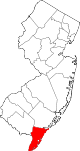 | |
| Boroughs | ||
| Townships | ||
| CDPs | ||
| Other communities |
| |
| ||
Authority control | |
|---|---|
| General | |
| National libraries | |
Другой контент может иметь иную лицензию. Перед использованием материалов сайта WikiSort.org внимательно изучите правила лицензирования конкретных элементов наполнения сайта.
WikiSort.org - проект по пересортировке и дополнению контента Википедии