world.wikisort.org - USA
West Cape May is a Walsh Act borough in Cape May County, New Jersey, United States. It is part of the Ocean City Metropolitan Statistical Area. As of the 2010 United States Census, the borough's population was 1,024,[16][17][18] reflecting a decline of 71 (−6.5%) from the 1,095 counted in the 2000 Census, which had in turn increased by 69 (+6.7%) from the 1,026 counted in the 1990 Census.[19]
West Cape May, New Jersey | |
|---|---|
Borough | |
| Borough of West Cape May | |
 Whilldin-Miller House | |
 West Cape May Borough highlighted in Cape May County. Inset map: Cape May County highlighted in the State of New Jersey. | |
 Census Bureau map of West Cape May, New Jersey | |
 West Cape May Location in Cape May County  West Cape May Location in New Jersey  West Cape May Location in the United States | |
| Coordinates: 38.942226°N 74.939033°W[1][2] | |
| Country | |
| State | |
| County | |
| Incorporated | April 17, 1884 |
| Named for | Cape May / Cornelius Jacobsen May |
| Government | |
| • Type | Walsh Act |
| • Body | Board of Commissioners |
| • Mayor | Carol Sabo (term ends December 31, 2025)[4][5] |
| • Municipal clerk | Theresa Enteado (acting)[6] |
| Area | |
| • Total | 1.19 sq mi (3.07 km2) |
| • Land | 1.17 sq mi (3.04 km2) |
| • Water | 0.01 sq mi (0.03 km2) 1.09% |
| • Rank | 489th of 565 in state 14th of 16 in county[1] |
| Elevation | 10 ft (3 m) |
| Population (2020)[9] | |
| • Total | 1,010 |
| • Rank | 533rd of 566 in state 13th of 16 in county[10] |
| • Density | 861.04/sq mi (332.36/km2) |
| • Rank | 399th of 566 in state 9th of 16 in county[10] |
| Time zone | UTC−05:00 (Eastern (EST)) |
| • Summer (DST) | UTC−04:00 (Eastern (EDT)) |
| ZIP Code | 08204[11] |
| Area code | 609[12] |
| FIPS code | 3400978530[1][13][14] |
| GNIS feature ID | 0885435[1][15] |
| Website | www |
West Cape May was incorporated as a borough by an act of the New Jersey Legislature on April 17, 1884, from portions of Lower Township, based on the results of a referendum held two days earlier. The borough was reincorporated on April 11, 1890, and again on May 4, 1897.[20] The borough's name derives from Cape May, which was named for 1620 Dutch captain named Cornelius Jacobsen May who explored and charted the area between 1611 and 1614, and established a claim for the province of New Netherland.[21][22]
During Hurricane Sandy in October 2012, West Cape May was hit by 9.53 inches (242 mm) of rain, the most of any place in the state.[23]
West Cape May had been a dry town until May 2012, when a new store opened after the Board of Commissioners approved the sale of a liquor license for more than $600,000.[24] In 2008, voters approved a referendum that allowed the issuance of a single license for retail liquor sales and another for sale of alcoholic beverages at a restaurant.[25] The borough had been dry for 128 years, where alcohol cannot be sold, affirmed by the results of a referendum held in 1940,[26][27] joining Cape May Point, Ocean City and Wildwood Crest among municipalities in Cape May restricting the sale of alcohol.[28]
History

The borough's history goes back to the time of the Lenape Native Americans and several buildings date to the Colonial period. The area has a rich agricultural history which continues to be celebrated each year with a summer farmers' market, and strawberry, tomato and lima bean festivals. It has been known as the "Lima Bean Capital of the World." The Lima Bean Festival is an annual event held in West Cape May, New Jersey, the "Lima Bean Capital of the World", and is the world's only such celebration. It is held annually on the Saturday of Columbus Day weekend in Wilbraham Park.[29]
West Cape May, once known as Eldredge, is one of the four jurisdictions that comprise Cape Island in Cape May County. West Cape May was incorporated as a borough by an act of the New Jersey Legislature on April 17, 1884, from portions of Lower Township, based on the results of a referendum held two days earlier. The borough was reincorporated on April 11, 1890, and again on May 4, 1897.[20]
The Borough has reported ties to the Underground Railroad.[30]
From 1881 to 1931, the Hastings Goldbeating Company was located in the Borough employing women to pound one-inch strips of gold into gossamer-thin sheets used for decorative arts. Women continued to do the "booking" of gold leaf sheets until 1961. A plaque indicating the location of the factory can be found on Goldbeaten Alley. It was this business, along with real estate speculation and subdivision of the land, that led to the Borough's incorporation in 1884.[31]
Historic sites
The historic core of the Borough was placed on the National Register of Historic Places along with sections of the City of Cape May in 1976.[32]
Whilldin-Miller House was added to the National Register of Historic Places on February 12, 2003. The original timber frame two-story house remaining in the rear was built by Joseph Whilldin about 1715, while the front portion of the house was built in 1860, making it one of the oldest remaining houses on Cape Island.[33]
Geography
According to the United States Census Bureau, the borough had a total area of 1.19 square miles (3.07 km2), including 1.17 square miles (3.04 km2) of land and 0.01 square miles (0.03 km2) of water (1.09%).[1][2]
The borough borders the Cape May County municipalities of Cape May City and Lower Township.[34][35][36]
Demographics
| Historical population | |||
|---|---|---|---|
| Census | Pop. | %± | |
| 1890 | 757 | — | |
| 1900 | 696 | −8.1% | |
| 1910 | 844 | 21.3% | |
| 1920 | 967 | 14.6% | |
| 1930 | 1,048 | 8.4% | |
| 1940 | 934 | −10.9% | |
| 1950 | 897 | −4.0% | |
| 1960 | 1,030 | 14.8% | |
| 1970 | 1,005 | −2.4% | |
| 1980 | 1,091 | 8.6% | |
| 1990 | 1,026 | −6.0% | |
| 2000 | 1,095 | 6.7% | |
| 2010 | 1,024 | −6.5% | |
| 2020 | 1,010 | −1.4% | |
| Population sources: 1890–2000[37] 1890–1920[38] 1890[39] 1890–1910[40] 1910–1930[41] 1930–1990[42] 2000[43][44] 2010[16][17][18][9] | |||
Census 2010
The 2010 United States census counted 1,024 people, 493 households, and 294 families in the borough. The population density was 878.8 per square mile (339.3/km2). There were 1,043 housing units at an average density of 895.1 per square mile (345.6/km2). The racial makeup was 85.84% (879) White, 8.69% (89) Black or African American, 0.78% (8) Native American, 0.20% (2) Asian, 0.00% (0) Pacific Islander, 3.13% (32) from other races, and 1.37% (14) from two or more races. Hispanic or Latino of any race were 4.98% (51) of the population.[16]
Of the 493 households, 14.0% had children under the age of 18; 46.0% were married couples living together; 10.3% had a female householder with no husband present and 40.4% were non-families. Of all households, 36.3% were made up of individuals and 17.2% had someone living alone who was 65 years of age or older. The average household size was 2.08 and the average family size was 2.66.[16]
12.8% of the population were under the age of 18, 6.1% from 18 to 24, 13.5% from 25 to 44, 39.2% from 45 to 64, and 28.5% who were 65 years of age or older. The median age was 55.0 years. For every 100 females, the population had 93.2 males. For every 100 females ages 18 and older there were 88.0 males.[16]
The Census Bureau's 2006–2010 American Community Survey showed that (in 2010 inflation-adjusted dollars) median household income was $48,281 (with a margin of error of +/− $6,924) and the median family income was $51,394 (+/− $3,176). Males had a median income of $42,361 (+/− $10,529) versus $43,860 (+/− $3,583) for females. The per capita income for the borough was $34,328 (+/− $4,010). About 8.4% of families and 6.7% of the population were below the poverty line, including 8.0% of those under age 18 and 4.8% of those age 65 or over.[45]
Census 2000
As of the 2000 United States Census[13] there were 1,095 people, 507 households, and 302 families residing in the borough. The population density was 923.5 inhabitants per square mile (356.6/km2). There were 1,004 housing units at an average density of 846.8 per square mile (327.0/km2). The racial makeup of the borough was 84.11% White, 14.52% African American, 0.37% Native American, 0.55% from other races, and 0.46% from two or more races. Hispanic or Latino of any race were 1.83% of the population.[43][44]
There were 507 households, out of which 21.1% had children under the age of 18 living with them, 44.2% were married couples living together, 11.2% had a female householder with no husband present, and 40.4% were non-families. 35.1% of all households were made up of individuals, and 17.4% had someone living alone who was 65 years of age or older. The average household size was 2.16 and the average family size was 2.80.[43][44]
In the borough the population was spread out, with 19.6% under the age of 18, 3.6% from 18 to 24, 23.7% from 25 to 44, 28.7% from 45 to 64, and 24.4% who were 65 years of age or older. The median age was 46 years. For every 100 females, there were 92.8 males. For every 100 females age 18 and over, there were 88.4 males.[43][44]
The median income for a household in the borough was $37,500, and the median income for a family was $47,031. Males had a median income of $36,375 versus $29,583 for females. The per capita income for the borough was $25,663. About 4.7% of families and 7.4% of the population were below the poverty line, including 6.3% of those under age 18 and 8.9% of those age 65 or over.[43][44]
African-Americans
African-Americans have been in West Cape May since the early 1800s. There is a West Cape May African-American Historical Society.[46] Julie Lasky of The New York Times wrote that "until recently" the African-American community was "vibrant" but that by 2020 the percentage declined to 5%.[47]
Government
Local government
The Borough of West Cape May has operated under the Walsh Act form of government since 1948.[48][49] The borough is one of 30 municipalities (of the 564) statewide to use the commission form of government,[50] down from a peak of 60 early in the 20th century and with most remaining municipalities using the form being shore communities.[51] The Board of Commissioners is comprised of three members, who are elected at-large in non-partisan elections held as part of the November general election and serve four-year, concurrent terms of office.[3] Once the Commissioners take office, they divide up responsibility for the municipal departments, with each Commissioner serving as a Department Director and holds all the executive, administrative, judicial and legislative powers, with no single chief executive. An ordinance adopted by the Board of Commissioners in December 2012 shifted the borough's municipal elections from May to November.[52]
As of 2022[update], the borough's commissioners are Mayor Carol E. Sabo (Commissioner of Revenue and Finance), Deputy Mayor Peter C. Burke (Commissioner of Public Works, Parks and Public Property) and Daniel M. Kurkowski (Commissioner of Public Affairs and Public Safety), who are all serving concurrent terms of office that end December 31, 2025.[53][54][55][56]
Carol Sabo was appointed in early 2013 to fill the vacant seat of Ramsay Geyer, who had resigned to move out of the borough.[57] Kaithern, Burke and Sabo were all re-elected in November 2013.[58]
Federal, state and county representation
West Cape May is located in the 2nd Congressional District[59] and is part of New Jersey's 1st state legislative district.[17][60][61]
For the 117th United States Congress, New Jersey's Second Congressional District is represented by Jeff Van Drew (R, Dennis Township).[62] New Jersey is represented in the United States Senate by Democrats Cory Booker (Newark, term ends 2027)[63] and Bob Menendez (Harrison, term ends 2025).[64][65]
For the 2022–2023 session, the 1st Legislative District of the New Jersey Legislature is represented in the State Senate by Mike Testa (R, Vineland) and in the General Assembly by Antwan McClellan (R, Ocean City) and Erik K. Simonsen (R, Lower Township).[66]
Cape May County is governed by a five-person Board of County Commissioners whose members are elected at-large on a partisan basis to three-year terms of office on a staggered basis, with either one or two seats coming up for election each year; At an annual reorganization held each January, the commissioners select one member to serve as director and another to serve as vice-director.[67] As of 2022[update], Cape May County's Commissioners are Commissioner Director Gerald M. Thornton (R, Middle Township; term as commissioner and as commissioner director ends December 31, 2022),[68] Commissioner Vice-Director Leonard C. Desiderio (R, Sea Isle City; term as commissioner ends 2024; term as vice-director ends 2022),[69] E. Marie Hayes (R, Ocean City; 2022),[70] Will Morey (R, Wildwood Crest; 2023)[71] and Jeffrey L. Pierson (R. Upper Township; 2023).[72][67][73] The county's constitutional officers are County Clerk Rita Marie Rothberg (R, 2025, Ocean City),[74][75] Sheriff Robert Nolan (R, 2023, Lower Township)[76][77] and Surrogate Dean Marcolongo (R, 2022, Upper Township).[78][79][80][73]
Politics
As of March 23, 2011, there were a total of 776 registered voters in West Cape May, of which 249 (32.1%) were registered as Democrats, 284 (36.6%) were registered as Republicans and 241 (31.1%) were registered as Unaffiliated. There were 2 voters registered as either Libertarians or Greens.[81]
In the 2012 presidential election, Democrat Barack Obama received 61.0% of the vote (385 cast), ahead of Republican Mitt Romney with 37.2% (235 votes), and other candidates with 1.7% (11 votes), among the 640 ballots cast by the borough's 830 registered voters (9 ballots were spoiled), for a turnout of 77.1%.[82][83] In the 2008 presidential election, Democrat Barack Obama received 62.9% of the vote (387 cast), ahead of Republican John McCain, who received 35.0% (215 votes), with 615 ballots cast among the borough's 752 registered voters, for a turnout of 81.8%.[84] In the 2004 presidential election, Democrat John Kerry received 60.5% of the vote (377 ballots cast), outpolling Republican George W. Bush, who received around 38.5% (240 votes), with 623 ballots cast among the borough's 818 registered voters, for a turnout percentage of 76.2.[85]
In the 2013 gubernatorial election, Republican Chris Christie received 59.8% of the vote (329 cast), ahead of Democrat Barbara Buono with 37.6% (207 votes), and other candidates with 2.5% (14 votes), among the 582 ballots cast by the borough's 816 registered voters (32 ballots were spoiled), for a turnout of 71.3%.[86][87] In the 2009 gubernatorial election, Democrat Jon Corzine received 52.2% of the vote (245 ballots cast), ahead of both Republican Chris Christie with 39.0% (183 votes) and Independent Chris Daggett with 6.0% (28 votes), with 469 ballots cast among the borough's 778 registered voters, yielding a 60.3% turnout.[88]
Education

The West Cape May School District serves students in pre-kindergarten through sixth grade at West Cape May Elementary School.[89] As of the 2018–2019 school year, the district, comprised of one school, had an enrollment of 99 students and 9.7 classroom teachers (on an FTE basis), for a student–teacher ratio of 10.2:1.[90] In the 2016–2017 school year, the district had 98 students, making it the eighth-smallest district in the state.[91][92]
For seventh through twelfth grades, public school students attend the schools of the Lower Cape May Regional School District, which serves students from Cape May, Lower Township and West Cape May, along with students from Cape May Point who attend as part of a sending/receiving relationship.[93][94] As of the 2018–2019 school year, the high school district, comprised of two schools, had an enrollment of 1,330 students and 118.7 classroom teachers (on an FTE basis), for a student–teacher ratio of 11.2:1.[95] Schools in the district (with 2018–2019 enrollment data from the National Center for Education Statistics[96]) are Richard M. Teitelman Middle School[97] with 472 students in grades 7–8 and Lower Cape May Regional High School[93] with 828 students in grades 9–12.[98] The district's board of education has nine members, who are elected directly by voters to serve three-year terms of office on a staggered basis, with three seats up for election each year.[99][100] Seats on the board are allocated based on population, with West Cape May assigned one seat.[101]
In 2013, the Lower Cape May Regional School District received a feasibility study that looked at ways to reconfigure the district, which had been established in 1956. The study considered Cape May City withdrawing from the regional district or the dissolution of the district, converting Lower Township's existing Pre-K–6 district to serve Pre-K–12, as the regional district's school facilities are located in the township. Cape May City and West Cape May could see annual savings approaching a combined $6 million from the dissolution.[94]
Students are also eligible to attend Cape May County Technical High School in Cape May Court House, which serves students from the entire county in its comprehensive and vocational programs, which are offered without charge to students who are county residents.[102][103] Special needs students may be referred to Cape May County Special Services School District in the Cape May Court House area.
History
Previously a West Cape May High School existed. In an era of de jure educational segregation in the United States normally only white students were permitted to attend though the state made exceptions.[104] Ordinarily black students attended a different industrial high school. The district maintained separate white and black elementary schools.[105]
Transportation
Roads and highways

As of May 2010[update], the borough had a total of 11.87 miles (19.10 km) of roadways, of which 8.82 miles (14.19 km) were maintained by the municipality and 3.05 miles (4.91 km) by Cape May County.[106]
No Interstate, U.S., state or major county highways serve West Cape May. The most significant roads in the borough are minor county routes, such as County Route 607.
Public transportation
NJ Transit offers bus service between Cape May and Atlantic City on the 552 route.[107][108]
Parks and recreation

Wilbraham Park is in West Cape May. Every October the lima bean festival is held in that park.[109] There is also a strawberry festival in West Cape May, sponsored by the West Cape May Business Association.[110]
Wineries
- Willow Creek Winery
References
- 2019 Census Gazetteer Files: New Jersey Places, United States Census Bureau. Accessed July 1, 2020.
- US Gazetteer files: 2010, 2000, and 1990, United States Census Bureau. Accessed September 4, 2014.
- 2012 New Jersey Legislative District Data Book, Rutgers University Edward J. Bloustein School of Planning and Public Policy, March 2013, p. 8.
- Directory of Offices & Hours, Borough of West Cape May. Accessed June 29, 2016.
- 2022 New Jersey Mayors Directory, New Jersey Department of Community Affairs. Accessed March 1, 2022.
- Clerk / Registrar, Borough of West Cape May. Accessed May 3, 2022.
- "ArcGIS REST Services Directory". United States Census Bureau. Retrieved October 11, 2022.
- U.S. Geological Survey Geographic Names Information System: Borough of West Cape May, Geographic Names Information System. Accessed March 14, 2013.
- "Census Population API". United States Census Bureau. Retrieved October 11, 2022.
- GCT-PH1 Population, Housing Units, Area, and Density: 2010 - State -- County Subdivision from the 2010 Census Summary File 1 for New Jersey Archived February 12, 2020, at archive.today, United States Census Bureau. Accessed October 17, 2012.
- Look Up a ZIP Code for West Cape May, NJ, United States Postal Service. Accessed December 7, 2011.
- Area Code Lookup - NPA NXX for West Cape May, NJ, Area-Codes.com. Accessed November 11, 2013.
- U.S. Census website , United States Census Bureau. Accessed September 4, 2014.
- Geographic Codes Lookup for New Jersey, Missouri Census Data Center. Accessed April 1, 2022.
- US Board on Geographic Names, United States Geological Survey. Accessed September 4, 2014.
- DP-1 - Profile of General Population and Housing Characteristics: 2010 for West Cape May borough, Cape May County, New Jersey Archived February 12, 2020, at archive.today, United States Census Bureau. Accessed October 17, 2012.
- Municipalities Sorted by 2011-2020 Legislative District, New Jersey Department of State. Accessed February 1, 2020.
- Profile of General Demographic Characteristics: 2010 for West Cape May borough Archived May 6, 2012, at the Wayback Machine, New Jersey Department of Labor and Workforce Development. Accessed October 17, 2012.
- Table 7. Population for the Counties and Municipalities in New Jersey: 1990, 2000 and 2010, New Jersey Department of Labor and Workforce Development, February 2011. Accessed October 17, 2012.
- Snyder, John P. The Story of New Jersey's Civil Boundaries: 1606-1968, Bureau of Geology and Topography; Trenton, New Jersey; 1969. p. 116. Accessed October 17, 2012.
- Hutchinson, Viola L. The Origin of New Jersey Place Names, New Jersey Public Library Commission, May 1945. Accessed August 28, 2015.
- Gannett, Henry. The Origin of Certain Place Names in the United States, p. 68. United States Government Printing Office, 1905. Accessed August 28, 2015.
- Sandy NJ Weather Dashboard, Rutgers University. Accessed October 31, 2012.
- Degener, Richard. "Liquor store set to end West Cape May's 128-year run as a dry town in May", The Press of Atlantic City, March 15, 2012. Accessed November 23, 2015. "This May, West Cape May's status as a dry borough will end after 128 years, when the first liquor store will open on Sunset Boulevard."
- Staff. "West Cape May looks at approving first liquor license", Cape May Gazette, February 8, 2012. Accessed November 23, 2015. "In December, commissioners accepted a $615,000 bid from Sunset Liquors. It was the only bid received for a license to permit sales from a package store.... In 2008, borough residents voted through a question that permits a single retail license and a single consumption license."
- New Jersey Division of Alcoholic Beverage Control. New Jersey ABC list of dry towns (May 1, 2013)
- Giordano, Rita. "More towns catching liquor-license buzz; Moorestown considers ending its dry spell", The Philadelphia Inquirer, June 24, 2007. Accessed February 16, 2014.
- Schaad, Jacob Jr. "Bizarre History of Cape May - Wet or dry?", The Cape May Gazette, October 30, 2013. Accessed February 16, 2014. "Wildwood Crest, Ocean City, West Cape May and Cape May Point have opted to stay dry while the 12 other communities in the county still permit their people to lift a few."
- America's Best (and only) Lima Bean Festival, accessed March 7, 2007
- Degener, Richard. "Photo Exhibit Brings West Cape May's Past to Light", The Press of Atlantic City, December 28, 2003. Accessed October 17, 2012. "It has Mayflower descendants, a link to the Underground Railroad, buildings that go back to the 17th century and a factory where women once beat gold into sheets with hammers.Who says West Cape May has to live in the shadow of Cape May's rich historical past?"
- Montet, Margaret. "Trolleying West of Cape May City", NJ.com, July 15, 2011. Accessed October 17, 2012. "So back to Goldbeaten Alley: from 1881 to 1931 workers at the Hastings Goldbeating Company cut gold bars into thin slices and then beat them paper-thin."
- Cape May County: New Jersey and National Registers of Historic Places, New Jersey Department of Environmental Protection Historic Preservation Office, December 30, 2019. Accessed March 13, 2020.
- Tischler, Susan. "Which house is the oldest house on Cape Island?", CapeMay.com, October 1, 2004. Accessed October 25, 2015. "Let's move on to our other property in question – The Whilldin-Miller House, AKA Daniels on Broadway Restaurant, at 416 South Broadway.The property is actually located in West Cape May and was built by Joseph Whilldin somewhere around 1711-1718 with an expanded addition built by Jonas Miller in 1860."
- Areas touching West Cape May, MapIt. Accessed March 13, 2020.
- Cape May County, Coalition for a Healthy NJ. Accessed March 13, 2020.
- New Jersey Municipal Boundaries, New Jersey Department of Transportation. Accessed November 15, 2019.
- Barnett, Bob. Population Data for Cape May County Municipalities, 1810 - 2000, WestJersey.org, January 6, 2011. Accessed October 17, 2012.
- Compendium of censuses 1726-1905: together with the tabulated returns of 1905, New Jersey Department of State, 1906. Accessed November 11, 2013.
- Porter, Robert Percival. Preliminary Results as Contained in the Eleventh Census Bulletins: Volume III - 51 to 75, p. 97. United States Census Bureau, 1890. Accessed November 11, 2013.
- Thirteenth Census of the United States, 1910: Population by Counties and Minor Civil Divisions, 1910, 1900, 1890, United States Census Bureau, p. 336. Accessed October 17, 2012.
- Fifteenth Census of the United States: 1930 - Population Volume I, United States Census Bureau, p. 715. Accessed October 17, 2012.
- New Jersey Resident Population by Municipality: 1930 - 1990 Archived March 19, 2018, at the Wayback Machine, Workforce New Jersey Public Information Network. Accessed June 28, 2015.
- Census 2000 Profiles of Demographic / Social / Economic / Housing Characteristics for West Cape May borough, New Jersey[permanent dead link], United States Census Bureau. Accessed October 17, 2012.
- DP-1: Profile of General Demographic Characteristics: 2000 - Census 2000 Summary File 1 (SF 1) 100-Percent Data for West Cape May borough, Cape May County, New Jersey Archived February 12, 2020, at archive.today, United States Census Bureau. Accessed October 17, 2012.
- DP03: Selected Economic Characteristics from the 2006-2010 American Community Survey 5-Year Estimates for West Cape May borough, Cape May County, New Jersey Archived February 12, 2020, at archive.today, United States Census Bureau. Accessed October 17, 2012.
- "West Cape May African American Historical Society Plans Recognition Ceremony". Cape May County Herald. September 27, 2018. - Press release.
- Lasky, Julie (June 16, 2021). "Cape May, N.J.: Salt Air and Cultural Riches". The New York Times. Retrieved June 16, 2021.
- "The Commission Form of Municipal Government" Archived June 5, 2015, at the Wayback Machine, p. 53. Accessed June 3, 2015.
- "Forms of Municipal Government in New Jersey", p. 8. Rutgers University Center for Government Studies. Accessed June 3, 2015.
- Inventory of Municipal Forms of Government in New Jersey, Rutgers University Center for Government Studies, July 1, 2011. Accessed November 18, 2019.
- Proctor, Owen; and Sobko, Katie. "Town commissions have become a New Jersey rarity", The Record, April 30, 2018, updated May 6, 2018. Accessed October 27, 2019. "Commissions rose in popularity, up to 60 statewide in the early part of the last century, from large cities and older suburbs to seaside resorts.... Today, only about 30 of New Jersey’s 565 municipalities are commissions, including six in North Jersey. There are North Bergen, Union City and West New York in Hudson County, Lyndhurst and Ridgefield Park in Bergen County, and Nutley in Essex County."
- Ordinance No. 476-12, Borough of West Cape May. Accessed October 31, 2014.
- Administration, Borough of West Cape May. Accessed May 3, 2022.
- 2022 Municipal User Friendly Budget, Borough of West Cape May. Accessed May 3, 2022.
- 2021 County & Municipal Elected Officials Cape May County, NJ -- July 2021, Cape May County, New Jersey, September 13, 2021. Accessed April 28, 2022.
- Cape May County 2021 General Election Successful Candidates, Cape May County, New Jersey, November 16, 2021. Accessed January 1, 2022.
- Degener, Richard. "Sabo picked to fill unexpired term on West Cape May Borough Commission", The Press of Atlantic City, February 1, 2013. Accessed April 29, 2013. "Broadway resident Carol Sabo has been picked to fill the unexpired Borough Commission seat left open when Ramsey Geyer moved to Florida."
- Staff. "Update: 2013 General Election Results", Cape May County Herald, November 4, 2013. Accessed November 11, 2013. "Commissioner West Cape May: Pamela M. Kaithern won West Cape May votes with 21 percent, Peter C. Burke and Carole E. Sabo tied for second with 20 percent of the votes."
- Plan Components Report, New Jersey Redistricting Commission, December 23, 2011. Accessed February 1, 2020.
- 2019 New Jersey Citizen's Guide to Government, New Jersey League of Women Voters. Accessed October 30, 2019.
- Districts by Number for 2011-2020, New Jersey Legislature. Accessed January 6, 2013.
- Directory of Representatives: New Jersey, United States House of Representatives. Accessed January 3, 2019.
- U.S. Sen. Cory Booker cruises past Republican challenger Rik Mehta in New Jersey, PhillyVoice. Accessed April 30, 2021. "He now owns a home and lives in Newark's Central Ward community."
- Biography of Bob Menendez, United States Senate, January 26, 2015. "Menendez, who started his political career in Union City, moved in September from Paramus to one of Harrison's new apartment buildings near the town's PATH station.."
- Home, sweet home: Bob Menendez back in Hudson County. nj.com. Accessed April 30, 2021. "Booker, Cory A. - (D - NJ) Class II; Menendez, Robert - (D - NJ) Class I"
- Legislative Roster for District 1, New Jersey Legislature. Accessed January 11, 2022.
- Board of County Commissioners, Cape May County, New Jersey. Accessed April 28, 2022. "Cape May County Government is governed by a Board of County Commissioners. These individuals are elected at large by the citizens of Cape May County and hold spaced 3-year terms." Note that as of date accessed, Desiderio is listed with an incorrect term-end year of 2020.
- Gerald M. Thornton, Cape May County, New Jersey. Accessed April 28, 2022.
- Leonard C. Desiderio, Cape May County, New Jersey. Accessed April 28, 2022.
- E. Marie Hayes, Cape May County, New Jersey. Accessed April 28, 2022.
- Will Morey, Cape May County, New Jersey. Accessed April 28, 2022.
- Jeffrey L. Pierson, Cape May County, New Jersey. Accessed April 28, 2022.
- 2021 County & Municipal Elected Officials Cape May County, NJ -- July 2021, Cape May County, New Jersey, September 13, 2021. Accessed April 28, 2022.
- County Clerk, Cape May County, New Jersey. Accessed April 28, 2022.
- Members List: Clerks, Constitutional Officers Association of New Jersey. Accessed April 28, 2022.
- Sheriff's Page Page, Cape May County, New Jersey. Accessed April 28, 2022.
- Members List: Sheriffs, Constitutional Officers Association of New Jersey. Accessed April 28, 2022.
- Surrogate, Cape May County, New Jersey. Accessed April 28, 2022.
- Members List: Surrogates, Constitutional Officers Association of New Jersey. Accessed April 28, 2022.
- Constitutional Officers, Cape May County, New Jersey. Accessed April 28, 2022.
- Voter Registration Summary - Cape May, New Jersey Department of State Division of Elections, March 23, 2011. Accessed October 16, 2012.
- "Presidential General Election Results - November 6, 2012 - Cape May County" (PDF). New Jersey Department of Elections. March 15, 2013. Retrieved December 24, 2014.
- "Number of Registered Voters and Ballots Cast - November 6, 2012 - General Election Results - Cape May County" (PDF). New Jersey Department of Elections. March 15, 2013. Retrieved December 24, 2014.
- 2008 Presidential General Election Results: Cape May County, New Jersey Department of State Division of Elections, December 23, 2008. Accessed October 16, 2012.
- 2004 Presidential Election: Cape May County, New Jersey Department of State Division of Elections, December 13, 2004. Accessed October 16, 2012.
- "Governor - Cape May County" (PDF). New Jersey Department of Elections. January 29, 2014. Retrieved December 24, 2014.
- "Number of Registered Voters and Ballots Cast - November 5, 2013 - General Election Results - Cape May County" (PDF). New Jersey Department of Elections. January 29, 2014. Retrieved December 24, 2014.
- 2009 Governor: Cape May County Archived October 17, 2012, at the Wayback Machine, New Jersey Department of State Division of Elections, December 31, 2009. Accessed October 16, 2012.
- Comprehensive Annual Financial Report of the West Camp May School District, New Jersey Department of Education, for year ending June 30, 2019. Accessed August 14, 2020. "The Borough of West Cape May School District ('School District') is a Type II district located in the County of Cape May, State of New Jersey. As a Type II district, the School District functions independently through a Board of Education. The Board of Education is comprised of five members elected to three-year terms. These terms are staggered so that one or two member’s terms expire each year. The purpose of the School District is to provide educational services for resident students in grades K through 6."
- District information for West Cape May Elementary School District, National Center for Education Statistics. Accessed April 1, 2020.
- Procida, Lee. "Sea Isle, Long Beach Island are examples of how closing small, high-cost schools can be difficult, unpopular", The Press of Atlantic City, September 20, 2011. Accessed March 12, 2015. "The 10 smallest school districts in the state each have fewer than 100 students. Seven of them, all in South Jersey, are grappling with shrinking enrollment, aging buildings and rising property taxes.... West Cape May disregarded a recommendation to send students to Cape May, and instead started welcoming students from outside its borders through the state Public School Choice program. The first 16 choice students increased the prekindergarten-through-sixth-grade school's enrollment to 58 students this year."
- Guion, Payton. "These 43 N.J. school districts have fewer than 200 students", NJ Advance Media for NJ.com, September 2017. Accessed January 30, 2020. "Based on data from the state Department of Education from the last school year and the Census Bureau, NJ Advance Media made a list of the smallest of the small school districts in the state, excluding charter schools and specialty institutions.... 8. West Cape May Borough - Enrollment: 98; Grades: Pre-K-6"
- Lower Cape May Regional High School, Lower Cape May Regional School District. Accessed January 30, 2020.
- Johnson, Virgil; and Kirtland, James L. "A Feasibility Study to Reconfigure the Lower Cape May Regional School District", Statistical Forecasting LLC, June 2013. Accessed March 13, 2020. "Cape May City is one of three constituent communities served by the Lower Cape May Regional School District ("Lower Cape May Regional"), a limited purpose school district providing education for the middle and high school students from Cape May City, Lower Township, and West Cape May.... Students from cape May Point attend on a sending-receiving basis."
- District information for Lower Cape May Regional School District, National Center for Education Statistics. Accessed April 1, 2020.
- School Data for the Lower Cape May Regional High School District, National Center for Education Statistics. Accessed April 1, 2020.
- Richard M. Teitelman Middle School, Lower Cape May Regional School District. Accessed January 30, 2020.
- New Jersey School Directory for the Lower Cape May Regional School District, New Jersey Department of Education. Accessed December 26, 2016.
- Comprehensive Annual Financial Report of the Lower Cape May Regional School District, New Jersey Department of Education, for year ending June 30, 2019. Accessed August 14, 2020. "The Lower Cape May Regional School District (District) is a Type II school district located in Cape May County, New Jersey and covers an area of approximately 34 square miles. As a Type II school district, it functions independently through a Board of Education. The Board is comprised of nine members elected to three-year terms. These terms are staggered so that three member’s terms expire each year. The purpose of the School District is to provide educational services for all of Lower Cape May Regional’s students in grades 7 through 12. "
- Board of Education, Lower Cape May Regional School District. Accessed March 13, 2020.
- Crowley, Terence J. A Response to the Cape May Study to Reconfigure the Lower Cape May Regional School District, Lower Cape May Regional School District, January 6, 2014. Accessed March 13, 2020. "The Lower Cape May Regional District (Regional is classified as a Limited Purpose District.... It is a Type II district and apportions the Board of Education seats based upon the most recent United States Census. It has nine seats on the Board and that are apportioned as follows: Cape May City 1; West Cape May 1; Lower Township 7."
- Frequently Asked Questions, Cape May County Technical High School. Accessed October 27, 2019. "All residents of Cape May County are eligible to attend Cape May County Technical High School.... The Cape May County Technical High School is a public school so there is no cost to residents of Cape May County."
- Technical High School Admissions, Cape May County Technical High School. Accessed October 27, 2019. "All students who are residents of Cape May County may apply to the Technical High School."
- Stump, Brice (January 13, 1998). "Who was Charles Chipman?". The Daily Times. Salisbury, Maryland. pp. 11, 12. - Clipping of first page and of second page at Newspapers.com
- "Dr. Charles H. Chipman Is Outstanding Man". The Daily Times. Salisbury, Maryland. February 23, 1981. p. 6. - Clipping at Newspapers.com
- Cape May County Mileage by Municipality and Jurisdiction, New Jersey Department of Transportation, May 2010. Accessed July 18, 2014.
- Cape May County Bus / Rail Connections, NJ Transit, backed up by the Internet Archive as of January 28, 2010. Accessed October 31, 2014.
- South Jersey Transit Guide, Cross County Connection, as of January 2007. Accessed March 13, 2020.
- "West Cape May". Cape May County Government. Retrieved April 26, 2021.
- Degener, Richard (June 6, 2015). "Strawberry festival hits spot in West Cape May". Press of Atlantic City. Retrieved May 22, 2021.
External links
- West Cape May Borough website
- West Cape May Commissioners for All the People website
- West Cape May Business Association website
- The Cape May Gazette – Weekly newspaper covering West Cape May
Municipalities and communities of Cape May County, New Jersey, United States | ||
|---|---|---|
County seat: Cape May Court House | ||
| Cities | 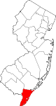 | |
| Boroughs | ||
| Townships | ||
| CDPs | ||
| Other communities |
| |
| ||
Authority control | |
|---|---|
| General |
|
| National libraries | |
Другой контент может иметь иную лицензию. Перед использованием материалов сайта WikiSort.org внимательно изучите правила лицензирования конкретных элементов наполнения сайта.
WikiSort.org - проект по пересортировке и дополнению контента Википедии