world.wikisort.org - USA
North Cape May is an unincorporated community and census-designated place (CDP) located within Lower Township in Cape May County, New Jersey, United States.[8] It is part of the Ocean City Metropolitan Statistical Area. At the 2010 United States Census, the CDP's population was 3,226.[9][10] The Cape May–Lewes Ferry departs from the area. North Cape May is mostly a residential community, with no hotels but many vacation homes. Many people retire to the community.
North Cape May, New Jersey | |
|---|---|
Census-designated place | |
 North Cape May Post Office | |
 Map of North Cape May in Cape May County. Inset: Location of Cape May County in New Jersey. | |
| Coordinates: 38.976427°N 74.951503°W | |
| Country | |
| State | |
| County | Cape May |
| Township | Lower |
| Area | |
| • Total | 2.13 sq mi (5.53 km2) |
| • Land | 2.01 sq mi (5.19 km2) |
| • Water | 0.13 sq mi (0.33 km2) 2.49% |
| Elevation | 13 ft (4 m) |
| Population (2020)[3] | |
| • Total | 4,007 |
| • Density | 1,997.51/sq mi (771.34/km2) |
| Time zone | UTC-5 (Eastern (EST)) |
| • Summer (DST) | UTC-4 (Eastern (EDT)) |
| ZIP code | |
| Area code | 609 |
| FIPS code | 3452650[5][6] |
| GNIS feature ID | 02389569[5][7] |
North Cape May had existed as an independent borough, formed by an act of the New Jersey Legislature on March 19, 1928, from portions of Lower Township. The borough remained independent until April 30, 1945, when it was returned to Lower Township.[11] The borough had a population of 5 at the 1930 Census,[12] which increased to 8 by 1940.[13]
Geography
According to the United States Census Bureau, the CDP had a total area of 1.494 square miles (3.870 km2), including 1.457 square miles (3.773 km2) of land and 0.037 square miles (0.096 km2) of water (2.49%).[5][14]
Demographics
| Historical population | |||
|---|---|---|---|
| Census | Pop. | %± | |
| 1970 | 3,812 | — | |
| 1980 | 4,029 | 5.7% | |
| 1990 | 3,574 | −11.3% | |
| 2000 | 3,618 | 1.2% | |
| 2010 | 3,226 | −10.8% | |
| 2020 | 4,007 | 24.2% | |
| Population sources: 1970-1980[15] 2000[16] 2010[9][3] | |||
Census 2010
The 2010 United States census counted 3,226 people, 1,395 households, and 896 families in the CDP. The population density was 2,214.3 per square mile (854.9/km2). There were 2,100 housing units at an average density of 1,441.5 per square mile (556.6/km2). The racial makeup was 92.87% (2,996) White, 3.22% (104) Black or African American, 0.34% (11) Native American, 0.59% (19) Asian, 0.00% (0) Pacific Islander, 1.30% (42) from other races, and 1.67% (54) from two or more races. Hispanic or Latino of any race were 3.66% (118) of the population.[9]
Of the 1,395 households, 20.7% had children under the age of 18; 47.2% were married couples living together; 13.3% had a female householder with no husband present and 35.8% were non-families. Of all households, 29.6% were made up of individuals and 15.2% had someone living alone who was 65 years of age or older. The average household size was 2.30 and the average family size was 2.82.[9]
18.2% of the population were under the age of 18, 7.7% from 18 to 24, 19.9% from 25 to 44, 31.8% from 45 to 64, and 22.3% who were 65 years of age or older. The median age was 47.6 years. For every 100 females, the population had 88.2 males. For every 100 females ages 18 and older there were 86.6 males.[9]
Census 2000
As of the 2000 United States Census[6] there were 3,618 people, 1,544 households, and 1,008 families residing in the CDP. The population density was 997.8/km2 (2,583.4/mi2). There were 2,090 housing units at an average density of 576.4/km2 (1,492.3/mi2). The racial makeup of the CDP was 94.42% White, 2.79% African American, 0.44% Native American, 0.47% Asian, 0.75% from other races, and 1.13% from two or more races. Hispanic or Latino of any race were 2.16% of the population.[16]
There were 1,544 households, out of which 27.0% had children under the age of 18 living with them, 48.1% were married couples living together, 13.7% had a female householder with no husband present, and 34.7% were non-families. 29.6% of all households were made up of individuals, and 15.5% had someone living alone who was 65 years of age or older. The average household size was 2.33 and the average family size was 2.88.[16]
In the CDP the population was spread out, with 22.8% under the age of 18, 6.0% from 18 to 24, 26.3% from 25 to 44, 24.2% from 45 to 64, and 20.7% who were 65 years of age or older. The median age was 42 years. For every 100 females, there were 86.7 males. For every 100 females age 18 and over, there were 81.3 males.[16]
The median income for a household in the CDP was $37,071, and the median income for a family was $42,161. Males had a median income of $33,036 versus $26,875 for females. The per capita income for the CDP was $18,420. About 1.0% of families and 4.1% of the population were below the poverty line, including 3.1% of those under age 18 and 3.0% of those age 65 or over.[16]
Wineries
- Cape May Winery & Vineyard
- Turdo Vineyards & Winery
Parks and recreation
North Cape May has the Lower Township municipal pool.[17]
Education
As with other parts of Lower Township, it is served by Lower Township School District for primary grades and Lower Cape May Regional School District for secondary grades. David C. Douglass Memorial Elementary School (Pre-Kindergarten and Kindergarten) is in Villas CDP. The other three elementary schools are in Cold Spring: Carl T. Mitnick (grades 1-2), Maud Abrams (grades 3-4), and Sandman Consolidated (grades 5-6). The LCMR schools (Richard Teitelman Middle and Lower Cape May Regional High School) are in the Erma area.
Students are also eligible to attend Cape May County Technical High School in Cape May Court House, which serves students from the entire county in its comprehensive and vocational programs, which are offered without charge to students who are county residents.[18][19] Special needs students may be referred to Cape May County Special Services School District in Cape May Court House.
South Cape Christian Academy, a private Christian school, opened sometime after 1976,[20] and was located in a campus with a North Cape May postal address; as of 2010 it was outside of the North Cape May CDP.[21] Circa 1990 it merged into Cape Christian Academy,[20] which is now in a consolidated campus in Middle Township, with a Cape May Court House postal address and located in the CMCH CDP.[22] Richard Degener of the Press of Atlantic City described the consolidated campus as being in Burleigh.[20]
The nearest private Catholic school serving North Cape May is Wildwood Catholic Academy (PreK-12) in North Wildwood, which the Roman Catholic Diocese of Camden has under its supervision. Previously the area Catholic school was Our Lady Star of the Sea School in Cape May, which served as the parish school for St. John of God Church in North Cape May.[23] In 2010 Our Lady Star of the Sea merged into Cape Trinity Regional School (PreK – 8) in North Wildwood.[24] That school in turn merged into Wildwood Catholic Academy in 2020.[25]
Notable people
People who were born in, residents of, or otherwise closely associated with North Cape May include:
- Bob Andrzejczak (born 1986), politician who represented the 1st Legislative District in the New Jersey General Assembly from 2013 to 2019 and in the New Jersey Senate in 2019.[26]
- Chris Jay, (born 1978), musician, screenwriter, actor, member of the band, Army of Freshmen.[27]
 Cape May–Lewes Ferry terminal
 Shoreline near the ferry terminal


References
- "ArcGIS REST Services Directory". United States Census Bureau. Retrieved October 11, 2022.
- U.S. Geological Survey Geographic Names Information System: North Cape May Census Designated Place, Geographic Names Information System. Accessed October 18, 2012.
- "Census Population API". United States Census Bureau. Retrieved Oct 11, 2022.
- Look Up a ZIP Code for North Cape May, NJ, United States Postal Service. Accessed October 18, 2012.
- Gazetteer of New Jersey Places, United States Census Bureau. Accessed July 21, 2016.
- U.S. Census website, United States Census Bureau. Accessed September 4, 2014.
- US Board on Geographic Names, United States Geological Survey. Accessed September 4, 2014.
- New Jersey: 2010 - Population and Housing Unit Counts - 2010 Census of Population and Housing (CPH-2-32), United States Census Bureau, August 2012. Accessed October 18, 2012.
- DP-1 - Profile of General Population and Housing Characteristics: 2010 Demographic Profile Data for North Cape May CDP, New Jersey Archived 2020-02-12 at archive.today, United States Census Bureau. Accessed October 18, 2012.
- Locality Search, State of New Jersey. Accessed April 19, 2015.
- Snyder, John P. The Story of New Jersey's Civil Boundaries: 1606-1968, Bureau of Geology and Topography; Trenton, New Jersey; 1969. p. 115. Accessed October 18, 2012.
- "Fifteenth Census of the United States: 1930 - Population Volume I", United States Census Bureau, p. 715. Accessed October 18, 2012.
- "Sixteenth Census of the United States: 1940 - Population Volume I; Number of Inhabitants", United States Census Bureau, p. 676. Accessed October 18, 2012.
- US Gazetteer files: 2010, 2000, and 1990, United States Census Bureau. Accessed September 4, 2014.
- Staff. 1980 Census of Population: Number of Inhabitants United States Summary, p. 1-141. United States Census Bureau, June 1983. Accessed June 28, 2015.
- DP-1 - Profile of General Demographic Characteristics: 2000 from the Census 2000 Summary File 1 (SF 1) 100-Percent Data for North Cape May CDP, New Jersey Archived 2020-02-12 at archive.today, United States Census Bureau. Accessed October 18, 2012.
- "Lower Township Pool Offers Cool Relief from Heat Waves". Cape May County Herald. 2014-07-08. Retrieved 2021-05-20. - Press release
- Frequently Asked Questions, Cape May County Technical High School. Accessed October 27, 2019. "All residents of Cape May County are eligible to attend Cape May County Technical High School.... The Cape May County Technical High School is a public school so there is no cost to residents of Cape May County."
- Technical High School Admissions, Cape May County Technical High School. Accessed October 27, 2019. "All students who are residents of Cape May County may apply to the Technical High School."
- Degener, Richard (1993-09-23). "PROPERTIED CLASS / CAPE CHRISTIAN ACADEMY BUYS LAND FOR CENTRAL CAMPUS". The Press of Atlantic City. p. C1. - Available from Newsbank, ID# news/0EAEAA6D18083359.
- "OBITUARIES (CAPE MAY, CUMBERLAND & OCEAN COUNTY EDITIONS)". The Press of Atlantic City. 1989-11-03. p. C3.
Donations may be made to the South Cape Christian Academy, 123 Fishing Creek Road, North Cape May[...]
- Available on Newsbank, ID# F0EAEA80A5401A343. Compare to the address of the North Cape May CDP, 2010. - "Home". Cape Christian Academy. Retrieved 2021-07-15.
10 Oyster Road Cape May Court House, NJ 08210
- See map of CDP from the 2010 U.S. Census - page 1 and page 2. In contrast it is across from but not in the Burleigh CDP: Seen here. - "Home". Our Lady Star of the Sea Catholic School. 2009-07-28. Archived from the original on 28 July 2009. Retrieved 2020-09-14.
- DiPasquale, Donna (2010-06-22). "After 92 years, Star of the Sea School closes its doors". Cape Publishing, Inc. Retrieved 2020-09-11. - The author was the principal of Our Lady Star of the Sea Regional School.
- Franklin, Chris (2020-06-04). "2 Jersey Shore Catholic schools slated to close have been saved". Nj.com. NJ Advance Media. Retrieved 2020-09-11.
- Avedissian, Eric. "A soldier’s story: Bob Andrzejczak lost a leg, not his resolve; The hardest part about the aftermath of attack in Iraq was not the pain ... it was calling home", Ocean City Sentinel, May 20, 2015. Accessed January 11, 2018. "Andrzejczak grew up in Lower Township in North Cape May, a bedroom community straddling the Delaware Bay."
- Weinberg, David "Cape musician Chris Jay forms unlikely friendship with Russian boxer Magomed Abdusalamov", The Press of Atlantic City, March 8, 2013. Accessed January 11, 2018. "The 34-year-old Lower Township native grew up in a musical household. Both of his parents, Ed and Lisa Jurewicz, are retired music teachers and own Mr. J's Music Shop in North Cape May, which is connected to their home."
External links
Municipalities and communities of Cape May County, New Jersey, United States | ||
|---|---|---|
County seat: Cape May Court House | ||
| Cities | 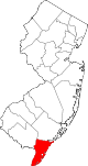 | |
| Boroughs | ||
| Townships | ||
| CDPs | ||
| Other communities |
| |
| ||
Authority control | |
|---|---|
| General |
|
| National libraries | |
Другой контент может иметь иную лицензию. Перед использованием материалов сайта WikiSort.org внимательно изучите правила лицензирования конкретных элементов наполнения сайта.
WikiSort.org - проект по пересортировке и дополнению контента Википедии