world.wikisort.org - United_Kingdom
Water is a hamlet in the unparished area of Rawtenstall, in the Rossendale district, in Lancashire, England. Located north of the village of Lumb. It is mostly made of a few homes, farms, a bistro called "The Water Trough",[1] a primary school and industrial estates.[2][3][4][5] In 2020 it had an estimated population of 835.[6]
| Water | |
|---|---|
 Burnley Road East, Water | |
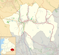 Water Location within Rossendale  Water Location within Lancashire | |
| Area | 0.2525 km2 (0.0975 sq mi) |
| Population | 835 (2020 estimate) |
| • Density | 3,307/km2 (8,570/sq mi) |
| District | |
| Shire county | |
| Region |
|
| Country | England |
| Sovereign state | United Kingdom |
| Post town | ROSSENDALE |
| Postcode district | BB4 |
| Dialling code | 01706 |
| Police | Lancashire |
| Fire | Lancashire |
| Ambulance | North West |
| UK Parliament |
|

References
- "'We are really excited' - New 'classy' bistro opens in East Lancashire town". Lancashire Telegraph. Retrieved 7 February 2022.
- "Water Primary School". water.lancs.sch.uk/. Retrieved 7 February 2022.
- "Pictures of Water, Lancashire, England | England Photography & History". www.picturesofengland.com. Retrieved 7 February 2022.
- "Water & Lumb". Rossendale Community Directory. Retrieved 7 February 2022.
- "Peers Clough Farm". Retrieved 7 February 2022.
- "Water". City Population De. Retrieved 8 February 2022.
This Lancashire location article is a stub. You can help Wikipedia by expanding it. |
Текст в блоке "Читать" взят с сайта "Википедия" и доступен по лицензии Creative Commons Attribution-ShareAlike; в отдельных случаях могут действовать дополнительные условия.
Другой контент может иметь иную лицензию. Перед использованием материалов сайта WikiSort.org внимательно изучите правила лицензирования конкретных элементов наполнения сайта.
Другой контент может иметь иную лицензию. Перед использованием материалов сайта WikiSort.org внимательно изучите правила лицензирования конкретных элементов наполнения сайта.
2019-2025
WikiSort.org - проект по пересортировке и дополнению контента Википедии
WikiSort.org - проект по пересортировке и дополнению контента Википедии