world.wikisort.org - United_Kingdom
Sharneyford is a hamlet in Lancashire, England, on the A681 road between Bacup and Todmorden. It is home to one of the smallest schools in Britain,[citation needed] Sharneyford Primary School. Sharneyford Mill, located north of the school, was once the highest in England, at around 1,250 feet (380 m) above sea level;[1] it has now been demolished. Further up the hill there was a chapel, which was replaced by church further down the hill; the chapel became an engine-house for the railway that provided transport to and from the mill, when the mill was destroyed, the engine-house was emptied and abandoned.
This article needs additional citations for verification. (November 2007) |
| Sharneyford | |
|---|---|
 Todmorden Road (A681) | |
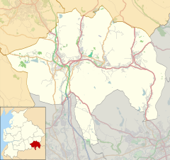 Sharneyford Location within Rossendale  Sharneyford Location within Lancashire | |
| OS grid reference | SD881243 |
| District | |
| Shire county |
|
| Region |
|
| Country | England |
| Sovereign state | United Kingdom |
| Post town | BACUP |
| Postcode district | OL13 |
| Dialling code | 01706 |
| Police | Lancashire |
| Fire | Lancashire |
| Ambulance | North West |
| UK Parliament |
|
References
- Newbigging, Thomas (1893). History of the forest of Rossendale. J.J. Riley. p. 269. Retrieved 26 May 2012.
sharneyford mill.
External links
![]() Media related to Sharneyford at Wikimedia Commons
Media related to Sharneyford at Wikimedia Commons
This Lancashire location article is a stub. You can help Wikipedia by expanding it. |
Текст в блоке "Читать" взят с сайта "Википедия" и доступен по лицензии Creative Commons Attribution-ShareAlike; в отдельных случаях могут действовать дополнительные условия.
Другой контент может иметь иную лицензию. Перед использованием материалов сайта WikiSort.org внимательно изучите правила лицензирования конкретных элементов наполнения сайта.
Другой контент может иметь иную лицензию. Перед использованием материалов сайта WikiSort.org внимательно изучите правила лицензирования конкретных элементов наполнения сайта.
2019-2025
WikiSort.org - проект по пересортировке и дополнению контента Википедии
WikiSort.org - проект по пересортировке и дополнению контента Википедии