world.wikisort.org - United_Kingdom
Kimberley is a village and civil parish in the South Norfolk district, in the county of Norfolk, England, situated about 3 miles (4.8 km) north-west of Wymondham, around the crossroads of the B1108 and B1135. The parish has an area of 9.33 km2 (3.60 sq mi) and had a total population of 121 in 52 households as of the 2001 census.[2] The parish absorbed the parish of Carleton Forehoe on the 1 April 1935.[3]
| Kimberley | |
|---|---|
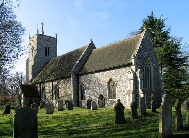 St Peter, Kimberley | |
 Kimberley Location within Norfolk | |
| Area | 9.33 km2 (3.60 sq mi) |
| Population | 154 (2011)[1] |
| • Density | 17/km2 (44/sq mi) |
| OS grid reference | TG071041 |
| Civil parish |
|
| District | |
| Shire county |
|
| Region | |
| Country | England |
| Sovereign state | United Kingdom |
| Post town | WYMONDHAM |
| Postcode district | NR18 |
| Police | Norfolk |
| Fire | Norfolk |
| Ambulance | East of England |

The villages name means 'Cyneburg's wood/clearing', a feminine personal name.
Kimberley is served by rail, as the Kimberley Park railway station is on the Mid-Norfolk Railway, which goes between Dereham and Wymondham.
The River Tiffey flows through the village.
Kimberley is home to Kimberley Hall, a house whose grounds were designed by Capability Brown.
The Wodehouse family had owned land in Kimberley since the 1370s, and in c. 1400 John Wodehouse built Wodehouse Tower at the site of the later Kimberley Hall. John's son John Wodehouse Esq. distinguished himself in the Battle of Agincourt and was granted large estates by Henry V as a reward. Earl of Kimberley is a title in the Peerage of the United Kingdom, created for John Wodehouse, 3rd Baron Wodehouse in 1866. The present holder of the title is John Wodehouse, 5th Earl of Kimberley.
Notable people
- Ernest Raikes (1863–1931), cricketer
- John Jenkins (composer) (1592–1678), English composer
Notes
- "Parish population 2011". Retrieved 10 September 2015.
- "Kimberley and Carleton Forehoe parish information". South Norfolk Council. 30 March 2009. Archived from the original on 29 August 2008. Retrieved 20 June 2009.
- "Relationships and changes Kimberley AP/CP through time". Vision of Britain. Retrieved 16 June 2018.
External links
![]() Media related to Kimberley at Wikimedia Commons
Media related to Kimberley at Wikimedia Commons
This Norfolk location article is a stub. You can help Wikipedia by expanding it. |
Другой контент может иметь иную лицензию. Перед использованием материалов сайта WikiSort.org внимательно изучите правила лицензирования конкретных элементов наполнения сайта.
WikiSort.org - проект по пересортировке и дополнению контента Википедии