world.wikisort.org - Turkey
Reşadiye is a district of Tokat located within the Cappadocia land within the Kızılırmak arc in the central part of the Black Sea. It is on the E E80 highway, on the edge of the Kelkit Stream. Reşadiye is surrounded by Ordu in the north, Almus in the south, Niksar and Başçiftlik in the west and Sivas in the southeast. According to the 2020 TUIK data, its total population is 43,870.
This article needs additional citations for verification. (December 2009) |
Reşadiye | |
|---|---|
 Reşadiye | |
| Coordinates: 40°23′29″N 37°20′18″E | |
| Country | |
| Province | Tokat |
| Government | |
| Area | |
| • District | 1,246.40 km2 (481.24 sq mi) |
| Population (2012)[2] | |
| • Urban | 8,835 |
| • District | 42,365 |
| • District density | 34/km2 (88/sq mi) |
Geography
Geographically, it is located between 400 31 'north latitudes and 370 06' east longitudes and the highest hill of Reşadiye, established on the banks of the Kelkit River, is Erdem Baba Hill with 2.183 meters. This is followed by Küçük Erdem Hill (2.113 meters), Kabaktepe (2.037 meters), Çal Hill (2.022 meters), Mektep Hill, Tömbül Hill and Lalelik Hill. All of these heights are located in Günüş Mountain. Zinav Lake is located within the boundaries of the district.
Terror Attacks
The town was the scene of two major insurgent attacks during the Kurdish-Turkish conflict, the first one being the Sazak assault in 1997, a joint operation between the PKK, DHKP/C and the TKP/ML, killing 4 soldiers and the second being the Reşadiye shooting in 2009 in which the PKK killed 7 and injured 3 soldiers.[3]
Notable people
- Hüseyin Özer, Turkish-British executive chef and restaurateur
References
- "Area of regions (including lakes), km²". Regional Statistics Database. Turkish Statistical Institute. 2002. Retrieved 2013-03-05.
- "Population of province/district centers and towns/villages by districts - 2012". Address Based Population Registration System (ABPRS) Database. Turkish Statistical Institute. Retrieved 2013-02-27.
- "Tension high as heinous attack leaves unanswered questions behind". Archived from the original on 2011-07-28. Retrieved 2015-04-03.
Reşadiye in Tokat Province of Turkey | |||||||||||||||||||||||||||
|---|---|---|---|---|---|---|---|---|---|---|---|---|---|---|---|---|---|---|---|---|---|---|---|---|---|---|---|
| Districts |  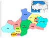 | ||||||||||||||||||||||||||
|
Metropolitan municipalities are bolded. | |||||||||||||||||||||||||||
This article about a Black Sea Region of Turkey location is a stub. You can help Wikipedia by expanding it. |
На других языках
[de] Reşadiye
Reşadiye ist eine Stadt und Hauptort des gleichnamigen Landkreises (İlçe) in der türkischen Provinz Tokat. Die Stadt liegt etwa 70 Kilometer östlich der Provinzhauptstadt Tokat. Der Ort hieß bis 1906 İskefsir und wurde laut Stadtsiegel als Reşadiye 1907 in den Stand einer Gemeinde (Belediye) erhoben.[2]- [en] Reşadiye
Другой контент может иметь иную лицензию. Перед использованием материалов сайта WikiSort.org внимательно изучите правила лицензирования конкретных элементов наполнения сайта.
WikiSort.org - проект по пересортировке и дополнению контента Википедии