world.wikisort.org - Turkey
Kofçaz is a town and district of Kırklareli Province in the Marmara region of Turkey. The mayor is Ziya Karataş (AKP). The nearby village of Ahlatlı, 30 km away, is the northernmost settlement in the country.
Kofçaz | |
|---|---|
 | |
 Kofçaz Kofçaz | |
| Coordinates: 41°56′24″N 27°09′43″E | |
| Country | Turkey |
| Province | Kırklareli |
| Government | |
| • Mayor | Ziya Karataş (AKP) |
| • Kaymakam | Enver Özderin |
| Area | |
| • District | 464.45 km2 (179.33 sq mi) |
| Elevation | 455 m (1,493 ft) |
| Population (2012)[2] | |
| • Urban | 855 |
| • District | 2,924 |
| • District density | 6.3/km2 (16/sq mi) |
| Post code | 39700 |
| Climate | Cfb |
| Website | www.kofcaz.bel.tr |
Facts
Kofçaz is a district of the province of Kırklareli in northwestern Turkey neighbouring with Bulgaria. It is situated in a mountainous area in the outskirts of Yıldız (Istranca) mountains at an elevation of 640 m and has one of the lowest population densities in all of Turkey. The population of the district consists of the local Turkish population who call themselves Gacal and the Turkish communities who came after the Balkan defeat. The population of the district is 2.282 (together with the rural population of the district) according to the 2020 census.[3] The climate is typical continental with cold, snowy winters and hot, dry summers. There is no industry. Forestry, agriculture, and cattle raising are the major ways of living.
History
Kofçaz became part of the Ottoman Empire in 1369 and became a district in 1953 with the appointment of a sub-governor (kaymakam). It contains 16 villages and 2 neighborhoods within its administrative zone.
Geography
Climate
| Climate data for Kofçaz | |||||||||||||
|---|---|---|---|---|---|---|---|---|---|---|---|---|---|
| Month | Jan | Feb | Mar | Apr | May | Jun | Jul | Aug | Sep | Oct | Nov | Dec | Year |
| Average high °C (°F) | 4.4 (39.9) |
6.3 (43.3) |
9.7 (49.5) |
15.7 (60.3) |
21.0 (69.8) |
25.3 (77.5) |
28.2 (82.8) |
27.8 (82.0) |
24.1 (75.4) |
17.6 (63.7) |
12.0 (53.6) |
6.7 (44.1) |
16.6 (61.8) |
| Daily mean °C (°F) | 1.1 (34.0) |
2.7 (36.9) |
5.2 (41.4) |
10.3 (50.5) |
15.1 (59.2) |
19.2 (66.6) |
21.6 (70.9) |
21.3 (70.3) |
17.9 (64.2) |
12.7 (54.9) |
8.0 (46.4) |
3.4 (38.1) |
11.5 (52.8) |
| Average low °C (°F) | −2.1 (28.2) |
−0.8 (30.6) |
0.8 (33.4) |
5.0 (41.0) |
9.3 (48.7) |
13.1 (55.6) |
15.1 (59.2) |
14.9 (58.8) |
11.7 (53.1) |
7.9 (46.2) |
4.0 (39.2) |
0.2 (32.4) |
6.6 (43.9) |
| Average precipitation mm (inches) | 64 (2.5) |
56 (2.2) |
51 (2.0) |
56 (2.2) |
60 (2.4) |
53 (2.1) |
33 (1.3) |
30 (1.2) |
44 (1.7) |
50 (2.0) |
80 (3.1) |
78 (3.1) |
655 (25.8) |
| Source: Climate-data.org[4] | |||||||||||||
References
- "Area of regions (including lakes), km²". Regional Statistics Database. Turkish Statistical Institute. 2002. Retrieved 2013-03-05.
- "Population of province/district centers and towns/villages by districts - 2012". Address Based Population Registration System (ABPRS) Database. Turkish Statistical Institute. Retrieved 2013-02-27.
- "Türkiye İstatistik Kurumu (TÜİK)". www.tuik.gov.tr. Retrieved 2022-09-12.
- "Climate: Kofçaz". Climate-data.org.
External links
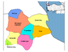
Kofçaz in Kırklareli Province of Turkey | |||||||||||||||||||||||||||
|---|---|---|---|---|---|---|---|---|---|---|---|---|---|---|---|---|---|---|---|---|---|---|---|---|---|---|---|
| Districts |
|   | |||||||||||||||||||||||||
||
Metropolitan municipalities are bolded. | |||||||||||||||||||||||||||
This geographical article about a location in Kırklareli Province, Turkey is a stub. You can help Wikipedia by expanding it. |
На других языках
[de] Kofçaz
Kofçaz (bulgarisch Кофчаз) ist eine Stadt und Hauptort des gleichnamigen Landkreises in der Provinz Kırklareli in Ostthrakien. Der Ort liegt ca. 26 km Straßenkilometer nördlich von der Provinzhauptstadt Kırklareli am Fındıklı-Bach. Die im Stadtlogo manifestierte Jahreszahl (1959) dürfte ein Hinweis auf das Jahr der Erhebung zur Stadtgemeinde (Belediye) sein.- [en] Kofçaz
[ru] Кофчаз
Кофчаз (тур. Kofçaz) — город и район в провинции Кыркларели (Турция).Другой контент может иметь иную лицензию. Перед использованием материалов сайта WikiSort.org внимательно изучите правила лицензирования конкретных элементов наполнения сайта.
WikiSort.org - проект по пересортировке и дополнению контента Википедии