world.wikisort.org - Turkey
Karaman, historically known as Laranda (Greek: Λάρανδα), is a city in south central Turkey, located in Central Anatolia, north of the Taurus Mountains, about 100 km (62 mi) south of Konya. It is the capital district of the Karaman Province. According to the 2000 census, the population of the province is 231,872 of which 132,064 live in the town of Karaman.[3][4] The district covers an area of 3,686 km2 (1,423 sq mi),[5] and the town lies at an average elevation of 1,039 m (3,409 ft). The Karaman Museum is one of the major sights.

Karaman | |
|---|---|
Municipality | |
 View from Karaman Castle | |
 Coat of arms | |
 Karaman  Karaman  Karaman  Karaman | |
| Coordinates: 37°10′55″N 33°13′05″E | |
| Country | Turkey |
| Province | Karaman |
| Government | |
| • Mayor | Savaş Kalaycı (MHP) |
| Area | |
| • District | 3,685.73 km2 (1,423.07 sq mi) |
| Population (2012)[2] | |
| • Urban | 141,630 |
| • District | 175,397 |
| • District density | 48/km2 (120/sq mi) |
| Website | https://www.karaman.bel.tr |
Etymology
The town owes its name to Karaman Bey, who was one of the rulers of the Karamanid dynasty. The former name Laranda which in turn comes from the Luwian language Larawanda, literally means "sandy, a sandy place".[6]
History

In ancient times, Karaman was known as Laranda[7] (Greek: Λάρανδα). In the 6th century BC it came under Achaemenid rule until 322 BC, when it was destroyed by Perdiccas,[7] a former general of Alexander the Great, after he had defeated Ariarathes I, king of Cappadocia.[8] It later became a seat of Isaurian pirates. At some point it was possessed by Antipater of Derbe.[9] It belonged to the Roman and later Byzantine Empires until it was captured by the Seljuks in the early 12th century. Karaman was occupied by Frederick Barbarossa in 1190[7] and by the Armenian Kingdom of Cilicia between 1211 and 1216. In 1256, the town was taken by Karaman Bey and was renamed Karaman in his honour. From 1275, Karaman was the capital of the Karamanid beylik.
In 1468 the Karamanids were conquered by the Ottomans and in 1483 the capital of the province was moved to Konya. Karaman has retained ruins of a Karamanid castle and some walls, two mosques and a Koran school (madrasah) from that age. A mihrab from a mosque from Karaman can now be found in the Çinili Pavilion near the Archeology Museum in Istanbul. The Karamans were Cappadocian Turkomans who fought the Ottomans on the side of the Comnenes, became Christian and migrated westwards.

There was a Roman Catholic titular see for the city.[10] The poet Yunus Emre (c. 1238–1320) resided in Karaman during his later years and is believed to lie buried beside the Yunus Emre Mosque. A small adjacent park is adorned with quotations from his verse, many of them graffiti-splattered. In 1222, the Sufi preacher Bahaeddin Veled arrived in town with his family, and the Karamanoğlu emir built a madrasah to accommodate them. Veled's son was the famous Rumi, who married his wife, Gevher Hatun, while his family was living in Karaman. It was here, too, that Rumi's mother died in 1224. She was buried, along with other family members, in the Aktekke Mosque (also known as the Mader-i Mevlana Cami), which Alaeddin Ali Bey had built to replace the original madrasah in 1370.[11]
When Thomas Jefferson fought Libya's Barbary pirates, he replaced one member of the al-Qaramanli dynasty with another as Pasha.
Notable people
- Nestor of Laranda, an epic poet, the father of the poet Peisander.[12]
- Peisander of Laranda an epic poet, the son of the poet Nestor.[12]
Karamanlides
The bearers of the Greek name Karamanlis as well as other surnames beginning with "Karaman" are a toponymic surname for the town.
Gallery
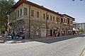 Karaman Street view
 Karaman Nefesi Sultan Medresesi monumental entrance
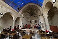 Karaman Medrese of Nefesi Sultan
 Karaman Hac Beyler Mosque Entrance
 Karaman Haci Beyler Camisi entrance
 Karaman Ibrahim Bey Imareti door
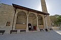 Karaman Ibrahim Bey Mosque
 Ibrahim Bey Mihrab in Çinili Köşk
 Karaman Castle Mosque and surroundings
 Karaman Castle mosque
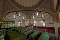 Karaman Ak Tekke interior
 Karaman Castle Exterior
 Karaman Castle Interior
 Karaman Museum Can Hasan I Pottery
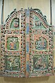 Karaman Museum Iconostasis doors
 Karaman Museum Kadın fez süsü
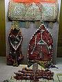 Karaman Museum Cowry shell adorned objects


Climate
Karaman has a cold semi-arid climate under Köppen climate classification (BSk) and a continental climate under the Trewartha climate classification (Dc), with hot, dry summers and cold, snowy winters. Karaman is generally very sunny, with almost 3000 hours of sunshine per year.
| Climate data for Karaman (1991–2020, extremes 1951–2020) | |||||||||||||
|---|---|---|---|---|---|---|---|---|---|---|---|---|---|
| Month | Jan | Feb | Mar | Apr | May | Jun | Jul | Aug | Sep | Oct | Nov | Dec | Year |
| Record high °C (°F) | 21.2 (70.2) |
22.3 (72.1) |
28.7 (83.7) |
32.3 (90.1) |
34.4 (93.9) |
37.5 (99.5) |
40.4 (104.7) |
40.4 (104.7) |
39.1 (102.4) |
33.2 (91.8) |
25.8 (78.4) |
22.3 (72.1) |
40.4 (104.7) |
| Average high °C (°F) | 5.6 (42.1) |
7.5 (45.5) |
12.9 (55.2) |
18.3 (64.9) |
23.7 (74.7) |
28.3 (82.9) |
31.7 (89.1) |
31.7 (89.1) |
27.7 (81.9) |
21.3 (70.3) |
13.5 (56.3) |
7.5 (45.5) |
19.1 (66.4) |
| Daily mean °C (°F) | 0.7 (33.3) |
2.1 (35.8) |
6.7 (44.1) |
11.7 (53.1) |
16.6 (61.9) |
20.8 (69.4) |
24.0 (75.2) |
23.7 (74.7) |
19.5 (67.1) |
13.8 (56.8) |
6.8 (44.2) |
2.5 (36.5) |
12.4 (54.3) |
| Average low °C (°F) | −3.4 (25.9) |
−2.7 (27.1) |
0.9 (33.6) |
5.2 (41.4) |
9.5 (49.1) |
13.3 (55.9) |
16.0 (60.8) |
15.8 (60.4) |
11.3 (52.3) |
6.7 (44.1) |
1.0 (33.8) |
−1.7 (28.9) |
6.0 (42.8) |
| Record low °C (°F) | −26.8 (−16.2) |
−28.0 (−18.4) |
−20.2 (−4.4) |
−8.3 (17.1) |
−3.1 (26.4) |
3.1 (37.6) |
6.4 (43.5) |
3.6 (38.5) |
−1.0 (30.2) |
−8.5 (16.7) |
−21.2 (−6.2) |
−26.1 (−15.0) |
−28.0 (−18.4) |
| Average precipitation mm (inches) | 41.8 (1.65) |
33.7 (1.33) |
33.6 (1.32) |
32.1 (1.26) |
34.0 (1.34) |
28.0 (1.10) |
6.7 (0.26) |
8.7 (0.34) |
9.2 (0.36) |
25.8 (1.02) |
32.9 (1.30) |
48.8 (1.92) |
335.3 (13.20) |
| Average precipitation days | 10.07 | 8.10 | 9.23 | 9.17 | 9.70 | 6.07 | 1.50 | 1.33 | 2.23 | 5.67 | 6.50 | 9.70 | 79.3 |
| Mean monthly sunshine hours | 105.4 | 130.0 | 189.1 | 234.0 | 297.6 | 342.0 | 387.5 | 356.5 | 294.0 | 229.4 | 162.0 | 99.2 | 2,826.7 |
| Mean daily sunshine hours | 3.4 | 4.6 | 6.1 | 7.8 | 9.6 | 11.4 | 12.5 | 11.5 | 9.8 | 7.4 | 5.4 | 3.2 | 7.7 |
| Source: Turkish State Meteorological Service[13] | |||||||||||||
See also
- Anatolian Tigers
References
- "Area of regions (including lakes), km²". Regional Statistics Database. Turkish Statistical Institute. 2002. Retrieved 2013-03-05.
- "Population of province/district centers and towns/villages by districts - 2012". Address Based Population Registration System (ABPRS) Database. Turkish Statistical Institute. Retrieved 2013-02-27.
- Turkish Statistical Institute. "Census 2000, Key statistics for urban areas of Turkey" (in Turkish). Archived from the original (XLS) on 2007-09-27. Retrieved 2008-03-20.
- GeoHive. "Statistical information on Turkey's administrative units". Archived from the original on 2007-10-19. Retrieved 2008-03-20.
- Statoids. "Statistical information on districts of Turkey". Retrieved 2008-04-12.
- Bilge Umar. Türkiye'deki Tarihsel Adlar. İnkılap Kitabevi, 1993. ISBN 975-10-0539-6.
- Chisholm, Hugh, ed. (1911). . Encyclopædia Britannica. Vol. 15 (11th ed.). Cambridge University Press. p. 676.
- Diodorus Siculus 18.22.1-2
- Strabo, Geography, §12.6.3
- Herbermann, Charles, ed. (1913). . Catholic Encyclopedia. New York: Robert Appleton Company.
- "Today's Zaman". Archived from the original on 2012-06-29., todayszaman.com
- Suda Encyclopedia, §nu.261
- "Resmi İstatistikler: İllerimize Ait Mevism Normalleri (1991–2020)" (in Turkish). Turkish State Meteorological Service. Retrieved 6 July 2021.
External links
Karaman in Karaman Province of Turkey | |||||||||||||||||||||||||||
|---|---|---|---|---|---|---|---|---|---|---|---|---|---|---|---|---|---|---|---|---|---|---|---|---|---|---|---|
| Districts |  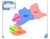 | ||||||||||||||||||||||||||
|
Metropolitan municipalities are bolded. | |||||||||||||||||||||||||||
Authority control | |
|---|---|
| General | |
| National libraries | |
На других языках
[de] Karaman (Stadt)
Karaman, früher Larende, altgriechisch Λάρανδα .mw-parser-output .Latn{font-family:"Akzidenz Grotesk","Arial","Avant Garde Gothic","Calibri","Futura","Geneva","Gill Sans","Helvetica","Lucida Grande","Lucida Sans Unicode","Lucida Grande","Stone Sans","Tahoma","Trebuchet","Univers","Verdana"}Laranda, hethitisch vielleicht Landa, ist eine türkische Stadt in Kleinasien und die Provinzhauptstadt der gleichnamigen Provinz Karaman.- [en] Karaman
[ru] Караман (город)
Караман (Ларинда) (тур. Karaman) — город и район в центральной части Южной Турции, центр турецкой провинции (вилайята) Караман. Население — 152 450 (2000, перепись).Другой контент может иметь иную лицензию. Перед использованием материалов сайта WikiSort.org внимательно изучите правила лицензирования конкретных элементов наполнения сайта.
WikiSort.org - проект по пересортировке и дополнению контента Википедии