world.wikisort.org - Russia
Magadan (Russian: Магадан, IPA: [məɡɐˈdan]) is a port town and the administrative center of Magadan Oblast, Russia, located on the Sea of Okhotsk in Nagayev Bay (within Taui Bay) and serving as a gateway to the Kolyma region.
This article's lead section may be too short to adequately summarize the key points. (June 2022) |
Magadan
Магадан | |
|---|---|
Town[1] | |
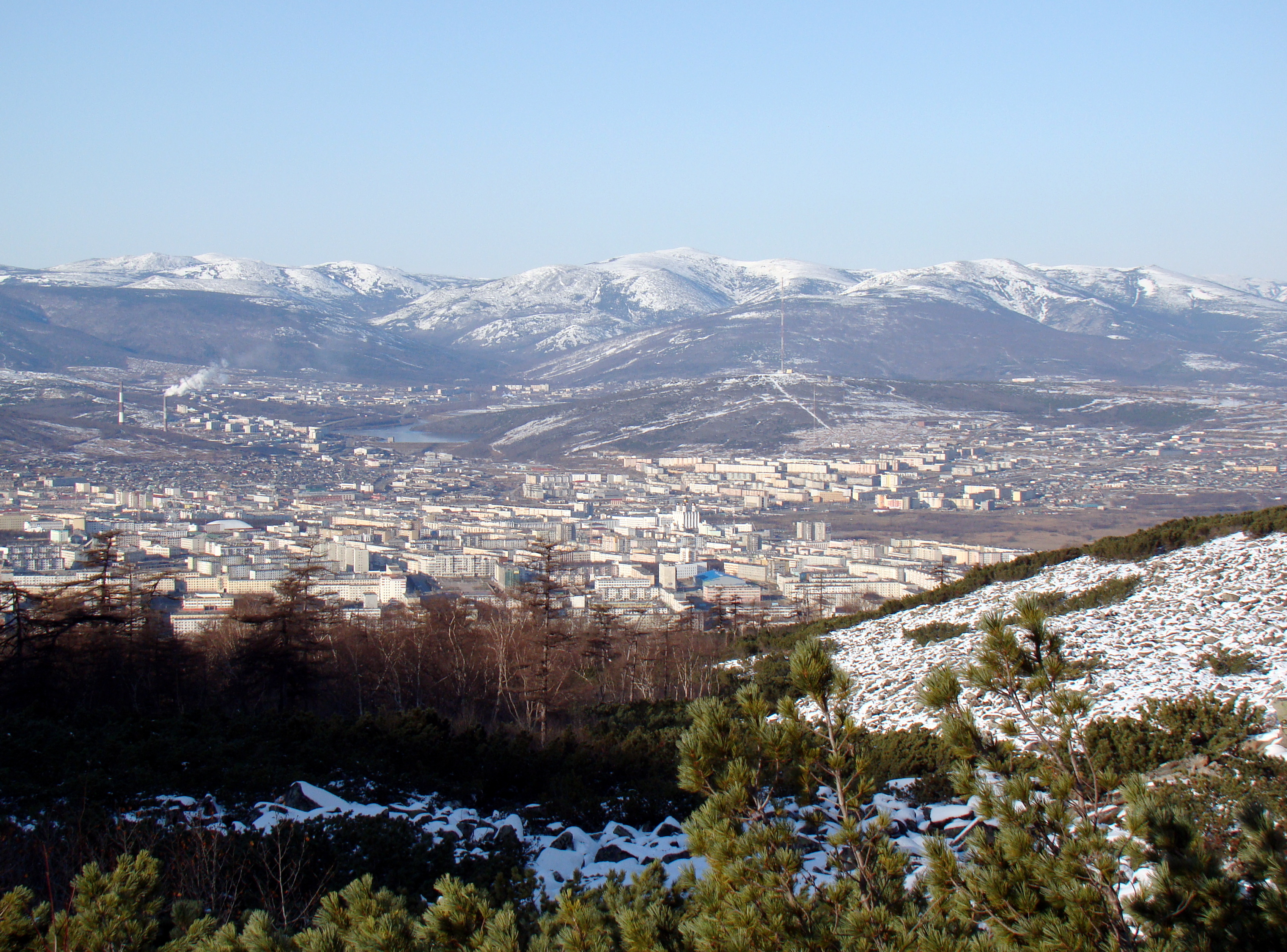 Magadan seen from the local mountains | |
 Flag  Coat of arms | |
| Anthem: none[2] | |
Location of Magadan  | |
 Magadan Location of Magadan 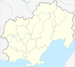 Magadan Magadan (Magadan Oblast) | |
| Coordinates: 59°34′N 150°48′E | |
| Country | Russia |
| Federal subject | Magadan Oblast[1] |
| Founded | 1929[3] |
| Town status since | July 14,[citation needed] 1939[3] |
| Government | |
| • Body | Town Duma[4] |
| • Head/Mayor[5] | Andrey Popov (Head),[6] Yuri Fyodorovich Grishan (Mayor)[7] |
| Area | |
| • Total | 295 km2 (114 sq mi) |
| Elevation | 70 m (230 ft) |
| Population | |
| • Total | 95,982 |
| • Estimate (2018)[10] | 92,782 (−3.3%) |
| • Rank | 178th in 2010 |
| • Density | 330/km2 (840/sq mi) |
Administrative status | |
| • Subordinated to | town of oblast significance of Magadan[1] |
| • Capital of | Magadan Oblast[11], town of oblast significance of Magadan[1] |
Municipal status | |
| • Urban okrug | Magadan Urban Okrug[12] |
| • Capital of | Magadan Urban Okrug[12] |
| Time zone | UTC+11 (MSK+8 |
| Postal code(s)[14] | 685000–685005, 685007, 685017, 685021, 685024, 685030–685031, 685098–685099, 685700, 685960–685961 |
| Dialing code(s) | +7 4132 |
| OKTMO ID | 44701000001 |
| Town Day | July 14; observed on the third Saturday of July[15] |
| Website | www |
History
Magadan was founded in 1930 in the Ola (river) valley,[3] near the settlement of Nagayevo. During the Stalin era, Magadan was a major transit center for political prisoners sent to slave camps. From 1932 to 1953, it was the administrative center of the Dalstroy organization—a vast slave-labor gold-mining operation and forced-labor camp system. The first director of Dalstroy was Eduard Berzin, who between 1932 and 1937 established the infrastructure of the forced labour camps in Magadan. Berzin was executed in 1938 by Stalin, towards the end of the Great Purge.[16]
The town later served as a port for exporting gold and other metals mined in the Kolyma region.[17] Its size and population grew quickly as facilities were rapidly developed for the expanding mining activities in the area. Town status was granted to it on July 14, 1939.[citation needed]
Magadan was visited by U.S. Vice President Henry Wallace in May 1944. He took an instant liking to his NKVD host, admired handiwork done by the enslaved political prisoners, and later glowingly called the town a combination of Tennessee Valley Authority and Hudson's Bay Company.[18] Wallace's collaborative stance towards the Soviet Union discouraged the Democratic Party of the United States from renominating him as vice president later in the summer of 1944, helping lead to the selection of Harry Truman in his place.
Administrative and municipal status
Magadan is the administrative center of the oblast.[1] Within the framework of administrative divisions, it is, together with the urban-type settlements of Sokol and Uptar, incorporated as the town of oblast significance of Magadan—an administrative unit with the status equal to that of the districts.[1] As a municipal division, the town of oblast significance of Magadan is incorporated as Magadan Urban Okrug.[12]
Economy and infrastructure
Transport
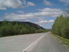 R504 Kolyma Highway near Magdan
 R504 Kolyma Highway
 Port of Magadan
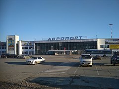
 former Train Station of Magadan-Palatka line


The Port of Magadan is second largest seaport in the North-East of the Russia after Petropavlovsk-Kamchatsky located on Nagaev Bay and Sea of Okhotsk.[19] It operates all year round with the help of icebreakers. There is currently no operating railway in Magadan. However, the Magadan-Palatka line was operational between 1941 and 1956. Russian Railways are considering the possibility of building a railway from the Nizhny Bestyakh of the Amur-Yakutsk railway to Magadan by 2035, which will contribute to the development of an area with huge mineral deposits.[20] Magadan is the final destination of the federal highway R504 Kolyma Highway, which connects the region with Yakutia and other parts of Russia. Anadyr Highway, currently under construction, will provide access to Chukotka Autonomous Okrug.[21] Sokol Airport and Magadan-13 airport provide access to air transport for numerous destinations in Russia. The former is for big aircraft and the latter is mainly for small aircraft.
Magadan is also the home of the Magadan/Sokol Flight Information Region (FIR) and Magadan Oceanic FIR, which controls the Northeastern part of the Russia and its Arctic airspace.[22][23] Most of the westbound transpacific flights from North America to Asia will use those FIRs.[24]
Economy
The principal sources of income for the local economy are gold mining and fisheries. Recently, gold production has declined.[25] Fishing production, although improving from year to year, is still well below the allocated quotas, apparently as a result of an aging fleet.[26] Other local industries include pasta and sausage plants, and a distillery.[27] Although farming is difficult owing to the harsh climate, there are many public and private farming enterprises.
Culture and religion
Culture
 Gornyak Cinema
 Pushkin Library
 Magadan Theatre
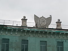 Magadan Hotel
 Polytechnic Magadan


It has a number of cultural institutions, including the Regional Museum of Anthropology, a geological museum, a regional library and a university. Magadanskaya Pravda is the main newspaper.[citation needed]
The town figures prominently in the gulag literature of Varlam Shalamov and in the eponymous song by Mikhail Krug.[citation needed] Actor of film and stage Georgiy Zhzhonov worked at Magadan Theatre for two years after being released from a gulag in May 1945.[28]
Magadan was home to Eastern Syndrome a famous Soviet and Russian rock group founded there in 1986.[citation needed]
The town was a focal point of the Long Way Round TV series of a motorcycle journey made by Ewan McGregor, Charley Boorman and their team in 2004.[citation needed]
Religion
 Church of St. Sergius of Radonezh
 holy Trinity Cathedral
 Cathedral of the Holy Spirit
 Church of the Nativity


The town has the new[when?] Orthodox Cathedral Church of the Trinity, Roman Catholic Church of the Nativity (completed in 2002 [29])
Memorials
 Magadan Coat of Arm
 Lenin monument
 Lenin monument


The Mask of Sorrow memorial, a large sculpture in memory of Stalin's victims, designed by Ernst Neizvestny. The Church of the Nativity ministers to survivors of the labor camps. It is staffed by several priests and nuns.
Sport
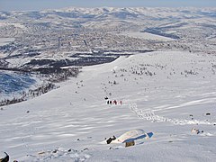 skiing in Marchekanskaya
 Magadan Palace of Sports


Geography
The Magadanka river, a 192km long river flowing to the Sea of Okhotsk passes the city. The city is located on Staritsky Peninsula on Gertner Bay and Nagaev Bay
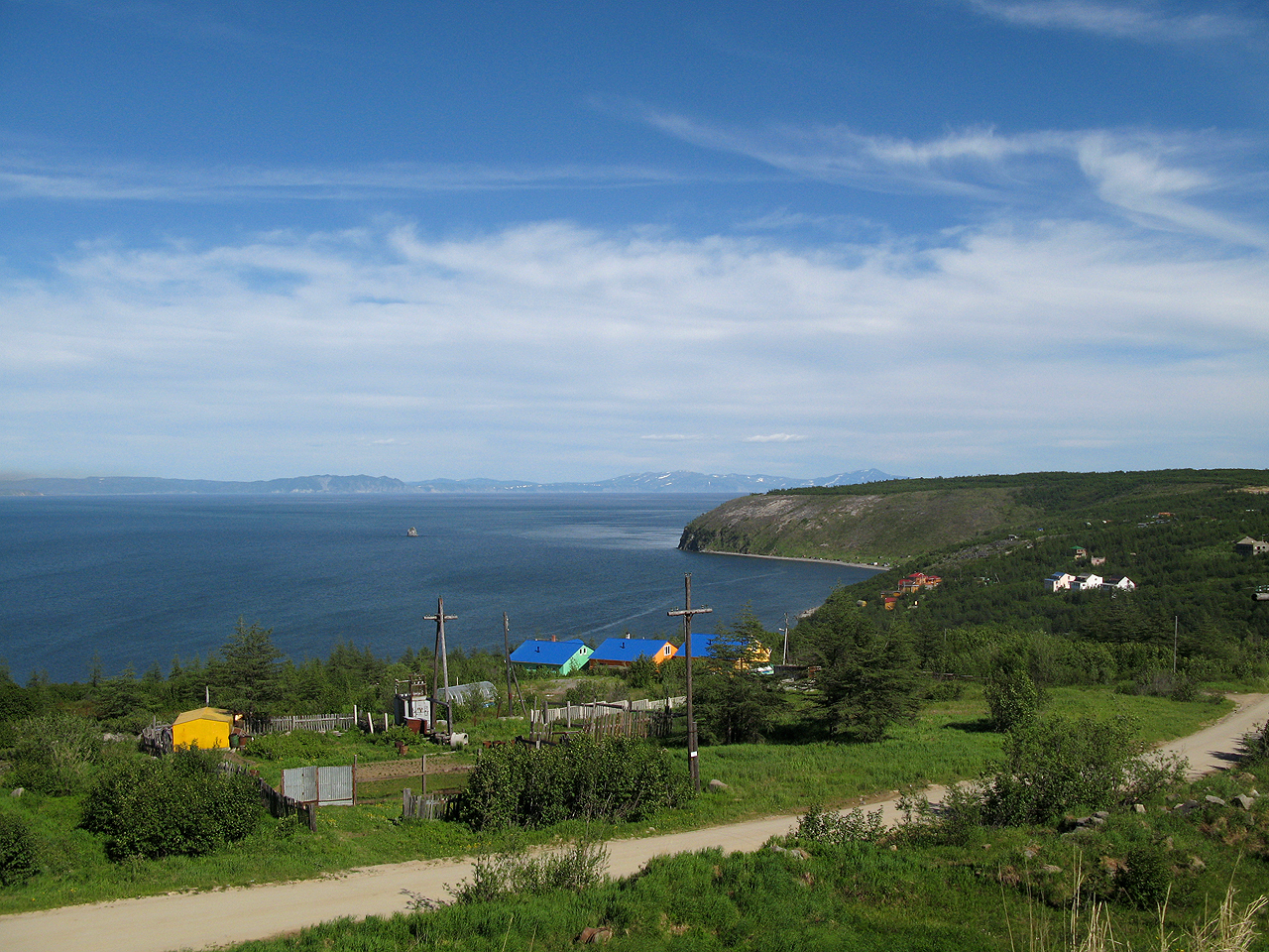
 View of Gertner Bay, Cape Red and Kekurny Island
 Nagaev Bay
 Gorokhovoe Pole
 Magadan beach, July 2011


Ecologically situated in the Northeast Siberian taiga, the town's arboreal flora is made up of conifer trees, such as firs and larches, and silver birches.[30] The city sits besides the Sea of Okhotsk in Nagayev Bay on both sides, and it is surrounded by mountains to the west and northeast. Permafrost and tundra cover most of the region. The growing season is only one hundred days long.[31]
The city of Magadan is on the same longitude as the suburbs of Greater Western Sydney, Australia, which lie on the eastern end of the 150th meridian east line, bordering the 151st meridian and is on the same latitude as Southern Scandinavia, and the far north of Scotland.
Climate
The climate of Magadan is subarctic (Köppen climate classification Dfc). Winters are prolonged and very cold, with up to six months of sub-zero high temperatures, so that the soil remains permanently frozen. Average temperatures on the coast of the Sea of Okhotsk range from −22 °C (−8 °F) in January to +12 °C (54 °F) in July. Average temperatures in the interior range from −38 °C (−36 °F) in January to +16 °C (61 °F) in July. Due to the wet nature of October and November, a snow pack is built up early, which then lasts throughout the winter even while the influence from the Siberian High lowers precipitation throughout those months.
- Highest temperature: 27.2 °C (81.0 °F) on July 8, 2015
- Lowest temperature: −37 °C (−35 °F) on December 20, 1995
- Warmest month: 14.1 °C (57.4 °F) in July, 2009
- Coldest month: −25.0 °C (−13.0 °F) in January, 1933
- Warmest year: −1.3 °C (29.7 °F) in 2017
- Coldest year: −5.0 °C (23.0 °F) in 1967
- Highest daily Precipitation: 108 millimetres (4.3 in) in July, 2014
- Wettest month: 306 millimetres (12.0 in) in July, 2014
- Wettest year: 1,004 millimetres (39.5 in) in 1950
- Driest year: 226 millimetres (8.9 in) in 1947
| Climate data for Magadan (1991–2020, extremes 1930–present) | |||||||||||||
|---|---|---|---|---|---|---|---|---|---|---|---|---|---|
| Month | Jan | Feb | Mar | Apr | May | Jun | Jul | Aug | Sep | Oct | Nov | Dec | Year |
| Record high °C (°F) | 2.4 (36.3) |
3.2 (37.8) |
5.8 (42.4) |
9.7 (49.5) |
22.3 (72.1) |
24.5 (76.1) |
27.8 (82.0) |
26.1 (79.0) |
20.2 (68.4) |
13.8 (56.8) |
6.6 (43.9) |
3.6 (38.5) |
27.8 (82.0) |
| Average high °C (°F) | −13.3 (8.1) |
−12.5 (9.5) |
−7.5 (18.5) |
−1.1 (30.0) |
5.4 (41.7) |
11.5 (52.7) |
15.1 (59.2) |
15.1 (59.2) |
10.8 (51.4) |
2.1 (35.8) |
−7 (19) |
−12.3 (9.9) |
0.5 (32.9) |
| Daily mean °C (°F) | −15.6 (3.9) |
−15.4 (4.3) |
−10.9 (12.4) |
−4.1 (24.6) |
2.2 (36.0) |
8.0 (46.4) |
12.1 (53.8) |
12.2 (54.0) |
7.8 (46.0) |
−0.7 (30.7) |
−9.5 (14.9) |
−14.5 (5.9) |
−2.4 (27.7) |
| Average low °C (°F) | −17.8 (0.0) |
−17.8 (0.0) |
−13.9 (7.0) |
−6.9 (19.6) |
−0.2 (31.6) |
5.5 (41.9) |
9.9 (49.8) |
9.9 (49.8) |
5.3 (41.5) |
−3 (27) |
−11.7 (10.9) |
−16.6 (2.1) |
−4.8 (23.4) |
| Record low °C (°F) | −34.6 (−30.3) |
−33.3 (−27.9) |
−30.8 (−23.4) |
−23.5 (−10.3) |
−10.8 (12.6) |
−3 (27) |
2.0 (35.6) |
−1 (30) |
−6.3 (20.7) |
−21.1 (−6.0) |
−26.9 (−16.4) |
−37 (−35) |
−37 (−35) |
| Average precipitation mm (inches) | 18 (0.7) |
14 (0.6) |
21 (0.8) |
24 (0.9) |
40 (1.6) |
52 (2.0) |
67 (2.6) |
102 (4.0) |
85 (3.3) |
75 (3.0) |
61 (2.4) |
27 (1.1) |
586 (23.1) |
| Average extreme snow depth cm (inches) | 26 (10) |
24 (9.4) |
25 (9.8) |
24 (9.4) |
9 (3.5) |
0 (0) |
0 (0) |
0 (0) |
0 (0) |
5 (2.0) |
23 (9.1) |
31 (12) |
31 (12) |
| Average rainy days | 0.1 | 0.3 | 0.3 | 2 | 11 | 17 | 21 | 20 | 19 | 10 | 2 | 0.1 | 103 |
| Average snowy days | 16 | 16 | 16 | 17 | 12 | 0 | 0 | 0 | 1 | 14 | 19 | 16 | 127 |
| Average relative humidity (%) | 65 | 64 | 65 | 71 | 78 | 82 | 86 | 83 | 78 | 69 | 66 | 64 | 73 |
| Mean monthly sunshine hours | 74 | 127 | 225 | 228 | 199 | 217 | 184 | 169 | 148 | 131 | 82 | 41 | 1,825 |
| Source 1: Погода и Климат[32] | |||||||||||||
| Source 2: NOAA (sun, 1961–1990)[33] | |||||||||||||
Education
- North-Eastern State University (СВГУ, formerly Northern International University)
Notable people
- Anton Belyaev (b. 1979), musician, lead singer of Therr Maitz
- Anya Garnis (b. 1982), professional dancer, raised in Magadan, but not born there.
- Nikolai Getman (1917–2004), artist
- Dimitry Ipatov (b. 1984), ski jumper
- Inna Korobkina (b. 1981), actress
- Vadim Kozin (1903–1994), tenor
- Nina Lugovskaya (1918–1993), artist
- Sasha Luss (b. 1992), fashion model
- Viktor Rybakov (b. 1956), former European amateur boxing champion
- Pavel Vinogradov (b. 1953), cosmonaut
- Yelena Vyalbe (b. 1968), Olympic cross-country skier
Twin towns and sister cities
Magadan is twinned with:
 Anchorage, United States (1991)
 Tonghua, Jilin, China (1992)
 Jelgava, Latvia (2006)
 Zlatitsa, Bulgaria (2012)
- Shuangyashan, China (2013)
References
Notes
- Law #1292-OZ
- Article 4 of the Charter of Magadan does not specify any town symbols other than a flag and a coat of arms
- Vazhenin, p. 4
- Charter of Magadan, Article 24
- Charter of Magadan, Articles 33 and 35.1
- Official website of Magadan Town Duma. Andrey Anatolyevich Popov (in Russian)
- Official website of Magadan's Mayor Office. Serey Vasilyevich Abramov Archived May 27, 2013, at the Wayback Machine, Mayor of Magadan (in Russian)
- Official website of Magadan's Mayor Office. Official Site of Magadan. Обновление материалов генерального плана 1994 г. Пояснительная записка. Archived May 13, 2013, at the Wayback Machine (in Russian)
- Russian Federal State Statistics Service (2011). Всероссийская перепись населения 2010 года. Том 1 [2010 All-Russian Population Census, vol. 1]. Всероссийская перепись населения 2010 года [2010 All-Russia Population Census] (in Russian). Federal State Statistics Service.
- http://www.gks.ru/free_doc/doc_2016/bul_dr/mun_obr2016.rar.
- Charter of Magadan Oblast, Article 38
- Law #489-OZ
- "Об исчислении времени". Официальный интернет-портал правовой информации (in Russian). June 3, 2011. Retrieved January 19, 2019.
- Почта России. Информационно-вычислительный центр ОАСУ РПО. (Russian Post). Поиск объектов почтовой связи (Postal Objects Search) (in Russian)
- Decision #49-D
- Kapuscinski, Imperium, 2019, pp. 200-204
- Козлов, А. Г. (1989). Магадан. Конспект прошлого. Магаданское книжное издательство. p. 16. ISBN 5-7581-0066-8.
- John C. Culver, John Hyde, American Dreamer: The Life and Times of Henry A. Wallace, 1 Sep 2001
- "Главная страница | Ассоциация морских торговых портов". www.morport.com. Retrieved May 5, 2022.
- "РЖД изучают возможность строительства железной дороги до Магадана". news.mail.ru. August 27, 2020. Archived from the original on August 1, 2021. Retrieved May 5, 2022.
- "Дорогу Колыма – Омсукчан – Омолон – Анадырь начали строить в Магаданской области - MagadanMedia". magadanmedia.ru. Retrieved May 5, 2022.
- "AIR TRAFFIC MANAGEMENT OPERATIONAL CONTINGENCY PLAN FOR THE ARCTIC AREA" (PDF). Federal Aviation Administration. December 9, 2011.
- "North-East Air Navigation, Magadan". GKOVD.
- "User Preferred Routes within Magadan ACC Airspace" (PDF). GKOVD. FAA. 2020.
- Russian gold mine production declined four tonnes in 2006 Archived June 20, 2017, at the Wayback Machine, Mineweb, 31 January 2007
- New Russian Fishing Quotas Distribution System, Strategis international market reports[dead link], 28 August 2004
- Magadan Region from Kommersant, Russia's Daily Online Archived October 25, 2007, at the Wayback Machine. Retrieved 22 January 2007.
- "Georgiy Zhzhonov's Russian Cross". ФОНД РУССКИЙ МИР. March 21, 2015. Archived from the original on June 5, 2015. Retrieved August 17, 2022.
- "Magadan, Russian Federation: Catholic Parish of the Nativity of Jesus". The Catholic Travel Guide. Retrieved September 7, 2020.
- Sakha Republic & Magadan Region is pine trees and rushing rivers by the Lonely Planet
- THE SEA OF OKHOTSK by the National Geographic
- "КЛИМАТ МАГАДАНА" (in Russian). Погода и Климат. Retrieved November 8, 2021.
- "Magadan Climate Normals 1961–1990". National Oceanic and Atmospheric Administration. Retrieved November 7, 2021.
Sources
- Магаданская городская Дума. Решение №96-Д от 26 августа 2005 г. «Устав муниципального образования "Город Магадан"», в ред. Решения №61-Д от 15 сентября 2017 г. «О внесении изменений в Устав муниципального образования "Город Магадан"». Вступил в силу 1 января 2006 г. (за исключением отдельных положений). Опубликован: "Вечерний Магадан", №3(861), 19 января 2006 г. (Magadan Town Duma. Decision #96-D of August 26, 2005 Charter of the Municipal Formation of the "Town of Magadan", as amended by the Decision #61-D of September 15, 2017 On Amending the Charter of the Municipal Formation of the "Town of Magadan". Effective as of January 1, 2006 (with the exception of certain clauses).).
- Магаданская городская Дума. Решение №49-Д от 1 июля 1999 г. «О установлении общегородского праздника "День города Магадана"». (Magadan Town Duma. Decision #49-D of July 1, 1999 On Establishing Town Holiday "Day of the Town of Magadan". ).
- Магаданская областная Дума. Закон №1292-ОЗ от 9 июня 2010 г. «Об административно-территориальном устройстве Магаданской области», в ред. Закона №1756-ОЗ от 9 июня 2014 г. «О внесении изменений в Закон Магаданской области "Об административно-территориальном устройстве Магаданской области"». Вступил в силу через 10 дней после дня официального опубликования. Опубликован: Приложение к газете "Магаданская правда", №63(20183), 16 июня 2010 г. (Magadan Oblast Duma. Law #1292-OZ of June 9, 2010 On the Administrative-Territorial Structure of Magadan Oblast, as amended by the Law #1756-OZ of June 9, 2014 On Amending the Law of Magadan Oblast "On the Administrative-Territorial Structure of Magadan Oblast". Effective as of the day which is 10 days after the official publication date.).
- Магаданская областная Дума. №218-ОЗ 28 декабря 2001 г. «Устав Магаданской области», в ред. Закона №2185-ОЗ от 14 июня 2017 г. «О принятии поправки к Уставу Магаданской области». Вступил в силу по истечении десяти дней со дня официального опубликования. Опубликован: "Магаданская правда", №201 (18919), 29 декабря 2001 г. (Magadan Oblast Duma. Law #218-OZ of December 28, 2001 Charter of Magadan Oblast, as amended by the Law #2185-OZ of June 14, 2017 On Adopting an Amendment to the Charter of Magadan Oblast. Effective as of the day ten days after the official publication date.).
- Магаданская областная Дума. Закон №489-ОЗ от 6 декабря 2004 г. «О муниципальном образовании "город Магадан"», в ред. Закона №1578-ОЗ от 6 марта 2013 г. «О внесении изменения в статью 3 Закона Магаданской области "О муниципальном образовании "город Магадан"». Вступил в силу 31 декабря 2004 г.. Опубликован: "Магаданская правда", №140 (19364), 15 декабря 2004 г. (Magadan Oblast Duma. Law #489-OZ of December 6, 2004 On the Municipal Formation of the "Town of Magadan", as amended by the Law #1578-OZ of March 6, 2013 On Amending Article 3 of the Law of Magadan Oblast "On the Municipal Formation of the "Town of Magadan". Effective as of December 31, 2004.).
- Ryszard Kapuscinski, Imperium, Granta, 2019, ISBN 9781783785254
- McGregor, E & Boorman, C: Long Way Round. Time Warner Books, 2004. ISBN 0-7515-3680-6
- David J. Nordlander: Origins of a Gulag Capital: Magadan and Stalinist Control in the Early 1930s, Slavic Review, Vol. 57, No. 4 (Winter, 1998), pp. 791–812
External links
 Magadan travel guide from Wikivoyage
 Media related to Magadan at Wikimedia Commons
- Б. П. Важенин (B. P. Vazhenin). "Магадан: к историческим истокам названия" (Magadan: The Historical Sources of Its Name). Российская академия наук, Дальневосточное отделение. Магадан, 2003.
- Map of Magadan (in Russian)
- Documentary *** GOLD*** - lost in Siberia GOLD - lost in Siberia / GOUD - vergeten in Siberië / ЗОЛОТО/БОЛЬ - потеряно в Сибири (1994) by Gerard Jacobs (schrijver) (author) and Theo Uittenbogaard (VPRO/The Netherlands/1994) was filmed in the summer of 1993 in Magadan, along the Road of Bones, through Ust-Umshug and Susuman and at the Sverovostok Zoloto gold mine, Siberia, by the first foreign film crew ever, visiting the Kolyma District -which had been under control of the Soviet secret service-, under the company name Dalstroj, for over 60 years.
- The road up to the Kolyma river. Documentary: repressed in Magadan recall. To watch video.
Authority control | |
|---|---|
| General | |
| National libraries | |
| Other | |
На других языках
[de] Magadan
Magadan (russisch Магадан) ist eine russische Hafenstadt in der Oblast Magadan an zwei Buchten des Ochotskischen Meeres. Die Stadt hat 95.982 Einwohner (Stand: 14. Oktober 2010).[1]- [en] Magadan
[ru] Магадан
Магада́н (ранее также рус. дореф. Магодан[5]) — город-порт на северо-востоке России. Административный центр Магаданской области, образующий городской округ город Магадан.Другой контент может иметь иную лицензию. Перед использованием материалов сайта WikiSort.org внимательно изучите правила лицензирования конкретных элементов наполнения сайта.
WikiSort.org - проект по пересортировке и дополнению контента Википедии