world.wikisort.org - Russia
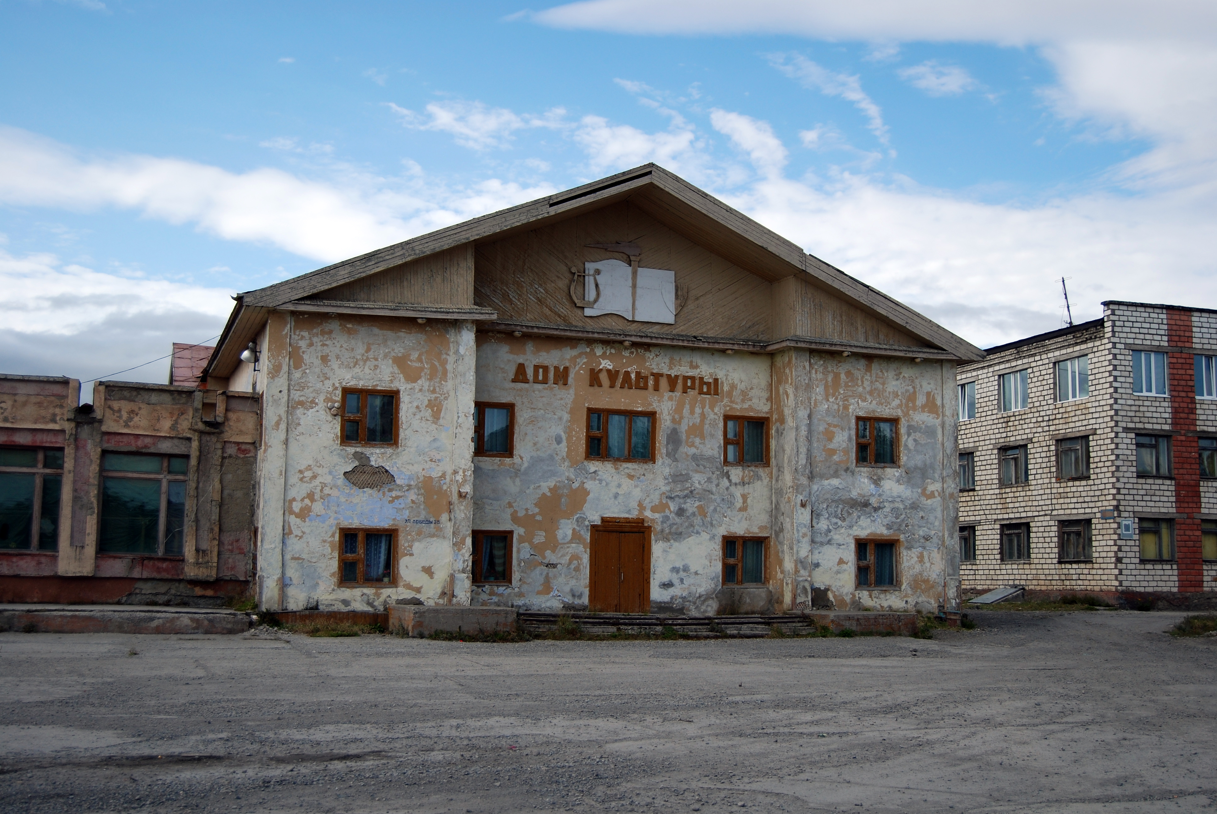
Evensk (Russian: Эвенск) is an urban-type settlement in the Severo-Evensky District, Magadan Oblast, Russia. As of 2016[update], it has a population of 1567.[5]
This article may be expanded with text translated from the corresponding article in Russian. (February 2021) Click [show] for important translation instructions.
|
This article may require cleanup to meet Wikipedia's quality standards. The specific problem is: climate table is not properly formatted. (April 2020) |
Evensk
Эвенск | |
|---|---|
Urban-type settlement | |
Location of Evensk  | |
 Evensk Location of Evensk 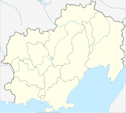 Evensk Evensk (Magadan Oblast) | |
| Coordinates: 61°55′01″N 159°13′59″E | |
| Country | Russia |
| Federal subject | Magadan Oblast |
| Administrative district | Severo-Evensky District |
| Population | |
| • Total | 1,567 |
| • Estimate (2018)[2] | 1,407 (−10.2%) |
| Time zone | UTC+11 (MSK+8 |
| Postal code(s)[4] | 686430 |
| OKTMO ID | 44707000051 |
Geography
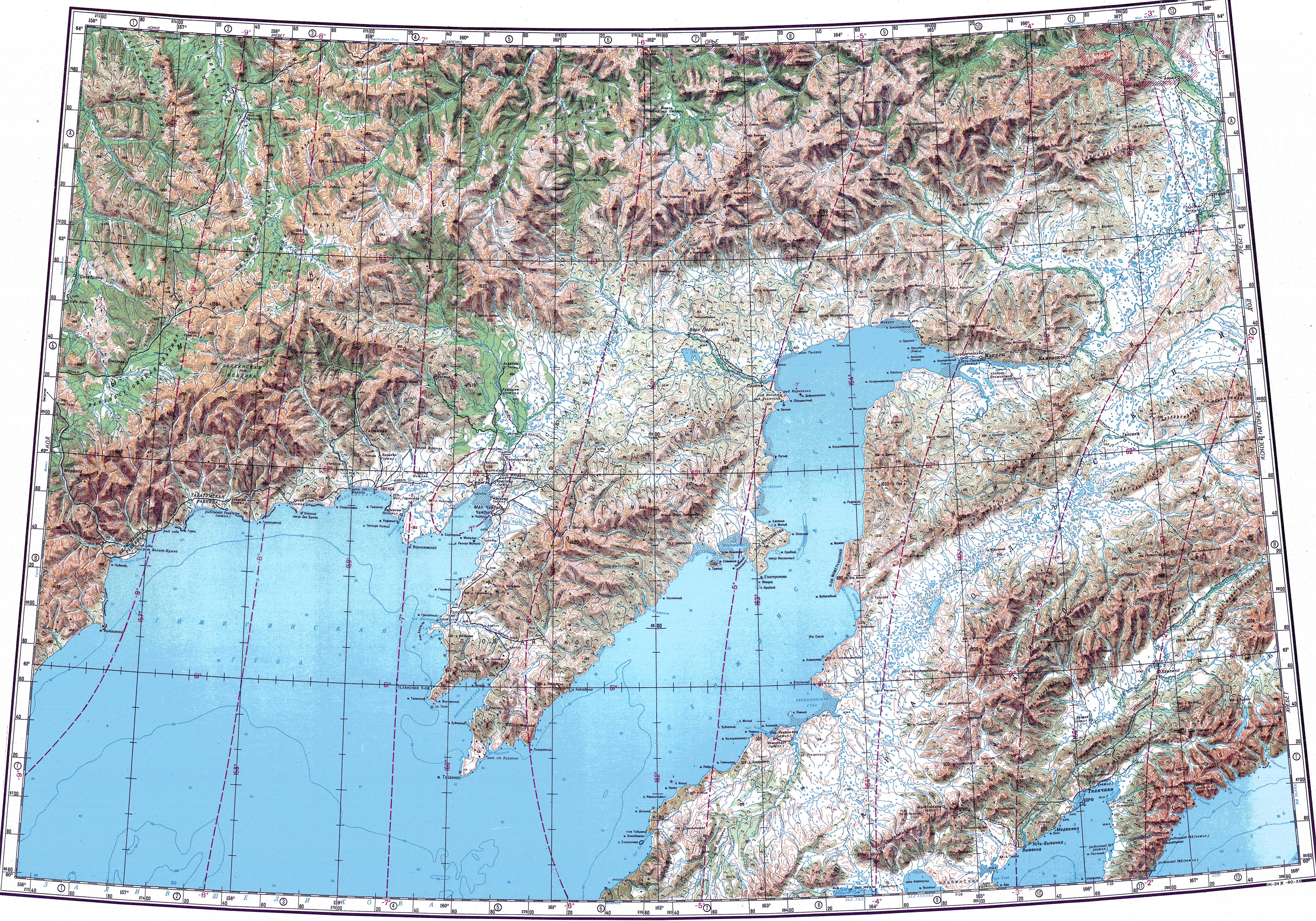
The village is located by the seashore in Gizhigin Bay of the Sea of Okhotsk.[6]
Climate
Evensk has a cold subarctic climate (Köppen climate classification Dfc), with very cold, snowy winters and rather cool, short summers. Precipitation is quite high compared to interior Siberia, and somewhat higher in summer than at other times of the year. Climate data was taken from nearby settlement of Nayakhan.
| Climate data for Evensk/Nayakhan | |||||||||||||
|---|---|---|---|---|---|---|---|---|---|---|---|---|---|
| Month | Jan | Feb | Mar | Apr | May | Jun | Jul | Aug | Sep | Oct | Nov | Dec | Year |
| Record high °C (°F) | 3.9 (39.0) |
5.0 (41.0) |
5.0 (41.0) |
7.6 (45.7) |
19.8 (67.6) |
28.0 (82.4) |
30.0 (86.0) |
27.2 (81.0) |
23.9 (75.0) |
12.2 (54.0) |
10.0 (50.0) |
3.9 (39.0) |
30.0 (86.0) |
| Average high °C (°F) | −14.4 (6.1) |
−13.7 (7.3) |
−10.4 (13.3) |
−3.8 (25.2) |
4.9 (40.8) |
12.0 (53.6) |
15.1 (59.2) |
15.1 (59.2) |
10.2 (50.4) |
−0.4 (31.3) |
−10.1 (13.8) |
−14.5 (5.9) |
−0.8 (30.5) |
| Daily mean °C (°F) | −17.8 (0.0) |
−17.4 (0.7) |
−14.8 (5.4) |
−8.4 (16.9) |
1.2 (34.2) |
7.6 (45.7) |
11.0 (51.8) |
10.7 (51.3) |
5.7 (42.3) |
−4.3 (24.3) |
−13.4 (7.9) |
−17.8 (0.0) |
−4.8 (23.4) |
| Average low °C (°F) | −21.2 (−6.2) |
−21.2 (−6.2) |
−19.2 (−2.6) |
−12.9 (8.8) |
−2.6 (27.3) |
3.1 (37.6) |
6.8 (44.2) |
6.2 (43.2) |
1.1 (34.0) |
−8.1 (17.4) |
−16.7 (1.9) |
−21.1 (−6.0) |
−8.8 (16.1) |
| Record low °C (°F) | −42.0 (−43.6) |
−38.9 (−38.0) |
−36.0 (−32.8) |
−29.0 (−20.2) |
−20.0 (−4.0) |
−5.0 (23.0) |
−0.6 (30.9) |
−8.9 (16.0) |
−8.9 (16.0) |
−24.0 (−11.2) |
−35.5 (−31.9) |
−42.0 (−43.6) |
−42.0 (−43.6) |
| Average precipitation mm (inches) | 34.8 (1.37) |
21.5 (0.85) |
30.1 (1.19) |
34.7 (1.37) |
72.7 (2.86) |
94.1 (3.70) |
68.4 (2.69) |
86.3 (3.40) |
66.1 (2.60) |
71.7 (2.82) |
50.1 (1.97) |
29.0 (1.14) |
659.5 (25.96) |
| Average precipitation days (≥ 1 mm) | 5.5 | 4.7 | 4.3 | 5.7 | 6.1 | 7.2 | 8.9 | 8.5 | 6.4 | 7.0 | 6.2 | 4.5 | 75 |
| Source: climatebase.ru[7] | |||||||||||||
See also
References
- Russian Federal State Statistics Service (2011). Всероссийская перепись населения 2010 года. Том 1 [2010 All-Russian Population Census, vol. 1]. Всероссийская перепись населения 2010 года [2010 All-Russia Population Census] (in Russian). Federal State Statistics Service.
- "26. Численность постоянного населения Российской Федерации по муниципальным образованиям на 1 января 2018 года". Federal State Statistics Service. Retrieved 23 January 2019.
- "Об исчислении времени". Официальный интернет-портал правовой информации (in Russian). 3 June 2011. Retrieved 19 January 2019.
- Почта России. Информационно-вычислительный центр ОАСУ РПО. (Russian Post). Поиск объектов почтовой связи (Postal Objects Search) (in Russian)
- Численность населения Российской Федерации по муниципальным образованиям на 1 января 2016 года [The population of the Russian Federation for municipalities on January 1, 2016] (in Russian). Retrieved December 14, 2016.
- "Топографска карта P-57_58; M 1:1 000 000 - Topographic USSR Chart (in Russian)". Retrieved 23 March 2022.
- "Nayakhan, Russia". Climatebase.ru. Retrieved 21 January 2013.
This Magadan Oblast location article is a stub. You can help Wikipedia by expanding it. |
На других языках
[de] Ewensk
Ewensk (russisch Эве́нск) ist eine Siedlung städtischen Typs in der Oblast Magadan (Russland) mit 1793 Einwohnern (Stand 14. Oktober 2010).[1]- [en] Evensk
[ru] Эвенск
Эве́нск — посёлок городского типа, административный центр Северо-Эвенского района и соответствующего ему городского округа Магаданской области России.Текст в блоке "Читать" взят с сайта "Википедия" и доступен по лицензии Creative Commons Attribution-ShareAlike; в отдельных случаях могут действовать дополнительные условия.
Другой контент может иметь иную лицензию. Перед использованием материалов сайта WikiSort.org внимательно изучите правила лицензирования конкретных элементов наполнения сайта.
Другой контент может иметь иную лицензию. Перед использованием материалов сайта WikiSort.org внимательно изучите правила лицензирования конкретных элементов наполнения сайта.
2019-2026
WikiSort.org - проект по пересортировке и дополнению контента Википедии
WikiSort.org - проект по пересортировке и дополнению контента Википедии