world.wikisort.org - Philippines
Los Baños, officially the Municipality of Los Baños (Tagalog: Bayan ng Los Baños), colloquialy 'elbi' or simply LB, is a 1st class municipality in the province of Laguna, Philippines. According to the 2020 census, it has a population of 115,353 people. [4]
Los Baños | |
|---|---|
Municipality | |
| Municipality of Los Baños | |
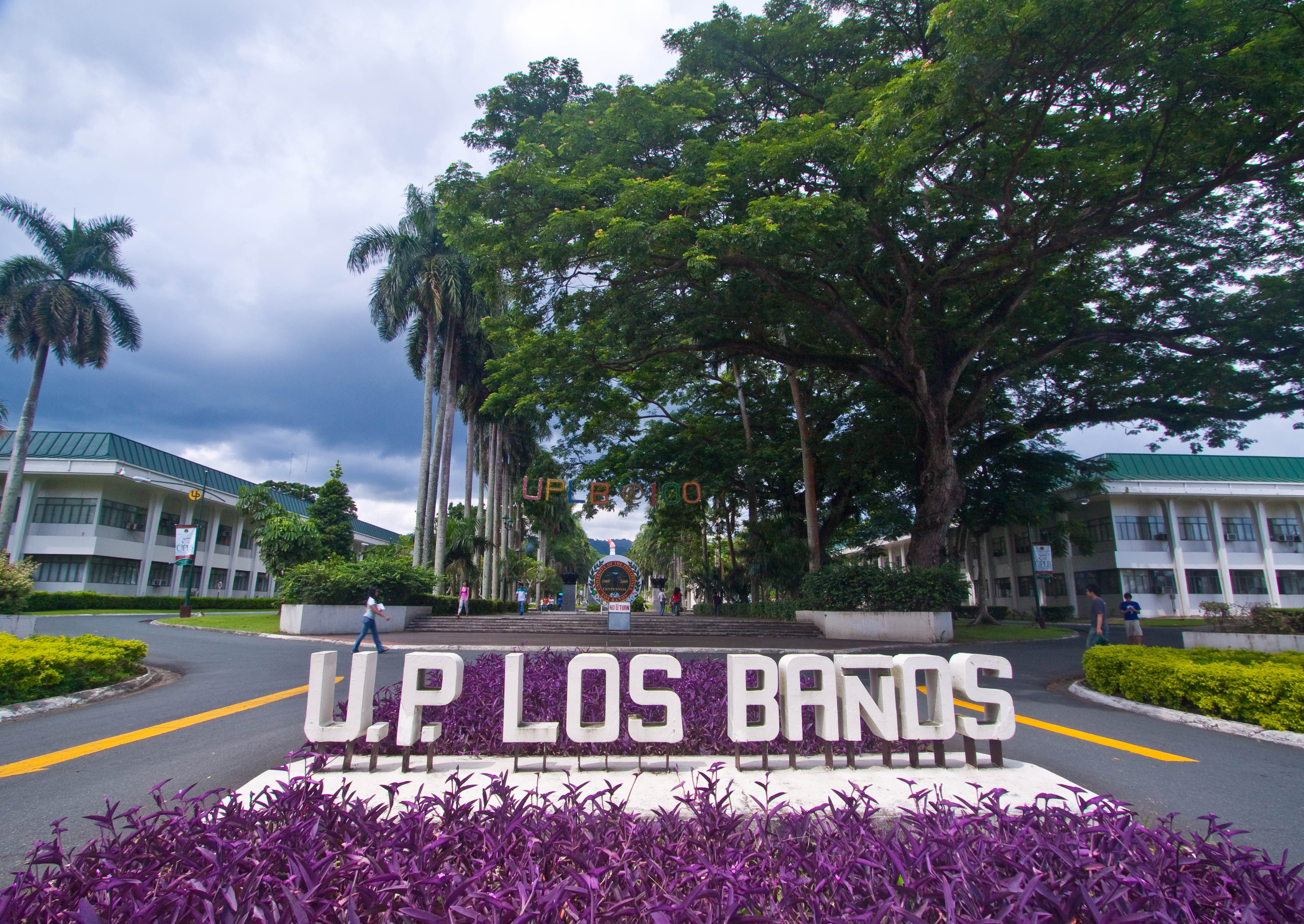
    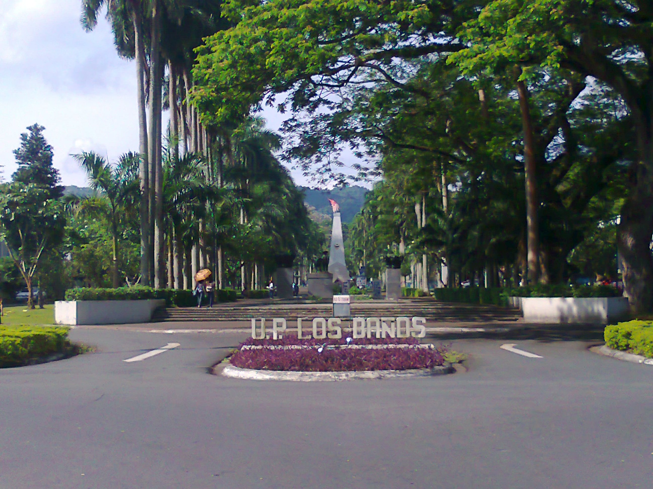 From top, left to right: Mount Makiling, welcome signage at Los Baños–Calamba boundary, Tadlac lake, Los Baños Museum, and UPLB main gate | |
 Flag  Seal | |
| Etymology: lit: The Bath or The Bathing Place | |
| Nickname(s): Special Science and Nature City[1] | |
 Map of Laguna with Los Baños highlighted | |
OpenStreetMap  | |
 Los Baños Location within the Philippines | |
| Coordinates: 14°10′N 121°13′E | |
| Country | Philippines |
| Region | Calabarzon |
| Province | Laguna |
| District | 2nd district |
| Founded | 17 September 1615 |
| Barangays | 14 (see Barangays) |
| Government | |
| • Type | Sangguniang Bayan |
| • Mayor | Anthony F. Genuino (Bigkis) |
| • Vice Mayor | Josephine S. Evangelista (Bigkis) |
| • Representative | Ruth B. Mariano-Hernandez (PDP–Laban) |
| • Municipal Council | Members |
| • Electorate | 71,941 voters (2022) |
| Area | |
| • Total | 54.22 km2 (20.93 sq mi) |
| Elevation | 118 m (387 ft) |
| Highest elevation | 1,095 m (3,593 ft) |
| Lowest elevation | 2 m (7 ft) |
| Population | |
| • Total | 115,353 |
| • Density | 2,100/km2 (5,500/sq mi) |
| • Households | 32,017 |
| Demonym | Los Bañense |
| Economy | |
| • Income class | 1st municipal income class |
| • Poverty incidence | 1.57% (2018)[5] |
| • Revenue | ₱372,043,735.06 (2020) |
| • Assets | ₱1,007,459,101.51 (2020) |
| • Expenditure | ₱278,068,187.37 (2020) |
| • Liabilities | ₱222,940,195.48 (2020) |
| Service provider | |
| • Electricity | Manila Electric Company (Meralco) |
| Time zone | UTC+8 (PST) |
| ZIP code | 4030, 4031 |
| PSGC | |
| IDD : area code | +63 (0)49 |
| Native languages | Tagalog |
| Website | losbanos |
It has a total land area of 56.5 square kilometers and is bordered on the south and south-west by Mount Makiling, on the north by Laguna de Bay., on the north-west by Calamba and on the east by the town of Bay. The town is located 63 kilometres (39 mi) southeast of Manila and is easily accessible via the South Luzon Expressway along with the Manila South Road segment of the Philippine Highway Network.
The municipality lies on the northern slopes of the long dormant volcano Mount Makiling and is known among tourists for its hot spring resorts. Los Baños also hosts two constituent universities of the University of the Philippines System: the University of the Philippines Los Baños and University of the Philippines Open University, along with other foreign and local and international research centers, such as the International Rice Research Institute, the ASEAN Center for Biodiversity, the Philippine Rice Research Institute, Philippine Carabao Center at UPLB, and SEAMEO-SEARCA, making the town a temporary home for tens of thousands of both local and foreign undergraduate and graduate students, researchers and support staff.
Los Baños was declared as the Special Science and Nature City of the Philippines through Presidential Proclamation No. 349.[6] The proclamation, however, does not convert the municipality to a city or give it corporate powers that are accorded to other cities.
Aside from its importance in academics, science and research, Los Baños is a well-known tourist destination. Because of the town's proximity to Metro Manila, Los Baños' hot spring resorts are frequent weekend or summer getaways for residents of the vast metropolis and tourists from other places in the Philippines and abroad. Tourists who visit Los Baños also come to the several native delicacies stores in the town to buy the town's famous buko pie (coconut meat pie) as well as a home-grown brand of chocolate cake.[7][8] Currently, it is Laguna's richest municipality in terms of assets amounting to Php 652.95 M.[9]
History
Precolonial and Spanish colonial period
Los Baños started as a settlement, a barrio of Bay, called Mainit, the Tagalog term for "hot", alluding to the thermal springs at the foot of Mount Makiling. By 1589, through a Franciscan friar, it became popularly called by its present name, "Los Baños", which is Spanish for "bathing place".[10]
In 1595, a temporary building made of bamboo and cogon was built to serve as shelter for the patients who journeyed to Mainit to seek cures for their ailments. It was on 17 September 1615 when the friars administered Los Baños as a separate town from Bay.[10]
In 1671, more permanent structures like churches and hospitals were built only to be destroyed by a fire in 1727. The structures were re-erected at a slow rate. The church which now stands in the municipal center of Los Baños dates back to 1851. The Spanish Governor's palace was built in 1879 but was only completed in 1892.[11]
American colonial period (1900–1946)
This section needs expansion. You can help by adding to it. (January 2022) |

In 1909, the University of the Philippines College of Agriculture (UPCA) was established.
The UPCA became a Japanese prisoner of war camp for nationals of the Allied countries, a target of Kempetai punitive measures, and the headquarters of a secret organization of guerrillas. On 23 February 1945, US forces of the First Battalion, 511th Parachute Infantry Regiment of the Eleventh Airborne Division led a combined amphibious and airborne raid against the prison camp, rescuing over 2,000 Allied nationals. They killed the 250-man Japanese garrison. In order to force the prisoners to leave behind their belongings and speed up the evacuation before the Japanese could send reinforcements, US forces and Filipino guerrillas burned the camp. Only Baker Hall, the university gymnasium until 2010, remained intact.[12]
Postwar era (1946-1965)
In 1959, the 10th World Scout Jamboree was held in Los Baños, with the theme "Building Tomorrow Today" with an attendance of 12,203 Scouts.
The International Rice Research Institute (IRRI) was established in 1960 during the administration of President Carlos P. Garcia,[13] and soon after President Diosdado Macapagal had started his term, IRRI had begun work on the development of the new “Miracle Rice” (IR8) variety, which would later increase Philippine rice production significantly.[13]
Marcos martial law era (1965-1986)
The social unrest which arose when Ferdinand Marcos' debt-driven campaign spending led to the 1969 Philippine balance of payments crisis [14][15] spread beyond the capital and also triggered protests by students in UP Los Baños, most prominently in the form of a 13-day strike which saw barricades established at the UPLB Gate and Los Baños Highway Junction areas.[16] This unrest coincided with another issue, which was the call for the UP College of Agriculture to become independent from the University of the Philippines in Diliman.[16]
When martial law was declared in September 1972, Marcos cracked down on any form of criticism or activism, leading to the arrest of many of Los Baños residents. Among those who experienced arrest and torture during martial law were the UPLB Institute of Chemistry's Dr. Aloysious Baes, while among those who became desaparecidos were Tish Ladlad, Cristina Catalla, Gerardo "Gerry" Faustino, Rizalina Ilagan, and UPLB Professor Jessica Sales. Among those confirmed to have been martyred for their beliefs was Manuel Bautista, the student leader who had spearheaded the establishment of UPLB's Textbook Exchange and Rental Center (TERC).[16][17]
In 1979, the evolution and development of academic excellence in Los Baños moved the people of Los Baños to request president Marcos to declare the municipality as "A Special University Zone", granted on 15 June 1982 by virtue of letter of instruction No. 883.
Los Baños was further declared as an "Agriculture, Forestry, and Life Sciences Community" on 17 March 1982 by virtue of Executive Order No. 784 (Section 23).
Post-EDSA revolution era
On 7 August 2000, Los Baños was declared a Special Science and Nature City of the Philippines by virtue of Presidential Proclamation 349. It was signed by then President Joseph Estrada. The Proclamation is in recognition of the town's important contribution in country. The municipality has remained as the country's hub of science and nature with the presence of national and international research institutions collaborating towards the advancement of science research.[18]
21st Century
The 6th Flora Malesiana, a triennial gathering of people with botanical expertise regarding "Malesia", was held from 20 to 24 September 2004. It provided a forum for Flora Malesiana members and encouraged publications on Malesian plants.
During the 2005 Southeast Asian Games, Los Baños played host to the aquatics events, with the newly built Trace Aquatic Center at Trace College serving as the venue.
The headquarters of the Association of Southeast Asian Nations (ASEAN) Center for Biodiversity was opened on 8 August 2006, having leased office spaces until late 2010s from the DENR-Ecosystems Research and Development Bureau, located at the College of Forestry, University of the Philippines Los Baños. It coincided with the foundation day celebrations of the organization. The Philippines assumed the Chairmanship of ASEAN in 2006 and played host to the 12th ASEAN and East Asia Summits (held in Metro Cebu, January 2007).
In January 2007, the 5th ASEAN Inter-Club Age-Group Swimming Championships was held in the Trace Aqua Sports Center.
Los Baños also plays host to the UAAP, as the Trace Aquatics Center has served as the venue for the league's swimming competitions since UAAP Season 70 until UAAP Season 76.
Currently, Los Baños is probably the densest habitat of academicians in South East Asia.[19] Although it is a small town, it has contributed widely through scientific achievements and contributions locally and worldwide particularly on agriculture.[citation needed]
On 3 December 2020, its incumbent mayor, Caesar P. Perez was assassinated by an armed assailant,[20] with a former councilor-colleague said to be the mastermind.[21]
Geography

Los Baños is nestled between two of Southern Luzon's most dominant geographical features – Mount Makiling to the south and south-west and Laguna de Bay to the north.[22] In fact, Laguna de Bay's southernmost tip is at Barangay Bambang, and Barangay Bagong Silang is already halfway up Mount Makiling. Both the mountain and the lake are volcanic features – Makiling being a potentially active volcano whose geothermal activities gave birth to the hot springs after which the town was named, and Laguna de Bay being the filled-in caldera of a massive prehistoric volcano.
Another notable geological feature is Tadlac Lake, a maar lake whose almost perfectly round shape and uncharted waters have led some locals to call it "the enchanted lake". Others call it "alligator lake", a reminder that it served as the last bastion of Laguna de Bay's once-plentiful cayman population, which has since been wiped out and is now just another legendary part of Philippine history.
Rivers
The town of Los Baños is crossed by five rivers or creeks:[22]
- The Dampalit river, which is named after an edible herb, dampalit (Sesuvium portulacastrum), which often grows near river shores, originates on the north face of Mt. Makiling east of the Philippine High School for the Arts, and feeds into Laguna lake at the boundary of Barangays Lalakay and Bambang.[22]
- The Saran creek, whose headwaters begin somewhere near the municipal dumpsite, flows through Barangay Anos near the municipal cemetery, and feeds into the lake at Barangay Malinta.
- The Pele creek, named after the pili tree (Canarium ovatum), flows through the west side of Barangay Batong Malake and has its mouth at the boundary of Barangays Malinta and Mayondon.[22]
- The Molawin River, most familiar to UPLB students because it flows through the UPLB campus and the Makiling Botanic Gardens, is named after the Molave tree (Vitex parviflora).
- The Maitim river, whose name means "black", flows through the westernmost portions of Los Baños, marking the town's boundary with its neighboring town of Bay. The Molawin and Maitim rivers merge just a few meters before feeding into Laguna de Bay at the shore of Barangay Maahas.[22]
Climate
Los Baños has a tropical monsoon climate (Köppen climate classification Am).
| Climate data for Los Baños, Laguna | |||||||||||||
|---|---|---|---|---|---|---|---|---|---|---|---|---|---|
| Month | Jan | Feb | Mar | Apr | May | Jun | Jul | Aug | Sep | Oct | Nov | Dec | Year |
| Average high °C (°F) | 26 (79) |
27 (81) |
29 (84) |
31 (88) |
31 (88) |
30 (86) |
29 (84) |
29 (84) |
29 (84) |
29 (84) |
28 (82) |
26 (79) |
29 (84) |
| Average low °C (°F) | 22 (72) |
22 (72) |
22 (72) |
23 (73) |
24 (75) |
25 (77) |
24 (75) |
24 (75) |
24 (75) |
24 (75) |
24 (75) |
23 (73) |
23 (74) |
| Average precipitation mm (inches) | 58 (2.3) |
41 (1.6) |
32 (1.3) |
29 (1.1) |
91 (3.6) |
143 (5.6) |
181 (7.1) |
162 (6.4) |
172 (6.8) |
164 (6.5) |
113 (4.4) |
121 (4.8) |
1,307 (51.5) |
| Average rainy days | 13.4 | 9.3 | 9.1 | 9.8 | 19.1 | 22.9 | 26.6 | 24.9 | 25.0 | 21.4 | 16.5 | 16.5 | 214.5 |
| Source: Meteoblue[23] | |||||||||||||
Barangays
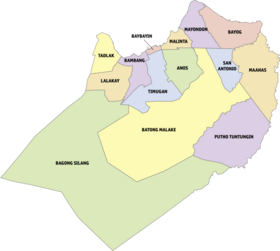

Los Baños is politically subdivided into 14 barangays.
- Anos
- Bagong Silang
- Bambang
- Batong Malake
- Baybayin
- Bayog
- Lalakay
- Maahas
- Malinta
- Mayondon
- Putho-Tuntungin
- San Antonio
- Tadlac
- Timugan
Demographics
| Year | Pop. | ±% p.a. |
|---|---|---|
| 1903 | 3,352 | — |
| 1918 | 6,337 | +4.34% |
| 1939 | 9,612 | +2.00% |
| 1948 | 10,954 | +1.46% |
| 1960 | 21,519 | +5.79% |
| 1970 | 32,167 | +4.10% |
| 1975 | 38,351 | +3.59% |
| 1980 | 49,555 | +5.26% |
| 1990 | 66,211 | +2.94% |
| 1995 | 71,683 | +1.50% |
| 2000 | 82,027 | +2.93% |
| 2007 | 98,631 | +2.58% |
| 2010 | 101,884 | +1.19% |
| 2015 | 112,008 | +1.82% |
| 2020 | 115,353 | +0.58% |
| Source: Philippine Statistics Authority [24] [25] [26][27] | ||
In the 2020 census, the population of Los Baños was 115,353 people, [4] with a density of 2,100 inhabitants per square kilometre or 5,400 inhabitants per square mile.
Economy
Tourism
- University of the Philippines Los Baños and other places of interest within its administered area
- Mount Makiling
- Makiling Botanic Gardens
- ASEAN Center for Biodiversity
- UPLB Museum of Natural History
- Flatrocks – creek usually frequented by hikers
- Mudspring – Presumed volcanic crater of Mt. Makiling
- Peak 2 – Highest peak of Mt. Makiling
- Pook ni Maria Makiling, an eco-tourism site adjacent to the Jamboree Site, National Arts Center, and U.P. Los Baños
- Boy Scouts of the Philippines and Jamboree Site – a campsite at the foot of Mount Makiling adjacent to U.P. Los Baños, which is being managed by the Boy Scouts of the Philippines and the site of the 10th World Scout Jamboree in 1959, the 1st and 12th Asia Pacific Jamboree in 1973 and 1991, and the 1st ASEAN Jamboree in 1993.
- National Arts Center – a patch of land at the foot of Mount Makiling adjacent to U.P. Los Baños, which is being managed by the Cultural Center of the Philippines and the site of the Philippine High School for the Arts, a special school for young artist scholars.
- International Rice Research Institute

International Rice Research Institute - Philippine Rice Research Institute
- Dairy Training & Research Institute
- Philippine Carabao Center at UPLB (PCC at UPLB) – conducts R&D in water buffalo; implements other programs related to water buffalo development; one of the 13 regional centers of PCC (see the link below)
- Agricultural and Life Sciences Complex
- National Institute of Molecular Biology and Biotechnology (NIMBB/BIOTECH) – UPLB
- Institute of Plant Breeding
- APEC Center for Technology Exchange and Training for Small and Medium Enterprises (ACTETSME)
- National Crop Protection Center (NCPC)
- College of Agriculture AgriPark
- Baker Hall (also known as Los Baños Internment Camp during World War II)
- Mount Makiling
- University of the Philippines Open University

University of the Philippines Open University (UPOU) - Philippine Council for Agriculture, Aquatic, and Natural Resources Research and Development (PCAARRD)
- Department of Science and Technology Regional Office for Region IV (DOST IV)
- Magnetic Hill
- Dampalit Falls
- Immaculate Conception Parish – a centuries-old church at the town proper (Poblacion/Bayan)
- Paciano Rizal Shrine – house of Paciano Rizal, brother of National Hero Jose Rizal
- Paciano Rizal Park – park dedicated to Paciano Rizal, brother of National Hero Jose Rizal
- Trace Aqua Sports Complex and Museum – aquatic sports venue for the 2005 SEA Games and Philippine Olympic Festival
- Yamashita Shrine – execution site of Gen. Homma and Gen. Yamashita


Education
There are 16 daycare schools in Los Baños, managed by DSWD and local government.
- University of the Philippines Los Baños
- University of the Philippines Open University
- Laguna State Polytechnic University (Los Baños Campus)
- Christian School International
- Maquiling School Incorporated
- Trace College
- Colegio De Los Baños
- Saint Anthony School-LB
- Los Baños National High School
- Los Baños National High School – Poblacion
- Liceo de Los Baños
- University of the Philippines Rural High School
- Los Baños Central Elementary School
- Lopez Elementary School
- Bernaldo N. Calara Elementary School
- Liceo de Los Baños
- South Hill School Inc.
- San Antonio Elementary School
- The Learning Place International
- Morning Star Montessori School Inc.
- Maranatha Elementary School
- Hasik Bagong Buhay Christian School
- Joy in Learning School
- Los Baños Faith Christian School
- Lalakay Elementary School
- Malinta Elementary School
- Mayondon Elementary School
- Tuntungin Elementary School
- Bayog Elementary School
- Tadlac Elementary School
- Bagong Silang Elementary School
Sister cities
References
- "The Special Science and Nature City | Municipality of Los Banos". losbanos.gov.ph. 23 April 2015. Retrieved 17 November 2016.
- Municipality of Los Baños | (DILG)
- "2015 Census of Population, Report No. 3 – Population, Land Area, and Population Density" (PDF). Philippine Statistics Authority. Quezon City, Philippines. August 2016. ISSN 0117-1453. Archived (PDF) from the original on 25 May 2021. Retrieved 16 July 2021.
- Census of Population (2020). "Region IV-A (Calabarzon)". Total Population by Province, City, Municipality and Barangay. PSA. Retrieved 8 July 2021.
- "PSA Releases the 2018 Municipal and City Level Poverty Estimates". Philippine Statistics Authority. 15 December 2021. Retrieved 22 January 2022.
- "Proclamation Order No. 349, s. 2000: Designating and Declaring the Municipality of Los Baños, Laguna as a Special Science and Nature City of the Philippines". Official Gazette of the Republic of the Philippines. Manila. 7 August 2000. Retrieved 26 May 2017.
- Cinco, Maricar. "In Los Baños, giant 'buko' pie steals Christmas show". Philippine Daily Inquirer. Retrieved 21 April 2020.
- "Meet the couple behind Laguna's 'famous cakes'". ABS-CBN News. ABS-CBN Broadcasting Corporation. Retrieved 3 November 2016.
- 2016 Annual Financial Report – Local Government (PDF). Vol. 1. Republic of the Philippines – Commission on Audit. 25 September 2017. Retrieved 10 September 2018.
- [dead link]
- Kirk, Kate (2001). A Guide to Los Baños for IRRI International Staff & Families. Int. Rice Res. Inst. p. 4. ISBN 9789712201608.
- Henderson, Bruce (2015). Rescue at Los Baños: The Most Darking Prison Camp Raid of World War II.
- Ganzel, Bill (2007). "The Development of "Miracle Rice" Varieties". Wessels Living History Farm. Ganzel Group. Retrieved 19 September 2017.
- Balbosa, Joven Zamoras (1992). "IMF Stabilization Program and Economic Growth: The Case of the Philippines" (PDF). Journal of Philippine Development. XIX (35).
- Diola, Camille. "Debt, deprivation and spoils of dictatorship | 31 years of amnesia". The Philippine Star. Archived from the original on 26 June 2017. Retrieved 2 May 2018.
- Pangilinan-Jamolin, Lei; Guzman, Rowena de; Yema, Dan Paolo (1 December 2020). "Experiences of selected University of the Philippines Los Banos (UPLB) community members during Martial Law in the Philippines". U.P. Los Baños Journal.
- Malay, Carolina S., 1940- (2015). Ang mamatay nang dahil sa 'yo. Ermita, Manila, Philippines. ISBN 978-971-538-270-0. OCLC 927728036.
{{cite book}}: CS1 maint: multiple names: authors list (link) - "The Special Science and Nature City". Municipality of Los Baños. Archived from the original on 29 December 2016. Retrieved 17 August 2016.
- "FACTS & FIGURES: Municipality of Los Banos". losbanos.gov.ph. Retrieved 20 November 2019.
- "Los Baños mayor shot dead inside municipal hall". Retrieved 4 December 2020.
- "Main suspect in killing of Los Baños mayor arrested in Baguio City". Retrieved 18 October 2022.
- Plan of Road Network for Municipality of Los Baños, Province of Laguna, Island of Luzon (Map). Los Baños Municipal Planning and Development Office.
- "Los Baños: Average Temperatures and Rainfall". Meteoblue. Retrieved 11 May 2020.
- Census of Population (2015). "Region IV-A (Calabarzon)". Total Population by Province, City, Municipality and Barangay. PSA. Retrieved 20 June 2016.
- Census of Population and Housing (2010). "Region IV-A (Calabarzon)". Total Population by Province, City, Municipality and Barangay. NSO. Retrieved 29 June 2016.
- Censuses of Population (1903–2007). "Region IV-A (Calabarzon)". Table 1. Population Enumerated in Various Censuses by Province/Highly Urbanized City: 1903 to 2007. NSO.
- "Province of Laguna". Municipality Population Data. Local Water Utilities Administration Research Division. Retrieved 17 December 2016.
- "Poverty incidence (PI):". Philippine Statistics Authority. Retrieved 28 December 2020.
- https://psa.gov.ph/sites/default/files/NSCB_LocalPovertyPhilippines_0.pdf; publication date: 29 November 2005; publisher: Philippine Statistics Authority.
- https://psa.gov.ph/sites/default/files/2003%20SAE%20of%20poverty%20%28Full%20Report%29_1.pdf; publication date: 23 March 2009; publisher: Philippine Statistics Authority.
- https://psa.gov.ph/sites/default/files/2006%20and%202009%20City%20and%20Municipal%20Level%20Poverty%20Estimates_0_1.pdf; publication date: 3 August 2012; publisher: Philippine Statistics Authority.
- https://psa.gov.ph/sites/default/files/2012%20Municipal%20and%20City%20Level%20Poverty%20Estima7tes%20Publication%20%281%29.pdf; publication date: 31 May 2016; publisher: Philippine Statistics Authority.
- https://psa.gov.ph/sites/default/files/City%20and%20Municipal-level%20Small%20Area%20Poverty%20Estimates_%202009%2C%202012%20and%202015_0.xlsx; publication date: 10 July 2019; publisher: Philippine Statistics Authority.
- "PSA Releases the 2018 Municipal and City Level Poverty Estimates". Philippine Statistics Authority. 15 December 2021. Retrieved 22 January 2022.
- "Sister Cities | City of Davis, CA". www.cityofdavis.org. Retrieved 11 June 2021.
{{cite web}}: CS1 maint: url-status (link)
External links
- Municipality of Los Baños official[permanent dead link]
- Los Baños History
- Philippine Standard Geographic Code
- Philippine Census Information
- Local Governance Performance Management System
Places adjacent to Los Baños, Laguna | ||||||||||||||||
|---|---|---|---|---|---|---|---|---|---|---|---|---|---|---|---|---|
| ||||||||||||||||
На других языках
[de] Los Baños (Laguna)
Los Baños ist eine Stadtgemeinde in der philippinischen Provinz Laguna. Sie liegt 63 Kilometer südöstlich von Manila und kann von dort über den South Luzon Expressway erreicht werden. Los Baños ist bekannt für seine heißen Quellen. Los Baños ist Standort der Universität der Philippinen und des International Rice Research Institute (IRRI).- [en] Los Baños, Laguna
Другой контент может иметь иную лицензию. Перед использованием материалов сайта WikiSort.org внимательно изучите правила лицензирования конкретных элементов наполнения сайта.
WikiSort.org - проект по пересортировке и дополнению контента Википедии