world.wikisort.org - Norway
Vang is a municipality in Innlandet county, Norway. It is located in the traditional district of Valdres. The administrative centre of the municipality is the village of Vang i Valdres. Other villages in Vang include Hænsgardane, Nystuen, Øye, Ryfoss, and Tyinkrysset.
Vang kommune | |
|---|---|
Municipality | |
 | |
 Flag  Coat of arms  Innlandet within Norway | |
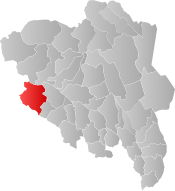 Vang within Innlandet | |
| Coordinates: 61°12′52″N 8°30′15″E | |
| Country | Norway |
| County | Innlandet |
| District | Valdres |
| Established | 1 Jan 1838 |
| • Created as | Formannskapsdistrikt |
| Administrative centre | Vang i Valdres |
| Government | |
| • Mayor (2014) | Vidar Eltun (Ap) |
| Area | |
| • Total | 1,505.46 km2 (581.26 sq mi) |
| • Land | 1,310.01 km2 (505.80 sq mi) |
| • Water | 195.45 km2 (75.46 sq mi) 13% |
| • Rank | #55 in Norway |
| Population (2022) | |
| • Total | 1,587 |
| • Rank | #298 in Norway |
| • Density | 1.2/km2 (3/sq mi) |
| • Change (10 years) | |
| Demonym | Vangsgjelding[1] |
| Official language | |
| • Norwegian form | Nynorsk |
| Time zone | UTC+01:00 (CET) |
| • Summer (DST) | UTC+02:00 (CEST) |
| ISO 3166 code | NO-3454 |
| Website | Official website |
The 1,505-square-kilometre (581 sq mi) municipality is the 55th largest by area out of the 356 municipalities in Norway. Vang is the 298th most populous municipality in Norway with a population of 1,587. The municipality's population density is 1.2 inhabitants per square kilometre (3.1/sq mi) and its population has decreased by 1.9% over the previous 10-year period.[3][4]
General information


On 1 January 1838, the prestegjeld of Vang was established as a civil municipality (see formannskapsdistrikt law). On 1 January 1882, a small area of Vang (population: 31) was transferred into the neighboring Øystre Slidre Municipality. The municipal boundaries have not changed since that time.[5]
Name
The municipality (originally the parish) is named after the old Vang farm (Old Norse: Vangr) since the first Vang Church was built here. The name is identical with the word vangr which means "field" or "meadow".[6]
Coat of arms
The coat of arms was granted on 26 June 1987. The municipal arms are based on historic descriptions and depictions of the personal arms the a local medieval nobleman Sigvat of Leirhol. He was named as one of the members of the delegation that followed King Håkon V Magnusson to Copenhagen in 1309. Later, he became the local governor of Valdres and Hallingdal (Vang is part of the Valdres region). He played a major role in the development of the region and the arms can be seen on different places, including in the local Vang Church.[7] [8]
Churches
The Church of Norway has four parishes (sokn) within the municipality of Vang. It is part of the Valdres prosti (deanery) in the Diocese of Hamar.
| Parish (sokn) | Church name | Location of the church | Year built |
|---|---|---|---|
| Heensåsen | Heensåsen Church | Hænsgardane | 1902 |
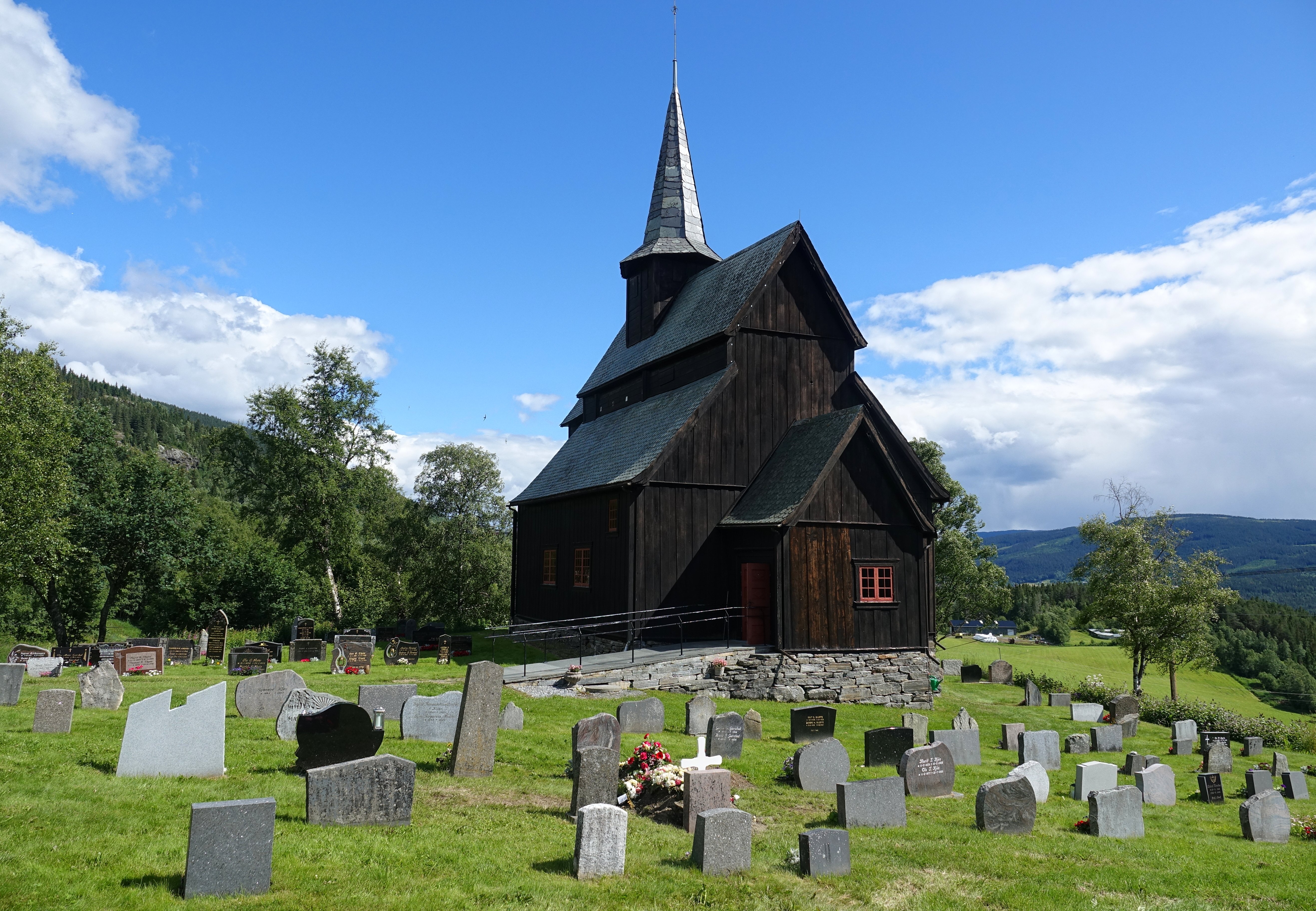
| Høre | Høre Stave Church | near Ryfoss | 1180 |
| Vang | Vang Church | Vang i Valdres | 1840 |
| Øye | Øye Church | Øye | 1747 |
| Øye Stave Church | Øye | 1965 | |
| St. Thomas Church | Nystuen | 1971 |
History

| Ancestry | Number |
|---|---|
| 55 | |
| 44 | |
| 25 |
Vang, like the rest of Valdres, was originally populated by migrants from Vestlandet. In 1153, recognizing this, Cardinal Breakspear included these valleys in the Diocese of Stavanger.[10]
The ancient Vang Church was the site of a legal court (thing) held by King Haakon VI in 1368. Here, he settled a boundary dispute. The boundary stone which resulted stands to this day.[10]
High up the slopes of Filefjell is the site of Nystuen, where travellers found refuge as they passed across the divide into Vestlandet. On the other side of the pass, Maristua was erected at the direction of Queen Margaret circa 1390. Although Nystuen is first mentioned in 1627, it is undoubtedly older. These refuges were maintained by the state until 1830.[10]
Smeddalen (Smith's Valley) immediately to the west of Nystuen, was for centuries the site of the church of St. Thomas på Filefjell. The earliest reference to it is in 1615, but it was apparently a stave church, so would have been much older. According to F.N. Stagg "It was reconditioned (c. 1615)… the priest at Vang preached there once a year–on July 2nd… many sought cures for their ailments in the miraculous powers possessed by splinters from its timbers…"[10] A market grew up near the church as a result of the 2 July service. "Horses were traded, races run, heavy drinking indulged in and many a fight ensued."[10] Markets continued to be held near the church until the 19th century, but as a result of fighting and general unrest in connection with the market days the church was torn down in 1808. A new church was built on the site in 1971.[10]
Government
All municipalities in Norway, including Vang, are responsible for primary education (through 10th grade), outpatient health services, senior citizen services, unemployment and other social services, zoning, economic development, and municipal roads. The municipality is governed by a municipal council of elected representatives, which in turn elects a mayor.[11] The municipality falls under the Vestre Innlandet District Court and the Eidsivating Court of Appeal.
Municipal council
The municipal council (Kommunestyre) of Vang is made up of 17 representatives that are elected to four year terms. The party breakdown of the council is as follows:
| Party Name (in Nynorsk) | Number of representatives | |
|---|---|---|
| Labour Party (Arbeidarpartiet) | 9 | |
| Green Party (Miljøpartiet Dei Grøne) | 1 | |
| Centre Party (Senterpartiet) | 4 | |
| Local list in Vang (Bygdelista i Vang) | 3 | |
| Total number of members: | 17 | |
| Party Name (in Nynorsk) | Number of representatives | |
|---|---|---|
| Labour Party (Arbeidarpartiet) | 7 | |
| Green Party (Miljøpartiet Dei Grøne) | 1 | |
| Centre Party (Senterpartiet) | 7 | |
| Local list in Vang (Bygdelista i Vang) | 2 | |
| Total number of members: | 17 | |
| Party Name (in Nynorsk) | Number of representatives | |
|---|---|---|
| Labour Party (Arbeidarpartiet) | 9 | |
| Conservative Party (Høgre) | 2 | |
| Centre Party (Senterpartiet) | 5 | |
| Local list in Vang (Bygdelista i Vang) | 1 | |
| Total number of members: | 17 | |
| Party Name (in Nynorsk) | Number of representatives | |
|---|---|---|
| Labour Party (Arbeidarpartiet) | 4 | |
| Conservative Party (Høgre) | 2 | |
| Centre Party (Senterpartiet) | 8 | |
| Local list (Bygdelista) | 3 | |
| Total number of members: | 17 | |
| Party Name (in Nynorsk) | Number of representatives | |
|---|---|---|
| Labour Party (Arbeidarpartiet) | 3 | |
| Conservative Party (Høgre) | 2 | |
| Centre Party (Senterpartiet) | 8 | |
| Local list (Bygdelista) | 4 | |
| Total number of members: | 17 | |
| Party Name (in Nynorsk) | Number of representatives | |
|---|---|---|
| Labour Party (Arbeidarpartiet) | 2 | |
| Conservative Party (Høgre) | 1 | |
| Centre Party (Senterpartiet) | 8 | |
| Local list (Bygdelista) | 6 | |
| Total number of members: | 17 | |
| Party Name (in Nynorsk) | Number of representatives | |
|---|---|---|
| Labour Party (Arbeidarpartiet) | 5 | |
| Conservative Party (Høgre) | 1 | |
| Centre Party (Senterpartiet) | 11 | |
| Total number of members: | 17 | |
| Party Name (in Nynorsk) | Number of representatives | |
|---|---|---|
| Labour Party (Arbeidarpartiet) | 5 | |
| Conservative Party (Høgre) | 2 | |
| Christian Democratic Party (Kristeleg Folkeparti) | 1 | |
| Centre Party (Senterpartiet) | 9 | |
| Total number of members: | 17 | |
| Party Name (in Nynorsk) | Number of representatives | |
|---|---|---|
| Labour Party (Arbeidarpartiet) | 6 | |
| Conservative Party (Høgre) | 2 | |
| Christian Democratic Party (Kristeleg Folkeparti) | 1 | |
| Centre Party (Senterpartiet) | 8 | |
| Total number of members: | 17 | |
| Party Name (in Nynorsk) | Number of representatives | |
|---|---|---|
| Labour Party (Arbeidarpartiet) | 5 | |
| Conservative Party (Høgre) | 4 | |
| Christian Democratic Party (Kristeleg Folkeparti) | 1 | |
| Centre Party (Senterpartiet) | 7 | |
| Total number of members: | 17 | |
| Party Name (in Nynorsk) | Number of representatives | |
|---|---|---|
| Labour Party (Arbeidarpartiet) | 5 | |
| Conservative Party (Høgre) | 3 | |
| Christian Democratic Party (Kristeleg Folkeparti) | 2 | |
| Centre Party (Senterpartiet) | 7 | |
| Total number of members: | 17 | |
| Party Name (in Nynorsk) | Number of representatives | |
|---|---|---|
| Labour Party (Arbeidarpartiet) | 3 | |
| Christian Democratic Party (Kristeleg Folkeparti) | 1 | |
| Centre Party (Senterpartiet) | 7 | |
| Non-party list (Upolitisk liste) | 5 | |
| Free voters (Frie velgere) | 1 | |
| Total number of members: | 17 | |
| Party Name (in Nynorsk) | Number of representatives | |
|---|---|---|
| Labour Party (Arbeidarpartiet) | 4 | |
| Local List(s) (Lokale lister) | 13 | |
| Total number of members: | 17 | |
| Party Name (in Nynorsk) | Number of representatives | |
|---|---|---|
| Labour Party (Arbeidarpartiet) | 2 | |
| Centre Party (Senterpartiet) | 3 | |
| Joint List(s) of Non-Socialist Parties (Borgarlege Felleslister) | 3 | |
| Local List(s) (Lokale lister) | 9 | |
| Total number of members: | 17 | |
| Party Name (in Nynorsk) | Number of representatives | |
|---|---|---|
| Labour Party (Arbeidarpartiet) | 4 | |
| Conservative Party (Høgre) | 1 | |
| Centre Party (Senterpartiet) | 5 | |
| Local List(s) (Lokale lister) | 7 | |
| Total number of members: | 17 | |
| Party Name (in Nynorsk) | Number of representatives | |
|---|---|---|
| Labour Party (Arbeidarpartiet) | 4 | |
| List of workers, fishermen, and small farmholders (Arbeidarar, fiskarar, småbrukarar liste) | 3 | |
| Joint List(s) of Non-Socialist Parties (Borgarlege Felleslister) | 10 | |
| Total number of members: | 17 | |
| Party Name (in Nynorsk) | Number of representatives | |
|---|---|---|
| Labour Party (Arbeidarpartiet) | 4 | |
| Joint List(s) of Non-Socialist Parties (Borgarlege Felleslister) | 7 | |
| Local List(s) (Lokale lister) | 6 | |
| Total number of members: | 17 | |
| Party Name (in Nynorsk) | Number of representatives | |
|---|---|---|
| Labour Party (Arbeidarpartiet) | 3 | |
| List of workers, fishermen, and small farmholders (Arbeidarar, fiskarar, småbrukarar liste) | 1 | |
| Joint List(s) of Non-Socialist Parties (Borgarlege Felleslister) | 7 | |
| Local List(s) (Lokale lister) | 5 | |
| Total number of members: | 16 | |
| Party Name (in Nynorsk) | Number of representatives | |
|---|---|---|
| Labour Party (Arbeidarpartiet) | 2 | |
| Joint List(s) of Non-Socialist Parties (Borgarlege Felleslister) | 10 | |
| Local List(s) (Lokale lister) | 4 | |
| Total number of members: | 16 | |
| Party Name (in Nynorsk) | Number of representatives | |
|---|---|---|
| Labour Party (Arbeidarpartiet) | 4 | |
| Local List(s) (Lokale lister) | 12 | |
| Total number of members: | 16 | |
| Party Name (in Nynorsk) | Number of representatives | |
|---|---|---|
| Labour Party (Arbeidarpartiet) | 3 | |
| Farmers' Party (Bondepartiet) | 9 | |
| List of workers, fishermen, and small farmholders (Arbeidarar, fiskarar, småbrukarar liste) | 1 | |
| Joint List(s) of Non-Socialist Parties (Borgarlege Felleslister) | 3 | |
| Total number of members: | 16 | |
| Note: Due to the German occupation of Norway during World War II, no elections were held for new municipal councils until after the war ended in 1945. | ||
Mayor
The mayors of Vang (incomplete list):
- 1976–1995: Erling Øraker (Sp)
- 1996-2011: Knut Haalien (Sp)
- 2011-present: Vidar Eltun (Ap)
Geography

Vang is bordered to the north by the municipalities of Lom and Vågå, to the east by Øystre Slidre, to the southeast by Vestre Slidre, to the south by Hemsedal (in Viken county), and to the west by Lærdal and Årdal (in Vestland county).
Vang is part of the Valdres region in central, southern Norway. This region is situated between the Gudbrandsdal and Hallingdal valleys.
Vang municipality is 56 kilometres (35 mi) on a north–south axis and 47.3 kilometres (29.4 mi) on an east–west axis. The highest point is Kalvehøgde with a height of 2,208 metres (7,244.1 ft) above sea level.
Three-quarters of the region is above 900 metres (3,000 ft). About 13 percent of the municipality is covered by water, including Lakes Fleinsendin, Slettningen and Vangsmjøsa. The lowest point is 363 metres (1,191 ft) above sea level. The river Begna has its headwaters in the Filefjell area of Vang.
Attractions
- The Vang stone
- The Ryfossen waterfall
- The Sputrefossen waterfall
Gallery
 St. Thomas Church
 Highway E16
 Lake Vangsmjøsa
 Tyin lake


Trivia
The Veblen and Bunde farmsteads were the homes of the parents of Thorstein Bunde Veblen, from where they emigrated a year before the birth of their son.
Notable people
- Christopher Andreas Holmboe (1796 in Vang – 1882) a philologist, orientalist and numismatist
- Johannes Belsheim (1829 in Thorpegardane – 1909) a teacher, priest, translator and biographer
- Nils Nilsen Thune (1880 in Vang – 1950) a Norwegian jurist and civil servant
- Torstein Høverstad (1880 in Vang – 1959) an educator, teacher educator, school historian and government scholar
References
- "Navn på steder og personer: Innbyggjarnamn" (in Norwegian). Språkrådet.
- "Forskrift om målvedtak i kommunar og fylkeskommunar" (in Norwegian). Lovdata.no.
- Statistisk sentralbyrå (2022). "Table: 06913: Population 1 January and population changes during the calendar year (M)" (in Norwegian).
- Statistisk sentralbyrå (2022). "09280: Area of land and fresh water (km²) (M)" (in Norwegian).
- Jukvam, Dag (1999). "Historisk oversikt over endringer i kommune- og fylkesinndelingen" (PDF) (in Norwegian). Statistisk sentralbyrå.
- Rygh, Oluf (1900). Norske gaardnavne: Kristians amt (Anden halvdel) (in Norwegian) (4 ed.). Kristiania, Norge: W. C. Fabritius & sønners bogtrikkeri. pp. 308 & 313.
- "Civic heraldry of Norway - Norske Kommunevåpen". Heraldry of the World. Retrieved 1 September 2022.
- "Vang Municipality". GoNorway.com. Retrieved 3 January 2009.
- "Immigrants and Norwegian-born to immigrant parents, by immigration category, country background and percentages of the population". ssb.no. Archived from the original on 2 July 2015. Retrieved 29 June 2015.
- Stagg, Frank Noel (1956). East Norway and its Frontier. George Allen & Unwin, Ltd.
- Hansen, Tore, ed. (12 May 2016). "kommunestyre". Store norske leksikon (in Norwegian). Kunnskapsforlaget. Retrieved 30 January 2022.
- "Tall for Norge: Kommunestyrevalg 2019 - Innlandet". Valg Direktoratet. Retrieved 1 September 2022.
- "Tall for Norge: Kommunestyrevalg 2015 - Innlandet". Valg Direktoratet.
- "Table: 04813: Members of the local councils, by party/electoral list at the Municipal Council election (M)" (in Norwegian). Statistics Norway.
- "Tall for Norge: Kommunestyrevalg 2011 - Innlandet". Valg Direktoratet.
- "Kommunestyrevalget 1999" (PDF) (in Norwegian). Oslo-Kongsvinger, Norge: Statistisk sentralbyrå. 2000. ISBN 8253748531. ISSN 0332-8023.
- "Kommunestyrevalget 1995" (PDF) (in Norwegian). Oslo-Kongsvinger, Norge: Statistisk sentralbyrå. 1996. ISBN 8253743351. ISSN 0332-8023.
- "Kommunestyrevalget 1991" (PDF) (in Norwegian). Oslo-Kongsvinger, Norge: Statistisk sentralbyrå. 1993. ISBN 8253737939. ISSN 0332-8023.
- "Kommunestyrevalget 1987" (PDF) (in Norwegian). Oslo-Kongsvinger, Norge: Statistisk sentralbyrå. 1988. ISBN 8253726325. ISSN 0332-8023.
- "Kommunestyrevalget 1983" (PDF) (in Norwegian). Oslo-Kongsvinger, Norge: Statistisk sentralbyrå. 1984. ISBN 8253720378. ISSN 0332-8023.
- "Kommunestyrevalget 1979" (PDF) (in Norwegian). Oslo, Norge: Statistisk sentralbyrå. 1979. ISBN 8253710836. ISSN 0332-8023.
- "Kommunevalgene 1975" (PDF) (in Norwegian). Oslo, Norge: Statistisk sentralbyrå. 1977. ISBN 8253705646.
- "Kommunevalgene 1972" (PDF) (in Norwegian). Oslo, Norge: Statistisk sentralbyrå. 1973. ISBN 8253701144.
- "Kommunevalgene 1967" (PDF) (in Norwegian). Oslo, Norge: Statistisk sentralbyrå. 1967.
- "Kommunevalgene 1963" (PDF) (in Norwegian). Oslo, Norge: Statistisk sentralbyrå. 1964.
- "Kommunevalgene og Ordførervalgene 1959" (PDF) (in Norwegian). Oslo, Norge: Statistisk sentralbyrå. 1960.
- "Kommunevalgene og Ordførervalgene 1955" (PDF) (in Norwegian). Oslo, Norge: Statistisk sentralbyrå. 1957.
- "Kommunevalgene og Ordførervalgene 1951" (PDF) (in Norwegian). Oslo: Statistisk sentralbyrå. 1952.
- "Kommunevalgene og Ordførervalgene 1947" (PDF) (in Norwegian). Oslo: Statistisk sentralbyrå. 1948.
- "Kommunevalgene og Ordførervalgene 1945" (PDF) (in Norwegian). Oslo: Statistisk sentralbyrå. 1947.
- "Kommunevalgene og Ordførervalgene 1937" (PDF) (in Norwegian). Oslo: Statistisk sentralbyrå. 1938.
External links
- Municipal fact sheet from Statistics Norway (in Norwegian)
- Municipal site (in Norwegian)
Innlandet county, Norway | |||||||||||||||||||||
|---|---|---|---|---|---|---|---|---|---|---|---|---|---|---|---|---|---|---|---|---|---|
| |||||||||||||||||||||
 | Towns and cities |
|  | ||||||||||||||||||
| Municipalities |
| ||||||||||||||||||||
| Authority control |
|
|---|
На других языках
[de] Vang
Vang (oft zur besseren Unterscheidung auch Vang i Valdres) ist eine Kommune in der norwegischen Provinz Innlandet. Sie hat eine Fläche von 1.505 km² mit einer Nord-Süd-Ausdehnung von 56 km und einer Ost-West-Ausdehnung von 47,3 km (Wasser miteingerechnet 47,6 km). Bei einer Einwohnerzahl von 1587 (Stand 1. Januar 2022) beträgt die Bevölkerungsdichte 1,05 Einwohner pro Quadratkilometer.- [en] Vang, Innlandet
[ru] Ванг (коммуна)
Ванг (норв. Vang i Valdres) — коммуна в губернии Оппланн в Норвегии. Административный центр коммуны — город Ванг. Официальный язык коммуны — нюнорск. Население коммуны на 2007 год составляло 1582 чел. Площадь коммуны Ванг — 1505,24 км², код-идентификатор — 0545.Другой контент может иметь иную лицензию. Перед использованием материалов сайта WikiSort.org внимательно изучите правила лицензирования конкретных элементов наполнения сайта.
WikiSort.org - проект по пересортировке и дополнению контента Википедии