world.wikisort.org - Norway
Sel is a municipality in Innlandet county, Norway. It is located in the traditional district of Gudbrandsdal. The administrative centre of the municipality is the town of Otta. The municipality also includes several notable villages including Bjølstad, Dale, Høvringen, Nord-Sel, Sandbumoen, Sjoa, and Skogbygda.
Sel kommune | |
|---|---|
Municipality | |
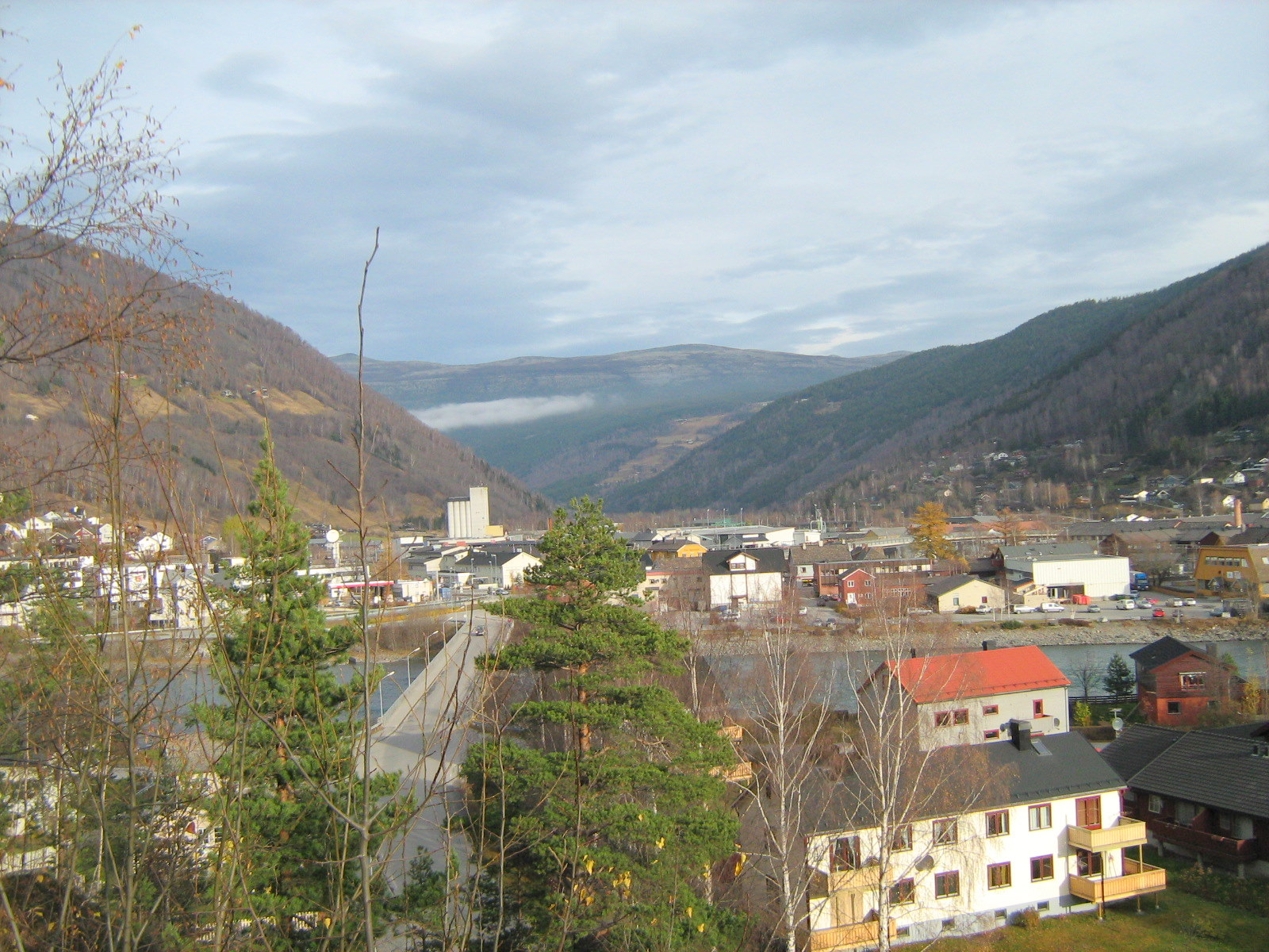 View of the town of Otta | |
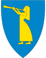 Coat of arms  Innlandet within Norway | |
 Sel within Innlandet | |
| Coordinates: 61°49′1″N 9°34′24″E | |
| Country | Norway |
| County | Innlandet |
| District | Gudbrandsdal |
| Established | 1 Jan 1908 |
| • Preceded by | Vågå Municipality |
| Administrative centre | Otta |
| Government | |
| • Mayor (2019) | Eldri Siem (Sp) |
| Area | |
| • Total | 905.05 km2 (349.44 sq mi) |
| • Land | 888.48 km2 (343.04 sq mi) |
| • Water | 16.57 km2 (6.40 sq mi) 1.8% |
| • Rank | #130 in Norway |
| Population (2022) | |
| • Total | 5,531 |
| • Rank | #172 in Norway |
| • Density | 6.2/km2 (16/sq mi) |
| • Change (10 years) | |
| Demonym | Selvær[1] |
| Official language | |
| • Norwegian form | Neutral |
| Time zone | UTC+01:00 (CET) |
| • Summer (DST) | UTC+02:00 (CEST) |
| ISO 3166 code | NO-3437 |
| Website | Official website |
The 905-square-kilometre (349 sq mi) municipality is the 130th largest by area out of the 356 municipalities in Norway. Sel is the 172nd most populous municipality in Norway with a population of 5,531. The municipality's population density is 6.2 inhabitants per square kilometre (16/sq mi) and its population has decreased by 7.7% over the previous 10-year period.[3][4]
General information
The new municipality of Sel was established on 1 January 1908 when Vågå Municipality was divided into three. The northeastern part became the new Sel Municipality (population: 2,287), the southeastern part became the new Heidal Municipality (population: 1,241) and the western part continued as Vågå Municipality (population: 2,953). During the 1960s, there were many municipal mergers across Norway due to the work of the Schei Committee. On 1 January 1965, the municipality of Heidal (population: 1,731) was dissolved and it was merged with the neighboring municipality of Sel (population: 3,687) along with the Tolstadåsen area of Vågå Municipality (population: 35) and the Sjoa area of Nord-Fron Municipality (population: 413) to form a new, larger Sel Municipality.[5]
Name
The municipality (originally the parish) is named after the old Sel farm (Old Norse: Sil), since the first Sel Church was built there. This farm is located in the present-day village of Nord-Sel. The name is identical with the word sil which means "slowly running and quiet part of a river" (here meaning the Gudbrandsdalslågen river).[6]
Coat of arms
The coat of arms was granted on 18 May 1985. The arms show a gold-colored girl playing a trumpet on a blue background. The image is based on the local Prillar-Guri legend. In 1612, a Scottish army marched through the area on its way to Sweden. They were stopped by the local farmers at the Battle of Kringen. The legend tells that the farmers were warned for the Scots by a local girl with a trumpet.[7]
Churches
The Church of Norway has three parishes (sokn) within the municipality of Sel. It is part of the Nord-Gudbrandsdal prosti (deanery) in the Diocese of Hamar.
| Parish (sokn) | Church name | Location of the church | Year built |
|---|---|---|---|
| Heidal | Heidal Church | Bjølstad | 1941 |
| Nord-Sel | Nord-Sel Church | Nord-Sel | 1932 |
| Sel | Sel Church | Selsverket (just north of Otta) | 1742 |
| Sjoa Chapel | Sjoa | 1978 |
Government
All municipalities in Norway, including Sel, are responsible for primary education (through 10th grade), outpatient health services, senior citizen services, unemployment and other social services, zoning, economic development, and municipal roads. The municipality is governed by a municipal council of elected representatives, which in turn elects a mayor.[8] The municipality falls under the Vestre Innlandet District Court and the Eidsivating Court of Appeal.
Municipal council
The municipal council (Kommunestyre) of Sel is made up of 25 representatives that are elected to four year terms. The party breakdown of the council is as follows:
| Party Name (in Norwegian) | Number of representatives | |
|---|---|---|
| Labour Party (Arbeiderpartiet) | 7 | |
| Green Party (Miljøpartiet De Grønne) | 1 | |
| Conservative Party (Høyre) | 1 | |
| Centre Party (Senterpartiet) | 15 | |
| Socialist Left Party (Sosialistisk Venstreparti) | 1 | |
| Total number of members: | 25 | |
| Party Name (in Norwegian) | Number of representatives | |
|---|---|---|
| Labour Party (Arbeiderpartiet) | 15 | |
| Green Party (Miljøpartiet De Grønne) | 1 | |
| Conservative Party (Høyre) | 3 | |
| Centre Party (Senterpartiet) | 5 | |
| Socialist Left Party (Sosialistisk Venstreparti) | 1 | |
| Total number of members: | 25 | |
| Party Name (in Norwegian) | Number of representatives | |
|---|---|---|
| Labour Party (Arbeiderpartiet) | 15 | |
| Conservative Party (Høyre) | 5 | |
| Christian Democratic Party (Kristelig Folkeparti) | 1 | |
| Centre Party (Senterpartiet) | 3 | |
| Socialist Left Party (Sosialistisk Venstreparti) | 1 | |
| Total number of members: | 25 | |
| Party Name (in Norwegian) | Number of representatives | |
|---|---|---|
| Labour Party (Arbeiderpartiet) | 15 | |
| Progress Party (Fremskrittspartiet) | 2 | |
| Conservative Party (Høyre) | 2 | |
| Christian Democratic Party (Kristelig Folkeparti) | 1 | |
| Centre Party (Senterpartiet) | 3 | |
| Socialist Left Party (Sosialistisk Venstreparti) | 2 | |
| Total number of members: | 25 | |
| Party Name (in Norwegian) | Number of representatives | |
|---|---|---|
| Labour Party (Arbeiderpartiet) | 12 | |
| Progress Party (Fremskrittspartiet) | 2 | |
| Conservative Party (Høyre) | 2 | |
| Christian Democratic Party (Kristelig Folkeparti) | 1 | |
| Red Electoral Alliance (Rød Valgallianse) | 1 | |
| Centre Party (Senterpartiet) | 4 | |
| Socialist Left Party (Sosialistisk Venstreparti) | 3 | |
| Total number of members: | 25 | |
| Party Name (in Norwegian) | Number of representatives | |
|---|---|---|
| Labour Party (Arbeiderpartiet) | 16 | |
| Conservative Party (Høyre) | 4 | |
| Christian Democratic Party (Kristelig Folkeparti) | 3 | |
| Red Electoral Alliance (Rød Valgallianse) | 1 | |
| Centre Party (Senterpartiet) | 4 | |
| Socialist Left Party (Sosialistisk Venstreparti) | 3 | |
| Total number of members: | 31 | |
| Party Name (in Norwegian) | Number of representatives | |
|---|---|---|
| Labour Party (Arbeiderpartiet) | 18 | |
| Conservative Party (Høyre) | 2 | |
| Christian Democratic Party (Kristelig Folkeparti) | 1 | |
| Centre Party (Senterpartiet) | 7 | |
| Socialist Left Party (Sosialistisk Venstreparti) | 2 | |
| Local list (Bygdalista) | 1 | |
| Total number of members: | 31 | |
| Party Name (in Norwegian) | Number of representatives | |
|---|---|---|
| Labour Party (Arbeiderpartiet) | 16 | |
| Progress Party (Fremskrittspartiet) | 1 | |
| Conservative Party (Høyre) | 3 | |
| Centre Party (Senterpartiet) | 7 | |
| Socialist Left Party (Sosialistisk Venstreparti) | 4 | |
| Total number of members: | 31 | |
| Party Name (in Norwegian) | Number of representatives | |
|---|---|---|
| Labour Party (Arbeiderpartiet) | 19 | |
| Conservative Party (Høyre) | 3 | |
| Christian Democratic Party (Kristelig Folkeparti) | 1 | |
| Centre Party (Senterpartiet) | 5 | |
| Socialist Left Party (Sosialistisk Venstreparti) | 3 | |
| Total number of members: | 31 | |
| Party Name (in Norwegian) | Number of representatives | |
|---|---|---|
| Labour Party (Arbeiderpartiet) | 20 | |
| Conservative Party (Høyre) | 4 | |
| Christian Democratic Party (Kristelig Folkeparti) | 1 | |
| Centre Party (Senterpartiet) | 5 | |
| Socialist Left Party (Sosialistisk Venstreparti) | 1 | |
| Total number of members: | 31 | |
| Party Name (in Norwegian) | Number of representatives | |
|---|---|---|
| Labour Party (Arbeiderpartiet) | 19 | |
| Conservative Party (Høyre) | 4 | |
| Christian Democratic Party (Kristelig Folkeparti) | 1 | |
| Centre Party (Senterpartiet) | 5 | |
| Socialist Left Party (Sosialistisk Venstreparti) | 2 | |
| Total number of members: | 31 | |
| Party Name (in Norwegian) | Number of representatives | |
|---|---|---|
| Labour Party (Arbeiderpartiet) | 21 | |
| Conservative Party (Høyre) | 2 | |
| Christian Democratic Party (Kristelig Folkeparti) | 1 | |
| Centre Party (Senterpartiet) | 6 | |
| Socialist Left Party (Sosialistisk Venstreparti) | 1 | |
| Total number of members: | 31 | |
| Party Name (in Norwegian) | Number of representatives | |
|---|---|---|
| Labour Party (Arbeiderpartiet) | 20 | |
| Conservative Party (Høyre) | 2 | |
| Christian Democratic Party (Kristelig Folkeparti) | 1 | |
| Centre Party (Senterpartiet) | 6 | |
| Socialist People's Party (Sosialistisk Folkeparti) | 2 | |
| Total number of members: | 31 | |
| Party Name (in Norwegian) | Number of representatives | |
|---|---|---|
| Labour Party (Arbeiderpartiet) | 21 | |
| Conservative Party (Høyre) | 2 | |
| Centre Party (Senterpartiet) | 6 | |
| Socialist People's Party (Sosialistisk Folkeparti) | 1 | |
| Liberal Party (Venstre) | 1 | |
| Total number of members: | 31 | |
| Party Name (in Norwegian) | Number of representatives | |
|---|---|---|
| Labour Party (Arbeiderpartiet) | 12 | |
| Joint List(s) of Non-Socialist Parties (Borgerlige Felleslister) | 5 | |
| Total number of members: | 17 | |
| Party Name (in Norwegian) | Number of representatives | |
|---|---|---|
| Labour Party (Arbeiderpartiet) | 11 | |
| Joint List(s) of Non-Socialist Parties (Borgerlige Felleslister) | 6 | |
| Total number of members: | 17 | |
| Party Name (in Norwegian) | Number of representatives | |
|---|---|---|
| Labour Party (Arbeiderpartiet) | 11 | |
| Conservative Party (Høyre) | 1 | |
| Communist Party (Kommunistiske Parti) | 1 | |
| Farmers' Party (Bondepartiet) | 2 | |
| Liberal Party (Venstre) | 2 | |
| Total number of members: | 17 | |
| Party Name (in Norwegian) | Number of representatives | |
|---|---|---|
| Labour Party (Arbeiderpartiet) | 10 | |
| Communist Party (Kommunistiske Parti) | 1 | |
| Farmers' Party (Bondepartiet) | 3 | |
| Liberal Party (Venstre) | 2 | |
| Total number of members: | 16 | |
| Party Name (in Norwegian) | Number of representatives | |
|---|---|---|
| Labour Party (Arbeiderpartiet) | 9 | |
| Communist Party (Kommunistiske Parti) | 1 | |
| Farmers' Party (Bondepartiet) | 3 | |
| Joint list of the Liberal Party (Venstre) and the Radical People's Party (Radikale Folkepartiet) | 2 | |
| Local List(s) (Lokale lister) | 1 | |
| Total number of members: | 16 | |
| Party Name (in Norwegian) | Number of representatives | |
|---|---|---|
| Labour Party (Arbeiderpartiet) | 12 | |
| Communist Party (Kommunistiske Parti) | 1 | |
| Local List(s) (Lokale lister) | 3 | |
| Total number of members: | 16 | |
| Party Name (in Norwegian) | Number of representatives | |
|---|---|---|
| Labour Party (Arbeiderpartiet) | 9 | |
| Joint list of the Conservative Party (Høyre) and the Farmers' Party (Bondepartiet) | 5 | |
| Local List(s) (Lokale lister) | 2 | |
| Total number of members: | 16 | |
| Note: Due to the German occupation of Norway during World War II, no elections were held for new municipal councils until after the war ended in 1945. | ||
Mayors
The mayors of Sel (incomplete list):
| Years | Mayor |
|---|---|
| 1926-1934 | Arthur Janson (Ap) |
| 1935-1938 | Ole Næprud (Ap) |
| 1939-1940 | Kristian Lien (Ap) |
| 1945-1948 | Kristian Lien (Ap) |
| 1948-1956 | Leif Slåen (Ap) |
| 1957-1975 | Ola Dahl (Ap) |
| 1976-1979 | Jarle Fosshagen (Ap) |
| 1980-1995 | Ivar Grindstuen (Ap) |
| 1995-2003 | Ola Svaet (Ap) |
| 2003-2019 | Dag Erik Pryhn (Ap) |
| 2019–present | Eldri Siem (Sp) |
Geography
| Ancestry | Number |
|---|---|
| 57 | |
| 43 | |
| 38 | |
| 35 | |
| 25 | |
| 19 | |
| 16 |
Sel is bordered on the north by Dovre and Vågå municipalities, and on the south by Nord-Fron municipality. To the northeast it is bordered by Folldal municipality. Large parts of the very first national park in Norway, Rondane National Park is situated in the municipality of Sel and has its main entrances from the mountain villages of Høvringen and Mysuseter. The Jutulhogget canyon is located in the park.
Although it has a small population, Sel is one of the more scenic and historically significant areas of the Gudbrandsdalen valley. A large concentration of Norway's heritage-listed farms are located in the Heidal valley in Sel municipality (Heidal became part of Sel municipality in 1965).
The town of Otta, named after the Otta River, is the main population center in the municipality. Otta lies at the point where the Otta River joins the Gudbrandsdalslågen river from the west. The Otta River leads up to the historically important Vågå and Lom regions and the passes to the west into the Jotunheimen mountain range.[30]
Attractions
- Jørundgard Medieval Center - This reconstructed 14th century medieval farm, the location of Sigrid Undset's novel "Kristin Lavransdatter", was the site of a 1994 filming of Kransen. The buildings were furnished in medieval style for the film. It is open to the public and traditional crafts are demonstrated by staff, providing a uniquely medieval look at Norwegian history.[31]
- Pilgrim's Route/Old Kings Road - The Pilgrim's Route and Old King's Road passes through Sel on its way through the Gudbrand Valley and northwards over Dovrefjell mountains near present-day Dombås in the Dovre municipality.[32]
- Selsverket - Sel municipality has a long tradition in mining and quarrying for minerals, soapstone, and slate. Selsverket was the copper works from the 18th century which was located approximately 2 kilometers north of Otta. There were also copper works in neighboring Folldal.[31]
- Sel Church - The church at Selsverket was built in 1742. It is constructed of logs.[31]
- Steinberget Fortress - Built in the pre-Christian period, the Steinberget fortress is now a jumble of rock along European route E6.[32]
- Kringen - In 1612, a peasant militia ambushed Scots marching to support Sweden at Kringen (the narrowest part of the Gudbrand Valley, just below the confluence of the Otta and the Gudbrandsdalslågen). As the Scots reached the ambush site of Prillarguri hill, legend has it that Prillar-Guri, riding on the other side of the lågen, distracted the Scots until they were in the right position. She then sounded a blast with her prillarhorn (a ram's horn), and the Battle of Kringen began. A monument can be found there today, and she's also found on Sel's coat-of-arms today.[31]
- Hilltop Fortress - West of Prillarguri hill is another hilltop fortress, protected by a sheer drop on three sides and walls on the fourth side, which was built in the period from 300 to 600 AD.[31]
- Ula Dam - In 1877-1879 the Norwegian parliament ordered construction of the Ula Dam to stop gravel and rock transported by the Ula River from blocking the Gudbrandsdalslågen and flooding the fertile valley floor. The debris washed down by the Ula in 1789 destroyed the houses at Selsverket and rerouted the Gudbrandsdalslågen, such that the farms along the Sel became marshes.[31]
In literature and legend
- Sel is where Kristin Lavransdatter, a fictitious Norwegian woman living in the 14th century, grows up. Kristin Lavransdatter is a trilogy of historical novels written by the 1928 Nobel laureate Sigrid Undset.
- Prillar-Guri or Prillarguri is a semi legendary figure who, according to oral tradition, was a woman from Sel, Norway who played a key role in the Battle of Kringen in August 1612
Notable people
- Paul Thorsen Harildstad (1764 in Heidal – 1843) a farmer, rep. at the Norwegian Constitutional Assembly at Eidsvoll
- Olav Kringen (1867 in Sel – 1951) a Norwegian newspaper editor and politician; 1887–1897 in USA
- Erling Steineide (1938 in Heidal – 2019) a cross-country skier, participated at the 1964 Winter Olympics
- Hans Ola Sørlie (1953 in Otta – 1988) a Norwegian actor[33]
- Even Aleksander Hagen (born 1988 in Otta) a Norwegian politician, County Mayor of Oppland
Gallery
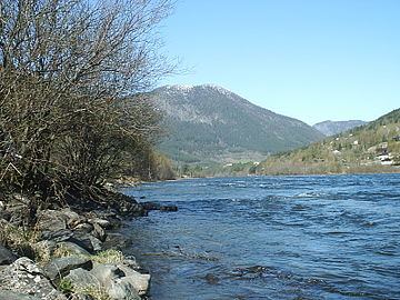 Otta River
 Gudbrandsdalen Valley
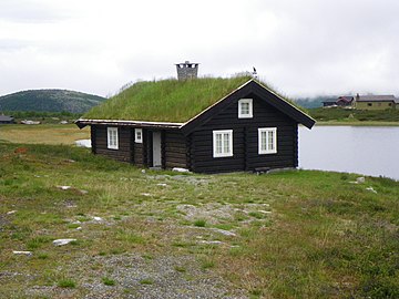 Rondane
 A carved troll woman in the Gudbrandsdalen Valley


References
- "Navn på steder og personer: Innbyggjarnamn" (in Norwegian). Språkrådet.
- "Forskrift om målvedtak i kommunar og fylkeskommunar" (in Norwegian). Lovdata.no.
- Statistisk sentralbyrå (2021). "Table: 06913: Population 1 January and population changes during the calendar year (M)" (in Norwegian).
- Statistisk sentralbyrå (2021). "09280: Area of land and fresh water (km²) (M)" (in Norwegian).
- Jukvam, Dag (1999). "Historisk oversikt over endringer i kommune- og fylkesinndelingen" (PDF) (in Norwegian). Statistisk sentralbyrå.
- Rygh, Oluf (1900). Norske gaardnavne: Kristians amt (in Norwegian) (4 ed.). Kristiania, Norge: W. C. Fabritius & sønners bogtrikkeri. p. 88.
- "Civic heraldry of Norway - Norske Kommunevåpen". Heraldry of the World. Retrieved 6 June 2022.
- Hansen, Tore, ed. (12 May 2016). "kommunestyre". Store norske leksikon (in Norwegian). Kunnskapsforlaget. Retrieved 30 January 2022.
- "Tall for Norge: Kommunestyrevalg 2019 - Innlandet". Valg Direktoratet. Retrieved 13 April 2022.
- "Tall for Norge: Kommunestyrevalg 2015 - Oppland". Valg Direktoratet.
- "Table: 04813: Members of the local councils, by party/electoral list at the Municipal Council election (M)" (in Norwegian). Statistics Norway.
- "Tall for Norge: Kommunestyrevalg 2011 - Oppland". Valg Direktoratet.
- "Kommunestyrevalget 1999" (PDF) (in Norwegian). Oslo-Kongsvinger: Statistisk sentralbyrå. 2000.
- "Kommunestyrevalget 1995" (PDF) (in Norwegian). Oslo-Kongsvinger: Statistisk sentralbyrå. 1996.
- "Kommunestyrevalget 1991" (PDF) (in Norwegian). Oslo-Kongsvinger: Statistisk sentralbyrå. 1993.
- "Kommunestyrevalget 1987" (PDF) (in Norwegian). Oslo-Kongsvinger: Statistisk sentralbyrå. 1988.
- "Kommunestyrevalget 1983" (PDF) (in Norwegian). Oslo-Kongsvinger: Statistisk sentralbyrå. 1984.
- "Kommunestyrevalget 1979" (PDF) (in Norwegian). Oslo: Statistisk sentralbyrå. 1979.
- "Kommunevalgene 1975" (PDF) (in Norwegian). Oslo: Statistisk sentralbyrå. 1977.
- "Kommunevalgene 1972" (PDF) (in Norwegian). Oslo: Statistisk sentralbyrå. 1973.
- "Kommunevalgene 1967" (PDF) (in Norwegian). Oslo: Statistisk sentralbyrå. 1967.
- "Kommunevalgene 1963" (PDF) (in Norwegian). Oslo: Statistisk sentralbyrå. 1964.
- "Kommunevalgene og Ordførervalgene 1959" (PDF) (in Norwegian). Oslo: Statistisk sentralbyrå. 1960.
- "Kommunevalgene og Ordførervalgene 1955" (PDF) (in Norwegian). Oslo: Statistisk sentralbyrå. 1957.
- "Kommunevalgene og Ordførervalgene 1951" (PDF) (in Norwegian). Oslo: Statistisk sentralbyrå. 1952.
- "Kommunevalgene og Ordførervalgene 1947" (PDF) (in Norwegian). Oslo: Statistisk sentralbyrå. 1948.
- "Kommunevalgene og Ordførervalgene 1945" (PDF) (in Norwegian). Oslo: Statistisk sentralbyrå. 1947.
- "Kommunevalgene og Ordførervalgene 1937" (PDF) (in Norwegian). Oslo: Statistisk sentralbyrå. 1938.
- "Immigrants and Norwegian-born to immigrant parents, by immigration category, country background and percentages of the population". ssb.no. Archived from the original on 2 July 2015. Retrieved 29 June 2015.
- Taylor-Wilkie, Doreen, ed. (1996). Insight Guides Norway (2 ed.). Houghton Mifflin Company. ISBN 978-0-395-81912-8.
- Stagg, Frank Noel (1956). East Norway and its Frontier. George Allen & Unwin, Ltd.
- Welle-Strand, Erling (1996). Adventure Roads in Norway. Nortrabooks. ISBN 978-82-90103-71-7.
- IMDb Database retrieved 20 November 2020
External links
- Municipal fact sheet from Statistics Norway (in Norwegian)
 Innlandet travel guide from Wikivoyage
- Gudbrandsdalen travel guide from Wikivoyage
Innlandet county, Norway | |||||||||||||||||||||
|---|---|---|---|---|---|---|---|---|---|---|---|---|---|---|---|---|---|---|---|---|---|
| |||||||||||||||||||||
 | Towns and cities |
|  | ||||||||||||||||||
| Municipalities |
| ||||||||||||||||||||
Authority control | |
|---|---|
| General | |
| National libraries | |
На других языках
[de] Sel
Sel ist eine Kommune im norwegischen Fylke Innlandet am Ende des Ottadals sowie im oberen Gudbrandsdalen.- [en] Sel
[ru] Сель (Оппланн)
Сель (норв. Sel i Oppland) — коммуна в губернии Оппланн в Норвегии. Административный центр коммуны — город Отта. Официальный язык коммуны — нейтральный[1]. Население коммуны на 2007 год составляло 6005 чел. Площадь коммуны Сель — 904,7 км², код-идентификатор — 0517.Другой контент может иметь иную лицензию. Перед использованием материалов сайта WikiSort.org внимательно изучите правила лицензирования конкретных элементов наполнения сайта.
WikiSort.org - проект по пересортировке и дополнению контента Википедии