world.wikisort.org - Norway
Lødingen (Northern Sami: Lodegat) is a municipality in Nordland county in Norway. Lødingen is located on the southeastern corner of the island of Hinnøya, and is part of the traditional district of Ofoten. The administrative centre of the municipality is the village of Lødingen. The other main part of the municipality is Vestbygda. Lødingen has the nickname "Biketown" because it hosts several annual bicycle races, including "Lofoten Insomnia" and Vestbygd-rittet.
Lødingen kommune
Lodegat | |
|---|---|
Municipality | |
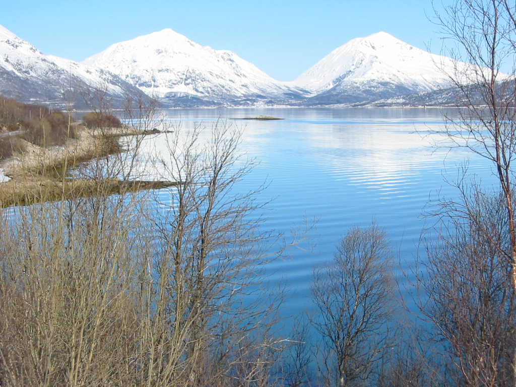
 Lødingen City seen from Hjertholmen lighthouse | |
 Flag  Coat of arms 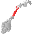 Nordland within Norway | |
| Nickname: Biketown | |
 Lødingen within Nordland | |
| Coordinates: 68°24′15″N 15°34′17″E | |
| Country | Norway |
| County | Nordland |
| District | Ofoten |
| Established | 1 Jan 1838 |
| • Created as | Formannskapsdistrikt |
| Administrative centre | Lødingen |
| Government | |
| • Mayor (2019) | Hugo Jacobsen (Ap) |
| Area | |
| • Total | 527.42 km2 (203.64 sq mi) |
| • Land | 507.67 km2 (196.01 sq mi) |
| • Water | 19.75 km2 (7.63 sq mi) 3.7% |
| • Rank | #202 in Norway |
| Population (2022) | |
| • Total | 1,976 |
| • Rank | #282 in Norway |
| • Density | 3.9/km2 (10/sq mi) |
| • Change (10 years) | |
| Demonym | Lødingsværing[1] |
| Official language | |
| • Norwegian form | Bokmål |
| Time zone | UTC+01:00 (CET) |
| • Summer (DST) | UTC+02:00 (CEST) |
| ISO 3166 code | NO-1851 |
| Website | Official website |
The 527-square-kilometre (203 sq mi) municipality is by area the 202nd largest out of the 356 municipalities in Norway. Lødingen is the 282nd most populous municipality in Norway with a population of 1,976. The municipality's population density is 3.9 inhabitants per square kilometre (10/sq mi) and its population has decreased by 9.3% over the previous 10-year period.[3][4]
General information
The municipality of Lødingen was established on 1 January 1838 (see formannskapsdistrikt law). On 1 January 1869, the southern district of Lødingen surrounding the Tysfjorden on the mainland (population: 1,402) was separated to form the new Tysfjord Municipality. This left 2,064 residents in Lødingen. Then on 1 January 1909, the northeastern district of Lødingen (population: 1,404) was separated to form the new Tjeldsund Municipality. This left 3,034 residents in Lødingen.
During the 1960s, there were many municipal mergers across Norway due to the work of the Schei Committee. On 1 January 1962, the southern mainland part of Lødingen surrounding the Efjorden and the island of Barøya (population: 433) were transferred to Ballangen Municipality. Then on 1 January 1964, the eastern part of Lødingen on the island of Tjeldøya (population: 297) was transferred to Tjeldsund Municipality.[5]
Name
The municipality (originally the parish) is named after the old Lødingen farm (Old Norse: Lǫðueng), since the first Lødingen Church was built there. The first element is the genitive case of laða which means "grain/hay barn" and the last element is eng which means "meadow".[6][7]
Coat of arms
The coat of arms was granted on 11 May 1984. The arms show a gold-colored woollen thread that is folded as a flower with five leaves on a red background. The municipality is at the junction of road, shipping, and ferry routes to five areas: Lofoten, Ofoten, Salten, Vesterålen, and Southern Troms. It is also located between five fjords: Vestfjorden, Ofotfjorden, Tysfjorden, Tjeldsundet, and Gullesfjorden. The symbol is also an ancient symbol for good fortune.[8]
Churches
The Church of Norway has one parish (sokn) within the municipality of Lødingen. It is part of the Ofoten prosti (deanery) in the Diocese of Sør-Hålogaland.
| Parish (sokn) | Church Name | Location of the Church | Year Built |
|---|---|---|---|
| Lødingen | Lødingen Church | Lødingen | 1897 |
| Vestbygd Church | Vågehamn | 1885 |
Government
All municipalities in Norway, including Lødingen, are responsible for primary education (through 10th grade), outpatient health services, senior citizen services, unemployment and other social services, zoning, economic development, and municipal roads. The municipality is governed by a municipal council of elected representatives, which in turn elect a mayor.[9] The municipality falls under the Ofoten District Court and the Hålogaland Court of Appeal.
Municipal council
The municipal council (Kommunestyre) of Lødingen is made up of 17 representatives that are elected to four year terms. The party breakdown of the council is as follows:
| Party Name (in Norwegian) | Number of representatives | |
|---|---|---|
| Labour Party (Arbeiderpartiet) | 5 | |
| Progress Party (Fremskrittspartiet) | 3 | |
| Conservative Party (Høyre) | 3 | |
| Centre Party (Senterpartiet) | 3 | |
| Socialist Left Party (Sosialistisk Venstreparti) | 2 | |
| Liberal Party (Venstre) | 1 | |
| Total number of members: | 17 | |
| Party Name (in Norwegian) | Number of representatives | |
|---|---|---|
| Labour Party (Arbeiderpartiet) | 8 | |
| Progress Party (Fremskrittspartiet) | 2 | |
| Conservative Party (Høyre) | 3 | |
| Socialist Left Party (Sosialistisk Venstreparti) | 2 | |
| Liberal Party (Venstre) | 2 | |
| Total number of members: | 17 | |
| Party Name (in Norwegian) | Number of representatives | |
|---|---|---|
| Labour Party (Arbeiderpartiet) | 4 | |
| Progress Party (Fremskrittspartiet) | 4 | |
| Conservative Party (Høyre) | 5 | |
| Centre Party (Senterpartiet) | 1 | |
| Socialist Left Party (Sosialistisk Venstreparti) | 1 | |
| Liberal Party (Venstre) | 2 | |
| Total number of members: | 17 | |
| Party Name (in Norwegian) | Number of representatives | |
|---|---|---|
| Labour Party (Arbeiderpartiet) | 5 | |
| Progress Party (Fremskrittspartiet) | 7 | |
| Conservative Party (Høyre) | 3 | |
| Centre Party (Senterpartiet) | 2 | |
| Socialist Left Party (Sosialistisk Venstreparti) | 3 | |
| Liberal Party (Venstre) | 1 | |
| Total number of members: | 21 | |
| Party Name (in Norwegian) | Number of representatives | |
|---|---|---|
| Labour Party (Arbeiderpartiet) | 4 | |
| Progress Party (Fremskrittspartiet) | 6 | |
| Conservative Party (Høyre) | 3 | |
| Centre Party (Senterpartiet) | 1 | |
| Socialist Left Party (Sosialistisk Venstreparti) | 5 | |
| Liberal Party (Venstre) | 2 | |
| Total number of members: | 21 | |
| Party Name (in Norwegian) | Number of representatives | |
|---|---|---|
| Labour Party (Arbeiderpartiet) | 9 | |
| Progress Party (Fremskrittspartiet) | 4 | |
| Conservative Party (Høyre) | 5 | |
| Centre Party (Senterpartiet) | 1 | |
| Liberal Party (Venstre) | 2 | |
| Total number of members: | 21 | |
| Party Name (in Norwegian) | Number of representatives | |
|---|---|---|
| Labour Party (Arbeiderpartiet) | 6 | |
| Progress Party (Fremskrittspartiet) | 1 | |
| Conservative Party (Høyre) | 5 | |
| Centre Party (Senterpartiet) | 2 | |
| Socialist Left Party (Sosialistisk Venstreparti) | 3 | |
| Liberal Party (Venstre) | 4 | |
| Total number of members: | 21 | |
| Party Name (in Norwegian) | Number of representatives | |
|---|---|---|
| Labour Party (Arbeiderpartiet) | 6 | |
| Conservative Party (Høyre) | 7 | |
| Centre Party (Senterpartiet) | 2 | |
| Socialist Left Party (Sosialistisk Venstreparti) | 4 | |
| Liberal Party (Venstre) | 2 | |
| Total number of members: | 21 | |
| Party Name (in Norwegian) | Number of representatives | |
|---|---|---|
| Labour Party (Arbeiderpartiet) | 8 | |
| Conservative Party (Høyre) | 10 | |
| Centre Party (Senterpartiet) | 1 | |
| Socialist Left Party (Sosialistisk Venstreparti) | 1 | |
| Liberal Party (Venstre) | 1 | |
| Total number of members: | 21 | |
| Party Name (in Norwegian) | Number of representatives | |
|---|---|---|
| Labour Party (Arbeiderpartiet) | 9 | |
| Conservative Party (Høyre) | 8 | |
| Christian Democratic Party (Kristelig Folkeparti) | 1 | |
| Centre Party (Senterpartiet) | 1 | |
| Socialist Left Party (Sosialistisk Venstreparti) | 1 | |
| Liberal Party (Venstre) | 1 | |
| Total number of members: | 21 | |
| Party Name (in Norwegian) | Number of representatives | |
|---|---|---|
| Labour Party (Arbeiderpartiet) | 7 | |
| Conservative Party (Høyre) | 9 | |
| Christian Democratic Party (Kristelig Folkeparti) | 1 | |
| Centre Party (Senterpartiet) | 2 | |
| Socialist Left Party (Sosialistisk Venstreparti) | 1 | |
| Liberal Party (Venstre) | 1 | |
| Total number of members: | 21 | |
| Party Name (in Norwegian) | Number of representatives | |
|---|---|---|
| Labour Party (Arbeiderpartiet) | 9 | |
| Conservative Party (Høyre) | 7 | |
| Christian Democratic Party (Kristelig Folkeparti) | 1 | |
| Centre Party (Senterpartiet) | 3 | |
| Joint list of the Liberal Party (Venstre) and New People's Party (Nye Folkepartiet) | 1 | |
| Total number of members: | 21 | |
| Party Name (in Norwegian) | Number of representatives | |
|---|---|---|
| Labour Party (Arbeiderpartiet) | 11 | |
| Conservative Party (Høyre) | 7 | |
| Centre Party (Senterpartiet) | 2 | |
| Liberal Party (Venstre) | 1 | |
| Total number of members: | 21 | |
| Party Name (in Norwegian) | Number of representatives | |
|---|---|---|
| Labour Party (Arbeiderpartiet) | 11 | |
| Conservative Party (Høyre) | 6 | |
| Centre Party (Senterpartiet) | 2 | |
| Liberal Party (Venstre) | 2 | |
| Total number of members: | 21 | |
| Party Name (in Norwegian) | Number of representatives | |
|---|---|---|
| Labour Party (Arbeiderpartiet) | 10 | |
| Conservative Party (Høyre) | 7 | |
| Liberal Party (Venstre) | 2 | |
| Local List(s) (Lokale lister) | 2 | |
| Total number of members: | 21 | |
| Party Name (in Norwegian) | Number of representatives | |
|---|---|---|
| Labour Party (Arbeiderpartiet) | 10 | |
| Conservative Party (Høyre) | 6 | |
| Liberal Party (Venstre) | 2 | |
| Local List(s) (Lokale lister) | 3 | |
| Total number of members: | 21 | |
| Party Name (in Norwegian) | Number of representatives | |
|---|---|---|
| Labour Party (Arbeiderpartiet) | 10 | |
| Conservative Party (Høyre) | 8 | |
| Liberal Party (Venstre) | 3 | |
| Total number of members: | 21 | |
| Party Name (in Norwegian) | Number of representatives | |
|---|---|---|
| Labour Party (Arbeiderpartiet) | 12 | |
| Conservative Party (Høyre) | 6 | |
| Liberal Party (Venstre) | 3 | |
| Total number of members: | 21 | |
| Party Name (in Norwegian) | Number of representatives | |
|---|---|---|
| Labour Party (Arbeiderpartiet) | 11 | |
| Liberal Party (Venstre) | 4 | |
| Joint List(s) of Non-Socialist Parties (Borgerlige Felleslister) | 6 | |
| Total number of members: | 21 | |
| Party Name (in Norwegian) | Number of representatives | |
|---|---|---|
| Labour Party (Arbeiderpartiet) | 9 | |
| Local List(s) (Lokale lister) | 7 | |
| Total number of members: | 16 | |
| Party Name (in Norwegian) | Number of representatives | |
|---|---|---|
| Labour Party (Arbeiderpartiet) | 7 | |
| Joint List(s) of Non-Socialist Parties (Borgerlige Felleslister) | 9 | |
| Total number of members: | 16 | |
| Note: Due to the German occupation of Norway during World War II, no elections were held for new municipal councils until after the war ended in 1945. | ||
Mayor
The mayors of Lødingen (incomplete list):
- 2019–present: Hugo Bongard Jacobsen (Ap)
- 2015-2019: Atle Andersen (Ap)
- 2011-2015: Anita Marthinussen (H)
- 2007-2011: Vibeke Tveit (Ap)
- 2003-2007: Kurt Olsen (SV)
- 1999-2003: Eirik Eriksen (Ap)
Geography
The municipality encompasses the southern part of the island of Hinnøya. The terrain is mountainous, with several small islands and fjords. The administrative centre of the municipality is the village of Lødingen, located at the inner part of the Vestfjorden at the southern entrance of the Tjeldsundet strait. The nearest airport is Harstad/Narvik Airport, Evenes, about 73 kilometres (45 mi) away by road. Lødingen is an important ferry harbor, the car ferry to/from Bognes in Tysfjord leaves 12 times per day and takes 60 minutes. Møysalen National Park is located in the northern part of the municipality. It's named after the mountain Møysalen on the municipal border between Lødingen and Sortland. The Rotvær Lighthouse is located in Lødingen.
Climate
| Climate data for Lødingen (village) | |||||||||||||
|---|---|---|---|---|---|---|---|---|---|---|---|---|---|
| Month | Jan | Feb | Mar | Apr | May | Jun | Jul | Aug | Sep | Oct | Nov | Dec | Year |
| Daily mean °C (°F) | −3.1 (26.4) |
−3.0 (26.6) |
−1.6 (29.1) |
1.5 (34.7) |
6.3 (43.3) |
10.0 (50.0) |
12.5 (54.5) |
12.0 (53.6) |
8.1 (46.6) |
4.2 (39.6) |
0.4 (32.7) |
−2.1 (28.2) |
3.8 (38.8) |
| Average precipitation mm (inches) | 158 (6.2) |
140 (5.5) |
114 (4.5) |
95 (3.7) |
71 (2.8) |
80 (3.1) |
100 (3.9) |
110 (4.3) |
157 (6.2) |
230 (9.1) |
160 (6.3) |
185 (7.3) |
1,600 (63.0) |
| Source: Norwegian Meteorological Institute[28] | |||||||||||||
Attractions

- Eye in Stone (Øye i stein), part of Artscape Nordland (Skulpturlandskap Nordland)
- Norwegian Telecom Museum, telegraphy
- Pilotage Service Museum
- Rotvær Lighthouse
Notable people
- Christopher Nyrop (1680–1733) a theologian and Bishop of Christianssand
- Dagfinn Bakke (1933–2019) a painter, illustrator and printmaker
- Dagfinn Henrik Olsen (born 1966) a Norwegian politician
References
- "Navn på steder og personer: Innbyggjarnamn" (in Norwegian). Språkrådet.
- "Forskrift om målvedtak i kommunar og fylkeskommunar" (in Norwegian). Lovdata.no.
- Statistisk sentralbyrå. "Table: 06913: Population 1 January and population changes during the calendar year (M)" (in Norwegian).
- Statistisk sentralbyrå. "09280: Area of land and fresh water (km²) (M)" (in Norwegian).
- Jukvam, Dag (1999). "Historisk oversikt over endringer i kommune- og fylkesinndelingen" (PDF) (in Norwegian). Statistisk sentralbyrå.
- Rygh, Oluf (1905). Norske gaardnavne: Nordlands amt (in Norwegian) (16 ed.). Kristiania, Norge: W. C. Fabritius & sønners bogtrikkeri. p. 297.
- Store norske leksikon. "Lødingen" (in Norwegian). Retrieved 12 June 2012.
- "Civic heraldry of Norway - Norske Kommunevåpen". Heraldry of the World. Retrieved 3 January 2019.
- Hansen, Tore, ed. (12 May 2016). "kommunestyre". Store norske leksikon (in Norwegian). Kunnskapsforlaget. Retrieved 1 January 2019.
- "Tall for Norge: Kommunestyrevalg 2019 - Nordland". Valg Direktoratet. Retrieved 27 October 2019.
- "Table: 04813: Members of the local councils, by party/electoral list at the Municipal Council election (M)" (in Norwegian). Statistics Norway.
- "Tall for Norge: Kommunestyrevalg 2011 - Nordland". Valg Direktoratet. Retrieved 27 October 2019.
- "Kommunestyrevalget 1995" (PDF) (in Norwegian). Oslo-Kongsvinger: Statistisk sentralbyrå. 1996. Retrieved 18 March 2020.
- "Kommunestyrevalget 1991" (PDF) (in Norwegian). Oslo-Kongsvinger: Statistisk sentralbyrå. 1993. Retrieved 18 March 2020.
- "Kommunestyrevalget 1987" (PDF) (in Norwegian). Oslo-Kongsvinger: Statistisk sentralbyrå. 1988. Retrieved 18 March 2020.
- "Kommunestyrevalget 1983" (PDF) (in Norwegian). Oslo-Kongsvinger: Statistisk sentralbyrå. 1984. Retrieved 18 March 2020.
- "Kommunestyrevalget 1979" (PDF) (in Norwegian). Oslo: Statistisk sentralbyrå. 1979. Retrieved 18 March 2020.
- "Kommunevalgene 1975" (PDF) (in Norwegian). Oslo: Statistisk sentralbyrå. 1977. Retrieved 18 March 2020.
- "Kommunevalgene 1972" (PDF) (in Norwegian). Oslo: Statistisk sentralbyrå. 1973. Retrieved 18 March 2020.
- "Kommunevalgene 1967" (PDF) (in Norwegian). Oslo: Statistisk sentralbyrå. 1967. Retrieved 18 March 2020.
- "Kommunevalgene 1963" (PDF) (in Norwegian). Oslo: Statistisk sentralbyrå. 1964. Retrieved 18 March 2020.
- "Kommunevalgene og Ordførervalgene 1959" (PDF) (in Norwegian). Oslo: Statistisk sentralbyrå. 1960. Retrieved 18 March 2020.
- "Kommunevalgene og Ordførervalgene 1955" (PDF) (in Norwegian). Oslo: Statistisk sentralbyrå. 1957. Retrieved 18 March 2020.
- "Kommunevalgene og Ordførervalgene 1951" (PDF) (in Norwegian). Oslo: Statistisk sentralbyrå. 1952. Retrieved 18 March 2020.
- "Kommunevalgene og Ordførervalgene 1947" (PDF) (in Norwegian). Oslo: Statistisk sentralbyrå. 1948. Retrieved 18 March 2020.
- "Kommunevalgene og Ordførervalgene 1945" (PDF) (in Norwegian). Oslo: Statistisk sentralbyrå. 1947. Retrieved 18 March 2020.
- "Kommunevalgene og Ordførervalgene 1937" (PDF) (in Norwegian). Oslo: Statistisk sentralbyrå. 1938. Retrieved 18 March 2020.
- "eKlima Web Portal". Norwegian Meteorological Institute. Archived from the original on 14 June 2004.
External links
- Municipal fact sheet from Statistics Norway (in Norwegian)
 Nordland travel guide from Wikivoyage
- Skulpturlandskap Nordland (in Norwegian)
- Norwegian Telecom Museum (in Norwegian)
Nordland county, Norway | |||||||
|---|---|---|---|---|---|---|---|
| |||||||
 | Towns and cities |
|  | ||||
| Municipalities | |||||||
| Authority control |
|
|---|
На других языках
[de] Lødingen
Lødingen ist eine Kommune im norwegischen Fylke Nordland. Die Kommune hat 1976 Einwohner (Stand: 1. Januar 2022). Verwaltungssitz ist der gleichnamige Ort Lødingen.- [en] Lødingen
[ru] Лёдинген
Лёдинген (норв. Lødingen) — коммуна в фюльке Нурланн в Норвегии. Является частью региона Офотен. Административный центр коммуны — деревня Лёдинген.Другой контент может иметь иную лицензию. Перед использованием материалов сайта WikiSort.org внимательно изучите правила лицензирования конкретных элементов наполнения сайта.
WikiSort.org - проект по пересортировке и дополнению контента Википедии