world.wikisort.org - Norway
Ballangen (Northern Sami: Bálák) is a former municipality in Nordland county, Norway. The municipality existed from 1925 until its dissolution in 2020. The 932-square-kilometre (360 sq mi) municipality was part of the traditional district of Ofoten. The administrative centre of the municipality was the village of Ballangen. Other villages in the municipality included Bjørkåsen, Kjeldebotn, Kobbvika, and Skarstad.
Ballangen kommune | |
|---|---|
Former municipality | |
 Flag  Coat of arms 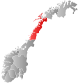 Nordland within Norway | |
 Ballangen within Nordland | |
| Coordinates: 68°18′23″N 16°44′39″E | |
| Country | Norway |
| County | Nordland |
| District | Ofoten |
| Established | 1 July 1925 |
| • Preceded by | Evenes Municipality |
| Disestablished | 1 Jan 2020 |
| • Succeeded by | Narvik Municipality |
| Administrative centre | Ballangen |
| Area (upon dissolution) | |
| • Total | 932.22 km2 (359.93 sq mi) |
| • Land | 846.38 km2 (326.79 sq mi) |
| • Water | 85.84 km2 (33.14 sq mi) 9.2% |
| • Rank | #119 in Norway |
| Population (2018) | |
| • Total | 2,522 |
| • Rank | #290 in Norway |
| • Density | 3.0/km2 (8/sq mi) |
| • Change (10 years) | |
| Demonym | Ballangsværing [1][2] |
| Official language | |
| • Norwegian form | Bokmål |
| Time zone | UTC+01:00 (CET) |
| • Summer (DST) | UTC+02:00 (CEST) |
| ISO 3166 code | NO-1854 |
| Website | Official website |
The municipality bordered Narvik Municipality to the east and Tysfjord Municipality to the south, and had a short border with Sweden to the southeast. Ballangen was situated on the southern shore of Ofotfjorden. Ballangen also included the long and narrow Efjorden, just south of the much larger Ofotfjorden. Its immediate surroundings were dominated by fjords, mountains, and forests. Ballangen relied on the nearby town of Narvik as its economic base.
Prior to its dissolution, the 932-square-kilometre (360 sq mi) municipality was the 119th largest by area out of the 422 municipalities in Norway. Ballangen was the 290th most populous municipality in Norway with a population of 2,522. The municipality's population density was 3 inhabitants per square kilometre (7.8/sq mi) and its population had decreased by 4.9% over the previous decade.[4][5]
General information
The municipality of Ballangen was established on 1 July 1925 when it was separated from the large Evenes Municipality. The new municipality encompassed all of Evenes located south of the Ofotfjorden. Initially, Ballangen had 3,270 residents.
During the 1960s, there were many municipal mergers across Norway due to the work of the Schei Committee. On 1 January 1962, the southern part of Lødingen Municipality (the island of Barøya and the area surrounding the Efjorden; population: 433) was transferred from Lødingen to Ballangen.[6]
On 1 January 2020, the municipality was merged with the neighboring Narvik Municipality and the eastern half of Tysfjord Municipality to form a new, larger municipality of Narvik. This decision had been reached in 2017 after national and local discussions involving municipal mergers.[7]
Coat of arms
The coat of arms was granted on 18 July 1980. The arms show a gold hammer on a green background. It was chosen as a symbol to represent the mining in the municipality. There used to be copper mines in the municipality. The green background symbolizes agriculture.[8]
Name
The Old Norse form of the name was Bagangr. The meaning of the first element is not known and the last element is angr, which means "fjord".[9][10][11]
Churches
The Church of Norway had one parish (sokn) within the municipality of Ballangen. It was part of the Ofoten prosti (deanery) in the Diocese of Sør-Hålogaland.
| Parish (sokn) | Church Name | Location of the Church | Year Built |
|---|---|---|---|
| Ballangen | Ballangen Church | Ballangen | 1923 |
| Efjord Chapel | Kobbvika | 1985 | |
| Kjeldebotn Church | Kjeldebotn | 1956 |
History
The first person living in Ballangen was Lodve Lange (Lodve the long), who is mentioned in Heimskringla as being one of King Olav Tryggvason's most trusted warriors, and being placed near the king in the famous ship Ormen Lange (long serpent).[12] Lodve probably participated in the Battle of Svolder in the year 1000, and might have been killed there. He lived at Saltvik, which is near the fjord, east of today's village of Ballangen.[12]
There is a long history of mining in Ballangen, starting from the 17th century. Over the years as many as 36 mines have been operated in Ballangen, including minerals like copper, nickel and iron, zinc, manganese, and lead, but the most serious mining started in 1911 with Bjørkåsen Gruver mining mostly pyrite. Mining for nickel and olivine continued until 2002. There is also a dolomite quarry in Ballangen. Ballangen is the main agricultural municipality in the Ofoten region.[11] The Ballangen Museum is located in the village of Bjørkåsen in the municipality and presents the local mining history.[13]
Ballangen has the dubious distinction of having Norway's highest rate of sick leave from work,[14] probably due to the high number of people who worked in the mines there, and related environmental effects.[15]
Government
The municipal council (Kommunestyre) of Ballangen was made up of 17 representatives that were elected to four year terms. The party breakdown of the final municipal council was as follows:
| Party Name (in Norwegian) | Number of representatives | |
|---|---|---|
| Labour Party (Arbeiderpartiet) | 5 | |
| Progress Party (Fremskrittspartiet) | 2 | |
| Conservative Party (Høyre) | 2 | |
| Christian Democratic Party (Kristelig Folkeparti) | 1 | |
| Centre Party (Senterpartiet) | 7 | |
| Total number of members: | 17 | |
| Party Name (in Norwegian) | Number of representatives | |
|---|---|---|
| Labour Party (Arbeiderpartiet) | 4 | |
| Progress Party (Fremskrittspartiet) | 2 | |
| Conservative Party (Høyre) | 6 | |
| Christian Democratic Party (Kristelig Folkeparti) | 1 | |
| Centre Party (Senterpartiet) | 4 | |
| Total number of members: | 17 | |
| Party Name (in Norwegian) | Number of representatives | |
|---|---|---|
| Labour Party (Arbeiderpartiet) | 4 | |
| Progress Party (Fremskrittspartiet) | 4 | |
| Conservative Party (Høyre) | 3 | |
| Christian Democratic Party (Kristelig Folkeparti) | 2 | |
| Centre Party (Senterpartiet) | 4 | |
| Total number of members: | 17 | |
| Party Name (in Norwegian) | Number of representatives | |
|---|---|---|
| Labour Party (Arbeiderpartiet) | 4 | |
| Progress Party (Fremskrittspartiet) | 3 | |
| Centre Party (Senterpartiet) | 7 | |
| Joint list of the Conservative Party (Høyre) and Christian Democratic Party (Kristelig Folkeparti) | 3 | |
| Total number of members: | 17 | |
| Party Name (in Norwegian) | Number of representatives | |
|---|---|---|
| Labour Party (Arbeiderpartiet) | 6 | |
| Centre Party (Senterpartiet) | 4 | |
| Joint list of the Conservative Party (Høyre), Christian Democratic Party (Kristelig Folkeparti), and Liberal Party (Venstre) | 7 | |
| Total number of members: | 17 | |
| Party Name (in Norwegian) | Number of representatives | |
|---|---|---|
| Labour Party (Arbeiderpartiet) | 9 | |
| Conservative Party (Høyre) | 6 | |
| Christian Democratic Party (Kristelig Folkeparti) | 2 | |
| Centre Party (Senterpartiet) | 5 | |
| Socialist Left Party (Sosialistisk Venstreparti) | 1 | |
| Total number of members: | 23 | |
| Party Name (in Norwegian) | Number of representatives | |
|---|---|---|
| Labour Party (Arbeiderpartiet) | 8 | |
| Conservative Party (Høyre) | 5 | |
| Christian Democratic Party (Kristelig Folkeparti) | 2 | |
| Centre Party (Senterpartiet) | 6 | |
| Socialist Left Party (Sosialistisk Venstreparti) | 2 | |
| Total number of members: | 23 | |
| Party Name (in Norwegian) | Number of representatives | |
|---|---|---|
| Labour Party (Arbeiderpartiet) | 12 | |
| Conservative Party (Høyre) | 4 | |
| Christian Democratic Party (Kristelig Folkeparti) | 2 | |
| Centre Party (Senterpartiet) | 3 | |
| Socialist Left Party (Sosialistisk Venstreparti) | 2 | |
| Total number of members: | 23 | |
| Party Name (in Norwegian) | Number of representatives | |
|---|---|---|
| Labour Party (Arbeiderpartiet) | 11 | |
| Conservative Party (Høyre) | 2 | |
| Christian Democratic Party (Kristelig Folkeparti) | 2 | |
| Centre Party (Senterpartiet) | 8 | |
| Total number of members: | 23 | |
| Party Name (in Norwegian) | Number of representatives | |
|---|---|---|
| Labour Party (Arbeiderpartiet) | 11 | |
| Conservative Party (Høyre) | 4 | |
| Christian Democratic Party (Kristelig Folkeparti) | 3 | |
| Centre Party (Senterpartiet) | 4 | |
| Joint list of the Liberal Party and Free Voters (Venstre og Frie velgere) | 1 | |
| Total number of members: | 23 | |
| Party Name (in Norwegian) | Number of representatives | |
|---|---|---|
| Labour Party (Arbeiderpartiet) | 13 | |
| Conservative Party (Høyre) | 3 | |
| Centre Party (Senterpartiet) | 4 | |
| Non-socialist common list (Ikkesosialistisk fellesliste) | 3 | |
| Total number of members: | 23 | |
| Party Name (in Norwegian) | Number of representatives | |
|---|---|---|
| Labour Party (Arbeiderpartiet) | 13 | |
| Conservative Party (Høyre) | 2 | |
| Centre Party (Senterpartiet) | 6 | |
| Socialist People's Party (Sosialistisk Folkeparti) | 1 | |
| Liberal Party (Venstre) | 1 | |
| Total number of members: | 23 | |
| Party Name (in Norwegian) | Number of representatives | |
|---|---|---|
| Labour Party (Arbeiderpartiet) | 13 | |
| Conservative Party (Høyre) | 2 | |
| Centre Party (Senterpartiet) | 4 | |
| Liberal Party (Venstre) | 3 | |
| Local List(s) (Lokale lister) | 1 | |
| Total number of members: | 23 | |
| Party Name (in Norwegian) | Number of representatives | |
|---|---|---|
| Labour Party (Arbeiderpartiet) | 10 | |
| Communist Party (Kommunistiske Parti) | 1 | |
| Joint List(s) of Non-Socialist Parties (Borgerlige Felleslister) | 10 | |
| Total number of members: | 21 | |
| Party Name (in Norwegian) | Number of representatives | |
|---|---|---|
| Labour Party (Arbeiderpartiet) | 9 | |
| Communist Party (Kommunistiske Parti) | 2 | |
| Joint List(s) of Non-Socialist Parties (Borgerlige Felleslister) | 5 | |
| Local List(s) (Lokale lister) | 5 | |
| Total number of members: | 21 | |
| Party Name (in Norwegian) | Number of representatives | |
|---|---|---|
| Labour Party (Arbeiderpartiet) | 7 | |
| Communist Party (Kommunistiske Parti) | 3 | |
| Local List(s) (Lokale lister) | 11 | |
| Total number of members: | 21 | |
| Party Name (in Norwegian) | Number of representatives | |
|---|---|---|
| Labour Party (Arbeiderpartiet) | 8 | |
| Communist Party (Kommunistiske Parti) | 4 | |
| Joint List(s) of Non-Socialist Parties (Borgerlige Felleslister) | 9 | |
| Total number of members: | 21 | |
| Party Name (in Norwegian) | Number of representatives | |
|---|---|---|
| Labour Party (Arbeiderpartiet) | 8 | |
| Communist Party (Kommunistiske Parti) | 3 | |
| Local List(s) (Lokale lister) | 10 | |
| Total number of members: | 21 | |
| Party Name (in Norwegian) | Number of representatives | |
|---|---|---|
| Labour Party (Arbeiderpartiet) | 8 | |
| Joint List(s) of Non-Socialist Parties (Borgerlige Felleslister) | 7 | |
| Local List(s) (Lokale lister) | 1 | |
| Total number of members: | 16 | |
| Note: Due to the German occupation of Norway during World War II, no elections were held for new municipal councils until after the war ended in 1945. | ||
Geography
The village of Ballangen lies along the southern shore of the Ofotfjorden along the European route E6 highway. The highway crosses the Efjord Bridges on its way to Ballangen and then on again to the town of Narvik.
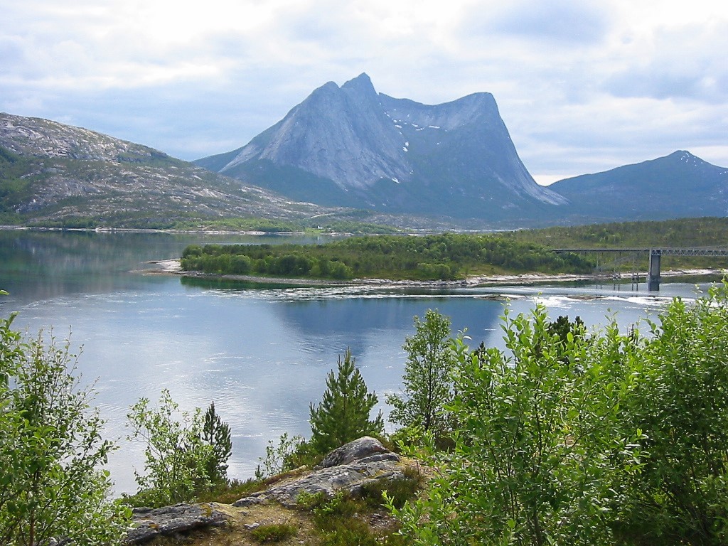
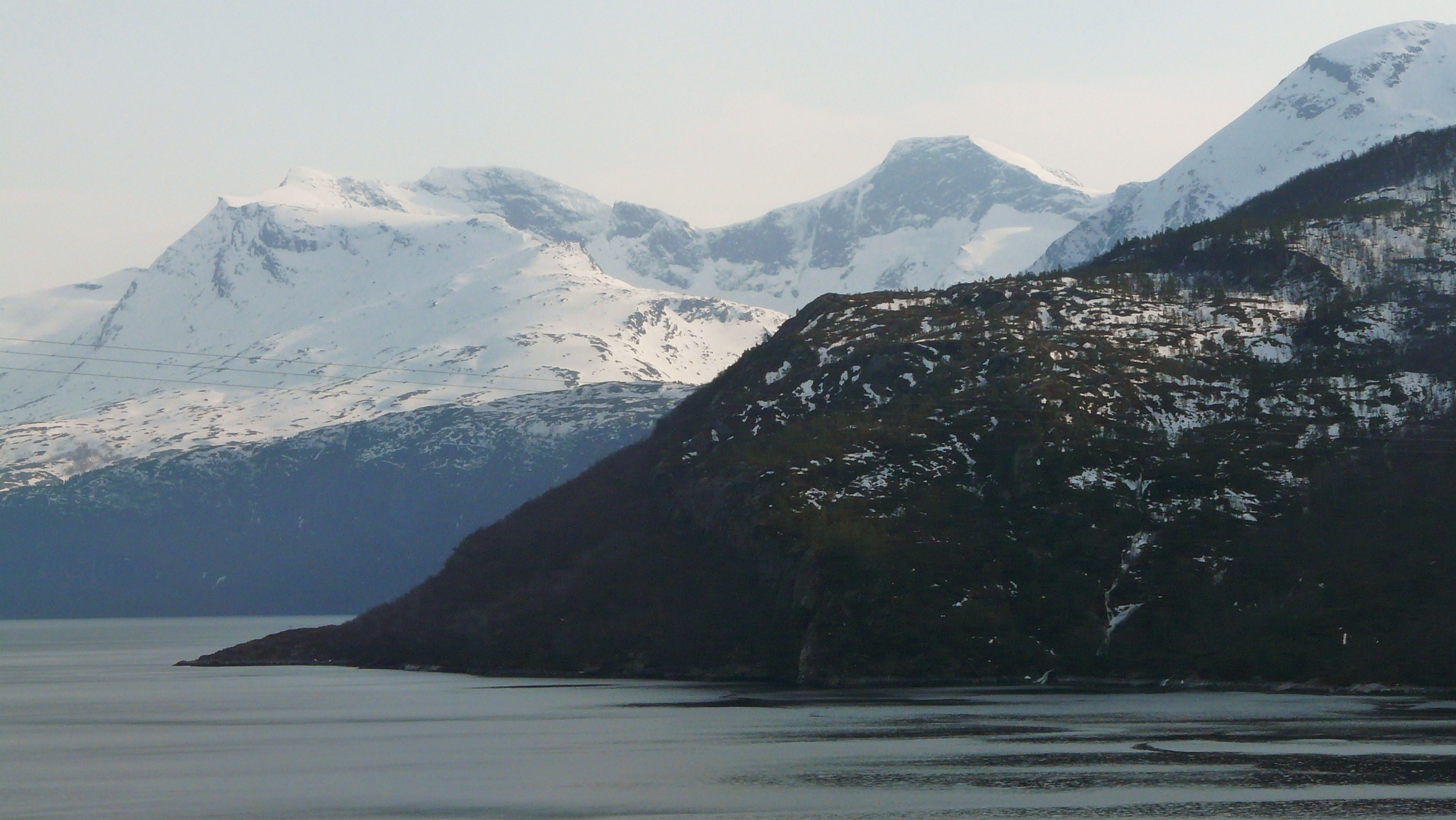
The Efjorden area is dominated by large slopes of bare rock with a narrow green area of vegetation near the fjord. The obelisk-like mountain, Stetind, nearby is dominated by the same, dark blue-grey rock, which contrasts with the clear water in the fjord where the sand banks can be seen just below the surface. Climbers and hikers are often tempted to test their skills on the rocky slopes. The large Frostisen glacier is located in the southeastern part of the municipality.
In the east, Ballangen borders on lake Siiddašjávri which it shares with Sweden. Siiddašjávri is the 14th largest lake which lies in or partially in Norway. Other lakes in the municipality include Børsvatnet, Geitvatnet, Hjertvatnet, Kjelvatnet, Langvatnet, Melkevatnet, Røvatnet, Søre Bukkevatnet, and Storvatnet.
The island of Barøya sits near the entrances to the Efjorden from the Ofotfjorden. The Barøy Lighthouse sits on the northern edge of the island.
Notable residents
- Anni-Frid Lyngstad, singer in the group ABBA, was born in Ballangen
- Geir Bratland, of Apoptygma Berzerk, Dimmu Borgir, God Seed, The Kovenant and Satyricon (band) was born and raised in Ballangen
Sister cities
 Tosno, Leningrad Oblast, Russia
See also
- List of former municipalities of Norway
References
- Andersen, Sander (9 March 2012). "Ballangsværing bak AWG-stadion". NRK (in Norwegian).
- "Navn på steder og personer: Innbyggjarnamn" (in Norwegian). Språkrådet.
- "Forskrift om målvedtak i kommunar og fylkeskommunar" (in Norwegian). Lovdata.no.
- Statistisk sentralbyrå (2018). "Table: 06913: Population 1 January and population changes during the calendar year (M)" (in Norwegian). Retrieved 12 January 2019.
- Statistisk sentralbyrå. "09280: Area of land and fresh water (km²) (M)" (in Norwegian). Retrieved 12 January 2019.
- Jukvam, Dag (1999). "Historisk oversikt over endringer i kommune- og fylkesinndelingen" (PDF) (in Norwegian). Statistisk sentralbyrå. Archived (PDF) from the original on 7 April 2004.
- Karlsen, Tone Anita (22 August 2017). "Ny Narvik tar form". Harstad Tidende (in Norwegian). Retrieved 10 September 2017.
- "Civic heraldry of Norway - Norske Kommunevåpen". Heraldry of the World. Retrieved 12 January 2019.
- Unger, Carl Rikard (1896). Sproglig-historiske studier (in Norwegian). Kristiania, Norge: H. Aschehoug & Co. p. 77. Retrieved 18 November 2008.
- Rygh, Oluf (1905). Norske gaardnavne: Nordlands amt (in Norwegian) (16 ed.). Kristiania, Norge: W. C. Fabritius & sønners bogtrikkeri. p. 293.
- Store norske leksikon. "Ballangen" (in Norwegian). Retrieved 22 May 2012.
- "Lodve Lange". Fylkesleksikon. Nordland fylkeskommune. 15 December 2010. Archived from the original on 15 August 2017.
- "Ballangen Museum". Museum Nord. Retrieved 13 September 2018.
- Taylor, Gerald (13 August 2017). "Ballangen, in Ofoten, enjoys dubious distinction of having Norway's highest absence from work due to sickness". Norway Today. Archived from the original on 15 August 2017.
- Kelion, Leo (15 August 2017). "Record-sized data centre planned inside Arctic Circle". BBC News.
- "Table: 04813: Members of the local councils, by party/electoral list at the Municipal Council election (M)" (in Norwegian). Statistics Norway.
- "Tall for Norge: Kommunestyrevalg 2011 - Nordland". Valg Direktoratet. Retrieved 27 October 2019.
- "Kommunestyrevalget 1995" (PDF) (in Norwegian). Oslo-Kongsvinger: Statistisk sentralbyrå. 1996. Retrieved 18 March 2020.
- "Kommunestyrevalget 1991" (PDF) (in Norwegian). Oslo-Kongsvinger: Statistisk sentralbyrå. 1993. Retrieved 18 March 2020.
- "Kommunestyrevalget 1987" (PDF) (in Norwegian). Oslo-Kongsvinger: Statistisk sentralbyrå. 1988. Retrieved 18 March 2020.
- "Kommunestyrevalget 1983" (PDF) (in Norwegian). Oslo-Kongsvinger: Statistisk sentralbyrå. 1984. Retrieved 18 March 2020.
- "Kommunestyrevalget 1979" (PDF) (in Norwegian). Oslo: Statistisk sentralbyrå. 1979. Retrieved 18 March 2020.
- "Kommunevalgene 1975" (PDF) (in Norwegian). Oslo: Statistisk sentralbyrå. 1977. Retrieved 18 March 2020.
- "Kommunevalgene 1972" (PDF) (in Norwegian). Oslo: Statistisk sentralbyrå. 1973. Retrieved 18 March 2020.
- "Kommunevalgene 1967" (PDF) (in Norwegian). Oslo: Statistisk sentralbyrå. 1967. Retrieved 18 March 2020.
- "Kommunevalgene 1963" (PDF) (in Norwegian). Oslo: Statistisk sentralbyrå. 1964. Retrieved 18 March 2020.
- "Kommunevalgene og Ordførervalgene 1959" (PDF) (in Norwegian). Oslo: Statistisk sentralbyrå. 1960. Retrieved 18 March 2020.
- "Kommunevalgene og Ordførervalgene 1955" (PDF) (in Norwegian). Oslo: Statistisk sentralbyrå. 1957. Retrieved 18 March 2020.
- "Kommunevalgene og Ordførervalgene 1951" (PDF) (in Norwegian). Oslo: Statistisk sentralbyrå. 1952. Retrieved 18 March 2020.
- "Kommunevalgene og Ordførervalgene 1947" (PDF) (in Norwegian). Oslo: Statistisk sentralbyrå. 1948. Retrieved 18 March 2020.
- "Kommunevalgene og Ordførervalgene 1945" (PDF) (in Norwegian). Oslo: Statistisk sentralbyrå. 1947. Retrieved 18 March 2020.
- "Kommunevalgene og Ordførervalgene 1937" (PDF) (in Norwegian). Oslo: Statistisk sentralbyrå. 1938. Retrieved 18 March 2020.
External links
- Municipal fact sheet from Statistics Norway (in Norwegian)
- (when the world's largest computer-center came to town(.) Ballangen was promised 3000 jobs - by trading-off a gigantic property. Four years later, large sums had found their way to private hands, and the municipality was stuck with a million-sized bill. What went wrong). 22 May 2021
 Nordland travel guide from Wikivoyage
- Some nice pictures from Ballangen
- Ballangen Camping
Nordland county, Norway | |||||||||||||||
|---|---|---|---|---|---|---|---|---|---|---|---|---|---|---|---|
| |||||||||||||||
 | Towns and cities |
|  | ||||||||||||
| Municipalities |
| ||||||||||||||
| Authority control |
|
|---|
На других языках
- [en] Ballangen
[ru] Балланген
Балланген — коммуна в фюльке Нурланн в Норвегии. Является частью региона Офотен. Административный центр коммуны — деревня Балланген. Балланген был отделен от коммуны Эвенес 1 июля 1925 года. Территория Эфьордена была передана от Лёдингена Баллангену 1 января 1962 года.Другой контент может иметь иную лицензию. Перед использованием материалов сайта WikiSort.org внимательно изучите правила лицензирования конкретных элементов наполнения сайта.
WikiSort.org - проект по пересортировке и дополнению контента Википедии