world.wikisort.org - Japan
Ukyō-ku (右京区) is one of the eleven wards in the city of Kyoto, in Kyoto Prefecture, Japan.
This article needs additional citations for verification. (September 2014) |
Ukyo
右京区 | |
|---|---|
Ward of Kyoto | |
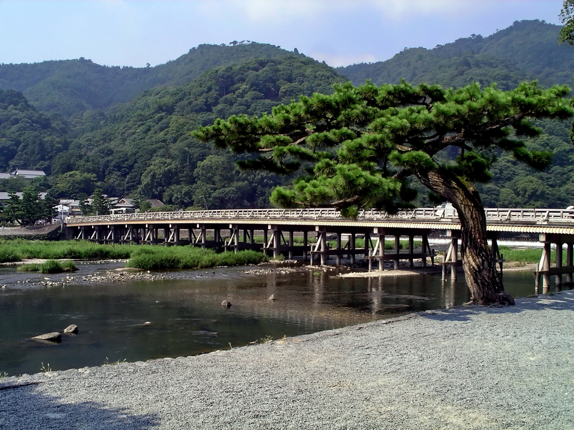 Togetsu Bridge in Arashiyama | |
 Location of Ukyo in Kyoto | |
 Ukyo Location in Japan | |
| Coordinates: 35°0′37″N 135°42′58″E | |
| Country | Japan |
| Region | Kinki (Kansai) |
| Prefecture | Kyoto |
| Area | |
| • Total | 292.07 km2 (112.77 sq mi) |
| Population (October 1, 2020) | |
| • Total | 202,047 |
| • Density | 690/km2 (1,800/sq mi) |
| Time zone | UTC+09:00 (JST) |
| City hall address | Uzumasa Shimokeibu-chō 12, Ukyo-ku, Kyoto City, Kyoto Prefecture (京都府京都市右京区太秦下刑部町12) 616-8511 |
| Website | www |
History
The meaning of ukyō (右京) is "on the Emperor's right." When residing in the Kyoto Imperial Palace the emperor would sit facing south,[1] thus the western direction would be to his right. Similarly, there is a ward to the east called Sakyō-ku (左京区), meaning "the ward on the Emperor's left." In old times, ukyō was referring to the western part of the capital. The area of ancient Ukyō slightly overlaps the area of present Ukyō-ku.
The ward was established in 1931 when nine villages merged to form it.
On April 1, 2005, the ward expanded its territory to the area of former town of Keihoku when the town merged into the city of Kyoto. This increased the ward's territory from 74.27 square kilometres (28.68 sq mi) to 291.95 square kilometres (112.72 sq mi), and made it the largest ward in the city by area.
As of October 1, 2020, the ward has an estimated population of 202,047, with 97,849 households and a density of 692 inhabitants per square kilometre (1,790/sq mi).
| Year | Pop. | ±% |
|---|---|---|
| 1980 | 192,646 | — |
| 1990 | 195,323 | +1.4% |
| 2000 | 195,573 | +0.1% |
| 2010 | 202,943 | +3.8% |
| 2020 | 202,047 | −0.4% |
Geography
Mountains
- Mount Atago
- Mount Ogura
- Iwatayama
Rivers
- Katsura River
- Tenjin River (Kamiya River)
- Arisugawa
- Yugegawa
Adjacent municipalities
- Kyoto wards of: Kita-ku, Sakyo-ku, Nakagyo-ku, Shimogyo-ku, Nishikyo-ku, and Minami-ku.
- Kameoka, Kyoto
- Nantan, Kyoto
Sights
Ukyo-ku is home to many renowned sites, including:
- Arashiyama, a hill famed for its maple leaves and the Togetsu-kyō, the Bridge to the Moon
- Ninna-ji, a Buddhist temple with a fine pagoda
- Ryōan-ji, the Zen Buddhist temple with the karesansui (dry-landscape, i.e. raked stones) garden
- Tenryū-ji, the head temple of the Tenryū branch of Rinzai Zen Buddhism
- Sagano, a neighborhood with Sagano Romantic Train and many temples, including the Nonomiya Shrine as well as Rakushi-sha, the Fallen Persimmon Hut
- Uzumasa, the location of Kōryū-ji, a temple founded before Kyoto became the Imperial capital. The neighborhood is also the home of the Toei Uzumasa Eigamura studios and the center of Japan's television and film industries.
Economy
Rohm, an electronic parts manufacturer,[2] and Nissin Electric, a global electrical equipment company,[3] are headquartered in the ward.
Education
Senior high schools
- Kyoto Prefectural Sagano High School
- Kyoto Gaidai Nishi High School
- Kitasaga Senior High School (ja:京都府立北嵯峨高等学校)
- Kitakuwada High School (ja:京都府立北桑田高等学校)
- Hanazono Senior High School (花園高等学校)
- Kyoto Gakuen High School (ja:京都学園高等学校)
- Kyoto Koka Senior High School (京都光華高等学校)
Universities
- Kyoto University of Foreign Studies
- Kyoto University of Advanced Science - Kyoto Uzumasa Campus
- Kyoto Koka Women's University
- Kyoto Saga University of Arts
Middle schools
There are 12 middle schools, of which nine are public and three are private.
Elementary schools
There are 21 elementary schools, of which 20 are public and one is private.
Others
- North Korean school: Kyoto Korean No. 2 Elementary School (京都朝鮮第二初級学校).[4]
Sights of Ukyo-ku
- Sights of Ukyō-ku
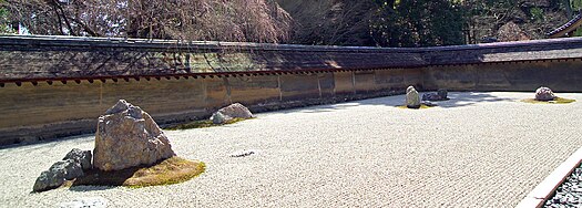 The karesansui garden at Ryoan-ji is one of Kyoto's most famous sights.
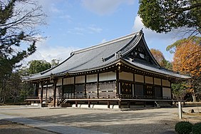 Ninna-ji Temple
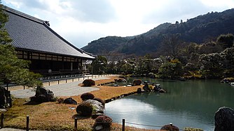 Tenryū-ji Temple
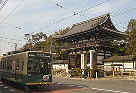 Rou Gate in Kōryū-ji Temple, and Randen Street-car
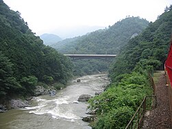 Hozu River and Gorge
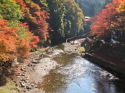 Kiyotaki river in Takao area


References
- "京都府の住所表記のなぞ - 右が左京区で左が右京区? 「上ル」「下ル」?" (in Japanese).
- "Corporate Data". ROHM Co., Ltd. Retrieved April 29, 2022.
- "Company Outline." Nissin Electric. Retrieved on April 29, 2022.
- "ウリハッキョ一覧" (Archive). Chongryon. Retrieved on October 14, 2015.
External links
На других языках
[de] Ukyō-ku (Kyōto)
Ukyō-ku (jap. 右京区, dt. „rechter Hauptstadtbezirk“) ist einer von elf Stadtbezirken (ku) von Kyōto, Japan.- [en] Ukyō-ku, Kyoto
[ru] Укё (Киото)
Укё (яп. 右京区, うきょうく [ukʲoː ku]) — район города Киото префектуры Киото в Японии. По состоянию на 1 июля 2012 года население района составило 203 368 человек, плотность населения — 697 чел / км ².Другой контент может иметь иную лицензию. Перед использованием материалов сайта WikiSort.org внимательно изучите правила лицензирования конкретных элементов наполнения сайта.
WikiSort.org - проект по пересортировке и дополнению контента Википедии