world.wikisort.org - Japan
Sannohe (三戸町, Sannohe-machi) is a town located in Aomori Prefecture, Japan. As of 31 March 2020[update], the town had an estimated population of 9,814 in 4260 households,[1] and a population density of 65 persons per km2. The total area of the town is 151.79 square kilometres (58.61 sq mi).[2]
Sannohe
三戸町 | |
|---|---|
Town | |
 Sannohe Town Hall | |
 Flag  Seal | |
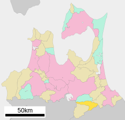 Location of Sannohe in Aomori Prefecture | |
 Sannohe | |
| Coordinates: 40°22′42.2″N 141°15′31.6″E | |
| Country | Japan |
| Region | Tōhoku |
| Prefecture | Aomori Prefecture |
| District | Sannohe |
| Area | |
| • Total | 151.79 km2 (58.61 sq mi) |
| Population (March 2020) | |
| • Total | 9,814 |
| • Density | 65/km2 (170/sq mi) |
| Time zone | UTC+9 (Japan Standard Time) |
| Phone number | 0179-20-1111 |
| Address | Zaifukojimachi, Sannohe, Sannohe-gun, Aomori 039-0132 |
| Climate | Cfa/Dfa |
| Website | Official website |
| Symbols | |
| Bird | Eurasian scops-owl |
| Flower | Far East Amur adonis |
| Tree | Paulownia tomentosa |

Geography
Sannohe occupies an inland area in southeast corner of Aomori Prefecture, south of the Hakkōda Mountains. The terrain is relatively flat, with mountains extending in the northwestern part of the town. The Mabechi River flows from north to south through the center of the town.
Neighbouring municipalities
Iwate Prefecture
Akita Prefecture
Climate
The town has a cold maritime climate characterized by cool short summers and long cold winters with heavy snowfall (Köppen climate classification Cfa). The average annual temperature in Sannohe is 10.2 °C. The average annual rainfall is 1259 mm with September as the wettest month. The temperatures are highest on average in August, at around 22.9 °C, and lowest in January, at around -2.5 °C.[3]
| Climate data for Sannohe (1991−2020 normals, extremes 1976−present) | |||||||||||||
|---|---|---|---|---|---|---|---|---|---|---|---|---|---|
| Month | Jan | Feb | Mar | Apr | May | Jun | Jul | Aug | Sep | Oct | Nov | Dec | Year |
| Record high °C (°F) | 14.4 (57.9) |
18.2 (64.8) |
21.6 (70.9) |
30.0 (86.0) |
34.7 (94.5) |
35.6 (96.1) |
37.7 (99.9) |
37.3 (99.1) |
35.0 (95.0) |
28.7 (83.7) |
25.2 (77.4) |
18.7 (65.7) |
37.7 (99.9) |
| Average high °C (°F) | 2.4 (36.3) |
3.5 (38.3) |
7.8 (46.0) |
14.9 (58.8) |
20.8 (69.4) |
23.9 (75.0) |
27.0 (80.6) |
28.3 (82.9) |
24.7 (76.5) |
18.6 (65.5) |
11.8 (53.2) |
5.0 (41.0) |
15.7 (60.3) |
| Daily mean °C (°F) | −1.8 (28.8) |
−1.2 (29.8) |
2.4 (36.3) |
8.5 (47.3) |
14.2 (57.6) |
18.0 (64.4) |
21.8 (71.2) |
22.9 (73.2) |
18.8 (65.8) |
12.1 (53.8) |
6.0 (42.8) |
0.6 (33.1) |
10.2 (50.3) |
| Average low °C (°F) | −6.3 (20.7) |
−6.1 (21.0) |
−2.8 (27.0) |
2.1 (35.8) |
8.1 (46.6) |
12.9 (55.2) |
17.6 (63.7) |
18.7 (65.7) |
14.1 (57.4) |
6.5 (43.7) |
0.8 (33.4) |
−3.6 (25.5) |
5.2 (41.3) |
| Record low °C (°F) | −17.6 (0.3) |
−20.2 (−4.4) |
−17.7 (0.1) |
−8.7 (16.3) |
−1.3 (29.7) |
1.9 (35.4) |
7.6 (45.7) |
8.9 (48.0) |
1.8 (35.2) |
−2.9 (26.8) |
−8.1 (17.4) |
−17.0 (1.4) |
−20.2 (−4.4) |
| Average precipitation mm (inches) | 49.4 (1.94) |
49.1 (1.93) |
63.3 (2.49) |
65.0 (2.56) |
81.9 (3.22) |
96.4 (3.80) |
161.4 (6.35) |
160.3 (6.31) |
159.4 (6.28) |
114.0 (4.49) |
66.1 (2.60) |
64.8 (2.55) |
1,131.1 (44.53) |
| Average snowfall cm (inches) | 111 (44) |
109 (43) |
77 (30) |
5 (2.0) |
0 (0) |
0 (0) |
0 (0) |
0 (0) |
0 (0) |
0 (0) |
3 (1.2) |
65 (26) |
367 (144) |
| Average precipitation days (≥ 1.0 mm) | 10.4 | 10.2 | 10.4 | 10.2 | 10.3 | 9.2 | 11.6 | 11.7 | 11.1 | 10.5 | 11.2 | 10.6 | 127.4 |
| Average snowy days (≥ 3 cm) | 14.9 | 14.3 | 9.8 | 0.6 | 0 | 0 | 0 | 0 | 0 | 0 | 0.4 | 8.4 | 48.4 |
| Mean monthly sunshine hours | 102.3 | 105.3 | 153.5 | 181.5 | 190.7 | 157.6 | 136.5 | 152.7 | 141.2 | 148.9 | 121.9 | 102.6 | 1,694.7 |
| Source: Japan Meteorological Agency[4][5] | |||||||||||||
Demographics
Per Japanese census data,[6] the population of Sannohe peaked in the 1950s has steadily declined since. It is now less than it was a century ago.
| Year | Pop. | ±% |
|---|---|---|
| 1920 | 12,714 | — |
| 1930 | 13,644 | +7.3% |
| 1940 | 13,768 | +0.9% |
| 1950 | 17,614 | +27.9% |
| 1960 | 17,332 | −1.6% |
| 1970 | 16,184 | −6.6% |
| 1980 | 15,506 | −4.2% |
| 1990 | 14,440 | −6.9% |
| 2000 | 13,223 | −8.4% |
| 2010 | 11,300 | −14.5% |
| 2020 | 9,082 | −19.6% |
History
The area around Sannohe has been inhabited since ancient times, and numerous Jōmon period remains have been found. During the Kamakura period it was the center of the domains awarded to Nanbu Mitsuyuki, a retainer of Minamoto no Yoritomo after the defeat of the Northern Fujiwara clan in 1187. It remained under the control of the Nanbu clan through the Sengoku period as a castle town centered on Sannohe Castle. During the Edo period, came under the control of Morioka Domain, and a daikansho was established on the site of the former castle. It was proclaimed a town after Meiji Restoration, with the establishment of the modern municipalities system on 1 April 1889. On 20 March 1955, the three neighboring villages of Sarube, Tomesaki and Tonai merged with Sannohe.
Government
Sannohe has a mayor-council form of government with a directly elected mayor and a unicameral town council of 14 members. Sannohe is part of Sannohe District which contributes three members to the Aomori Prefectural Assembly. In terms of national politics, the city is part of Aomori 2nd district of the lower house of the Diet of Japan.
Economy
The economy of Sannohe is heavily dependent on agriculture, with tobacco as the main crop, followed by rice and apples. Due to its many historical relics, the town is also developing tourism as a mainstay of the local economy.
Education
Sannohe has three public elementary schools and two public middle schools operated by the town government and one public high school operated by the Aomori Prefectural Board of Education.
Transportation
Railway
![]() Aoimori Railway Company - Aoimori Railway Line
Aoimori Railway Company - Aoimori Railway Line
Highway
 National Route 4
 National Route 104
International relations
 Tamworth, New South Wales, Australia[7] since 2001
Local attractions
Noted people from Sannohe
- Kagamisato Kiyoji, sumo wrestler
- Kanpei Matsuo, politician
- Noboru Baba, illustrator, manga artist
References
- Sannohe Town official statistics (in Japanese)
- 詳細データ 青森県三戸町. 市町村の姿 グラフと統計でみる農林水産業 (in Japanese). Ministry of Agriculture, Forestry and Fisheries. 2016. Retrieved 13 July 2017.
- Sannohe climate data
- 観測史上1~10位の値(年間を通じての値). JMA. Retrieved March 4, 2022.
- 気象庁 / 平年値(年・月ごとの値). JMA. Retrieved March 4, 2022.
- Sannohe population statistics
- "International Exchange". List of Affiliation Partners within Prefectures. Council of Local Authorities for International Relations (CLAIR). Archived from the original on 22 November 2015. Retrieved 21 November 2015.
- 青森県内の自然公園 [Natural Parks in Aomori Prefecture] (in Japanese). Aomori Prefecture. Retrieved 22 August 2012.
- 名久井岳県立自然公園 [Nakuidake Prefectural Natural Park] (in Japanese). Aomori Prefecture. Retrieved 22 August 2012.
External links
- Official Website (in Japanese)
Aomori (capital) | ||
| Core cities |
| |
| Cities | ||
| Districts |
| |
List of mergers in Aomori Prefecture | ||
Authority control | |
|---|---|
| General | |
| National libraries | |
На других языках
- [en] Sannohe
[es] Sannohe (Aomori)
Sannohe (三戸町, Sannohe-machi?) es un pueblo localizado en la prefectura de Aomori, Japón. En octubre de 2018 tenía una población de 9.362 habitantes y una densidad de población de 61,7 personas por km². Su área total es de 151,79 km².[ru] Саннохе (посёлок)
Саннохе (яп. 三戸町 Саннохэ-мати) — посёлок в Японии, находящийся в уезде Саннохе префектуры Аомори. Площадь посёлка составляет 151,55 км²[1], население — 11 159 человек (1 августа 2014)[2], плотность населения — 73,63 чел./км².Другой контент может иметь иную лицензию. Перед использованием материалов сайта WikiSort.org внимательно изучите правила лицензирования конкретных элементов наполнения сайта.
WikiSort.org - проект по пересортировке и дополнению контента Википедии