world.wikisort.org - Japan
Noheji (野辺地町, Noheji-machi) is a town located in Aomori Prefecture, Japan. As of 31 March 2020[update], the town had an estimated population of 12,956, and a population density of 168 persons per km2 in 6,466 households.[1] The total area of the town is 81.68 square kilometers (31.54 sq mi).[2]
Noheji
野辺地 | |
|---|---|
Town | |
 Noheji Town Hall | |
 Flag  Seal | |
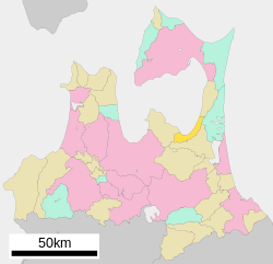 Location of Noheji in Aomori Prefecture | |
 Noheji | |
| Coordinates: 40°51′52″N 141°07′43.5″E | |
| Country | Japan |
| Region | Tōhoku |
| Prefecture | Aomori |
| District | Kamikita |
| Area | |
| • Total | 81.68 km2 (31.54 sq mi) |
| Population (March 31, 2020) | |
| • Total | 12,956 |
| • Density | 168/km2 (440/sq mi) |
| Time zone | UTC+9 (Japan Standard Time) |
| Phone number | 0175-64-2111 |
| Address | Noheiji 123-1, Kitakami-gun, Aomori-ken 039-3131 |
| Climate | Cfa |
| Website | Official website |
| Symbols | |
| Bird | Common gull |
| Flower | Rosa rugosa |
| Tree | Sakura |

Geography
Noheji occupies the southeastern coastline of Mutsu Bay at the base of the Shimokita Peninsula.
Neighboring municipalities
Aomori Prefecture
Climate
The town has a cold maritime climate characterized by cool short summers and long cold winters with heavy snowfall (Köppen climate classification Cfa). The average annual temperature in Noheji is 10.1 °C. The average annual rainfall is 1243 mm with September as the wettest month. The temperatures are highest on average in August, at around 22.7 °C, and lowest in January, at around -2.1 °C.[3]
| Climate data for Noheji (2008−2020 normals, extremes 2008−present) | |||||||||||||
|---|---|---|---|---|---|---|---|---|---|---|---|---|---|
| Month | Jan | Feb | Mar | Apr | May | Jun | Jul | Aug | Sep | Oct | Nov | Dec | Year |
| Record high °C (°F) | 12.2 (54.0) |
17.2 (63.0) |
20.7 (69.3) |
26.5 (79.7) |
28.4 (83.1) |
32.2 (90.0) |
33.0 (91.4) |
33.8 (92.8) |
32.6 (90.7) |
28.5 (83.3) |
21.6 (70.9) |
18.0 (64.4) |
33.8 (92.8) |
| Average high °C (°F) | 1.6 (34.9) |
2.3 (36.1) |
6.2 (43.2) |
11.9 (53.4) |
17.1 (62.8) |
20.4 (68.7) |
24.2 (75.6) |
25.8 (78.4) |
23.0 (73.4) |
17.2 (63.0) |
10.8 (51.4) |
4.4 (39.9) |
13.7 (56.7) |
| Daily mean °C (°F) | −0.7 (30.7) |
−0.5 (31.1) |
2.6 (36.7) |
7.3 (45.1) |
12.4 (54.3) |
16.0 (60.8) |
20.4 (68.7) |
22.1 (71.8) |
19.1 (66.4) |
13.2 (55.8) |
7.3 (45.1) |
1.6 (34.9) |
10.1 (50.1) |
| Average low °C (°F) | −3.5 (25.7) |
−3.5 (25.7) |
−1.2 (29.8) |
2.5 (36.5) |
8.2 (46.8) |
12.5 (54.5) |
17.5 (63.5) |
19.1 (66.4) |
15.2 (59.4) |
8.7 (47.7) |
3.5 (38.3) |
−1.4 (29.5) |
6.5 (43.7) |
| Record low °C (°F) | −12.3 (9.9) |
−11.1 (12.0) |
−10.7 (12.7) |
−4.7 (23.5) |
−1.0 (30.2) |
4.9 (40.8) |
11.8 (53.2) |
12.6 (54.7) |
5.7 (42.3) |
0.9 (33.6) |
−4.3 (24.3) |
−8.1 (17.4) |
−12.3 (9.9) |
| Average precipitation mm (inches) | 81.5 (3.21) |
66.4 (2.61) |
84.2 (3.31) |
75.5 (2.97) |
82.4 (3.24) |
89.5 (3.52) |
137.0 (5.39) |
196.8 (7.75) |
148.0 (5.83) |
132.5 (5.22) |
85.0 (3.35) |
109.8 (4.32) |
1,291.1 (50.83) |
| Average snowfall cm (inches) | 116 (46) |
99 (39) |
51 (20) |
4 (1.6) |
0 (0) |
0 (0) |
0 (0) |
0 (0) |
0 (0) |
0 (0) |
8 (3.1) |
97 (38) |
375 (147.7) |
| Average precipitation days (≥ 1.0 mm) | 17.0 | 14.4 | 12.5 | 9.9 | 9.8 | 8.7 | 10.7 | 10.9 | 11.1 | 12.3 | 14.3 | 18.2 | 149.8 |
| Average snowy days (≥ 3 cm) | 13.6 | 11.2 | 5.9 | 0.6 | 0 | 0 | 0 | 0 | 0 | 0 | 1.0 | 10.1 | 42.4 |
| Mean monthly sunshine hours | 74.3 | 94.8 | 153.3 | 192.7 | 210.0 | 166.1 | 136.4 | 148.5 | 160.7 | 150.3 | 96.0 | 70.1 | 1,651.6 |
| Source: Japan Meteorological Agency[4][5] | |||||||||||||
Demographics
Per Japanese census data,[6] the population of Noheji peaked in around the year 1970 and has declined over the past 50 years.
| Year | Pop. | ±% |
|---|---|---|
| 1920 | 10,240 | — |
| 1930 | 11,735 | +14.6% |
| 1940 | 12,975 | +10.6% |
| 1950 | 16,521 | +27.3% |
| 1960 | 17,447 | +5.6% |
| 1970 | 17,544 | +0.6% |
| 1980 | 18,419 | +5.0% |
| 1990 | 16,750 | −9.1% |
| 2000 | 16,012 | −4.4% |
| 2010 | 14,304 | −10.7% |
| 2020 | 12,374 | −13.5% |
History
The area around Noheji was inhabited by the Emishi people until the historical period, and the name "Noheji" is derived from "Nosobechi", or "place where a pure river flows through a field" in the Ainu language. During the Edo period, the area was controlled by the Nanbu clan of Morioka Domain and prospered due to its fishing industry and location on the road connecting Morioka Domain with the Hirosaki Domain. During the Boshin War of the Meiji Restoration, the Battle of Noheji occurred between the Tokugawa loyalist forces of Morioka Domain and pro-imperial forces of Hirosaki Domain on 11 November 1868, resulting in a victory for the Imperial faction.[7] During the post-Meiji restoration creation of the modern municipalities system on 1 April 1889, the village of Noheiji was established. Noheji was elevated to town status on 28 August 1898.
Government
Noheji has a mayor-council form of government with a directly elected mayor and a unicameral town council of 12 members. Noheji is part of Shimokita District which contributes four members to the Aomori Prefectural Assembly. In terms of national politics, the town is part of Aomori 1st district of the lower house of the Diet of Japan.
Economy
The economy of Noheji is heavily dependent on commercial fishing, especially for scallops, and on agriculture with the raising of mountain yams predominating. The town also serves as a commercial and transportation center for the surrounding rural areas.
Education
Noheji has three public elementary schools and one public middle school operated by the town government, and one public high school operated by the Aomori Prefectural Board of Education. The town also has one private high school.
Transportation
Railway
![]() Aoimori Railway Company - Aoimori Railway Line
Aoimori Railway Company - Aoimori Railway Line
![]() East Japan Railway Company (JR East) - Ōminato Line
East Japan Railway Company (JR East) - Ōminato Line
Highway
 Shimokita Expressway
 National Route 4
 National Route 45 (unsigned)
 National Route 279
Local attractions
- Makado Onsen, a hot spring and ski resort
Noted people from Noheji
- Tsuyoshi Ichinohe, skier
- Takaya Eguchi, modern dancer
- Gaku Shibasaki, footballer
References
- Noheji Town statistics
- 詳細データ 青森県野辺地町. 市町村の姿 グラフと統計でみる農林水産業 (in Japanese). Ministry of Agriculture, Forestry and Fisheries. 2016. Retrieved 13 July 2017.
- Noheiji climate data
- 観測史上1~10位の値(年間を通じての値). JMA. Retrieved March 5, 2022.
- 気象庁 / 平年値(年・月ごとの値). JMA. Retrieved March 5, 2022.
- Noheji population statistics
- "野辺地戦争戦死者の墓所" [Battle of Noheji cemetery]. Aomori Prefecture Government (in Japanese). 15 July 2010. Retrieved 7 April 2020.
External links
- Official Website (in Japanese)
Aomori (capital) | ||
| Core cities |
| |
| Cities | ||
| Districts |
| |
List of mergers in Aomori Prefecture | ||
На других языках
- [en] Noheji
[es] Noheji (Aomori)
Noheji (野辺地町, Noheji-machi?) es un pueblo localizado en la prefectura de Aomori, Japón. En octubre de 2018 tenía una población de 12.890 habitantes y una densidad de población de 158 personas por km². Su área total es de 81,68 km².[ru] Нохедзи
Нохедзи (яп. 野辺地町 Нохэдзи-мати) — посёлок в Японии, находящийся в уезде Камикита префектуры Аомори. Площадь посёлка составляет 81,61 км²[1], население — 14 201 человек (1 августа 2014)[2], плотность населения — 174,01 чел./км².Другой контент может иметь иную лицензию. Перед использованием материалов сайта WikiSort.org внимательно изучите правила лицензирования конкретных элементов наполнения сайта.
WikiSort.org - проект по пересортировке и дополнению контента Википедии