world.wikisort.org - Japan
Mamurogawa (真室川町, Mamurogawa-machi) is a town located in Yamagata Prefecture, Japan. As of 29 February 2020[update], the town has an estimated population of 7,506 in 2678 households,[1] and a population density of 20 persons per km². The total area of the town is 374.29 square kilometres (145 sq mi).
Mamurogawa
真室川町 | |
|---|---|
Town | |
 Mamurogawa Town Hall | |
 Flag  Seal | |
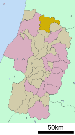 Location of Mamurogawa in Yamagata Prefecture | |
 Mamurogawa | |
| Coordinates: 38°51′28.4″N 140°15′8.3″E | |
| Country | Japan |
| Region | Tōhoku |
| Prefecture | Yamagata |
| District | Mogami |
| Area | |
| • Total | 374.29 km2 (144.51 sq mi) |
| Population (February 2020) | |
| • Total | 7,506 |
| • Density | 20/km2 (52/sq mi) |
| Time zone | UTC+9 (Japan Standard Time) |
| Phone number | 0233-62-2111 |
| Address | 127-7 Shincho, Mamurogawa-machi, Mogami-gun, Yamagata-ken 999-5301 |
| Climate | Cfa/Dfa |
| Website | Official website |
| Symbols | |
| Flower | Prunus mume |
| Tree | Prunus mume |
Geography
Mamurogawa is located in the extreme northern Yamagata Prefecture, bordering on Akita Prefecture to the north. The town is located in the Shinjō Valley, surrounding by low mountains on all sides, with the Ōu Mountains to the northeast. The area is known for its heavy snowfalls in winter.
Neighboring municipalities
Climate
Mamurogawa has a Humid continental climate (Köppen climate classification Cfa) with large seasonal temperature differences, with warm to hot (and often humid) summers and cold (sometimes severely cold) winters. Precipitation is significant throughout the year, but is heaviest from August to October. The average annual temperature in Mamurogawa is 10.2 °C (50.4 °F). The average annual rainfall is 2,810.9 mm (110.67 in) with July as the wettest month. The temperatures are highest on average in August, at around 23.2 °C (73.8 °F), and lowest in January, at around −1.0 °C (30.2 °F).[2]
| Climate data for Mamurogawa (1991−2020 normals, extremes 1976−present) | |||||||||||||
|---|---|---|---|---|---|---|---|---|---|---|---|---|---|
| Month | Jan | Feb | Mar | Apr | May | Jun | Jul | Aug | Sep | Oct | Nov | Dec | Year |
| Record high °C (°F) | 12.4 (54.3) |
13.8 (56.8) |
18.5 (65.3) |
29.2 (84.6) |
32.6 (90.7) |
32.2 (90.0) |
35.9 (96.6) |
36.1 (97.0) |
34.2 (93.6) |
28.1 (82.6) |
21.2 (70.2) |
18.2 (64.8) |
36.1 (97.0) |
| Average high °C (°F) | 1.9 (35.4) |
2.9 (37.2) |
6.4 (43.5) |
13.4 (56.1) |
20.1 (68.2) |
23.9 (75.0) |
27.0 (80.6) |
28.6 (83.5) |
24.3 (75.7) |
17.8 (64.0) |
10.7 (51.3) |
4.2 (39.6) |
15.1 (59.2) |
| Daily mean °C (°F) | −1.0 (30.2) |
−0.7 (30.7) |
1.6 (34.9) |
7.0 (44.6) |
13.8 (56.8) |
18.4 (65.1) |
22.2 (72.0) |
23.2 (73.8) |
18.9 (66.0) |
12.2 (54.0) |
6.0 (42.8) |
1.1 (34.0) |
10.2 (50.4) |
| Average low °C (°F) | −3.9 (25.0) |
−4.1 (24.6) |
−2.3 (27.9) |
1.5 (34.7) |
8.1 (46.6) |
13.5 (56.3) |
18.3 (64.9) |
19.1 (66.4) |
14.8 (58.6) |
7.9 (46.2) |
2.3 (36.1) |
−1.5 (29.3) |
6.1 (43.1) |
| Record low °C (°F) | −14.6 (5.7) |
−15.1 (4.8) |
−16.0 (3.2) |
−7.9 (17.8) |
−0.6 (30.9) |
3.1 (37.6) |
8.3 (46.9) |
9.5 (49.1) |
3.7 (38.7) |
−1.5 (29.3) |
−5.7 (21.7) |
−13.5 (7.7) |
−16.0 (3.2) |
| Average precipitation mm (inches) | 270.7 (10.66) |
196.1 (7.72) |
181.1 (7.13) |
154.5 (6.08) |
180.5 (7.11) |
189.8 (7.47) |
339.7 (13.37) |
275.4 (10.84) |
198.2 (7.80) |
228.7 (9.00) |
286.1 (11.26) |
310.0 (12.20) |
2,810.9 (110.67) |
| Average precipitation days (≥ 1.0 mm) | 25.5 | 21.9 | 19.5 | 14.8 | 13.0 | 11.9 | 15.0 | 13.2 | 14.4 | 15.9 | 20.0 | 24.7 | 209.8 |
| Mean monthly sunshine hours | 35.4 | 54.8 | 102.6 | 152.5 | 192.0 | 165.8 | 138.4 | 174.7 | 131.6 | 115.2 | 74.8 | 37.9 | 1,378.3 |
| Source: Japan Meteorological Agency[3][2] | |||||||||||||
Demographics
Per Japanese census data,[4] the population of Mamurogawa peaked in the 1950s and has declined by more than half since then. It is now less than it was a century ago.
| Year | Pop. | ±% |
|---|---|---|
| 1920 | 11,050 | — |
| 1930 | 12,499 | +13.1% |
| 1940 | 13,629 | +9.0% |
| 1950 | 17,020 | +24.9% |
| 1960 | 16,856 | −1.0% |
| 1970 | 13,976 | −17.1% |
| 1980 | 12,888 | −7.8% |
| 1990 | 12,230 | −5.1% |
| 2000 | 10,592 | −13.4% |
| 2010 | 9,165 | −13.5% |
| 2020 | 7,203 | −21.4% |
History
The area of present-day Mamurogawa was part of ancient Dewa Province and the location of Sakenobe Castle in the Sengoku period. After the start of the Meiji period, the area became part of Mogami District, Yamagata Prefecture. The village of Mamurogawa was established on April 1, 1889 with the establishment of the modern municipalities system. During World War II, an airbase for training pilots was established by the Imperial Japanese Army. The site is now a park, and part of the grounds of the local high school. Mamurogawa was elevated to town status on April 1, 1950. On August 1, 1954, it absorbed the neighboring villages of Araki and Nozoki.
Economy
The economy of Mamurogawa is based on agriculture and forestry.
Education
Mamurogawa has three public elementary schools and one public middle school operated by the town government and one public high school operated by the Yamagata Prefectural Board of Education.
Transportation
Railway
![]() East Japan Railway Company - Ōu Main Line
East Japan Railway Company - Ōu Main Line
- Mamurogawa - Kamabuchi - Ōtaki - Nozoki
Highway
 Tōhoku-Chūō Expressway – Mamurogawa interchange
 National Route 13
 National Route 344
Local attractions
- Kabusan Prefectural Park
- Tokasaka Dam
Notes
- Mamurogawa Town official statistics (in Japanese)
- 気象庁 / 平年値(年・月ごとの値). JMA. Retrieved March 25, 2022.
- 観測史上1~10位の値(年間を通じての値). JMA. Retrieved March 25, 2022.
- Mamurogawa population statistics
External links
![]() Media related to Mamurogawa, Yamagata at Wikimedia Commons
Media related to Mamurogawa, Yamagata at Wikimedia Commons
- Official Website (in Japanese)
Yamagata (capital) | ||
| Core city | ||
| Cities | ||
| Districts |
| |
List of mergers in Yamagata Prefecture | ||
Authority control | |
|---|---|
| General | |
| National libraries | |
На других языках
- [en] Mamurogawa
[ru] Мамурогава
Мамурогава (яп. 真室川町 Мамурогава-мати) — посёлок в Японии, находящийся в уезде Могами префектуры Ямагата. Площадь посёлка составляет 374,29 км²[1], население — 8467 человек (1 августа 2014)[2], плотность населения — 22,62 чел./км².Другой контент может иметь иную лицензию. Перед использованием материалов сайта WikiSort.org внимательно изучите правила лицензирования конкретных элементов наполнения сайта.
WikiSort.org - проект по пересортировке и дополнению контента Википедии