world.wikisort.org - Japan
Hirao (平生町, Hirao-chō) is a town located in Kumage District, Yamaguchi Prefecture, Japan.
This article may be expanded with text translated from the corresponding article in Japanese. (October 2022) Click [show] for important translation instructions.
|
Hirao
平生町 | |
|---|---|
Town | |
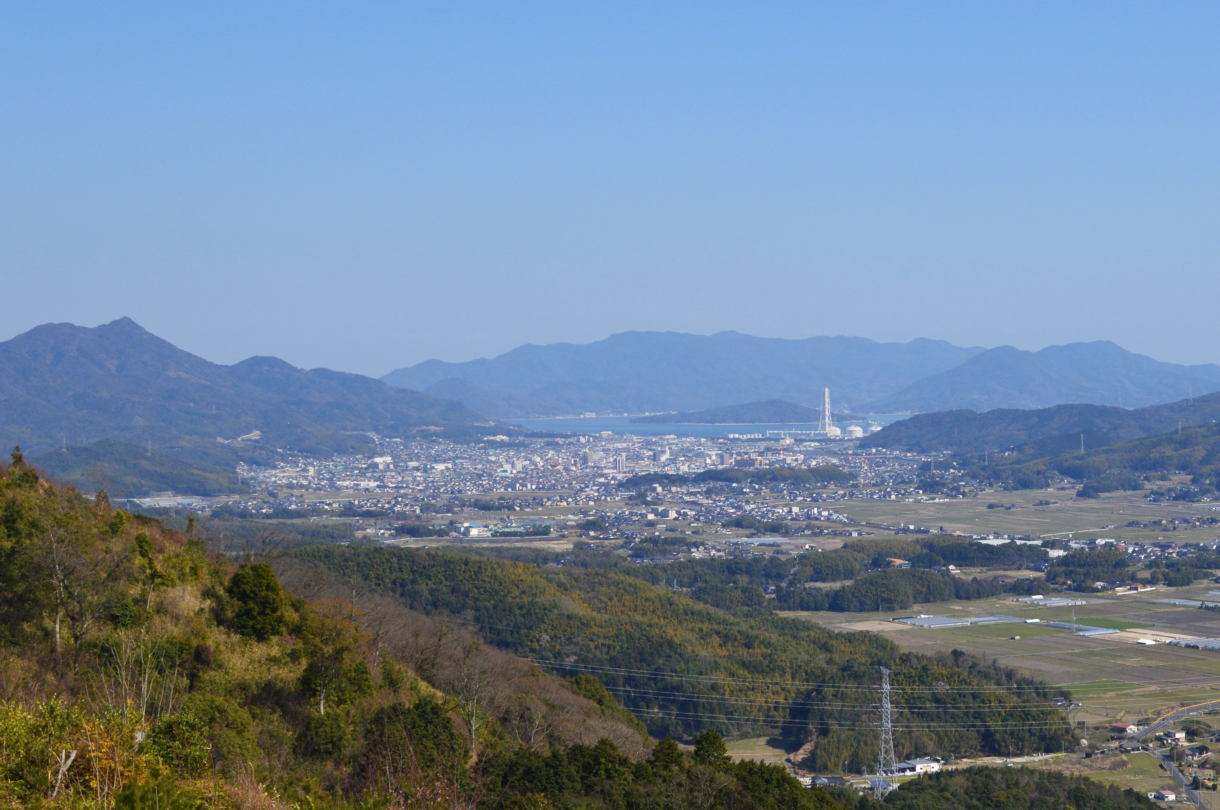 Hirao town viewed from Mt. Iwaki | |
 Flag | |
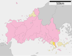 Location of Hirao in Yamaguchi Prefecture | |
 Hirao Location in Japan | |
| Coordinates: 33°56′N 132°04′E | |
| Country | Japan |
| Region | Chūgoku San'yō |
| Prefecture | Yamaguchi Prefecture |
| District | Kumage |
| Government | |
| • Mayor | Kunihiro Asamoto |
| Area | |
| • Total | 34.40 km2 (13.28 sq mi) |
| Population (October 1, 2016) | |
| • Total | 12,643 |
| • Density | 370/km2 (950/sq mi) |
| Time zone | UTC+09:00 (JST) |
| Website | www |
As of 2016, the town has an estimated population of 12,643 and a density of 370 inhabitants per square kilometre (958.30/sq mi). The total area is 34.40 km2 (13.28 sq mi).
Geography
Neighbouring municipalities
Transportation
Hirao did not have any train stations, with the Yanai station being the closest from the town and takes about a ten-minute travel from the town.[1] Japan National Route 188 passes through Hirao.
References
- "22 伊陸駅予定地だった所". 柳井にっぽん晴れ街道協議会 (in Japanese). Retrieved 2022-10-13.
External links
 Media related to Hirao, Yamaguchi at Wikimedia Commons
- Hirao official website (in Japanese)
Yamaguchi (capital) | ||
| Core city | ||
| Cities | ||
| Districts |
| |
List of mergers in Yamaguchi Prefecture | ||
Authority control | |
|---|---|
| General | |
| National libraries | |
This article about a location in Yamaguchi Prefecture is a stub. You can help Wikipedia by expanding it. |
На других языках
- [en] Hirao
[es] Hirao (Yamaguchi)
Hirao (平生町, Hirao-chō?) es un pueblo localizado en la prefectura de Yamaguchi, Japón. Tiene una población estimada, a fines de 2021, de 11 385 habitantes.[3][ru] Хирао
Хирао (яп. 平生町 Хирао-тё:) — посёлок в Японии, находящийся в уезде Кумаге префектуры Ямагути. Площадь посёлка составляет 34,47 км²[1], население — 13 060 человек (1 августа 2014)[2], плотность населения — 378,88 чел./км².Текст в блоке "Читать" взят с сайта "Википедия" и доступен по лицензии Creative Commons Attribution-ShareAlike; в отдельных случаях могут действовать дополнительные условия.
Другой контент может иметь иную лицензию. Перед использованием материалов сайта WikiSort.org внимательно изучите правила лицензирования конкретных элементов наполнения сайта.
Другой контент может иметь иную лицензию. Перед использованием материалов сайта WikiSort.org внимательно изучите правила лицензирования конкретных элементов наполнения сайта.
2019-2026
WikiSort.org - проект по пересортировке и дополнению контента Википедии
WikiSort.org - проект по пересортировке и дополнению контента Википедии