world.wikisort.org - Japan
Hakusan (白山市, Hakusan-shi) is a city located in Ishikawa Prefecture, Japan. As of 31 January 2018[update], the city had an estimated population of 113,375 in 43246 households, and a population density of 290 persons per km2.[2] The total area of the city was 754.93 square kilometres (291.48 sq mi). It is the second-most populous city in Ishikawa Prefecture after Kanazawa.
Hakusan
白山市 | |
|---|---|
City | |
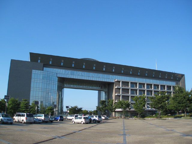 Hakusan City Hall | |
 Flag  Emblem | |
 Location of Hakusan in Ishikawa Prefecture | |
 Hakusan | |
| Coordinates: 36°30′59.9″N 136°33′56.1″E | |
| Country | Japan |
| Region | Chūbu (Hokuriku) |
| Prefecture | Ishikawa Prefecture |
| First official recorded | 91 BC |
| Matsutō city settled | October 10, 1970 |
| Changed to current name | February 1, 2005 |
| Government | |
| • - Mayor | Noriaki Yamada |
| Area | |
| • Total | 754.93 km2 (291.48 sq mi) |
| Population (December 31, 2019) | |
| • Total | 113,715[1] |
| Time zone | UTC+9 (Japan Standard Time) |
| Phone number | 076-276-1111 |
| Address | 2-1 Kuramitsu, Hakusan-shi, Ishikawa-ken 924-8688 |
| Climate | Cfa |
| Website | Official website |
| Symbols | |
| Bird | Japanese bush-warbler |
| Flower | Morning glory |
| Tree | Japanese beech |

Geography
Hakusan is located in southwestern Ishikawa Prefecture in the Hokuriku region of Japan and is bordered by the Sea of Japan to the west and Fukui Prefecture to the south, and Gifu Prefecture and Toyama Prefectures to the east. The southeastern portion of the city is dominated by high mountains. Parts of the city are within the borders of Hakusan National Park.
Neighbouring municipalities
- Ishikawa Prefecture
- Fukui Prefecture
- Gifu Prefecture
- Toyama Prefecture
- Nanto
Climate
Hakusan has a humid continental climate (Köppen Cfa) characterized by mild summers and cold winters with heavy snowfall. The average annual temperature in Hakusan is 14.2 °C. The average annual rainfall is 2542 mm with September as the wettest month. The temperatures are highest on average in August, at around 26.8 °C, and lowest in January, at around 2.9 °C.[3]
| Climate data for Hakusan (1991−2020 normals, extremes 1978−present) | |||||||||||||
|---|---|---|---|---|---|---|---|---|---|---|---|---|---|
| Month | Jan | Feb | Mar | Apr | May | Jun | Jul | Aug | Sep | Oct | Nov | Dec | Year |
| Record high °C (°F) | 17.9 (64.2) |
19.5 (67.1) |
23.9 (75.0) |
29.6 (85.3) |
32.2 (90.0) |
33.3 (91.9) |
37.3 (99.1) |
36.7 (98.1) |
35.5 (95.9) |
31.7 (89.1) |
25.5 (77.9) |
23.9 (75.0) |
37.3 (99.1) |
| Average high °C (°F) | 5.0 (41.0) |
5.9 (42.6) |
10.4 (50.7) |
17.0 (62.6) |
22.2 (72.0) |
25.0 (77.0) |
28.8 (83.8) |
30.5 (86.9) |
26.2 (79.2) |
20.6 (69.1) |
14.7 (58.5) |
8.2 (46.8) |
17.9 (64.2) |
| Daily mean °C (°F) | 1.5 (34.7) |
1.8 (35.2) |
5.1 (41.2) |
11.3 (52.3) |
16.6 (61.9) |
20.2 (68.4) |
24.1 (75.4) |
25.2 (77.4) |
21.1 (70.0) |
15.3 (59.5) |
9.7 (49.5) |
4.3 (39.7) |
13.0 (55.4) |
| Average low °C (°F) | −1.3 (29.7) |
−1.6 (29.1) |
0.8 (33.4) |
5.9 (42.6) |
11.4 (52.5) |
16.2 (61.2) |
20.5 (68.9) |
21.2 (70.2) |
17.2 (63.0) |
11.2 (52.2) |
5.6 (42.1) |
1.2 (34.2) |
9.0 (48.3) |
| Record low °C (°F) | −10.0 (14.0) |
−8.4 (16.9) |
−6.3 (20.7) |
−2.9 (26.8) |
1.5 (34.7) |
7.5 (45.5) |
13.6 (56.5) |
13.7 (56.7) |
7.8 (46.0) |
1.7 (35.1) |
−1.4 (29.5) |
−8.7 (16.3) |
−10.0 (14.0) |
| Average precipitation mm (inches) | 340.5 (13.41) |
210.2 (8.28) |
195.6 (7.70) |
167.7 (6.60) |
162.2 (6.39) |
208.7 (8.22) |
290.8 (11.45) |
224.4 (8.83) |
235.6 (9.28) |
215.8 (8.50) |
277.9 (10.94) |
372.1 (14.65) |
2,901.4 (114.23) |
| Average snowfall cm (inches) | 217 (85) |
155 (61) |
56 (22) |
2 (0.8) |
0 (0) |
0 (0) |
0 (0) |
0 (0) |
0 (0) |
0 (0) |
1 (0.4) |
89 (35) |
518 (204) |
| Average precipitation days (≥ 1.0 mm) | 23.5 | 19.2 | 16.8 | 13.2 | 12.1 | 12.5 | 14.7 | 11.2 | 13.6 | 13.5 | 17.2 | 22.5 | 190 |
| Average snowy days (≥ 3 cm) | 17.8 | 14.9 | 6.8 | 0.3 | 0 | 0 | 0 | 0 | 0 | 0 | 0.1 | 8.0 | 47.9 |
| Mean monthly sunshine hours | 51.2 | 74.6 | 120.9 | 175.0 | 196.9 | 139.0 | 139.8 | 186.1 | 138.6 | 137.5 | 99.5 | 56.3 | 1,515.4 |
| Source: Japan Meteorological Agency[4][5] | |||||||||||||
Demographics
Per Japanese census data,[6] the population of Hakusan has recently plateaued after decades of strong growth.
| Year | Pop. | ±% |
|---|---|---|
| 1970 | 65,725 | — |
| 1980 | 81,286 | +23.7% |
| 1990 | 98,499 | +21.2% |
| 2000 | 106,977 | +8.6% |
| 2010 | 110,459 | +3.3% |
| 2020 | 110,408 | −0.0% |
History
The area around Hakusan was part of ancient Kaga Province. The area became part Kaga Domain under the Edo period Tokugawa shogunate. Following the Meiji restoration, the area was organised into Ishikawa District, Ishikawa. The town of Mattō was established with the creation of the modern municipalities system on April 1, 1889. It became a city on October 10, 1970. On February 1, 2005, Mattō merged with the towns of Mikawa and Tsurugi, and the villages of Kawachi, Oguchi, Shiramine, Torigoe and Yoshinodani (all from Ishikawa District) to form the city of Hakusan.
Government
Hakusan has a mayor-council form of government with a directly elected mayor and a unicameral city legislature of 21 members.
Economy
Eizo and its subsidiary, Irem, have their headquarters in Hakusan.[7][8]
Education
Hakusan has 19 public elementary schools and ten middle schools operated by the city government, and three public high schools operated by the Ishikawa Prefectural Board of Education and one by the city government. There is also one private high school. Kinjo College, a private junior college is also located in Hakusan.
Transportation
Railway
![]() West Japan Railway Company - Hokuriku Main Line
West Japan Railway Company - Hokuriku Main Line
- Komaiko - Mikawa - Kaga-Kasama - Mattō
![]() Hokuriku Railroad - Ishikawa Line
Hokuriku Railroad - Ishikawa Line
Highway
- Hokuriku Expressway
 National Route 8
 National Route 157
 National Route 305
 National Route 360
Sister city relations
 - Fujieda, Shizuoka, Japan
 - Columbia, Missouri, United States
 - Boston, Lincolnshire, United Kingdom
 - Penrith, New South Wales, Australia
 - Liyang, Jiangsu, China
 - Raunheim, Hesse, Germany
 - Beaugency, Loiret, France
Local attractions
- Ishikawa Forest Experiment Station
- Hakusan, the "White Mountain" from which the merged city took its name.
- Hakusan National Park
- Tedori River
- Torigoe Castle ruins, a National Historic Site[9]
- Matto Stadium is home to the city's major football club, FC Hokuriku (formerly Fervorosa Ishikawa, Fervorosa Hakusan and FC Goals) which competes in the Hokushinetsu Regional League.
- Tedorigawa Yoshida Sake Brewery
References
- "人口および世帯数" (PDF). Hakusan City (in Japanese). Retrieved 4 April 2021.
- Official statistics page
- Hakusan climate data
- 観測史上1~10位の値(年間を通じての値). JMA. Retrieved March 5, 2022.
- 気象庁 / 平年値(年・月ごとの値). JMA. Retrieved March 5, 2022.
- Hakusan population statistics
- "Corporate Information Archived 2009-11-07 at the Wayback Machine." Eizo. Retrieved on October 20, 2009.
- "About Irem." Irem. Retrieved on October 20, 2009.
- 鳥越城跡 附二曲城跡. Cultural Heritage Online (in Japanese). Agency for Cultural Affairs. Retrieved 25 September 2018.
External links
![]() Media related to Hakusan, Ishikawa at Wikimedia Commons
Media related to Hakusan, Ishikawa at Wikimedia Commons
Kanazawa (capital) | ||
| Core city | ||
| Cities | ||
| Districts | ||
List of mergers in Ishikawa Prefecture | ||
На других языках
[de] Hakusan
Hakusan (jap. .mw-parser-output .Hani{font-size:110%}白山市, -shi) ist eine Stadt in der japanischen Präfektur Ishikawa. Der Name der Stadt stammt vom gleichnamigen Berg Haku-san.- [en] Hakusan, Ishikawa
[es] Hakusan (Ishikawa)
Hakusan (白山市, Hakusan-shi?) es una ciudad localizada en la prefectura de Ishikawa, Japón.[ru] Хакусан (город)
Хакусан (яп. 白山市 Хакусан-си) — город в Японии, находящийся в префектуре Исикава. Площадь города составляет 755,17 км²[1], население — 109 089 человек (1 июля 2014)[2], плотность населения — 144,46 чел./км².Другой контент может иметь иную лицензию. Перед использованием материалов сайта WikiSort.org внимательно изучите правила лицензирования конкретных элементов наполнения сайта.
WikiSort.org - проект по пересортировке и дополнению контента Википедии